The air hits different at 2,198 feet. Not quite mountain thin, but cooler than Cherokee six miles south. Smokemont Campground sits on the North Carolina side of Great Smoky Mountains National Park, and if you arrive on a Friday afternoon in July, you will watch the last handful of unreserved sites disappear by 3 PM. This is the closest family campground to the Oconaluftee Visitor Center, and for anyone entering from the Cherokee side, it is the practical choice. Loops A and B stay open year-round. Loop C runs March through October. Loops D and F open mid-May through October. The dump station is open year-round, which matters more than most first-timers realize.
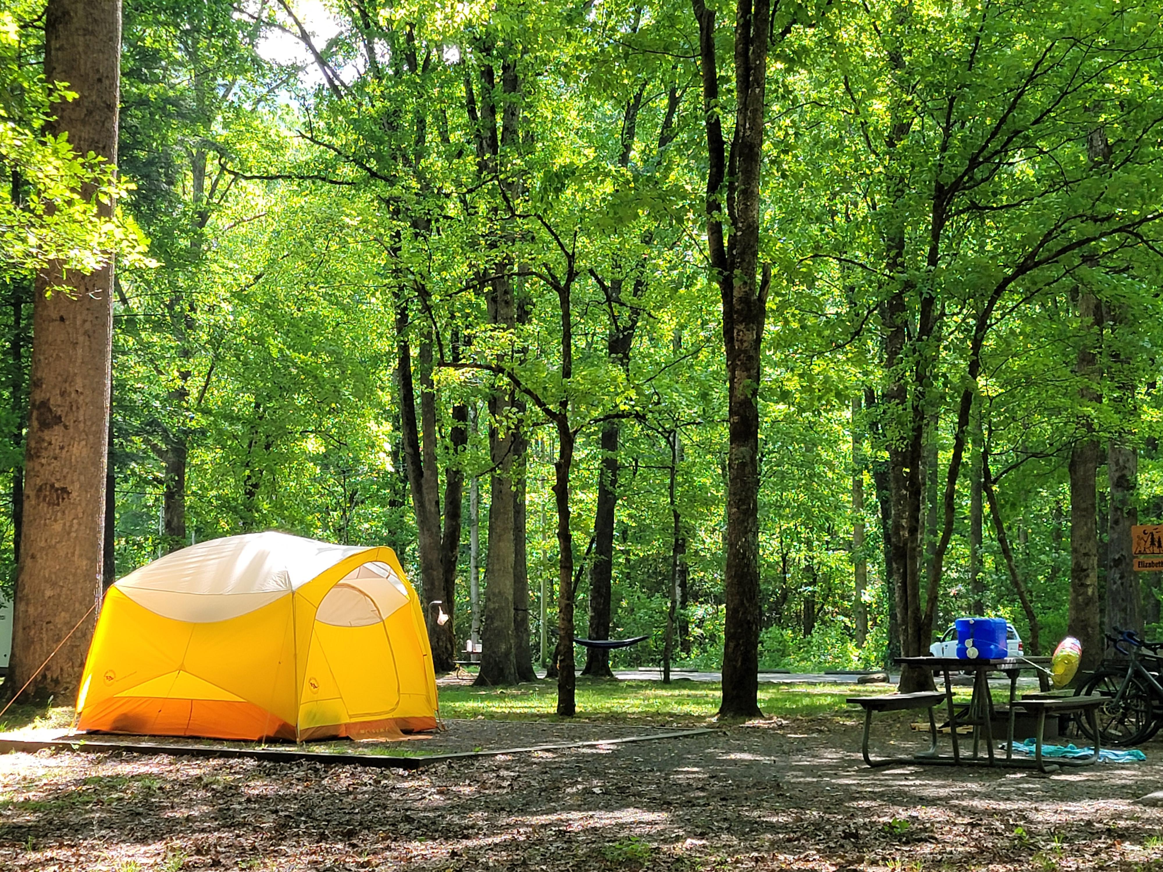
NPS via NPS.gov (Public Domain)
Campsites at Smokemont Campground (2026 Guide) — Planning Tips
5 min read
Campsite Guide
The air hits different at 2,198 feet. Not quite mountain thin, but cooler than Cherokee six miles south. Updated for 2026 with 5 Smokemont Campground:
Your plans
For more, see Great Smoky Mountains National Park Scenic Drives: Driving Trails (2026).
For more, see Great Smoky Mountains National Park Weather: Great Smoky and Best of Great Smoky Mountains National Park: Great Smoky Mountains Best Time to Visit (2026).
For more, see complete visitor guide, all campgrounds, hiking trails, lodging and accommodations, Campsites at Abrams Creek Campground (2026 Guide) (2026 Guide), Campsites at Balsam Mountain Campground (2026 Guide), Campsites at Big Creek Campground (2026 Guide) (2026 guide), Campsites at Cataloochee Campground (2026 Guide) (2026 Guide), and Campsites at Deep Creek Campground (2026 Guide) (2026 guide).
For the full picture of what this campground offers and how it fits into your larger trip, check the complete visitor guide. If you are weighing options across the park, the all campgrounds page gives the full lineup.
What You Get and What You Don't
Smokemont spreads across 142 sites, with 44 specifically set aside for RVs. The fee is $30 per site per night as of 2026. That covers tent and RV camping in the same loop areas - there is no separate tent-only section the way some campgrounds operate. Flush toilets and drinking water are available. Showers are not. Hookups are not.
This last point catches people. RVs park here, run their generators during quiet hours (which the park enforces), and use onboard tanks. The dump station is the only place to empty. Plan accordingly.
The campground ranger station sells America the Beautiful passes during summer and fall, or you can buy them online through the USGS store. Important note: that pass does not replace the parking tag. Every vehicle parking for more than 15 minutes anywhere in the park needs a tag - $5 daily, $15 weekly, or $40 annual. The pass gets you into federal lands, but the tag is a separate park requirement. Rangers will tell you this is the most common misunderstanding at the entrance station.

The Site Layout and What Matters
Loops A and B handle the year-round crowd. Winter camping here is mild by mountain standards - expect temperatures in the 30s and 40s Fahrenheit, occasional snow that melts within a day. Summer is the opposite: hot, humid, and crowded. The sites sit in a valley along the Oconaluftee River, which means you get creek noise at night and cooler air settling in after dark.
Loop C opens for the main season and fills fast. Loops D and F are the late-start options, opening mid-May. If you are booking for June, those loops are worth targeting - they tend to be a little quieter since they are the furthest from the entrance road.
The parking situation here is straightforward: one vehicle per site, with room for a second if your site allows it. Overflow parking exists but fills early. Most visitors underestimate how tight the RV spots can be. The 44 RV sites accommodate vehicles up to 40 feet, but the turn radii in some loops require careful backing. Walk your site before pulling in.

What the Website Doesn't Mention
The official page tells you about loops and fees. It does not tell you that cell service drops out about half a mile before the campground entrance and returns only in patches near the registration building. Verizon users get a weak signal near the ranger station. AT&T users lose it entirely. T-Mobile is a coin flip. Download your maps and directions before you leave Cherokee.
It also does not mention the bear activity. Hyatt Lane in Cades Cove is closed due to bear activity as of this writing, and while Smokemont has not had a closure, the same pressure applies. Food storage regulations are enforced - hard-sided containers or bear poles only. Rangers check. The fine is not small.
The road access note: Park Headquarters Road is closed for rehabilitation work on the Sugarlands water and wastewater systems. This affects access to the Sugarlands Visitor Center area, not Smokemont directly, but it changes how you route between the North Carolina and Tennessee sides. Heintooga Ridge Road and Balsam Mountain Road are also closed. Straight Fork and the one-way section of Balsam Mountain Road (Heintooga Round-Bottom Road) are closed as well. The Newfound Gap Road (US-441) remains the primary corridor.

Practical Timing
Early morning is your best bet for a smooth check-in. The ranger station processes registrations through the day, but arriving after 6 PM when the station is unattended means using the self-registration kiosk with cash or check. Credit cards require the station to be staffed.
Weekday arrivals have a clear advantage. Friday and Saturday fill completely from April through October. If you can arrive Sunday through Wednesday, you get your pick of the less-used sites along the outer edges of the loops.
The elevation gain is worth it for the temperature difference alone. Cherokee sits at roughly 2,000 feet. Newfound Gap at the state line is 5,046 feet. Smokemont sits in between at 2,198 feet, which puts it in a sweet spot - cooler than the lowlands, warmer than the high country. July highs average in the low 80s, dropping to the 60s at night.

What to Bring
Pack extra water for this stretch if you are planning day hikes. The campground has drinking water at spigots throughout the loops, but once you leave the campground, sources are limited. The Oconaluftee River runs alongside the campground and is treatable, but carrying your own is simpler.
A headlamp with fresh batteries. The flush toilets are lit, but the pathways between sites and the restrooms are not. After 10 PM, it is dark.
Your parking tag. Displayed on the dashboard. The $5 daily tag covers the vehicle, not the person, so one tag per car. The $15 weekly tag is the better value if you are staying more than two days.
Practical Takeaways
- Reserve online through Recreation.gov. Walk-ups exist but are unreliable in season.
- Arrive during staffed hours (generally 8 AM to 6 PM) if you want to pay with a card.
- The $30 nightly fee is per site, not per person. Four people in one tent pay the same as two.
- Dump station open year-round. Fill your fresh water tank before you park if you are in an RV.
- Flush toilets but no showers. Plan for sponge baths or use the shower facilities at the Oconaluftee Visitor Center - the campground has no shower building.
- Bear canisters recommended. The campground provides bear poles, but hard-sided containers are more convenient.
- Check the NPS alerts page before departure. Road closures change with weather and wildlife activity.
Final Thoughts
Smokemont is not the most remote campground in the Smokies, and it does not try to be. It is the practical base camp for the North Carolina side - close enough to Cherokee for supplies, close enough to Newfound Gap for the high country trails, and open year-round when most others close. The lack of hookups and showers keeps the crowd down to people who actually want to camp, not glamp. That is not a bad thing. The river noise fills the quiet, and the bear poles remind you where you are.
Book early for summer. Show up early for winter. The campground will be there either way.
For more information, see our complete Great Smoky Mountains National Park Guide.
Sources
- Official source: National Park Service nps.gov/grsm/planyourvisit/smokemont-campground.htm
- Official source: NPS — Great Smoky Mountains National Park nps.gov/grsm/index.htm
Photo Gallery
More to Explore

Park Guide
Acadia National Park: Carriage Roads, Cadillac Mountain & 2026 Guide
Discover carriage roads, Cadillac Mountain, and rugged Maine coast. Complete 2026 guide to Acadia National Park — trails, fees, lodging, permits, and what rangers recommend.

Hiking Guide
Grand Canyon Hiking Trails: Day Hikes, Water Sources & Rim to Rim
Compare Grand Canyon hiking trails: Bright Angel, South Kaibab, Hermit, Grandview, and rim to rim, with distances, elevation, water stops, and trailhead access for each.

Best Of
Best of Glacier Bay National Park
The best of Glacier Bay is reached by boat: ranger-led day tours up the bay to the tidewater glaciers. What's worth it, how to book, and when to go (2026).

Campsite Guide
White Sands Backcountry Camping: Closed for 2026 — What to Know
As of 2026, backcountry camping at White Sands National Park is closed for site rehabilitation. What that means, and where to camp nearby instead.

Weather Guide
Guadalupe Mountains National Park Weather: Weather
Guadalupe Mountains National Park: weather guide guide updated 2026. Practical visitor information, reservations, and seasonal tips worth bookmarking before

Best Of
Best of Cuyahoga Valley National Park: Best Things to Do
Seeing a Cleveland Orchestra concert with the woods as your backdrop is a uniquely Cuyahoga Valley experience.
Sign in to join the conversation.
Sources & Attribution
Location data courtesy of the National Park Service (U.S. Department of the Interior). NPS data is public domain. Official NPS page.
Images: NPS; NPS; NPS; NPS; NPS.
Map data © OpenStreetMap contributors.
Park operations alerts: NPS.gov · Weather and weather hazards: National Weather Service · Live conditions.
Information may change. Always verify fees, hours, and conditions directly with the official source before visiting.
Did this guide help? Share it with a friend.