Reservations for this campground open six months out, and the 43 sites fill fast - particularly for July and August weekends when the elevation keeps things tolerable. At 5,310 feet, Balsam Mountain Campground sits higher than any other frontcountry campground in Great Smoky Mountains National Park, and that elevation advantage is the main reason people book it. If you are planning a summer trip and want to sleep somewhere the daytime temperatures stay below 70°F, this is your spot. For a broader look at options across the park, check the complete visitor guide for seasonal recommendations and reservation strategy.
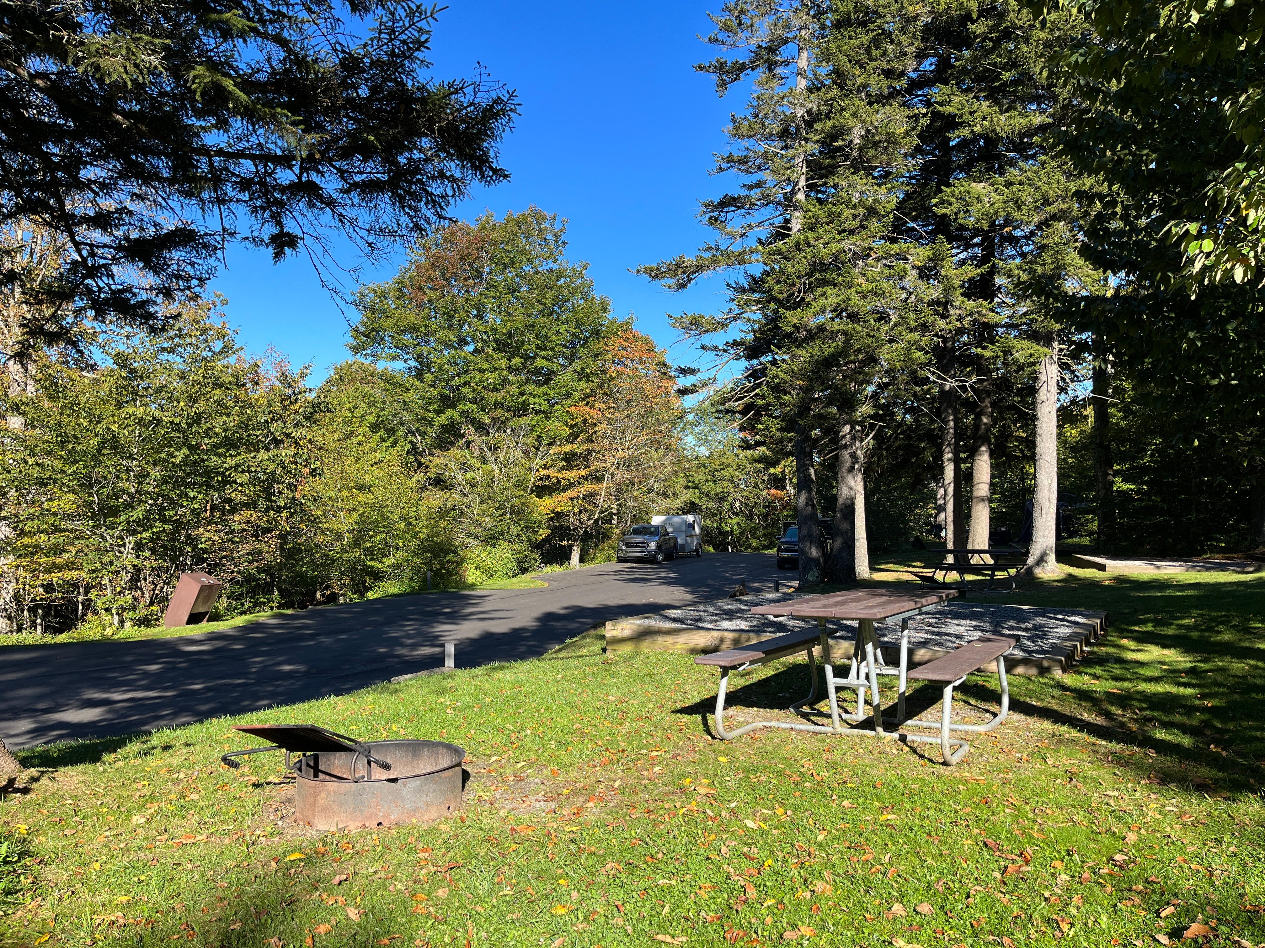
NPS via NPS.gov (Public Domain)
Campsites at Balsam Mountain Campground (2026 Guide)
8 min read
Campsite Guide
Of the 43 sites, 19 are designated tent-only. The remaining 24 accommodate RVs and trailers, but there is a catch - no hookups of any kind.
Your plans
For more, see complete visitor guide, all campgrounds, hiking trails, lodging and accommodations, Campsites at Abrams Creek Campground (2026 Guide) (2026 Guide), Campsites at Big Creek Campground (2026 Guide) (2026 guide), Campsites at Cataloochee Campground (2026 Guide) (2026 Guide), and Campsites at Deep Creek Campground (2026 Guide) (2026 guide).
What You Need to Know Before Booking
The campground operates on a seasonal schedule. As of 2026, it closes for the winter from mid-October through mid-May. That means the 2026 season opens May 15 and runs through October 12. The exact dates can shift by a few days depending on weather, so confirm opening and closing dates on recreation.gov when you reserve.
Site Types and Layout
Of the 43 sites, 19 are designated tent-only. The remaining 24 accommodate RVs and trailers, but there is a catch - no hookups of any kind. No electric, no water, no sewer. You run on battery and generator during quiet hours. This is not a campground for big rigs looking to plug in. The road in is paved, but some sites require backing into position on gravel pads. If you are driving something longer than 30 feet, call ahead and ask which sites can handle it.
Tent campers get the better end of the deal here. Most tent-only sites sit along the edges of the campground with more space between neighbors, and the forest canopy provides consistent shade. The ground is generally level, though a few sites have roots and grade issues - check site-specific photos on the reservation system before picking.
Amenities and What Is Missing
Flush toilets and drinking water are available. That is the full list of modern amenities. Showers do not exist here. The restrooms have no lights, so bring a headlamp or flashlight for nighttime trips - this is one of those details the park website does not emphasize enough, and first-time visitors regularly get caught off guard.
No dump station on site. No camp store. No laundry. If you forgot something, the closest supply points are in Cherokee, North Carolina, about a 30-minute drive, or Gatlinburg, Tennessee, roughly 45 minutes away. Plan accordingly.
The Quiet Hours Reality
Quiet hours run from 10 PM to 6 AM. Rangers will tell you this is enforced more strictly at Balsam Mountain than at lower-elevation campgrounds because the sound carries in the thin mountain air. Generators are permitted only during designated hours - typically 8 AM to 8 PM - and quiet generators are strongly recommended. If you show up with a loud contractor-grade generator, expect to hear about it from your neighbors before the ranger does.
Getting There and Parking
Balsam Mountain Campground is accessed via the Blue Ridge Parkway and then Heintooga Ridge Road. As of 2026, Heintooga Ridge Road has been closed periodically for maintenance, and Straight Fork and the one-way section of Balsam Mountain Road are also closed. Check current road conditions on the park website before you leave. These closures can add 45 minutes to your drive if you have to reroute through Cherokee or Gatlinburg.
The physical address is Gatlinburg, TN, 37738, but the campground is actually closer to Cherokee, North Carolina. Plug those coordinates - 35.5656, -83.1743 - into your GPS rather than trusting the town name. Cell service drops out at the lower elevations on the approach and does not return until you are nearly at the campground entrance.
Parking Tag Requirement
All vehicles parking for longer than 15 minutes need a tag. Three options are available: $5 daily, $15 weekly, or $40 annual. The tag covers all vehicle sizes and types. Buy it online before you arrive or at the visitor center in Cherokee or Oconaluftee. The self-pay station at the campground may or may not be stocked - do not count on it.

The Elevation Experience
This is the defining feature of Balsam Mountain Campground. At 5,310 feet, you are high enough that summer daytime temperatures rarely exceed 70°F, and overnight lows can drop to 50°F even in July. Pack a warm sleeping bag. A 40-degree bag will leave you shivering. Bring a fleece or puffy jacket for evenings around the campfire.
The elevation also means afternoon thunderstorms are common from June through August. They roll in fast, usually between 2 PM and 5 PM. Rain gear should be within easy reach, not buried in your duffel. Lightning at this elevation is a real concern - if you hear thunder, get off exposed ridges and into your vehicle or a hard-sided shelter immediately.
What the Cold Means for Your Gear
Propane stove performance drops at altitude. Canned fuel canisters lose pressure as the temperature drops. Bring a windscreen for your stove and consider using white gas fuel, which performs more consistently in cold conditions. The drinking water spigots are frost-free models, but during cold snaps in May or October, the park may shut off the water to prevent pipe damage. When that happens, you haul your own water. Always carry a full backup container.
Activities From the Campground
The campground itself is the base camp. You are not walking to trailheads from your site. The nearest hiking options require driving, and the road closures mentioned earlier may affect access.
Nearby Hiking Options
The research data lists 45+ activities across Great Smoky Mountains National Park, but most require driving from Balsam Mountain. The closest worthwhile hikes include:
- Balsam Mountain Trail: This trail connects to the Appalachian Trail and runs through high-elevation spruce-fir forest. Expect cool temperatures and potentially foggy conditions even on clear days. The trail narrows here in places, and footing can be muddy after rain.
- Flat Creek Trail: A quieter option descending through mixed hardwood forest. The elevation gain is worth it on the return for the perspective it gives on the surrounding ridges.
- Heintooga Overlook: A short drive from the campground. Early morning is your best bet for visibility before clouds roll in. From this overlook you can see the Balsam Mountain range stretching south into North Carolina.
Most visitors underestimate how long it takes to drive from the campground to trailheads in the main part of the park. Budget 30 to 45 minutes minimum to reach the Oconaluftee area or the Blue Ridge Parkway access points.
Fishing
The streams near the campground hold brook trout. You need a valid North Carolina or Tennessee fishing license depending on which side of the state line you are on - the campground sits close enough that it matters. Check the park fishing regulations before you cast. Brook trout are native and must be released immediately. Rainbow and brown trout have harvest limits.

What the Regulars Know
Returning visitors to Balsam Mountain Campground tend to book site 12 if they can get it. It sits at the far end of the loop, has the most privacy of any site, and backs up against the forest with decent separation from the next site. Site 6 is the largest and can handle a 30-foot RV plus a tent. Site 18 is the smallest tent-only site - fine for a single person or a couple, tight for a family of four.
The water spigot nearest sites 1 through 5 runs low pressure in late afternoon when everyone is filling containers. Fill your jugs in the morning instead.
Wildlife Etiquette
Black bears are active in this area. The campground has bear-proof food storage poles at each site. Use them. Every time. Rangers will tell you that the most common citation at Balsam Mountain is for improper food storage - and it carries a fine. Keep all food, coolers, toiletries, and pet food stored in your vehicle or on the pole. Do not leave anything in your tent. Keep an eye out for raccoons and groundhogs, which are bold and will chew through soft-sided coolers.
Elk frequent the nearby Oconaluftee area but rarely come into the campground itself. If you see one, stay 50 yards away. The park service is serious about this - elk are large, unpredictable animals, and people get hurt every year because they try to get closer for a photo.
Comparing Balsam Mountain to Other Campgrounds
Among Great Smoky Mountains campgrounds, Balsam Mountain sits at the extreme end of the spectrum for elevation and primitive character. If you want hookups, go to Cades Cove or Elkmont. If you want quiet, cool nights and fewer people, come here.
For a full breakdown of all campgrounds in the park, see the all campgrounds page, which covers site counts, fees, and reservation windows for each location.
Balsam Mountain vs. Cataloochee
Cataloochee Campground sits at 2,610 feet - half the elevation of Balsam Mountain. It also offers flush toilets and water but no hookups. Cataloochee is more remote from the main park corridor, which means fewer people but longer drives to most trailheads. Balsam Mountain gives you better summer temperatures; Cataloochee gives you better access to the elk herd and historic buildings in the valley.
Balsam Mountain vs. Smokemont
Smokemont Campground is open year-round at 2,200 feet. It has flush toilets, water, and a nearby visitor center. The temperature difference in July is significant - Smokemont will be in the 80s while Balsam Mountain stays in the 60s. If heat bothers you, Balsam Mountain is the clear choice. If you want convenience and proximity to park attractions, Smokemont wins.

Practical Takeaways
- Reserve early: Book exactly six months in advance for summer dates. The 43 sites go fast, especially the tent-only loops.
- Pack for cold: Bring a 20-degree sleeping bag and warm layers even in July. The 50°F overnight lows are not a joke.
- Bring light: The restrooms have no lights. A headlamp per person is mandatory.
- Fill water in the morning: Afternoon pressure drops at the spigots.
- Check road conditions: Heintooga Ridge Road and Balsam Mountain Road have active closures as of 2026. Confirm your route before driving.
- Buy your parking tag online: Avoid the line and the risk of the self-pay station being empty.
- Store food properly: Bear poles are provided. Use them every time. The fine is not worth the convenience of leaving a cooler out.
Final Thoughts
Balsam Mountain Campground is not for everyone. It lacks showers, lights in the restrooms, and any form of hookup. The roads leading to it close without warning, and the drive to most park attractions takes 30 to 45 minutes minimum. But for campers who understand what they are signing up for - cool summer nights, genuine quiet, and a forested site at 5,310 feet - it is the best base camp in the park. The people who book here tend to come back. That tells you something.
Sources
- Official source: NPS — Great Smoky Mountains National Park nps.gov/grsm/index.htm
- Official source: National Park Service nps.gov/grsm/planyourvisit/balsam-mountain.htm
Photo Gallery
More to Explore

Park Guide
Acadia National Park: Carriage Roads, Cadillac Mountain & 2026 Guide
Discover carriage roads, Cadillac Mountain, and rugged Maine coast. Complete 2026 guide to Acadia National Park — trails, fees, lodging, permits, and what rangers recommend.

Hiking Guide
Grand Canyon Hiking Trails: Day Hikes, Water Sources & Rim to Rim
Compare Grand Canyon hiking trails: Bright Angel, South Kaibab, Hermit, Grandview, and rim to rim, with distances, elevation, water stops, and trailhead access for each.

Best Of
Best of Glacier Bay National Park
The best of Glacier Bay is reached by boat: ranger-led day tours up the bay to the tidewater glaciers. What's worth it, how to book, and when to go (2026).

Campsite Guide
White Sands Backcountry Camping: Closed for 2026 — What to Know
As of 2026, backcountry camping at White Sands National Park is closed for site rehabilitation. What that means, and where to camp nearby instead.

Weather Guide
Guadalupe Mountains National Park Weather: Weather
Guadalupe Mountains National Park: weather guide guide updated 2026. Practical visitor information, reservations, and seasonal tips worth bookmarking before

Best Of
Best of Cuyahoga Valley National Park: Best Things to Do
Seeing a Cleveland Orchestra concert with the woods as your backdrop is a uniquely Cuyahoga Valley experience.
Sign in to join the conversation.
Sources & Attribution
Location data courtesy of the National Park Service (U.S. Department of the Interior). NPS data is public domain. Official NPS page.
Images: NPS; NPS; NPS; NPS; NPS.
Map data © OpenStreetMap contributors.
Park operations alerts: NPS.gov · Weather and weather hazards: National Weather Service · Live conditions.
Information may change. Always verify fees, hours, and conditions directly with the official source before visiting.
Did this guide help? Share it with a friend.