Start before 7 AM if you're driving to any trailhead on the east side of Rocky Mountain National Park. The parking lots at Bear Lake, Glacier Gorge, and even the Park & Ride fill before 8 AM most summer mornings. When you're budgeting for a visit, the rocky mountain trailhead bike price - essentially the per-person entrance fee for cyclists and walk-ins - runs $15 for a single day or $20 for seven consecutive days, and that covers everyone in your group who's not in a private vehicle. For the full picture, check the complete visitor guide before you go.
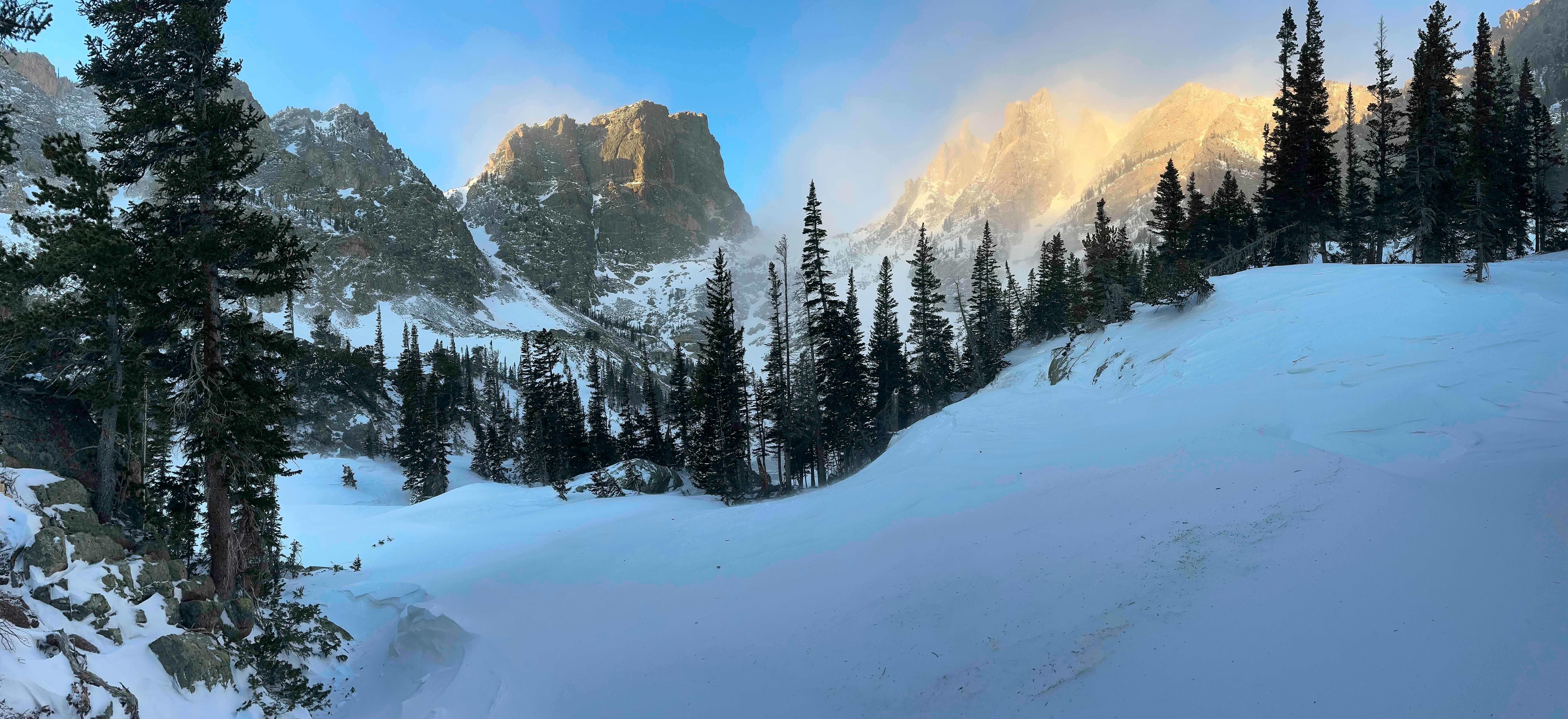
NPS via NPS.gov (Public Domain)
Rocky Mountain National Park Gear Guide: Rocky Mountain
6 min read
Gear Guide
Cyclists pay $15 for a one-day or $20 for a seven-day entrance pass at Rocky Mountain National Park. Start before 7 AM to beat trailhead parking crowds.
Entrance Fees and the Rocky Mountain Trailhead Bike Price
Rocky Mountain National Park charges entrance fees by vehicle type or by person. If you arrive on a bicycle, you pay the per-person rate. That $15 one-day pass (or $20 for seven days) is what most cyclists mean when they ask about the rocky mountain trailhead bike price. Motorcycles have their own rates: $25 for one day or $30 for seven days, covering up to two bikes and four passengers total.
Private vehicles pay $30 for one day or $35 for seven days. If you're planning multiple days inside the park, the seven-day passes offer better value. Park entrance passes can be purchased online at Recreation.gov or at any entrance station.
Nonresident fee. International visitors aged 16 and older pay an additional $100 nonresident fee on top of the standard entrance fee. This requirement applies to anyone entering with a commercial tour group, CUA group, or concessioner tour. The exception: if you already hold an Annual Pass or America the Beautiful Pass, the extra $100 is waived. That pass also covers entrance for up to four adults, so it can save international travelers significant money if they plan multiple national park visits.
Where to buy. All entrance stations accept credit cards and cash. Online advance purchase is available at Recreation.gov, which can speed up entry on busy days. The park is open 24 hours a day, 365 days a year, but entrance stations have staffed hours that vary seasonally.

Getting to the Park and Current Conditions
Rocky Mountain National Park is located in northern Colorado. The east side (Estes Park) is accessed via U.S. Highway 34 or 36 from I-25. The west side (Grand Lake) is reached via I-70 to U.S. Highway 40 toward Granby, then U.S. 34 east to Grand Lake.
The physical address: 1000 US Hwy 36, Estes Park, CO 80517. From Denver International Airport, plan on roughly 90 minutes to two hours driving time to Estes Park, depending on traffic.
Trail Ridge Road Closure
As of spring 2026, Trail Ridge Road (U.S. Highway 34 inside the park) remains closed to through travel. Recent winter weather in the high elevations and current snow conditions keep the road limited: open to Rainbow Curve on the east side and to Milner Pass on the west side. This affects planning for anyone wanting to cross the park east-west. Check the park's road status page before heading out.
Weather and Elevation
Elevation in the park ranges from 7,800 feet at the lowest point to over 14,000 feet at the highest peaks. Weather changes quickly. A sunny 70°F afternoon can turn into a 40°F thunderstorm with hail in under an hour. Snow falls in any month above 10,000 feet. The majority of first-time visitors underestimate how much cold weather gear they need even in August.
For up-to-date forecasts, check the National Weather Service page specifically for Rocky Mountain National Park. Rangers at the visitor center emphasize layering - you'll strip off a fleece at 10 AM and put it back on by 1 PM.

Hiking: Rocky Mountain Trails and Deer Mountain Trail
The park contains over 300 miles of hiking trails. They range from short wheelchair-accessible loops to multi-day backcountry routes. One trail that consistently surprises people is the deer mountain trail rocky mountain - a 6-mile round trip with 1,100 feet of elevation gain. It starts near the Beaver Meadows Entrance and climbs through open meadows and pine forest. The payoff is a 360-degree view of the Continental Divide and, on clear days, Longs Peak. The trail register is full of comments about how much harder the climb feels at 9,000 feet - your body will notice the altitude.
Rocky mountain hiking trails vary by difficulty and terrain. The popular Emerald Lake Trail (3.6 miles round trip) stays crowded until late afternoon. Early morning is your best bet for solitude and wildlife viewing. Keep an eye out for elk grazing in the meadows at dawn, especially around the Moraine Park area. The park's elk population is substantial, and during September's rut, bulls will bugle from sunrise to dusk.
For a longer day, the Flattop Mountain Trail climbs 4,400 feet over 8.8 miles to a 12,324-foot summit. Rocky mountain hiking at this elevation demands preparation: pack extra water for this stretch - at least three liters per person - and start before sunrise. The trail narrows here above timberline, and the wind can knock you sideways. Rangers will tell you that most search-and-rescue incidents involve hikers who underestimated the altitude and brought too little water.
Rocky mountain hiking trail conditions change with snowmelt. Trails may hold ice patches into July in shaded sections. Trekking poles help, not just for stability but for testing snow bridges over streams. The rocky mountain trails overall are well-marked, but junctions like the one at the Ute Trail to the Alpine Ridge can be confusing - a hand-drawn map from the visitor center helps.

Camping Near Rocky Mountain National Park
Reservations are essential. The park's five front-country campgrounds (Aspenglen, Glacier Basin, Longs Peak, Moraine Park, and Timber Creek) fill months in advance. Camping near rocky mountain national park includes private options outside the boundaries. The town of Estes Park has several RV parks and tent sites. Campgrounds near rocky mountain national park on the west side near Grand Lake offer quieter alternatives with easier access to the Colorado River headwaters.
Campsites near rocky mountain national park inside the park range from $20 to $35 per night. Backcountry camping requires a wilderness permit, available at the backcountry office. The park's group campsites can accommodate larger parties but require separate reservations through Recreation.gov.
One thing the park website doesn't emphasize: the hike-in sites at Longs Peak Campground (walk-up only, no reservations) are first-come, first-served and often have availability even when drive-up sites are full. The trade-off is carrying your gear a quarter-mile.

Practical Takeaways
- The rocky mountain trailhead bike price for cyclists is $15 for one day or $20 for seven days - same as per-person walk-in fee. Motorcycles pay $25 or $30 for one or seven days respectively.
- If you're an international visitor, bring your America the Beautiful pass to avoid the $100 nonresident fee.
- Trail Ridge Road is closed to through travel as of early 2026. Don't plan a cross-park drive. Verify current conditions at nps.gov/romo.
- Start hikes before 7 AM to find parking and avoid afternoon thunderstorms. Pack extra water - at least one liter per hour of hiking at high elevation.
- Reservations for campsites and timed entry (if required) should be made at Recreation.gov as soon as your trip dates are set. Popular sites sell out in January.
- Cell service drops out at the park boundary and remains unreliable inside. Download offline maps and have a paper backup.
Final Thoughts
Rocky Mountain National Park rewards the prepared visitor. The elevation gain is worth it - but only if you've brought enough layers and water. The common mistake, and almost everyone makes it, is treating this like a low-elevation hike. It's not. Your legs will have strong opinions about every switchback on the way back up. But the reward - standing above timberline with the Continental Divide curving away in both directions - is something you'll remember long after your quads stop complaining. Plan for the conditions, respect the altitude, and you'll leave wanting to come back.
Sources
- Official source: NPS — Rocky Mountain National Park nps.gov/romo/index.htm
Photo Gallery
More to Explore

Park Guide
Acadia National Park: Carriage Roads, Cadillac Mountain & 2026 Guide
Discover carriage roads, Cadillac Mountain, and rugged Maine coast. Complete 2026 guide to Acadia National Park — trails, fees, lodging, permits, and what rangers recommend.

Hiking Guide
Grand Canyon Hiking Trails: Day Hikes, Water Sources & Rim to Rim
Compare Grand Canyon hiking trails: Bright Angel, South Kaibab, Hermit, Grandview, and rim to rim, with distances, elevation, water stops, and trailhead access for each.

Best Of
Best of Glacier Bay National Park
The best of Glacier Bay is reached by boat: ranger-led day tours up the bay to the tidewater glaciers. What's worth it, how to book, and when to go (2026).

Campsite Guide
White Sands Backcountry Camping: Closed for 2026 — What to Know
As of 2026, backcountry camping at White Sands National Park is closed for site rehabilitation. What that means, and where to camp nearby instead.

Weather Guide
Guadalupe Mountains National Park Weather: Weather
Guadalupe Mountains National Park: weather guide guide updated 2026. Practical visitor information, reservations, and seasonal tips worth bookmarking before

Best Of
Best of Cuyahoga Valley National Park: Best Things to Do
Seeing a Cleveland Orchestra concert with the woods as your backdrop is a uniquely Cuyahoga Valley experience.
Sign in to join the conversation.
Sources & Attribution
Location data courtesy of the National Park Service (U.S. Department of the Interior). NPS data is public domain. Official NPS page.
Images: NPS; NPS; NPS; NPS; NPS.
Map data © OpenStreetMap contributors.
Park operations alerts: NPS.gov · Weather and weather hazards: National Weather Service · Live conditions.
Information may change. Always verify fees, hours, and conditions directly with the official source before visiting.
Did this guide help? Share it with a friend.