Skyline Drive runs 105 miles along the crest of the Blue Ridge Mountains through Shenandoah National Park, and here's what most guidebooks don't tell you: the drive takes 3 hours without stopping but plan for 5 to 7 hours your first time, because 75 overlooks will pull you over before you know it. The best direction is north to south, starting at Front Royal. This puts the sun behind you in the morning and keeps the Shenandoah Valley views ahead throughout the day. As of 2026, you'll need a credit or debit card at the entrance station - the park moved to fully cashless fee collection in July 2025.
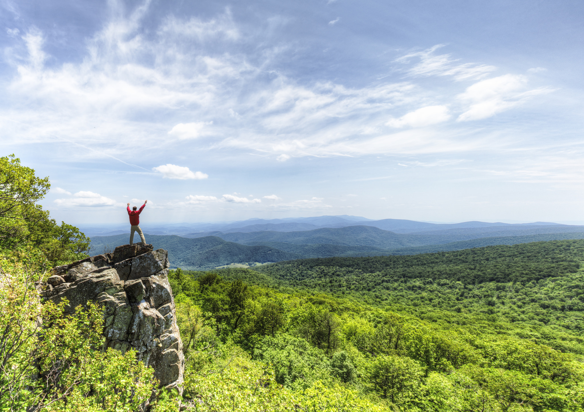
NPS via NPS.gov (Public Domain)
Shenandoah National Park Scenic Drives: Shenandoah Driving Trail
8 min read
Scenic Drives
Skyline Drive runs 105 miles through Shenandoah National Park; plan 5–7 hours for 75 overlooks. Cashless fee collection as of 2026.
For more, see best time to visit.
Start with the complete visitor guide for general park planning. What follows here is specific to executing the drive itself.
The Drive at a Glance
Total distance: 105 miles one-way, from Front Royal (northern entrance at Mile 0) to Rockfish Gap (southern entrance at Mile 105, which also connects to the Blue Ridge Parkway).
Typical time: 3 hours straight through. With stops - and you will stop - budget 5 to 7 hours. Most visitors spend 6 hours.
Road surface and restrictions: Fully paved, two-lane road with a 35 mph speed limit. RVs and trailers under 22 feet are fine. Longer than that and you'll struggle at some of the tighter switchbacks and low-clearance pullouts. The maximum vehicle length permitted is 22 feet for trailers and 50 feet total for RVs.
Seasonal access: The park is open year-round, but Skyline Drive closes periodically during winter storms and ice events. Text SHENALERTS to 888777 for real-time closure updates. Sections close without warning during winter weather; the park service recommends calling ahead November through March.
Best direction: North to south. The overlooks face predominantly west toward the Shenandoah Valley, so driving north to south keeps you on the correct side of the road to pull into the overlooks easily. Going south to north means crossing traffic for every pullout.

Stop by Stop
The following stops are organized north to south by mile marker. You won't hit all 75 overlooks in one day. These are the ones worth pulling over for.
Mile 4.6: Shenandoah Valley Overlook (first major view)
This is the first overlook most visitors hit, and it sets expectations. From 2,400 feet, you're looking west across the Shenandoah Valley toward Massanutten Mountain. The valley floor spreads out like a relief map - you can pick out individual farms, silos, and the occasional train along the Norfolk Southern line.
Best time: Mid-morning, after the ground fog burns off but before the haze builds. Time here: 10 minutes. What most miss: The pullout 100 yards south of the main overlook has fewer cars and essentially the same view.
Mile 10.4: Compton Gap
This stop serves double duty. The overlook faces west with a broad view of the valley, but the real draw is the trailhead for Compton Peak. The Appalachian Trail passes through here, and a 2-mile round trip hike gets you to columnar jointing in the basalt - hexagonal rock formations that look man-made but aren't.
Rangers will tell you this is one of the quietest sections of the park. The parking area holds maybe eight cars.
Mile 22.2: Mathews Arm / Traces Trail
Mathews Arm Campground is visible from the road, but don't stop for the camping. Stop for the Traces Trail, a 1-mile loop that passes old homestead foundations, stone walls, and apple trees that predate the park. It's the quickest place on the drive to see evidence of the families who lived here before the park was established in 1935.
Best time: Late afternoon for long shadows across the old fields. Time here: 30 minutes for the loop.
Mile 31.6: Marys Rock Tunnel
The tunnel itself is only 600 feet long, but there's no sidewalk and no stopping inside. What matters is the pullout just south of the tunnel. From here, a 1.5-mile hike (one way) reaches the summit of Marys Rock with 360-degree views. If you're not hiking, the pullout alone gives you a clean westward view of the valley.
Traffic note: Vehicles wider than 8 feet or taller than 13 feet cannot fit through the tunnel. There's a bypass road, but check conditions at the entrance station.
Mile 41.7: Stony Man Trailhead
The Stony Man hike is short - 1.6 miles round trip with low elevation gain - and leads to one of the best views on the entire drive. The summit sits at 4,011 feet, and on a clear day you can see Massanutten Mountain and the Allegheny Front beyond.
What the park website doesn't mention: The parking lot fills by 8:30 AM in October and by 9 AM in summer. Arrive early or skip it. Pets are not allowed on this trail.
Mile 45.5-46.5: Hawksbill Gap Area
Hawksbill is the highest point in Shenandoah at 4,051 feet. Two trailheads here: Hawksbill Gap (Mile 45.5, steeper and shorter) and Upper Hawksbill (Mile 46.5, longer but gentler). Both lead to a stone viewing platform with a 360-degree view.
Time here: 45-90 minutes depending on which approach you take. Best time: Late afternoon for golden light across the valley. The temperature at the summit is typically 10°F cooler than the valley floor, so bring a layer even in July.
Mile 51: Big Meadows Complex
This is the busiest section of the park for good reason. Big Meadows itself is a high-elevation grassland that feels out of place in a mountain forest - 150 acres of open meadow at 3,500 feet. The overlook here faces west.
Practical note: Big Meadows has the only gas station in the entire park. If you're below half a tank, fill up here. The next station is 53 miles south at Loft Mountain (which is a wayside, not a full gas station). The Big Meadows Wayside also has food, restrooms, and picnic tables.
Time here: 20 minutes for gas and a snack. The meadow itself deserves another 20 for a walk.
Mile 56.4: Bearfence Mountain
The Bearfence Rock Scramble is the most exposed hike in the park - a quarter-mile of hands-on climbing over boulders to a 360-degree summit view. It's not dangerous if you're careful, but if heights bother you, take the Bearfence Viewpoint trail instead, which reaches a 180-degree view without the scramble.
What most miss: The scramble only takes 30 minutes round trip. Most people drive past because they see "rock scramble" and assume it requires gear. It doesn't. Sturdy shoes and a willingness to use your hands are enough.
Mile 62.7: South River Overlook
This pullout faces south and east toward the Piedmont. The view is broad but not as dramatic as the western overlooks. Worth a 5-minute stop for the change in perspective - you're looking away from the valley toward the rolling hills of Virginia's eastern region.
Mile 79.5: Loft Mountain Wayside
The second major stop for services on the south end of the drive. Loft Mountain has a gift shop, snack bar, and restrooms. The Frazier Discovery Trail starts here - a 1-mile loop with several overlooks and interpretive signs about the forest ecology.
Best time: Late morning. Time here: 15 minutes for a stretch.
Mile 84.4: Blackrock Summit
A quarter-mile hike over a talus slope (essentially a pile of boulders the size of cars) leads to a viewpoint overlooking the Shenandoah Valley. The trail is paved and wheelchair-accessible to the first overlook. The full summit view requires walking on uneven rock.
What most miss: The talus slope itself is more interesting than the view. These rocks broke off the cliffs above during freeze-thaw cycles over thousands of years. You can hear water running somewhere beneath the boulders.
Mile 90: Riprap Trailhead
This is the southernmost notable stop before the drive ends at Rockfish Gap. The Riprap and Wildcat Ridge trails form a 9-mile loop that passes through the Shenandoah Wilderness. Not a quick stop - but the parking area gives you a valley view through the trees even if you're not hiking.
Mile 105: Rockfish Gap
The southern terminus connects to the Blue Ridge Parkway. There's a large parking area and a restaurant. If you plan to continue south on the Parkway, note that the speed limit drops to 25 mph and services become sparse for the next 100 miles.

Timing and Crowds
When Skyline Drive opens: The road is open 24/7, but sections close during winter weather. The park itself is always open to foot traffic even when the drive is closed.
Peak hours: Tour buses hit the drive between 10 AM and 2 PM, concentrated at Big Meadows and the major overlooks. The crowds thin noticeably after 3 PM.
Weekend vs weekday: Saturday is the busiest day. Sundays are slightly better because half the visitors are driving home. Tuesdays through Thursdays are quietest.
Seasonal crowds: October weekends are the busiest of the year - expect 30-45 minute waits at entrance stations, especially Front Royal. Early June and all of September are the sweet spots for reasonable crowds and good weather.
Best strategy: Enter by 7:30 AM. The overlooks are empty, the wildlife (deer and black bear) are most active, and the morning light on the valley is better than midday. By 10 AM, the overlooks fill and the haze builds.

Driving Logistics
Parking situation: Each overlook has 5 to 15 spaces. The popular ones (Stony Man, Big Meadows, Bearfence) fill by 9 AM in summer and by 8 AM in peak fall. If the lot is full, do not park on the shoulder - the park service tickets and tows at the owner's expense. The parking at boundary access areas specifically has strict rules: park on the right side of the road approaching Thompson Hollow, and only in designated spots.
Gas availability: Exactly one gas station in the park - Big Meadows Gas Station at Mile 51. It's a standard pump, not a full-service station. Loft Mountain Wayside has no fuel. Fill up in Front Royal (north) or Waynesboro (south) before entering.
Cell service: Cell service drops out at multiple points along the drive, especially between Mile 20 and Mile 40 and again between Mile 65 and Mile 85. Download your maps and route before you arrive. The park website has a downloadable Skyline Drive map in PDF format - grab that ahead of time.
RV restrictions: Vehicles over 22 feet long have limited access. The Marys Rock Tunnel (Mile 31.6) has a 13-foot height and 8-foot width restriction. The switchbacks between Mile 70 and Mile 80 are tight for longer rigs.
Winter driving: Skyline Drive closes without notice during ice and snow. Check by texting SHENALERTS to 888777 or calling 540-999-3500. The road typically reopens within 24 hours of clearing, but heavy storms can close it for multiple days.

Practical Takeaways
- Drive north to south (Front Royal to Rockfish Gap) for easiest access to the western overlooks without crossing traffic.
- Enter by 7:30 AM if you want empty overlooks and active wildlife. By 9 AM the lots fill at the popular stops.
- Fill your gas tank before entering. There is one gas station in the entire 105-mile park, located at Big Meadows (Mile 51).
- Carry cash is no longer needed - the park switched to cashless-only fee collection in July 2025. Credit cards, debit cards, and mobile payments only.
- Cell service drops out on roughly 40 percent of
For more information, see our complete National Park Guide.
Related: shenandoah hiking trails guide
Sources
- Official source: National Park Service nps.gov/shen/index.htm
Photo Gallery
More to Explore

Park Guide
Acadia National Park: Carriage Roads, Cadillac Mountain & 2026 Guide
Discover carriage roads, Cadillac Mountain, and rugged Maine coast. Complete 2026 guide to Acadia National Park — trails, fees, lodging, permits, and what rangers recommend.

Hiking Guide
Grand Canyon Hiking Trails: Day Hikes, Water Sources & Rim to Rim
Compare Grand Canyon hiking trails: Bright Angel, South Kaibab, Hermit, Grandview, and rim to rim, with distances, elevation, water stops, and trailhead access for each.

Best Of
Best of Glacier Bay National Park
The best of Glacier Bay is reached by boat: ranger-led day tours up the bay to the tidewater glaciers. What's worth it, how to book, and when to go (2026).

Campsite Guide
White Sands Backcountry Camping: Closed for 2026 — What to Know
As of 2026, backcountry camping at White Sands National Park is closed for site rehabilitation. What that means, and where to camp nearby instead.

Weather Guide
Guadalupe Mountains National Park Weather: Weather
Guadalupe Mountains National Park: weather guide guide updated 2026. Practical visitor information, reservations, and seasonal tips worth bookmarking before

Best Of
Best of Cuyahoga Valley National Park: Best Things to Do
Seeing a Cleveland Orchestra concert with the woods as your backdrop is a uniquely Cuyahoga Valley experience.
Sign in to join the conversation.
Sources & Attribution
Location data courtesy of the National Park Service (U.S. Department of the Interior). NPS data is public domain. Official NPS page.
Images: NPS; NPS; NPS; NPS; NPS.
Map data © OpenStreetMap contributors.
Park operations alerts: NPS.gov · Weather and weather hazards: National Weather Service · Live conditions.
Information may change. Always verify fees, hours, and conditions directly with the official source before visiting.
Did this guide help? Share it with a friend.