For more, see complete visitor guide.
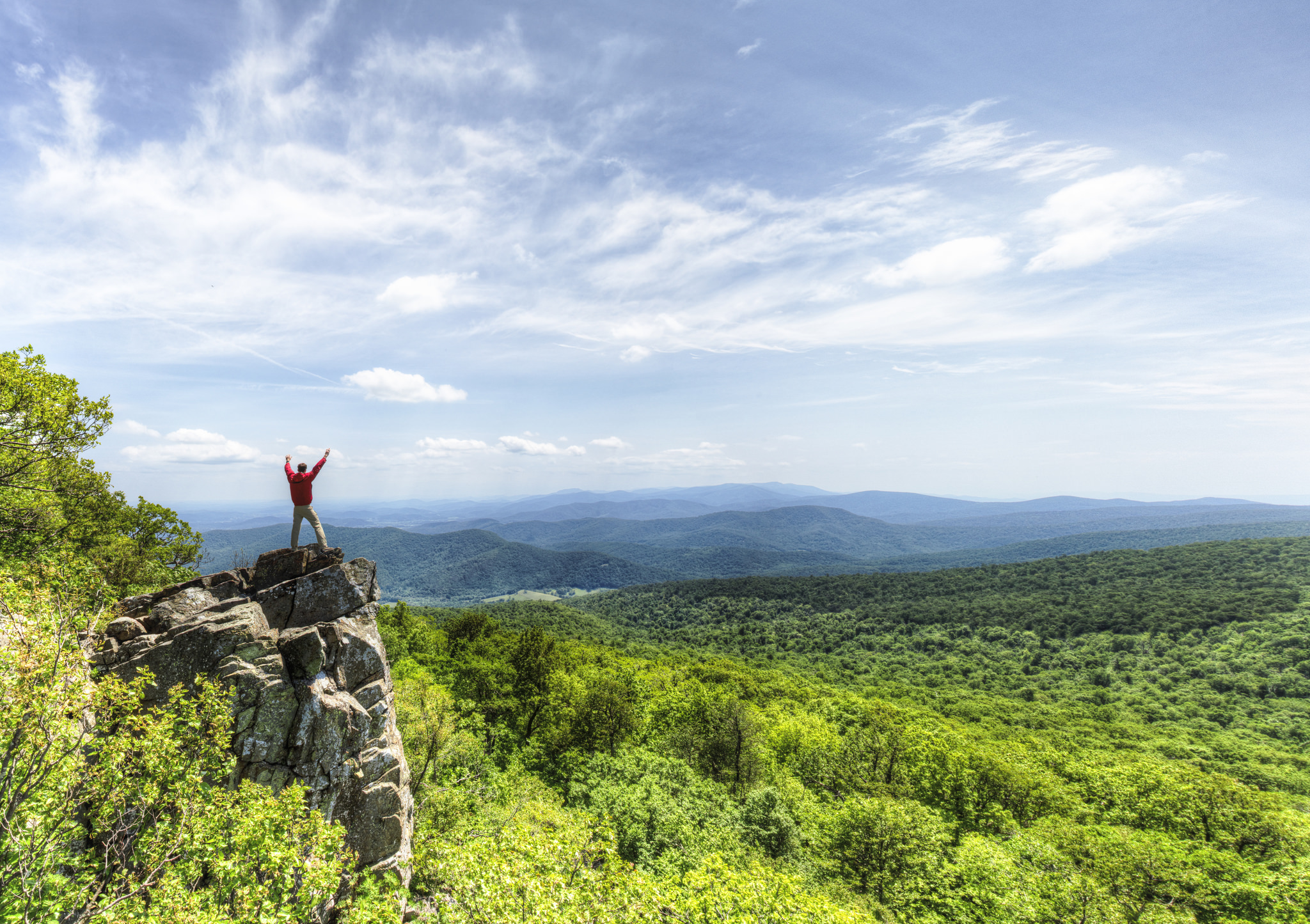
NPS via NPS.gov (Public Domain)
Shenandoah National Park Hiking
10 min read
Hiking Guide
Complete 2026 hiking guide for Shenandoah National Park. Trails, difficulty ratings, seasonal conditions, and practical tips for every skill level.
This article contains affiliate links — we may earn a small commission at no extra cost to you.
Shenandoah National Park Hiking: Old Rag, Hawksbill & Appalachian Trail Hikes (2026 Guide)
The quiet here is the first thing that registers. It's not silence—you'll hear a breeze in the oak leaves, a distant woodpecker, the crunch of gravel underfoot. The dense canopy of the Blue Ridge has a way of absorbing the world beyond the trail. That's the baseline of hiking in Shenandoah. You come for the steady rhythm of a forest walk, punctuated by those sudden, brilliant views that open like a curtain being drawn. Most first-timers underestimate two things: the deceptive steepness of these trails, which climb straight up the ridges, and the ten-degree temperature drop you'll feel stepping out of your car on Skyline Drive. For more on the park, our visitor guide covers entrances and history.
What Hiking Here Actually Means
Hiking here means following the grain of the land. This park is a long, narrow spine of mountains, so trails typically run along the ridgeline on the Appalachian Trail or drop sharply into the hollows. You won't find many gentle, meandering loops. You're either climbing to a viewpoint or descending to a waterfall, with the return trip reversing that. The terrain mixes packed dirt, leaf litter, and exposed, angled bedrock that turns slick with moisture. Your skill matters less than your knee and ankle strength—it's the constant elevation change that wears hikers out.
The common mistake, one almost everyone makes, is trying to do too many hikes in a day. Driving between trailheads on Skyline Drive takes longer than maps suggest, and a 'moderate' 4-mile hike here can tire you more than a flat 8-mile walk elsewhere. We rangers advise picking one or two good hikes to savor, not ticking off five overlooks. The forest is the main draw; the views are your reward.

Old Rag Circuit: The Full Shenandoah Experience
Distance: 9.4-mile loop
Elevation Gain: 2,415 feet
Trailhead & Parking: The main parking lot is at the end of Nethers Road, outside the park boundary. As of 2026, you cannot drive to the Old Rag trailhead from within Shenandoah. The lot holds about 200 cars and is typically full by 7:30 AM on weekends from March through November. Overflow parking spills along the road - parking in unauthorized spots risks a tow, per current alerts. This is the single most critical logistical hurdle for this hike.
The Trail: The circuit begins with a long, steady climb through woods on a fire road. After about a mile, you reach the rock scramble. This section isn't optional—you'll use your hands to pull up through narrow granite channels, chimney between boulders, and crab-walk across exposed slabs. The trail narrows to single-file for nearly a mile here. It's physically demanding and requires focus, particularly if the rock is damp. After the summit, the descent follows the Saddle Trail, a relentless, knee-jarring drop down a rocky path back to the fire road.
The Moment: Cresting the final scramble to stand on the summit's bald granite dome, with a 360-degree view of the Virginia Piedmont rolling out to the east and the Shenandoah Valley stacked in ridges to the west.
What Most Underestimate: The time. The park labels this a 7-8 hour hike. For most people, it's 8-10. The scramble creates a natural bottleneck where you will wait in line on busy days. Also, the permit. From March 1 through November 30, you must obtain an Old Rag day-use ticket in advance. No ticket, no hike. Rangers do check.
Best Time: A weekday in October, after the first light frost has thinned the crowds but before leaf drop. Start at first light.
Hawksbill Summit: The Highest Point, Fastest Route
Distance: 2.1-mile out-and-back
Elevation Gain: 520 feet
Trailhead & Parking: Hawksbill Gap at mile 45.5 on Skyline Drive. The parking area is small, maybe 20 cars. It fills by 9 AM. If full, the Upper Hawksbill lot at mile 46.5 offers a longer, easier approach.
The Trail: Straight up. The Salamander Trail climbs steadily via a series of stone steps and dirt switchbacks through a mature hemlock and oak forest. It's well-maintained but unrelenting. The grade eases only in the last 100 yards before the summit platform.
The Moment: Stepping onto the stone viewing platform at the top of Shenandoah's highest peak (4,051 feet) and getting that promised 360-degree panorama. On a clear day, you can see the snaking line of Skyline Drive to the north and south.
What Most Underestimate: The exposure at the top. It's often 10-15 degrees cooler and much windier than at the trailhead. That quick summit selfie turns into a chilly affair if you didn't pack a layer.
Best Time: Sunrise. You can drive up Skyline Drive before the gates are officially "open" (it's a public road). Hiking up in the dark with a headlamp to watch the sun break over the Piedmont to the east is a local favorite.
Dark Hollow Falls: The Crowd-Pleasing Waterfall
Distance: 1.6-mile out-and-back
Elevation Gain: 440 feet
Trailhead & Parking: Dark Hollow Falls parking area at mile 50.7, near Big Meadows Lodge. This is one of the most popular lots in the park. It's often full by 11 AM. Overflow parking is a half-mile walk south along Skyline Drive.
The Trail: A steep, rocky descent alongside Hogcamp Branch to the 70-foot cascading waterfall. The return trip is, as you'd expect, a steep, rocky climb back up. The trail is wide and obvious but can be a river of mud after rain.
The Moment: The first full view of the waterfall from the main observation point, about two-thirds of the way down. The lower you go, the more you're in the spray and the less you see of the full cascade.
What Most Underestimate: The climb back. It's short but steep enough that you'll hear plenty of heavy breathing and see people taking frequent breaks. It feels longer than 0.8 miles.
Best Time: Late afternoon, when the sun angles into the hollow and lights up the falling water. Spring or after heavy rains, when the flow is strongest.
Stony Man: The Best View-for-Effort Ratio
Distance: 1.5-mile loop
Elevation Gain: 340 feet
Trailhead & Parking: Stony Man parking area at mile 41.7, just north of Skyland Resort. Shares a lot with the horse trail. Fills later than others, usually by 10 AM.
The Trail: A gentle, almost entirely paved path through northern hardwoods that leads to a cliff-edge overlook. The most challenging part is a short, rocky section near the summit. It connects with the Appalachian Trail for the return leg, making a pleasant loop.
The Moment: Walking out onto the open rock ledge of Stony Man Cliff, with the town of Luray visible 2,400 feet below in the Shenandoah Valley and Massanutten Mountain rising beyond.
What Most Underestimate: How icy it can get. The paved sections hold a thin layer of black ice long after the surrounding trail has thawed. Microspikes are a wise winter carry here.
Best Time: Sunset. It faces west, making it the premier spot in the park to watch the day end over the valley. Bring a headlamp for the walk back.
Whiteoak Canyon & Cedar Run Circuit: The Waterfall Gauntlet
Distance: 8.5-mile circuit
Elevation Gain: 2,300 feet
Trailhead & Parking: Whiteoak Canyon parking area at the park boundary on Weakley Hollow Road. A large lot, but it services several major trails. Still fills by 8:30 AM on weekends. You must pay the park entrance fee here or have a pass.
The Trail: A brutally rewarding loop. You'll descend Whiteoak Canyon past six major waterfalls, then climb up the Cedar Run Trail alongside more cascades, before connecting on a fire road to complete the loop. The descent is rocky and steep. The climb up Cedar Run is steeper, with sections that are essentially a streambed.
The Moment: Standing at the base of the 86-foot Upper Whiteoak Falls, feeling the cool mist after the long downhill. The power and height of this fall is unmatched in the park.
What Most Underestimate: The sheer physical toll. This is often listed as "strenuous." Believe it. The climb out via Cedar Run is one of the most sustained, leg-burning ascents in Shenandoah. Pack extra water for this stretch.
Best Time: A weekday in May, when the waterfalls are roaring from spring melt and the mountain laurel along Cedar Run is in full, pink bloom.
Marys Rock Summit: The Appalachian Trail Classic
Distance: 3.4-mile out-and-back
Elevation Gain: 1,210 feet
Trailhead & Parking: Meadow Spring parking area at mile 33.5. A small pull-off for maybe 15 cars. Often full. The Panorama parking area at mile 31.6 offers a longer, alternate route.
The Trail: You're on the Appalachian Trail from the first step. It's a steady, rocky climb north along the ridge, with occasional glimpses through the trees. The final approach to the summit involves a short, easy rock scramble.
The Moment: Sitting on the broad, sloping summit rock of Marys Rock itself, with your legs dangling over a 1,800-foot drop into Thornton Gap. It's a wider, more relaxed summit than Hawksbill.
What Most Underestimate: The exposure on the summit rocks. There are no guardrails. The wind can be fierce and sudden, and a misstep has consequences. Watch your footing.
Best Time: Early morning on a crisp fall day. You'll have the rock to yourself and unimpeded views of the autumn color washing over the valleys on both sides of the ridge.

Seasonal Trail Conditions
Your experience is dictated by the calendar. For the best time to visit with specific climate details, consult our seasonal guide.
April-May: Trail mud season. Snowmelt and spring rains make lower trails like Dark Hollow and Whiteoak Canyon slick and muddy. Waterfalls are at their peak flow. Ticks emerge in force - perform checks. Wildflowers bloom in the meadows in May.
June-August: The green tunnel closes in. Humidity in the hollows can be oppressive, often 20 degrees warmer than on the ridge. Afternoon thunderstorms are a near-daily occurrence on the ridge tops. Start hikes early to avoid lightning risk. Deer flies can be relentless in July.
September-October: Prime hiking season. Crowds peak for fall foliage, usually mid-October. Trails are dry, air is cool. Parking is a competitive sport. Weekdays are essential. Mornings can start with frost.
November-March: A different park. Skyline Drive may close for snow and ice, cutting off access to many trailheads. Trails above 3,000 feet can hold snow and ice for weeks. Traction devices (microspikes) are non-negotiable for ridge hikes. Stream crossings are icy. But you'll have the silence and the long-range views almost entirely to yourself.

Trailhead Logistics
Parking strategy is half the battle. The lots at Old Rag, Dark Hollow, and Whiteoak Canyon are the first to fill, often before 9 AM. Your best bet is to plan your hike to finish by early afternoon, or to target trailheads further from major lodges (like Turk Mountain at mile 94.1).
Cell service drops out at almost every trailhead. Assume you will have no signal for the duration of your hike. Download offline maps or take a photo of the trail map at the kiosk.
There are no reliable water sources on the trails that don't require treatment. Streams in the hollows are your only option - carry a filter. The park recommends treating all water.
Bear canisters are not required for day hikes, but if you're carrying food, keep it on you. Black bears are active and accustomed to people. The standard advice applies: make noise, give them space, never run.
For current trail conditions, the closest ranger station depends on your location: Dickey Ridge (mile 4.6) for the north district, Byrd (mile 51) for the central, and Loft Mountain (mile 79.5) for the south. They post notes about washouts, bear activity, and water availability.

What to Carry
Forget the generic list. Shenandoah's conditions demand specific gear.
Footwear: Trail runners with good grip are sufficient for 90% of the trails in dry conditions. For Old Rag's scramble or any hike after rain, a sturdy hiking boot with aggressive tread is safer on the slick, angled bedrock.
Water: Carry a minimum of two liters per person for any hike over 3 miles. There are no water fill stations at trailheads. In summer, carry three. Your car is your oasis - leave a cooler with extra bottles there.
Layers: That 10-degree temperature differential is real. A lightweight windbreaker or fleece is essential for any summit, even in summer. In spring and fall, a hat and gloves can save you at exposed overlooks.
Traction: From November through April, a pair of microspikes in your pack is the single best safety investment you can make. The shaded, north-facing sections of trail, especially on the Appalachian Trail, hold ice long after a storm.
Navigation: A physical map or offline GPS. The trail network is complex, with many unmarked intersections. The "Shenandoah National Park" app allows offline map downloads.
Practical Takeaways
- The parking lot fill time is your wake-up call. For Old Rag, that's 7:30 AM. For others, 9 AM. Plan backward from there.
- Old Rag requires a day-use ticket from March 1 to November 30. Buy it online in advance. No exceptions.
- "Moderate" here means significant, sustained elevation change. Your fitness for flat miles does not translate directly.
- The summit is always windier and colder. That extra layer lives in your pack, not your car.
- Afternoon thunderstorms are a summer certainty on the ridge. Be off high points like Hawksbill or Marys Rock by 2 PM.
- Water sources are streams in hollows only. Plan your carry accordingly; two liters is the baseline.
- Skyline Drive is the only road through the park. Getting from a north district trailhead to a south district one can take over two hours of driving.
- Check the NPS alerts page before you go. As of 2026, fire bans and parking restrictions at boundary areas are actively enforced.
- For overnight trips, research your camping options well in advance, as backcountry permits and campgrounds fill quickly.
- The gift shop sells water for $4 a bottle. Fill your own at your lodging or in town.
Recommended Gear
What experienced visitors bring to Shenandoah National Park Hiking
Links may earn us a commission at no extra cost to you. We only recommend gear we believe in.
Hiking Essentials
Hydration Pack (3L)
Hands-free water for long trail days
Trekking Poles (Pair)
Save your knees on steep descents
Hiking Boots (Ankle Support)
Sturdy footwear for rocky, uneven trails
Sun & Heat Protection
Wide-Brim Sun Hat
Full coverage UPF 50+ protection at altitude
Insulated Water Bottle (32oz)
Keeps water cold in desert heat all day
Winter Gear
Microspikes / Traction Devices
Essential for icy rim trails in winter months
Packable Down Jacket
Lightweight warmth that stuffs into a pocket
Sources
- Official source: NPS — Shenandoah National Park nps.gov/shen/index.htm
Photo Gallery
More to Explore

Park Guide
Acadia National Park: Carriage Roads, Cadillac Mountain & 2026 Guide
Discover carriage roads, Cadillac Mountain, and rugged Maine coast. Complete 2026 guide to Acadia National Park — trails, fees, lodging, permits, and what rangers recommend.

Hiking Guide
Grand Canyon Hiking Trails: Day Hikes, Water Sources & Rim to Rim
Compare Grand Canyon hiking trails: Bright Angel, South Kaibab, Hermit, Grandview, and rim to rim, with distances, elevation, water stops, and trailhead access for each.

Best Of
Best of Glacier Bay National Park
The best of Glacier Bay is reached by boat: ranger-led day tours up the bay to the tidewater glaciers. What's worth it, how to book, and when to go (2026).

Campsite Guide
White Sands Backcountry Camping: Closed for 2026 — What to Know
As of 2026, backcountry camping at White Sands National Park is closed for site rehabilitation. What that means, and where to camp nearby instead.

Weather Guide
Guadalupe Mountains National Park Weather: Weather
Guadalupe Mountains National Park: weather guide guide updated 2026. Practical visitor information, reservations, and seasonal tips worth bookmarking before

Best Of
Best of Cuyahoga Valley National Park: Best Things to Do
Seeing a Cleveland Orchestra concert with the woods as your backdrop is a uniquely Cuyahoga Valley experience.
Sign in to join the conversation.
Sources & Attribution
Location data courtesy of the National Park Service (U.S. Department of the Interior). NPS data is public domain. Official NPS page.
Images: NPS; NPS; NPS; NPS; NPS.
Map data © OpenStreetMap contributors.
Park operations alerts: NPS.gov · Weather and weather hazards: National Weather Service · Live conditions.
Information may change. Always verify fees, hours, and conditions directly with the official source before visiting.
Did this guide help? Share it with a friend.