For more, see camping options, lodging and accommodations, and best time to visit.
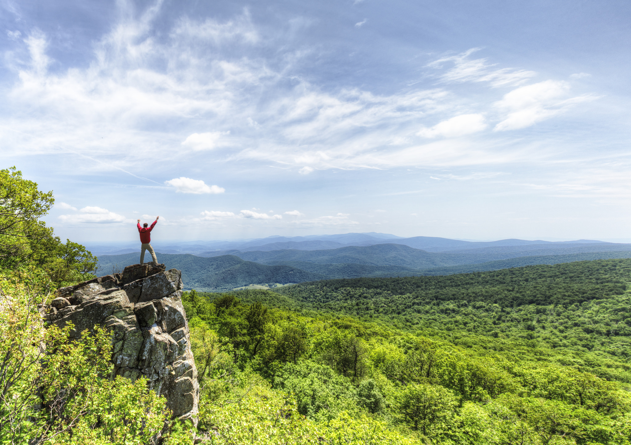
NPS via NPS.gov (Public Domain)
Shenandoah National Park: Skyline Drive & Blue Ridge Views - 2026 Guide
11 min read
Park Guide
By 10:30 on a summer Saturday, the main parking areas at popular trailheads are full, and vehicles begin circling the Big Meadows lot like hawks.
Your plans
This article contains affiliate links — we may earn a small commission at no extra cost to you.
At a glance
Entrance Fee
Private vehicle $30 · Motorcycle $25 · Per person $15Full fee schedule
Hours
Shenandoah National Park is always open. However, portions of Skyline Drive, the only public road th
Best Time
June-September (summer), September-October (fall colors)
Address
Shenandoah National Park, Luray, VA, 22835
Website
38.4924, -78.4691
Google MapsStart before 9 AM. That's the single most important piece of advice for anyone looking for practical tips for Shenandoah National Park that actually make a difference. By 10:30 on a summer Saturday, the main parking areas at popular trailheads are full, and vehicles begin circling the Big Meadows lot like hawks. By noon, you're parking along Skyline Drive shoulders if you can find a legal spot at all.
Shenandoah runs 105 miles along the Blue Ridge, barely 75 miles from D.C. It's a long, narrow park—never more than a few miles wide—defined by Skyline Drive, the 105-mile road that traces its spine. What sets it apart isn't just the westward views across the Shenandoah Valley, though that's what draws most people. It's the convergence of Appalachian hardwood forest, high-elevation meadows that seem misplaced on a ridge, and over 500 miles of trails tying it together. You can hike to a 93-foot waterfall before lunch and watch deer graze in a mountaintop meadow by sunset.
Newcomers often underestimate the elevation change packed into this park. The ridge sits about 3,000 feet above the valley floor, but trails drop into hollows and climb back out repeatedly. Your legs will remind you of every step the next morning.
The Lay of the Land
Shenandoah organizes itself along Skyline Drive, with mile markers that serve as the universal reference system. Everything in the park - trailheads, overlooks, campgrounds, lodges - is described by its mile marker. Get used to saying "mile 51" instead of "Big Meadows" and you'll navigate like someone who's been coming for years.
North District (Mile 0-31)
Front Royal entrance at mile 0. This section is the narrowest part of the park and sees the lightest traffic on the trails. Mathews Arm Campground (mile 22.1) anchors this district. The Dickey Ridge Visitor Center (mile 4.6) is your first stop entering from the north. Trails here tend to be shorter and less crowded than the central district. Elkwallow Wayside (mile 24) is the only food-and-gas stop in this section.
Central District (Mile 31-65)
This is where most visitors spend their time. Thornton Gap entrance (mile 31.5) and Swift Run Gap entrance (mile 65.5) bookend it. Big Meadows (mile 51) is the heart of the park - a high-elevation grassland that feels like someone lifted a chunk of prairie and dropped it on a mountain. The Big Meadows complex includes a campground, lodge, wayside, gas station, and amphitheater. This is also where the most popular trails concentrate: Dark Hollow Falls, Hawksbill Summit, and the Bearfence Rock Scramble.
The crowds are real here. Rangers will tell you that the stretch between mile 45 and mile 55 sees more traffic than the rest of the park combined on peak weekends.
South District (Mile 65-105)
Rockfish Gap entrance (mile 105) connects to the Blue Ridge Parkway. Loft Mountain (mile 79.5) is the main hub, with a campground, wayside, and store. This section feels more remote. The trails are longer, the overlooks less crowded, and the forest feels denser. The Appalachian Trail runs the entire length of the park, but in the south district it follows Skyline Drive more closely, making for easier access to short sections.
Driving from Front Royal to Rockfish Gap takes about three hours without stops. With stops at overlooks - and you will stop - plan on four to five hours.
Planning Your Visit
Entrance Fees (as of 2026)
The park went fully cashless on July 1, 2025. Credit cards, debit cards, and mobile payments only at the entrance stations.
- Private vehicle (7 days): $30
- Motorcycle (7 days): $25
- Per person (walk-in or bicycle, 16+): $15
- Commercial vehicles: $25 base + $10 per passenger (sedan), $75 (van, 7-15 capacity), $100 (mini-bus, 16-25), $200 (motor coach, 26+)
The America the Beautiful annual pass covers entrance for the pass holder and vehicle occupants. If you plan to visit more than two national parks in a year, buy the pass.
Hours
The park itself is always open. Skyline Drive closes during inclement weather - ice and snow in winter, high winds, and occasional fog so thick you can't see the hood of your car. Text SHENALERTS to 888777 for real-time road closure updates.
Reservation Windows
Most of the park operates on a first-come basis. The exceptions:
- Old Rag day-use tickets are required March 1 through November 30. You must obtain a ticket before arriving. These sell out weeks in advance on weekends.
- Campground reservations open six months ahead on Recreation.gov. Big Meadows Campground fills for the entire summer within hours of the booking window opening.
Best Time to Visit
The park has four distinct seasons, and they matter more here than at many parks because of the elevation. The mountain ridge runs about 10°F cooler than the valley below.
- March-May: Spring comes late at elevation. Trails below 2,000 feet green up in April; the ridge doesn't leaf out until mid-May. Wildflowers peak in late April through early June. Crowds are light. Some facilities remain closed until late March.
- June-August: Peak season. Hot and humid, but the ridge is bearable. Thunderstorms roll in almost daily by 2 PM. Start hikes early. All facilities open.
- September-October: The best season. Cool temperatures, lower humidity, and fall color that draws crowds from DC. Leaf peak varies by elevation - highest elevations color first in early October, the ridge in mid-October. Weekend traffic on Skyline Drive can be stop-and-go.
- November-February: Quiet. Many facilities closed. Ice and snow on trails. Skyline Drive closes during and after storms. Fewer than 10% of annual visitors come in winter.

Getting There & Getting Around
Directions
The park has four entrance stations, and which one you use determines your experience:
- Front Royal (north): I-66 to US 340. Best for entering the north district. Closest to DC (about 75 minutes).
- Thornton Gap: US 211. Most direct access to the central district and Big Meadows.
- Swift Run Gap: US 33. Good access to the central-south district.
- Rockfish Gap: I-64 to US 250. Southern entrance. Connects to the Blue Ridge Parkway.
The park's physical address (Luray, VA 22835) goes to the administrative offices, not the park itself. GPS can be unreliable - the park website recommends using entrance-specific addresses rather than the general park address.
Parking Reality
This is where most visitors underestimate Shenandoah.
The parking situation at popular trailheads is genuinely difficult from mid-June through October. Dark Hollow Falls lot (mile 50.7) fills by 8:30 AM on summer weekends. Old Rag's main lot is closed through November 2026 for infrastructure improvements - hikers must use the boundary access parking. The Big Meadows lots fill by 9:30 AM.
The park service rule: park only in designated areas. Vehicles towed from unauthorized spots at your expense.
Cell Service
Cell service drops out along most of Skyline Drive. You'll get sporadic signals at overlooks and near Big Meadows, but don't count on navigation apps. Download offline maps and a shenandoah national park map before you arrive. The NPS app has offline content for the park.
What to Do
Hiking
This is the reason most people come. Over 500 miles of trails, including 101 miles of the Appalachian Trail. The range is extraordinary - from the Limberlost Trail, a paved 1.3-mile loop accessible to wheelchairs, to the Old Rag Circuit, a 7-to-8-hour rock scramble that requires pre-purchased tickets.
The best shenandoah hiking trails for first-time visitors:
- Hawksbill Summit (mile 45.5-46.5): 1-2 hours round trip. Shenandoah's highest peak at 4,051 feet. The viewing platform offers 360-degree views. Two routes - the Upper Hawksbill trail is gentler; the shorter route from Hawksbill Gap is steeper.
- Stony Man (mile 41.7): 1-2 hours. Easy grade to a spectacular westward view. No pets allowed.
- Dark Hollow Falls (mile 50.7): 1.5-2 hours. 1.4 miles round trip to a 70-foot waterfall. Steep on the return. No pets. This is the most popular waterfall hike in the park - go early.
- Bearfence Rock Scramble (mile 56.4): 1-2 hours. Short but requires using hands and feet. 360-degree views from the top. No pets.
For a deeper specific routes, check out our full guide to shenandoah hiking trails.
Scenic Driving
Skyline Drive is the experience. 105 miles, 75 overlooks, 35 mph speed limit. Plan 3 hours minimum to drive the full length. The best overlooks face west for afternoon light: Baldface Mountain Overlook (mile 6.5), Brown Mountain Overlook (mile 29), and Big Run Overlook (mile 65) are standouts.
Wildlife Viewing
Big Meadows is the best spot. Deer graze here at dawn and dusk. Black bears are active in the park - you'll see them most often in early morning along Skyline Drive edges. Birders come for warblers in spring and raptors in fall. The park hosts more bird species than most state forests in the region. Our upcoming guide on wildlife viewing will cover specific locations and seasons.
Stargazing
Shenandoah has accessible night skies. Big Meadows and the higher overlooks offer dark enough conditions for Milky Way viewing. The park runs astronomy programs at the Big Meadows Amphitheater during summer.
Other Activities
Biking is allowed on Skyline Drive and park roads (not on trails). Fishing requires a Virginia license. Horseback riding on designated trails. The Junior Ranger program works well for families with kids.

Where to Stay
Inside the Park
Four campgrounds, and they fill fast:
- Big Meadows Campground (mile 51.2): 221 sites, $75/night as of 2025. Central location. Opens late March. Showers, flush toilets, dump station. This is the most convenient base for exploring the central district.
- Lewis Mountain Campground (mile 57.5): 30 sites, $30/night. Small, quiet, basic. Opens late March. Vault toilets, no showers. Appeals to visitors who want fewer neighbors.
- Mathews Arm Campground (mile 22.1): 165 sites, $30/night. Opens late April. North district. Good option if entering from Front Royal.
- Loft Mountain Campground (mile 79.5): Sites available. Opens late April. South district. Perched on Big Flat Mountain.
Lodging inside the park: Big Meadows Lodge (mile 51) offers rooms, cabins, and suites. Skyland (mile 42) is the other in-park lodging option. Both are operated by the park concessionaire and book out months in advance for fall weekends.
Outside the Park
Gateway towns include Luray (best for central district access), Front Royal (north), and Stanardsville (south). Luray has the widest range of shenandoah national park hotels nearby, from motels to B&Bs. For camping near shenandoah, the George Washington National Forest surrounds the park and offers dispersed camping options with no reservations needed.
For a full breakdown of where to sleep, see our guides on camping options and lodging and accommodations.
Seasonal Guide
Spring (March-May)
What's open: Big Meadows and Lewis Mountain campgrounds open late March. Mathews Arm and Loft Mountain open late April. Waysides and visitor centers open on staggered schedules through April.
Weather: 40-70°F. Rain is common. Trails are muddy. The lower elevations green up first - the ridge doesn't fully leaf out until mid-May.
What makes it worth it: Wildflowers. Trillium, bloodroot, and jack-in-the-pulpit carpet the forest floor. Crowds are thin. Waterfalls run full.
Summer (June-August)
Peak everything - crowds, heat, humidity, and operating hours. All facilities open. Daily thunderstorms by mid-afternoon. Temperatures on the ridge: 70-85°F. In the valley: 80-95°F.
Start every hike before 8 AM. Pack extra water for this stretch - dehydration is the most common issue rangers deal with. The elevation gain is worth it, but not in the midday heat.
The Big Meadows Amphitheater runs evening ranger programs. Stargazing programs happen on clear nights.
Fall (September-October)
The best season, and everyone knows it. Peak color on the ridge runs early to mid-October. Weekend traffic on Skyline Drive can back up for miles. Arrive before 8 AM or after 3 PM if you want to avoid the crawl.
Temperatures: 50-75°F in September, 40-65°F in October. Bring layers - the ridge is 10°F cooler than the valley, and temperature drops fast after sunset.
This is the time for shenandoah hikes best suited to long days: the Cedar Run-Whiteoak Circuit, Rose River Falls, and the full Hawksbill Loop.
Winter (November-February)
Quiet. Skyline Drive closes during and after storms. Ice and snow on trails - microspikes are essential above 3,000 feet. Most facilities are closed, though the park remains open for hiking.
What works in winter: Views. With the leaves gone, you can see 30+ miles from overlooks that are blocked by foliage in summer. Wildlife is more visible. You'll have entire trailheads to yourself.

Practical Takeaways
- Book Old Rag tickets in advance. From March 1 through November 30, you need a day-use ticket. They sell out weeks ahead for weekends. The main parking lot is closed through November 2026 - check the park website for boundary access parking locations.
- Bring cash is irrelevant - the park is cashless. As of July 2025, only credit cards, debit cards, and mobile payments are accepted at entrance stations.
- Skyline Drive is not a shortcut. The speed limit is 35 mph. It takes three hours to drive the full length. If you're trying to get from Front Royal to Waynesboro quickly, take the valley routes, not the park road.
- The park is 10°F cooler than the valley. That sounds nice in August. In April and October, it means you need a jacket you didn't pack. Always bring an extra layer.
- Cell service drops out at mile 5 and doesn't return reliably until mile 100. Download maps, directions, and your shenandoah national park map before you enter. The NPS app has offline content.
- Big Meadows Wayside has the only gas in the park. As of 2026, the pumps were closed for upgrades - verify current status before relying on them. Fill up in Luray or Front Royal before entering.
- Most visitors underestimate the elevation change on trails. A 3-mile hike that drops 1,000 feet to a waterfall means a 1,000-foot climb back to the car. Your calves will have strong opinions about this.
- The best views are not always at the named overlooks. The pullouts between mile 35 and mile 45, without signs or names, often have better sightlines than the official stops. Pull over when you see a gap in the trees.
- Rangers at the visitor center emphasize starting early for a reason. By 10 AM on a summer Saturday, the Dark Hollow Falls lot is full, the Bearfence lot is full, and the Big Meadows lots are circling. Early morning is your best bet for parking, wildlife viewing, and avoiding afternoon thunderstorms.
- The park's physical address is for administrative offices, not the park itself. Use entrance-specific GPS addresses from the park website. Plugging "Shenandoah National Park" into your navigation may send you to a building in Luray that is not where you want to be.
Final Thoughts
Shenandoah is a park that rewards people who arrive early, hike past the first mile (where 80% of visitors turn around), and understand that 105 miles of mountain ridge means the weather changes every few miles. It's not a park for checking off a single iconic landmark - there is no Old Faithful or Half Dome here. It's a park for spending time in: driving the full drive, hiking a half-dozen short trails, watching the light change across the valley from a different overlook each day.
The park asks you to plan ahead - for parking, for tickets, for weather. What it gives back is the Blue Ridge at its most accessible: a mountain range that runs within an hour of the nation's capital, holding waterfalls, meadows, and 500 miles of trail that most visitors never fully explore. That's the real Shenandoah.
For more information, see our complete National Park Guide.
Related: shenandoah hiking trails guide
Recommended Gear
What experienced visitors bring to Shenandoah National Park: Skyline Drive & Blue Ridge Views - 2026 Guide
Links may earn us a commission at no extra cost to you. We only recommend gear we believe in.
Hiking Essentials
Hydration Pack (3L)
Hands-free water for long trail days
Trekking Poles (Pair)
Save your knees on steep descents
Hiking Boots (Ankle Support)
Sturdy footwear for rocky, uneven trails
Sun & Heat Protection
Wide-Brim Sun Hat
Full coverage UPF 50+ protection at altitude
Insulated Water Bottle (32oz)
Keeps water cold in desert heat all day
Electrolyte Mix Packets
Replace what water alone cannot during intense heat
Winter Gear
Microspikes / Traction Devices
Essential for icy rim trails in winter months
Packable Down Jacket
Lightweight warmth that stuffs into a pocket
Sources
- Official source: NPS — Shenandoah National Park nps.gov/shen/index.htm
Explore More National Parks

Where to See New River Gorge Bridge
Discover whitewater rapids, elite rock climbing routes, and wild West Virginia gorge. Complete 2026...

Cuyahoga Valley National Park: Ohio's River Valley Escape - Complete 2026 Guide
Cuyahoga Valley National Park: Ohio's River Valley Escape - Complete 2026 Guide Overview Why does th...

Great Smoky Mountains National Park: Complete Guide (2026)
Great Smoky Mountains National Park, America's most visited park, has no entrance gates but requires...

Congaree National Park: Ancient Floodplain Forest & Fireflies - 2026 Guide
Discover Congaree National Park national park guide with our comprehensive guide. Expert tips, pract...
Photo Gallery
More to Explore

Park Guide
Acadia National Park: Carriage Roads, Cadillac Mountain & 2026 Guide
Discover carriage roads, Cadillac Mountain, and rugged Maine coast. Complete 2026 guide to Acadia National Park — trails, fees, lodging, permits, and what rangers recommend.

Hiking Guide
Grand Canyon Hiking Trails: Day Hikes, Water Sources & Rim to Rim
Compare Grand Canyon hiking trails: Bright Angel, South Kaibab, Hermit, Grandview, and rim to rim, with distances, elevation, water stops, and trailhead access for each.

Best Of
Best of Glacier Bay National Park
The best of Glacier Bay is reached by boat: ranger-led day tours up the bay to the tidewater glaciers. What's worth it, how to book, and when to go (2026).

Campsite Guide
White Sands Backcountry Camping: Closed for 2026 — What to Know
As of 2026, backcountry camping at White Sands National Park is closed for site rehabilitation. What that means, and where to camp nearby instead.

Weather Guide
Guadalupe Mountains National Park Weather: Weather
Guadalupe Mountains National Park: weather guide guide updated 2026. Practical visitor information, reservations, and seasonal tips worth bookmarking before

Best Of
Best of Cuyahoga Valley National Park: Best Things to Do
Seeing a Cleveland Orchestra concert with the woods as your backdrop is a uniquely Cuyahoga Valley experience.
Sign in to join the conversation.
Sources & Attribution
Location data courtesy of the National Park Service (U.S. Department of the Interior). NPS data is public domain. Official NPS page.
Images: NPS; NPS; NPS; NPS; NPS.
Map data © OpenStreetMap contributors.
Park operations alerts: NPS.gov · Weather and weather hazards: National Weather Service · Live conditions.
Information may change. Always verify fees, hours, and conditions directly with the official source before visiting.
Did this guide help? Share it with a friend.