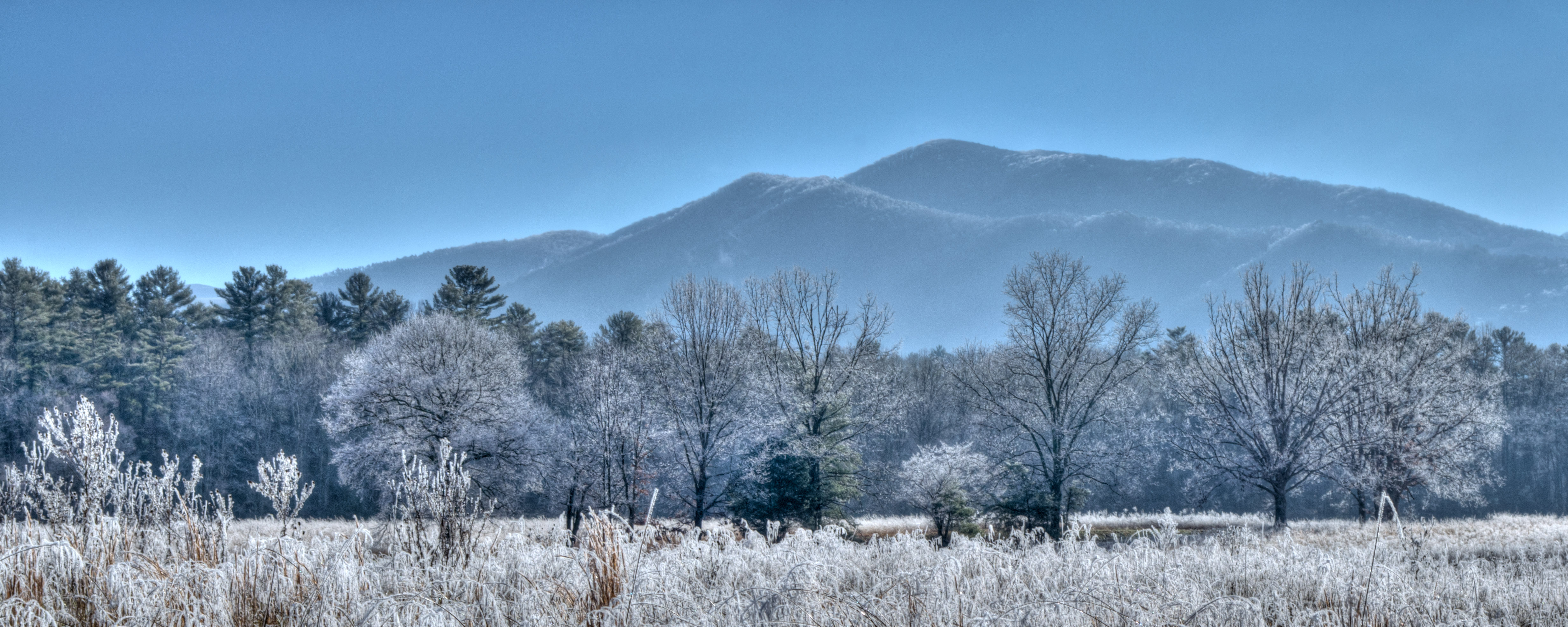
Congress established Great Smoky Mountains National Park in 1934, a hard-won compromise to protect a vital stretch of Southern Appalachian wilderness along the Tennessee-North Carolina border. The park's name refers to the distinctive blue-gray haze that settles over these ridges, created by volatile organic compounds released from the dense forest canopy. This mist, combined with ancient mountains and preserved pioneer settlements, now attracts over 12 million annual visitors—making it America's most visited national park. This guide provides the essential information for managing that popularity, from the required parking tag system to locating quieter areas beyond the main thoroughfares. We'll address practical logistics, seasonal considerations, and methods for experiencing the park's true character beyond the familiar scenic overlooks.
Flow reliability
Seasonal consistency of median discharge from the curated USGS gauge for this place.
Spring
77%
year-to-year consistency
Summer
70%
year-to-year consistency
Fall
42%
year-to-year consistency
Winter
61%
year-to-year consistency
Median monthly discharge (cfs)
Median discharge in cubic feet per second by calendar month
Jan
Feb
Mar
Apr
May
Jun
Jul
Aug
Sep
Oct
Nov
Dec
302
381
370
288
253
154
153
146
96.9
80.1
115
199
In the last 10 falls, roughly 3 of every 8 September–November weeks sat inside this band (116–348 cfs); typical flow in those weeks 178 cfs, median water temp 58°F (14.2°C).
Computed from 10 years of USGS daily records, station 03497300 (3,649 daily values). Last computed Oct 19, 2026.
Hydrological description only — not advice about wading, floating, or whether conditions are safe for recreation. Always check current USGS readings and local guidance before you go.
Advertisement
Photo: NPS via NPS.gov (Public Domain)
The Lay of the Land and Core Logistics
Great Smoky Mountains National Park has no entrance gates. You simply drive in, which is a key part of its accessibility and its congestion problem. The three main portal towns are Gatlinburg and Townsend in Tennessee, and Cherokee in North Carolina. Primary roads like Newfound Gap Road (US-441) and Little River Road are open 24/7, weather permitting. That "weather permitting" clause is critical - elevation here ranges from 875 feet to 6,643 feet, and conditions at the top can be a different season from the bottom. A 60-degree day in Cherokee can mean ice on the road at Newfound Gap.
The single most important logistical detail as of 2026 is the parking tag. Every vehicle parking for longer than 15 minutes anywhere in the park needs one. Daily tags are $5, weekly $15, and an annual tag is $40. Rangers check them diligently. You can purchase them online or at self-service kiosks at most major trailheads and visitor centers. This isn't an entrance fee; it's a parking fee. Plan for it.
Cell service is notoriously unreliable. Download maps, trail information, and your parking tag confirmation before you leave your lodging. The park's two main visitor centers are Sugarlands (near Gatlinburg) and Oconaluftee (near Cherokee). Both have park films, exhibits, bookstores, and rangers who can provide the latest trail and road conditions. That's your best first stop.
Navigating Seasonal Road Closures
A significant number of secondary roads are closed seasonally. As of spring 2026, this includes the road to Kuwohi (formerly Clingmans Dome), the Roaring Fork Motor Nature Trail, and Parson Branch Road, among others. These closures typically last from late fall through early spring. The park website updates these dates annually. If your dream drive is on that list, you're visiting in the wrong season. Always check the current scenic drive map and alerts before you finalize an itinerary.
Photo: NPS via NPS.gov (Public Domain)
Choosing Your Experience: Scenic Drives, Day Hikes, and Historic Areas
The park's scale requires strategic planning. Attempting to visit Cades Cove, Kuwohi, and complete a waterfall hike in a single day guarantees excessive time in your vehicle. Many first-time visitors underestimate travel durations—these mountain roads wind considerably and experience heavy traffic.
The Can't-Miss Scenic Drives
Newfound Gap Road is the park's cross-mountain artery, climbing from Cherokee to Gatlinburg. The view from Newfound Gap itself is the classic, wide-angle panorama. But the Carlos Campbell Overlook, a few miles north, offers a more interesting vista showing regrowth from the 2016 wildfires. Cades Cove Loop is an 11-mile, one-way road through a broad valley dotted with historic cabins, churches, and barns. It's a wildlife corridor, so traffic jams caused by bear sightings are standard. Go at sunrise or on a Wednesday or Saturday morning when the loop is closed to vehicles for cyclists and pedestrians. The Foothills Parkway sections, like the 16.6-mile stretch from Chilhowee to Walland, offer sweeping views of the Smokies with far fewer cars.
Accessible and Iconic Day Hikes
With over 800 miles of trails, the options are overwhelming. Rangers will tell you that parking at the most popular trailheads (Alum Cave, Rainbow Falls, Laurel Falls) is often full by 9 AM. Have a backup plan.
For a manageable waterfall loop, the Deep Creek Waterfalls Loop near Bryson City connects Tom Branch Falls and Indian Creek Falls on a 2.4-mile circuit. It's wide, gentle, and less crowded than the Gatlinburg-area falls. The Gatlinburg Trail itself is one of only two trails in the park where pets and bikes are allowed; it's a flat 2-mile one-way path from the Sugarlands Visitor Center to the edge of town.
For a high-elevation challenge with a payoff, the hike to Charlies Bunion is 8 miles roundtrip on the Appalachian Trail. The trail narrows here, with spruce-fir forest giving way to bare rock ledges and views that stretch for miles. It's a strenuous hike, and the weather up top can turn fast. The 5.4-mile Little River, Cucumber Gap, Jakes Creek Loop near Elkmont is a quieter, mid-elevation option that passes historic vacation cabins and follows a rushing stream.
Stepping into History
The park protects over 90 historic structures. In Cades Cove, the Cable Mill Historic Area is a working gristmill surrounded by barns and a homestead. The walk to the John Oliver Cabin is only 0.3 miles roundtrip, but it places you in the middle of the cove's pastoral scene. In the Cataloochee Valley on the North Carolina side, you'll find a more remote collection of frame houses, a school, and a church. This valley is also the best place for wildlife viewing, particularly the park's reintroduced elk herd. Dawn and dusk are your best bet.
Photo: NPS via NPS.gov (Public Domain)
When to Visit and Where to Stay
The best time to visit depends entirely on your tolerance for crowds and your objective. Summer (June-August) offers the most reliable road access and full greenery, but also thunderstorms, high humidity, and peak visitation. Fall (late September-October) brings spectacular color, but also the largest crowds of the year; weekends are a traffic standstill. Spring (April-May) has wildflowers and rushing streams, but many high-elevation roads and trails remain closed. Winter is quiet and starkly beautiful, but services are limited and ice is a real hazard.
Camping Inside the Park
The park operates nine frontcountry campgrounds. As of 2026, nightly rates are typically $30. None have RV hookups, but most have flush toilets and cold running water. Cades Cove Campground (161 sites) is open year-round and puts you in the heart of the most popular valley. Elkmont Campground (220 sites) is the closest to Sugarlands and Gatlinburg, open from March through November. For more solitude, consider Cosby Campground (157 sites) on the quieter, northeastern side of the park. All campgrounds are first-come, first-served for some sites, but reservations are strongly recommended and can be made up to six months in advance on Recreation.gov.
Lodging in Gateway Towns
If you're not camping, you'll be staying outside the park. Gatlinburg and nearby towns offer everything from chain hotels to cabins. Gatlinburg is a bustling, tourist-focused strip with endless attractions. Townsend bills itself as the "Peaceful Side of the Smokies" and is closer to Cades Cove. Cherokee, on the North Carolina side, is home to the Eastern Band of Cherokee Indians and has a different cultural flavor. Where you stay dictates which part of the park you'll explore most easily. Commuting across the park daily is possible but time-consuming.
Photo: NPS via NPS.gov (Public Domain)
Beyond the Basics: Crowd Management and Local Insights
Experienced visitors know a few tricks. First, anything you want to do that involves a parking lot, do it before 9 AM or after 3 PM. The midday hours are for scenic drives or picnics, not popular trailheads. Second, use the shuttle systems when available. In summer and fall, the park often runs a shuttle from the Sugarlands Visitor Center to the Laurel Falls trailhead, and from the Townsend Visitor Center to Cades Cove, to alleviate parking.
The park website doesn't mention the sound. On a quiet trail away from roads, the dominant noise is often the wind through the hemlocks and the constant chatter of streams over rock. It's a specific, calming white noise you don't get in drier parks.
For a guided perspective, consider the ranger-led programs or commercial tours and guided experiences. A naturalist can point out the difference between a tulip poplar and a buckeye, or explain how the chestnut blight changed this forest forever.
One common mistake is underestimating the weather. The temperature can drop 10-20 degrees from a trailhead to a summit. A lightweight rain layer is non-negotiable, even on a sunny forecast. The mountains make their own weather.
Practical Takeaways
Buy the Parking Tag First. Before you do anything else, purchase your daily, weekly, or annual parking tag online. Have the proof ready on your phone or printed.
Arrive Early or Late. Target trailheads before 9 AM. Use midday for scenic drives, visitor centers, or picnics. Popular areas like Cades Cove are often less crowded in the late afternoon.
Pack for All Weather. Always have a rain jacket, an extra insulating layer, and sturdy footwear. The elevation change is real and conditions shift fast.
Check Road Status. Before you go, verify which seasonal roads (like Roaring Fork or Kuwohi Road) are open for your visit. Base your itinerary on what's accessible.
Have a Backup Hike. Your first-choice trailhead parking will likely be full. Know the name and location of a second, less-congested option for the same area.
Respect Wildlife. Use the 50-yard rule for elk and bears. Never feed animals. Store food properly in your car or at bear-proof cable systems at campsites.
Go Beyond the Loop. If time allows, explore a less-visited area like Cataloochee Valley or the Greenbrier section. You'll find 90% fewer people and the same beautiful mountains.
Final Thoughts
Great Smoky Mountains National Park challenges you to look closer. The first view is a haze of blue ridges. The second look reveals the stone chimney hiding in the trees, the dark green of a rhododendron thicket, the precise engineering of a log cabin notch. Its popularity is its beauty, but also a management puzzle. Your visit will be smoother if you plan around the crowds, not through them. Embrace an early morning. Sit by a creek that isn't on the top ten list. Read the historical marker at a quiet picnic area. The park's real depth isn't just in its mountain vistas, but in the layers of life - human and natural - that have persisted here across centuries. That's what you're there to find.
Recommended Gear
What experienced visitors bring to Great Smoky Mountains National Park: Complete Guide (2026)
Links may earn us a commission at no extra cost to you. We only recommend gear we believe in.