Most visitors underestimate how much of Great Smoky Mountains National Park reveals itself from behind a windshield. The park contains over 800 square miles of protected forest, and the primary roads - Newfound Gap Road (US-441), Little River Road, and Laurel Creek Road - remain open 24 hours a day, year-round, weather permitting. But the real driving experience lies in understanding which road to take, which direction to drive it, and when to go. This guide covers the essential great smoky mountains national park driving trails and how to make the most of each one.
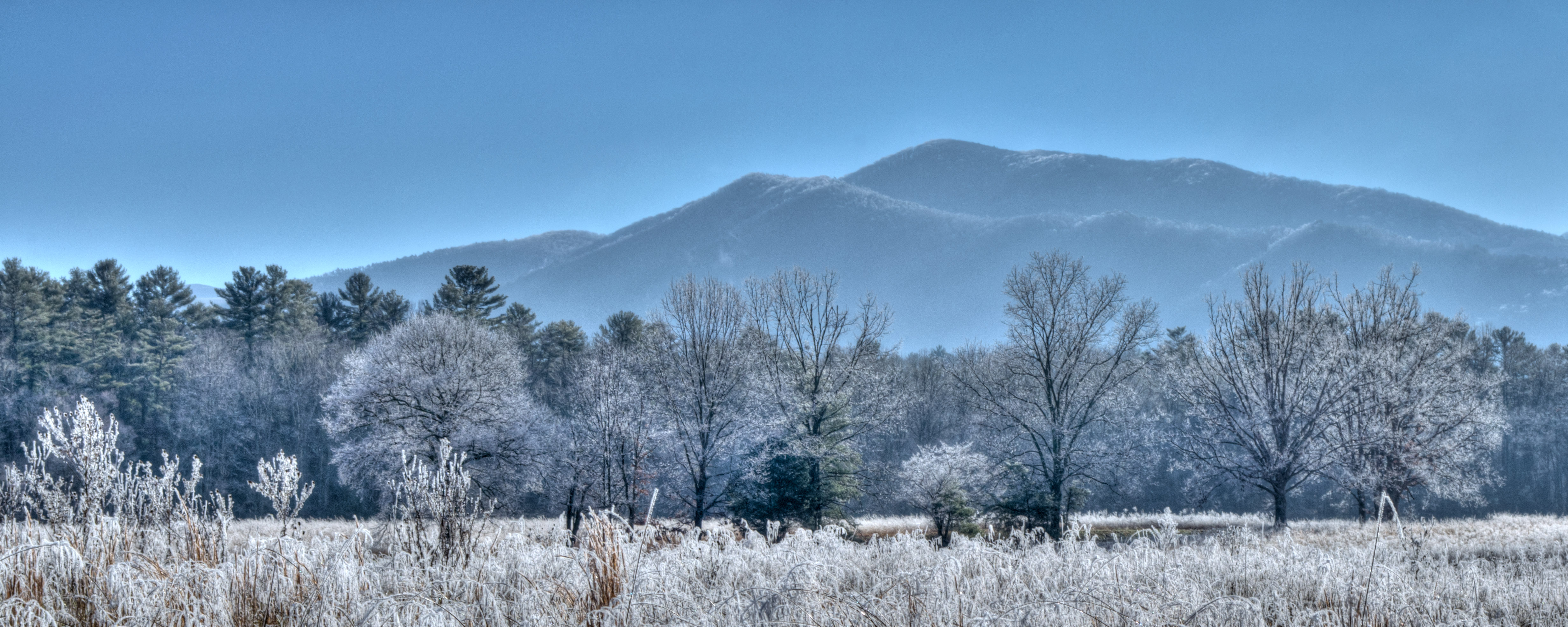
NPS via NPS.gov (Public Domain)
Great Smoky Mountains National Park Scenic Drives: Driving Trails (2026)
8 min read
Scenic Drives
Little River Road connects the Sugarlands Visitor Center near Gatlinburg to Townsend, running about 18 miles along the Little River.
For more, see hiking trails and best time to visit.
Start with the complete visitor guide for park-wide logistics, then come back here for drive-specific detail.
The Drive at a Glance
There isn't one single scenic drive in this park. There are several, and the best choice depends on what you want to see and how much time you have.
Newfound Gap Road (US-441) is the spine of the park, running 33 miles from Gatlinburg, TN to Cherokee, NC. It crosses the park's highest vehicle-accessible point at Newfound Gap (5,046 feet). Allow 1.5 to 2 hours without stops, but you'll want stops. Two-way road, paved, suitable for all vehicles.
Cades Cove Loop is an 11-mile one-way road through a broad valley ringed by mountains. The loop is paved but narrow, with frequent stops for wildlife jams. Plan 2 to 4 hours depending on traffic. Open year-round but closed to vehicles until 10 AM on Wednesdays May through September for bicycle and pedestrian access.
Foothills Parkway consists of three separate segments totaling about 37 miles. These are newer parkway-style roads built for scenic driving rather than transportation. The Chilhowee to Walland segment runs 16.6 miles one-way. The Walland to Wears Valley segment is 14.75 miles. The Cosby to I-40 segment is 5.6 miles. All are paved and suitable for any vehicle, but lack services.
Little River Road connects the Sugarlands Visitor Center near Gatlinburg to Townsend, running about 18 miles along the Little River. It's a primary thoroughfare but offers numerous pullouts for river views and trailheads. Often less crowded than Newfound Gap Road.

Stop by Stop
Newfound Gap Road: Gatlinburg to Cherokee
#### Sugarlands Visitor Center
The logical start point if entering from Gatlinburg. Pick up a park newspaper and check current road conditions. Rangers will tell you that conditions at the visitor center (elevation about 1,500 feet) rarely predict conditions at the top. Cell service drops out a few miles past the visitor center and won't return until Cherokee.
#### Carlos Campbell Overlook
About 5 miles up from Sugarlands. From this overlook you can see rolling mountain ridges and visible evidence of the 2016 Chimney Tops 2 fire regrowth. The south-facing orientation makes this best in late morning. Most people spend 5 minutes here - spend 10. The regrowth story is worth reading on the interpretive panel.
#### Alum Cave Bluffs Trailhead
At mile 8.5, this is one of the park's most popular trailheads. The parking lot fills by 7:30 AM on summer weekends. If you're driving through without hiking, the trailhead itself offers a look at Arch Rock from the road - a natural rock formation visible just off the pavement. This trail is a primary access point for some of the best hiking trails in great smoky mountains national park.
#### Newfound Gap
Elevation 5,046 feet. The state line crossing point. From this overlook you can see multiple mountain ranges on clear days: the Plott Balsams to the east, the Smokies crest to the west. The Appalachian Trail crosses the road here. The Rockefeller Memorial marks the spot where the park was officially dedicated in 1940. Plan 20-30 minutes. The temperature here is typically 10-20°F cooler than at the park entrances.
#### Deep Creek Valley Overlook
On the North Carolina side, about 6 miles south of Newfound Gap. This is where you might catch a cloud inversion on early mornings - clouds pooling in the valleys while the overlook stays clear. Come before 9 AM for that phenomenon. It's a quick pullout, 5 minutes unless photography is your focus.
#### Oconaluftee Visitor Center
The southern terminus near Cherokee. The adjacent Mountain Farm Museum is worth 15-20 minutes if you haven't seen the historic structures elsewhere in the park. Restrooms, water, and ranger-staffed information desk.
Cades Cove Loop
#### John Oliver Cabin
The first stop on the loop, about 0.3 miles from the start on a short path. This is the oldest structure in Cades Cove, built in the 1820s. The setting - a log cabin in a broad meadow with mountains rising behind - is what most people picture when they think of the Smokies. Early morning is your best bet for photos, when the light hits the cabin face-on.
#### Cable Mill Historic Area
About halfway around the loop. This cluster of buildings includes a gristmill, barn, blacksmith shop, and other structures typical of remote Appalachian communities. The mill operates seasonally - rangers demonstrate corn grinding when it's running. Plan 30-45 minutes here minimum. Restrooms available.
#### Dan Lawson Place
About 7 miles into the loop, just past the intersection with Hyatt Lane. A group of historic structures including a barn, smokehouse, and the main house built around 1856. Less crowded than the Cable Mill area. Worth 10-15 minutes.
#### Carter Shields Cabin
The last historic structure on the loop. A small log cabin with a distinctive setting near the end of the 11-mile drive. Most visitors have started to check out by this point - don't. It's one of the quieter stops on the loop and the cabin's location near the creek makes for good late-afternoon photos.
Foothills Parkway Segments
#### Chilhowee to Walland (16.6 miles)
Best driven south to north in the afternoon when the light falls on the Chilhowee Mountain face. This segment offers the longest continuous views of any park road. Multiple pullouts, no services. Most visitors underestimate how long this segment takes - budget 45 minutes to an hour not counting stops.
#### Walland to Wears Valley (14.75 miles)
This newer segment opened in 2018. It runs along the north side of the park with views toward the main Smoky Mountains crest. The overlook at Look Rock has a short trail to a fire tower. Early morning is your best bet for this segment - fog often settles in the valleys below while the overlooks stay clear. Cell service drops out midway through.
#### Cosby to I-40 (5.6 miles)
The shortest and least dramatic segment, but useful as a connector. It runs down to I-40 near the North Carolina line. Worth it if you're already in the Cosby area but not worth a dedicated trip.

Timing and Crowds
The single most important thing to understand about driving in this park: the roads are busiest between 10 AM and 3 PM, and the most popular pullouts fill early.
On Newfound Gap Road, traffic flows heaviest from Gatlinburg southbound between 9:30 AM and noon, then northbound from Cherokee between 1 PM and 4 PM. Drive the opposite direction of the flow to avoid the worst of it. Tour buses run heaviest in the middle of the day - they tend to stop at Newfound Gap and the visitor centers.
Cades Cove Loop experiences traffic jams that can turn a 1-hour drive into 3 hours on summer weekends. The biggest bottleneck is the Cable Mill area mid-loop. Wildlife sightings - particularly black bears - cause instant stop-and-go conditions. If you can, arrive at the loop entrance before 8 AM.
Seasonal road notes: Heintooga Ridge Road and Parson Branch Road are closed for the season as of 2026. Straight Fork and the one-way section of Balsam Mountain Road are also closed. Check the park website for current conditions before heading out.
For photography on Newfound Gap Road, the best light hits the upper elevations in the early morning and the lower elevations in the late afternoon. The Carlos Campbell Overlook works best in late morning. The Deep Creek Valley Overlook works best before 9 AM for cloud inversions.

Driving Logistics
Parking tags are required for all vehicles parking longer than 15 minutes. As of 2026, rates are $5 for a daily tag, $15 for a weekly tag, or $40 for an annual tag. Buy online before you arrive - cell service is unreliable inside the park and rangers do check.
Gas is available in Gatlinburg, Townsend, and Cherokee - nowhere inside the park boundaries. Fill up before entering.
Vehicle restrictions. The Foothills Parkway segments have no length restrictions for passenger vehicles. Newfound Gap Road is standard two-lane mountain highway - RVs and trailers can handle it but should use lower gears on the descents. Cades Cove Loop has a 25-foot vehicle length limit and sections that feel tighter than that. If you're driving anything longer than 20 feet, consider skipping Cades Cove or arriving early to avoid meeting oncoming traffic in the narrow sections.
Cell service drops out entirely on most of Newfound Gap Road between the Sugarlands and Oconaluftee. The Foothills Parkway segments also have dead zones. Download maps and directions before entering the park.
Park Headquarters Road is closed for rehabilitation work on the Sugarlands water and wastewater systems as of 2026. This doesn't affect scenic drives but does affect access to administration buildings.
Restrooms are available at both visitor centers, the Cable Mill area in Cades Cove, and a few picnic areas. Between those points, there are vault toilets at some pullouts but nothing reliable.

Practical Takeaways
- Drive Newfound Gap Road southbound (Gatlinburg to Cherokee) in the morning for the best light and to stay ahead of the tour bus traffic.
- For Cades Cove, arrive at the loop entrance before 8 AM or skip it entirely on summer weekends. The Wednesday vehicle-free mornings (May through September) are worth planning around.
- The Foothills Parkway segments are never as crowded as the main park roads - the Chilhowee to Walland segment is the best of the three for pure scenic value.
- Pack extra water for this stretch - there are no services on any of the scenic drives once you leave the visitor center areas.
- The temperature varies 10-20°F from the base of Newfound Gap Road to the top. Bring a layer even on summer days.
- Most visitors miss the Deep Creek Valley Overlook because they're focused on getting to Newfound Gap. It's worth the stop, especially early in the day.
- Check the official park website for current road closures before you go - conditions change with weather and maintenance schedules, and several secondary roads are closed seasonally as of 2026.
For more information, see our complete National Park Guide.
Related: hiking in great smoky mountains national park guide
Related: hiking trails in great smoky mountains national park guide
Sources
- Official source: NPS — Great Smoky Mountains National Park nps.gov/grsm/index.htm
Photo Gallery
More to Explore

Park Guide
Acadia National Park: Carriage Roads, Cadillac Mountain & 2026 Guide
Discover carriage roads, Cadillac Mountain, and rugged Maine coast. Complete 2026 guide to Acadia National Park — trails, fees, lodging, permits, and what rangers recommend.

Hiking Guide
Grand Canyon Hiking Trails: Day Hikes, Water Sources & Rim to Rim
Compare Grand Canyon hiking trails: Bright Angel, South Kaibab, Hermit, Grandview, and rim to rim, with distances, elevation, water stops, and trailhead access for each.

Best Of
Best of Glacier Bay National Park
The best of Glacier Bay is reached by boat: ranger-led day tours up the bay to the tidewater glaciers. What's worth it, how to book, and when to go (2026).

Campsite Guide
White Sands Backcountry Camping: Closed for 2026 — What to Know
As of 2026, backcountry camping at White Sands National Park is closed for site rehabilitation. What that means, and where to camp nearby instead.

Weather Guide
Guadalupe Mountains National Park Weather: Weather
Guadalupe Mountains National Park: weather guide guide updated 2026. Practical visitor information, reservations, and seasonal tips worth bookmarking before

Best Of
Best of Cuyahoga Valley National Park: Best Things to Do
Seeing a Cleveland Orchestra concert with the woods as your backdrop is a uniquely Cuyahoga Valley experience.
Sign in to join the conversation.
Sources & Attribution
Location data courtesy of the National Park Service (U.S. Department of the Interior). NPS data is public domain. Official NPS page.
Images: NPS; NPS; NPS; NPS; NPS.
Map data © OpenStreetMap contributors.
Park operations alerts: NPS.gov · Weather and weather hazards: National Weather Service · Live conditions.
Information may change. Always verify fees, hours, and conditions directly with the official source before visiting.
Did this guide help? Share it with a friend.