For more, see camping options and best time to visit.
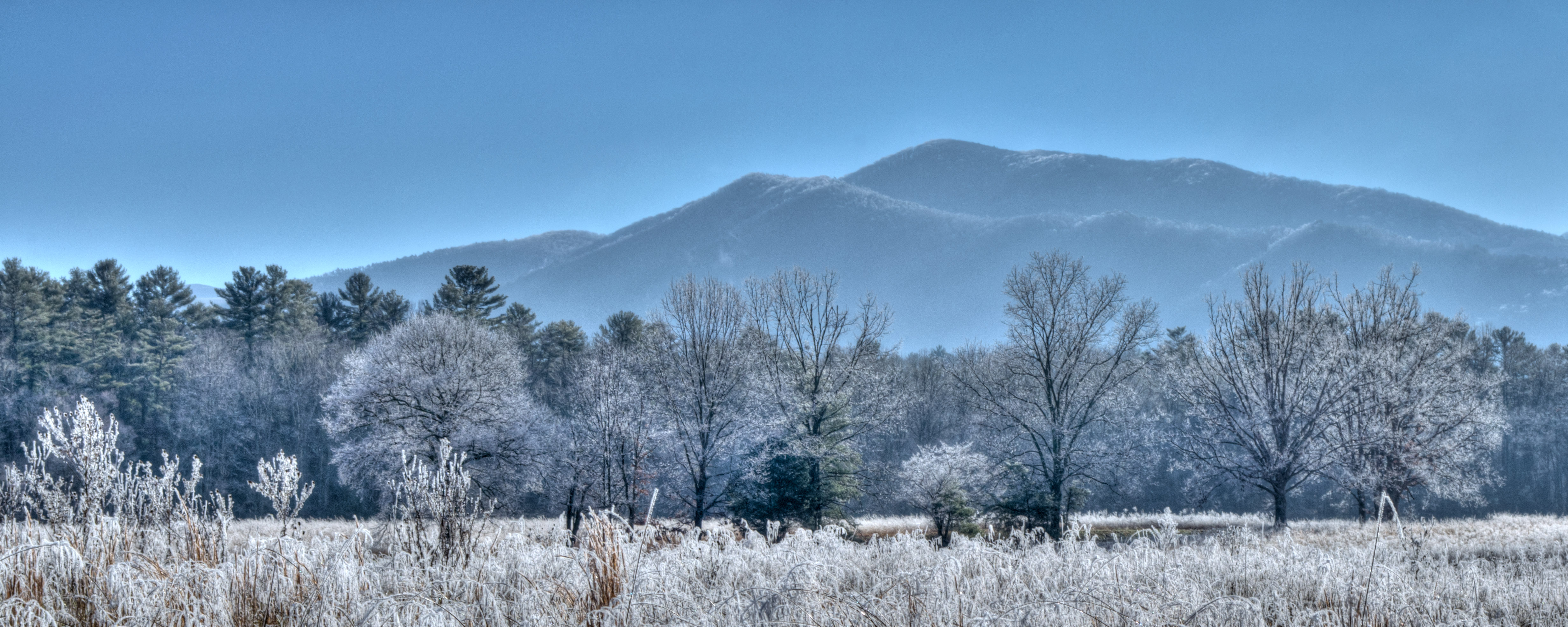
NPS via NPS.gov (Public Domain)
Hiking in Great Smoky Mountains National Park
12 min read
Hiking Guide
Alum Cave Trail gains 1,500 feet in 4 miles, and weather above 3,000 feet can shift two seasons. Plan your Great Smoky Mountains National Park hike (2026) with these trail insights.
This article contains affiliate links — we may earn a small commission at no extra cost to you.
Flow reliability
Seasonal consistency of median discharge from the curated USGS gauge for this place.
Spring
77%
year-to-year consistency
Summer
70%
year-to-year consistency
Fall
42%
year-to-year consistency
Winter
61%
year-to-year consistency
Median monthly discharge (cfs)
| Jan | Feb | Mar | Apr | May | Jun | Jul | Aug | Sep | Oct | Nov | Dec |
|---|---|---|---|---|---|---|---|---|---|---|---|
| 302 | 381 | 370 | 288 | 253 | 154 | 153 | 146 | 96.9 | 80.1 | 115 | 199 |
In the last 10 falls, roughly 3 of every 8 September–November weeks sat inside this band (116–348 cfs); typical flow in those weeks 178 cfs, median water temp 58°F (14.2°C).
Computed from 10 years of USGS daily records, station 03497300 (3,649 daily values). Last computed Oct 19, 2026.
Hydrological description only — not advice about wading, floating, or whether conditions are safe for recreation. Always check current USGS readings and local guidance before you go.
Great Smoky Mountains National Park Hiking: Alum Cave, Laurel Falls & Appalachian Trails (2026 Guide)
The humidity hits you first. It settles on your skin before you even step out of the car, a warm, damp blanket that defines the effort of every step. Hiking in Great Smoky Mountains National Park is a negotiation with moisture - the mist that gives the mountains their name, the sweat on your back, the slickness of roots and rocks on the trail. This isn't the arid, wide-open hiking of the West. It's a green, close-quarters experience where the forest is the main event, and the views are hard-won rewards. Most first-time visitors are caught off guard by the sheer physicality of the climbs; the trails here are old, often steep, and they don't believe in switchbacks. For a complete visitor guide to the park's logistics, check the official hub page.
What Hiking Here Actually Means
You'll earn every view here. The signature experience is climbing through dense, dripping forests of hemlock and rhododendron to emerge, breathless, on a rocky outcrop with the world falling away into blue ridges. The trails are mostly dirt and root, with frequent stream crossings on stepping stones or narrow log bridges. They can be deceptively slick, even on dry days.
The common mistake - and almost everyone makes it - is underestimating the elevation gain. A "moderate" 4-mile hike here can easily gain 1,500 feet. Your calves will have strong opinions by the end. This is also a park of microclimates. The weather at the trailhead can be sunny and 75°F, while the summit is shrouded in 55°F fog. Rangers will tell you to pack for at least two seasons on any hike above 3,000 feet. Success here isn't about speed; it's about persistence and paying attention to the details in the damp green world around you.
Alum Cave Trail to Mount LeConte: The Definitive Ascent
This trail defines the park's hiking character. It's the most direct, varied, and historically significant route to the summit of Mount LeConte, the park's third-highest peak. If you only do one strenuous hike here, make it this one.
Distance: 10.0 miles roundtrip
Elevation Gain: 2,763 feet
Trailhead & Parking: The Alum Cave Trailhead is on Newfound Gap Road, 8.6 miles south of the Sugarlands Visitor Center. The parking lot is notoriously small, holding about 25 vehicles. It fills by 7:30 AM on weekends from April through October and by 8 AM on weekdays. There's no formal overflow parking; you'll have to drive back down the road and look for a safe pull-off, which adds significant distance. Arriving before sunrise is your best bet.
The Trail: The first 1.3 miles are a gentle warm-up along Alum Cave Creek. The trail narrows here and starts to climb in earnest after the first footlog bridge. You'll hit Arch Rock around mile 1.4 - a stone staircase through a tunnel formed by a massive, water-carved rock. The grade increases steadily through rhododendron thickets until you reach the namesake Alum Cave Bluffs at mile 2.3. It's not a cave but a massive, concave cliff face that provides a dramatic, often drippy, resting spot. Past the bluffs, the trail gets serious. It traverses exposed cliffs with cable handrails, climbs steep stone steps, and offers the first real panoramic views back toward Cherokee Orchard. The final push through spruce-fir forest feels endless, but the summit clearing at LeConte Lodge appears suddenly.
The Moment: Stepping out of the dense, dark spruce onto the summit rocks at Cliff Top, looking west as the sun sets and the ridges fade into infinite layers of blue.
What Most Underestimate: The exposure on the cliff sections after Alum Cave Bluffs. It's not technically difficult, but the drop-offs are significant, and the rock can be wet and slick. People with a fear of heights often turn around here. Also, the temperature drop is drastic - pack that extra layer.
Best Time: Weekday mornings in late September or early October. You'll avoid the worst crowds and have a chance at clear skies for the famous view. Summer afternoons almost guarantee thunderstorms on the exposed ridges.

Laurel Falls Trail: The Paved Path to a Waterfall
This is the park's most popular hike for a reason: it's paved, relatively short, and ends at an 80-foot two-tiered waterfall. It's also a logistical challenge.
Distance: 2.6 miles roundtrip
Elevation Gain: 314 feet
Trailhead & Parking: The trailhead is on Little River Road, 3.8 miles west of the Sugarlands Visitor Center. The parking area is a narrow pull-off along the road that fills completely by 9 AM daily. Illegally parked cars are ticketed and towed regularly. The park often recommends using the shuttle from Gatlinburg or Sugarlands during peak season, which drops you right at the trailhead.
The Trail: The pavement is a blessing and a curse. It's accessible for strollers and those with mobility concerns, but it's also cracked, uneven, and steep in sections. It's not a smooth sidewalk. The trail climbs gradually through a young forest, with a few short, steeper pitches. You'll hear the falls before you see them. The trail ends at a bridge that crosses directly between the upper and lower sections of Laurel Falls. The rocks around the base are notoriously slippery.
The Moment: The cool mist hitting your face as you stand on the bridge, watching the water plunge into the pool below.
What Most Underestimate: The crowds. This isn't a peaceful nature walk; it's a procession. You will be sharing the trail with hundreds of others. The paved surface also gets extremely slick when wet - proper hiking shoes with grip are still a must. Rangers constantly warn visitors about the slippery rocks near the falls; injuries are common.
Best Time: As early as possible. Aim to be parked by 7:30 AM. Alternatively, late afternoon on a weekday can be slightly quieter, but you'll be hiking back in diminishing light.
Charlies Bunion via the Appalachian Trail: The Ridgewalk
For a taste of the iconic Appalachian Trail with payoff views, this is the hike. It follows the AT along the spine of the Smokies to a dramatic, rocky promontory.
Distance: 8.0 miles roundtrip
Elevation Gain: 1,640 feet
Trailhead & Parking: Start at the Newfound Gap parking lot. This is the highest point you can drive to on the Tennessee-North Carolina border, and the lot is huge - but it still fills by mid-morning. Tour buses stop here, so expect a crowd at the overlook. The trail begins at the far end of the lot, marked by the Appalachian Trail stone.
The Trail: You head north on the AT, climbing immediately through a spruce-fir forest that feels more like Maine than Tennessee. The air is cooler, the trees are shorter and twisted. The trail is rocky and rooty underfoot. After about 1.7 miles, you'll reach the junction with the Sweat Heifer Creek Trail. Keep straight on the AT. The trail continues to roll along the ridge, with occasional glimpses through the trees. At 4.0 miles, a short, unmarked side trail to the left leads out to Charlies Bunion itself - a bare, rocky outcrop with nothing between you and a 1,000-foot drop.
The Moment: Sitting on the sun-warmed granite of the Bunion, looking down into the deep, green wilderness of the Porters Creek valley.
What Most Underestimate: The exposure at the Bunion. There are no guardrails. The rock slopes downward, and a misstep has severe consequences. Wind can be fierce and sudden. Also, the weather at Newfound Gap is completely unreliable; check the forecast but trust nothing until you're there.
Best Time: A clear morning in June before the summer haze sets in, or a crisp October day for fall color vistas. Avoid this hike if thunderstorms are in the forecast - you are on the highest, most exposed ridge in the park.

Andrews Bald: High-Elevation Meadow
A shorter, high-elevation option that starts at the Clingmans Dome parking area but offers a more rewarding destination than the crowded tower.
Distance: 3.6 miles roundtrip
Elevation Gain: 1,200 feet
Trailhead & Parking: The trail begins at the far end of the Forney Ridge Parking Area at Clingmans Dome. The Clingmans Dome road opens seasonally (typically April-November) and the parking lot is a zoo by 10 AM. You must have a parking tag. Consider taking the shuttle from Cherokee or Newfound Gap.
The Trail: The first section is a steep, rocky descent on the Forney Ridge Trail. You lose about 400 feet quickly, which you'll have to regain on the return trip. The trail then levels out somewhat as it traverses through a magical spruce-fir forest, often draped in moss. The forest opens abruptly into Andrews Bald, a high-elevation grassy meadow maintained by the park. In late June and early July, it's covered in flame azalea and rhododendron blooms.
The Moment: Picnicking in the open grass of the bald with a 180-degree view of the southern Smokies, away from the crowds at the tower above.
What Most Underestimate: The climb back out. That initial descent means the return trip is a sustained, often strenuous uphill. The trail is also notoriously muddy and root-strewn; waterproof boots are recommended even on dry days.
Best Time: Late June for the azalea bloom, or any clear afternoon. This is one of the best sunset spots in the park, but you must be prepared to hike back in the dark with a headlamp.
Rainbow Falls Trail: The Waterfall Route to LeConte
A longer, more gradual alternative to Alum Cave for reaching Mount LeConte, with a major waterfall as a mid-hike reward.
Distance: 13.0 miles roundtrip (to LeConte Lodge)
Elevation Gain: 3,800 feet
Trailhead & Parking: The trailhead is on Cherokee Orchard Loop Road, just past the Noah "Bud" Ogle homesite. A dedicated parking lot serves this and the Bullhead Trail, but it fills nearly as fast as Alum Cave. Overflow parking spills along the one-way Roaring Fork Motor Nature Trail, which can complicate your exit.
The Trail: This is a relentless but steady climb. The first 1.7 miles to Rainbow Falls are popular, so expect company. The 80-foot falls are impressive, often creating a rainbow in the mist (hence the name). The trail gets significantly quieter and steeper past the falls. It follows LeConte Creek upward, crossing it multiple times on log bridges, and transitions into a rocky, rooty path through old-growth forest. It merges with the Bullhead Trail for the final push to the summit near LeConte Lodge.
The Moment: The cool spray from Rainbow Falls after the initial climb, a perfect natural air conditioner.
What Most Underestimate: The distance and cumulative gain. This is a full-day commitment. The falls are not the halfway point in mileage or effort. Many day hikers aim for the lodge and run out of daylight or energy on the return.
Best Time: Spring, when the water flow at the falls is at its peak. The trail can be slick with runoff, but the payoff is worth it. Summer afternoons risk thunderstorms on the upper mountain.

Deep Creek Waterfalls Loop: Triple Waterfall Tour
A family-friendly loop in the quieter North Carolina section of the park that packs three waterfalls into a short hike.
Distance: 2.4 miles roundtrip (loop)
Elevation Gain: 285 feet
Trailhead & Parking: The Deep Creek Trailhead is at the end of Deep Creek Road, just north of Bryson City, NC. The parking area is large and has restrooms. It fills later than Tennessee-side trailheads, usually by 10:30 or 11 AM on weekends.
The Trail: From the trailhead, take the Deep Creek Trail upstream. You'll reach Tom Branch Falls on your right in about 0.3 miles - a wide, graceful cascade across the creek. Continue another 0.5 miles to the junction. Turn right on the Indian Creek Trail to reach Indian Creek Falls (a tall, narrow chute) in 0.2 miles. Backtrack to the junction and continue on the Deep Creek Trail to complete the loop, which returns via a wide, gravel roadbed. Tubers use Deep Creek in summer, so the first section can be lively.
The Moment: Standing at the base of Indian Creek Falls, feeling the power of the water crashing into the pool.
What Most Underestimate: The popularity of the creek for tubing. On hot summer weekends, the path near the start can be a parade of people with inflatable tubes. Go early for a quieter hike. The loop is also a mountain biking trail, so stay alert.
Best Time: A weekday morning in May, when the rhododendron along the creek is in bloom and the tubing crowds are minimal.
Seasonal Trail Conditions
April-May: Lower elevation trails are clear and muddy. Wildflowers (trillium, lady slipper) peak in mid-April. Higher trails like Andrews Bald or the AT near Newfound Gap may have patches of ice or snow until early May. Stream crossings are high and fast with spring runoff.
June-August: All trails are clear. Heat and humidity are intense below 3,000 feet. Afternoon thunderstorms are a daily occurrence on ridges - be off high points by 2 PM. Rhododendron blooms at mid-elevations in June; flame azalea on the balds in late June. This is peak visitation; every parking lot is a battle.
September-October: The best time for hiking. Humidity drops, bugs subside, and crowds lessen after Labor Day. Fall color starts at high elevations in early October and sweeps down through the month. Mornings can be frosty at trailheads like Newfound Gap. Check for the best time to visit for specific conditions.
November-March: Many secondary roads (Roaring Fork, Clingmans Dome Road) are closed. Trails are open but can be icy, snowy, and bitterly cold at elevation. Microspikes are essential for any hike above 4,000 feet. Stream crossings can be treacherous with ice. You'll have the trails mostly to yourself, but winter hiking preparedness is non-negotiable.

Trailhead Logistics
Parking is the primary obstacle. The park's parking tag system is enforced from 2026 - all vehicles parked for longer than 15 minutes need a daily, weekly, or annual tag. Purchase them online in advance or at visitor centers.
For the Alum Cave, Rainbow Falls, and Laurel Falls trailheads, your goal is to be parked by 7:30 AM at the absolute latest. For Newfound Gap (Charlies Bunion) and Clingmans Dome (Andrews Bald), 8:30 AM is the safe cutoff. The Deep Creek lot is the exception, often having space later in the morning.
The park shuttle is a legitimate strategy, especially for Laurel Falls and Clingmans Dome/Andrews Bald. It runs from Gatlinburg and stops at key trailheads. Schedules are limited outside peak summer and fall seasons.
Cell service drops out at almost every trailhead and is non-existent on trails. Download offline maps or carry a paper one. The only reliable water sources are at developed campgrounds and visitor centers; treat all water from streams and springs. Bear canisters are required for all backcountry camping but not for day hikes. Carry bear spray and know how to use it. For current trail conditions, stop at the Sugarlands or Oconaluftee Visitor Center - they post daily ranger notes.
What to Carry
Forget generic lists. For the Smokies, your pack must account for wetness and radical temperature shifts.
Footwear: Waterproof hiking boots with aggressive tread. Trail runners will get soaked and slip on the ubiquitous slick roots and mud. The extra ankle support is worth it on the rocky, uneven terrain.
Water: Carry at least 2 liters per person, plus a filtration system. Summer humidity will dehydrate you faster than you realize. There are no water fill stations on trails.
Layers: A moisture-wicking base layer, a insulating mid-layer (fleece or puffy), and a waterproof/windproof shell. That's the non-negotiable trio, even for a summer day hike to a summit.
Traction: From November through April, carry microspikes in your pack if heading above 3,500 feet. Black ice on trails like Alum Cave is common and dangerous.
Navigation: A physical map and compass, or a GPS device with pre-loaded routes. Phone GPS will fail.
The Extras: Trekking poles for the steep descents, a headlamp with extra batteries (daylight fades fast in the hollows), and a zip-top bag for your phone/wallet to protect against the ever-present damp.
Practical Takeaways
- The parking tag is mandatory and enforced. Buy it online before you arrive.
- "Early" means at the trailhead by sunrise for popular hikes like Alum Cave. 7:30 AM is late.
- Pack for a 20-degree temperature swing from trailhead to summit. That fleece isn't optional.
- The return hike is almost always more strenuous than you remember due to cumulative fatigue and steep, slick descents.
- Afternoon thunderstorms are a summer certainty. Be off exposed ridges and peaks by 2 PM.
- The most dangerous animals are not bears - they're drivers on Newfound Gap Road and slippery rocks at waterfall bases.
- Check the NPS website for current trail closures. As of 2026, Abrams Falls Trail is closed due to bear activity, and several seasonal roads are gated.
- Your cotton t-shirt will be a soaked, cold liability. Wear synthetic or wool.
- The best views often require a side trip. Look for unmarked but worn paths near summit areas (like at Charlies Bunion).
- Success here is measured in preparedness, not miles per hour. Slow down, drink water, and let the humid, green silence of the oldest mountains on earth sink in.
For more information, see our complete National Park Guide.
Related: hiking trails in great smoky mountains national park guide
Recommended Gear
What experienced visitors bring to Hiking in Great Smoky Mountains National Park
Links may earn us a commission at no extra cost to you. We only recommend gear we believe in.
Hiking Essentials
Hydration Pack (3L)
Hands-free water for long trail days
Trekking Poles (Pair)
Save your knees on steep descents
Hiking Boots (Ankle Support)
Sturdy footwear for rocky, uneven trails
Sun & Heat Protection
Wide-Brim Sun Hat
Full coverage UPF 50+ protection at altitude
Insulated Water Bottle (32oz)
Keeps water cold in desert heat all day
Electrolyte Mix Packets
Replace what water alone cannot during intense heat
Winter Gear
Microspikes / Traction Devices
Essential for icy rim trails in winter months
Packable Down Jacket
Lightweight warmth that stuffs into a pocket
Sources
- Official source: NPS — Great Smoky Mountains National Park nps.gov/grsm/index.htm
Photo Gallery
More to Explore

Park Guide
Acadia National Park: Carriage Roads, Cadillac Mountain & 2026 Guide
Discover carriage roads, Cadillac Mountain, and rugged Maine coast. Complete 2026 guide to Acadia National Park — trails, fees, lodging, permits, and what rangers recommend.

Hiking Guide
Grand Canyon Hiking Trails: Day Hikes, Water Sources & Rim to Rim
Compare Grand Canyon hiking trails: Bright Angel, South Kaibab, Hermit, Grandview, and rim to rim, with distances, elevation, water stops, and trailhead access for each.

Best Of
Best of Glacier Bay National Park
The best of Glacier Bay is reached by boat: ranger-led day tours up the bay to the tidewater glaciers. What's worth it, how to book, and when to go (2026).

Campsite Guide
White Sands Backcountry Camping: Closed for 2026 — What to Know
As of 2026, backcountry camping at White Sands National Park is closed for site rehabilitation. What that means, and where to camp nearby instead.

Weather Guide
Guadalupe Mountains National Park Weather: Weather
Guadalupe Mountains National Park: weather guide guide updated 2026. Practical visitor information, reservations, and seasonal tips worth bookmarking before

Best Of
Best of Cuyahoga Valley National Park: Best Things to Do
Seeing a Cleveland Orchestra concert with the woods as your backdrop is a uniquely Cuyahoga Valley experience.
Sign in to join the conversation.
Sources & Attribution
Location data courtesy of the National Park Service (U.S. Department of the Interior). NPS data is public domain. Official NPS page.
Images: NPS; NPS; NPS; NPS; NPS.
Map data © OpenStreetMap contributors.
Park operations alerts: NPS.gov · Weather and weather hazards: National Weather Service · Live conditions.
Information may change. Always verify fees, hours, and conditions directly with the official source before visiting.
Did this guide help? Share it with a friend.