Congaree National Park protects the largest intact old-growth bottomland hardwood forest in the Southeast, with no entrance fee as of 2026. Flooding can occur with little warning, so check Cedar Creek and Congaree River water levels before you go.
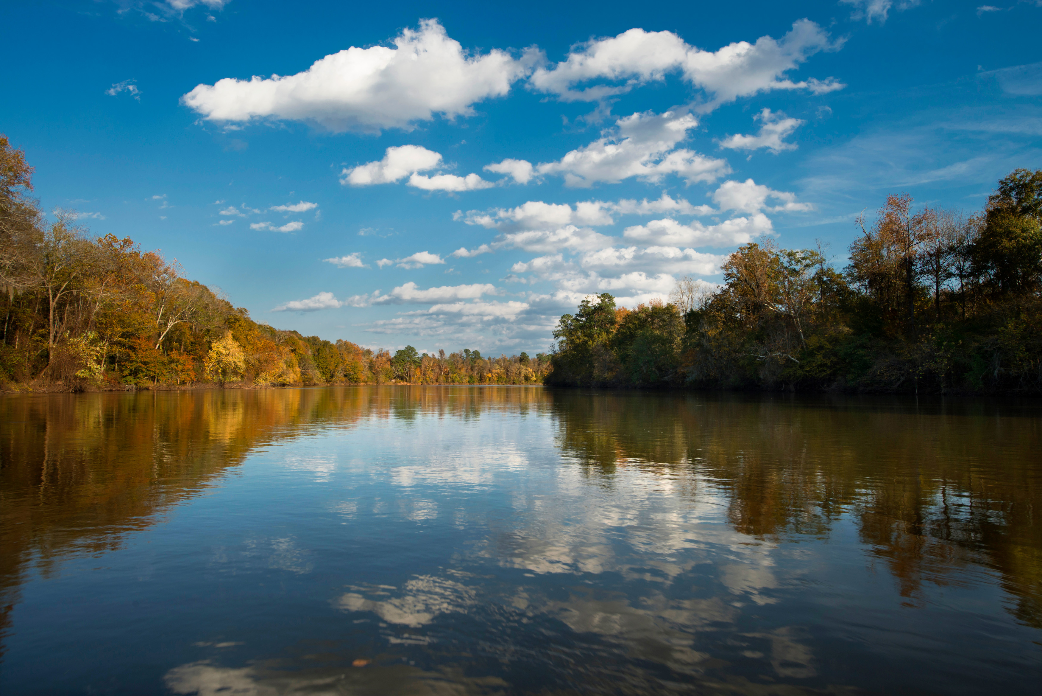
NPS via NPS.gov (Public Domain)
Congaree National Park: Ancient Floodplain Forest & Fireflies - 2026 Guide
9 min read
Park Guide
Explore the largest intact old-growth bottomland hardwood forest in the Southeast. No entrance fee in 2026, but check Cedar Creek water levels before hiking.
Your plans
This article contains affiliate links — we may earn a small commission at no extra cost to you.
At a glance
Hours
Congaree National Park is generally open 24 hours a day year-round. For visitor and staff safety, pa
Best Time
June-September (summer), September-October (fall colors)
Address
100 National Park Road, Hopkins, SC, 29061
Website
33.7919, -80.7487
Google MapsThe Lay of the Land: Floodplain Realities
Forget the standard national park itinerary. At Congaree, the environment dictates the terms. The park is open 24 hours a day, but the Harry Hampton Visitor Center keeps civilized hours: 9 a.m. to 5 p.m. daily, closed on a handful of federal holidays. As of 2026, there is no entrance fee, which the park notes means they don't have dedicated staff to sell passes. If you need an America the Beautiful pass for other parks, you must call ahead the day of your visit - there's no guarantee.
The single most important factor for your trip is the water level. Check the forecast for Hopkins, SC, but more critically, check the real-time water levels for Cedar Creek and the Congaree River before you get on the road. Flooding can happen with little warning. A trail that's dry in the morning can be under six inches of moving water by afternoon. Rangers treat this as the first piece of advice for a reason.
The park's layout is straightforward. From I-77, take Exit 5 onto SC Hwy 48 East/Bluff Road. Follow the brown signs for about 8 miles, take a slight right onto Old Bluff Road for 4.5 miles, and the park entrance will be on your right. A mile down the park road brings you to the visitor center and the main parking lots. The parking situation here is manageable compared to major western parks, but the main lot can fill by mid-morning on peak spring and fall weekends. Cell service drops out at the park boundary, so have your maps downloaded.
The Central Hub: Harry Hampton Visitor Center
Start here. Not just for the bathroom - which are clean, functional restrooms - but for the trail conditions board. Rangers update it with the latest on flooding, trail closures, and mosquito intensity. The adjacent park store, operated by America's National Parks, sells the usual souvenirs, guides, and yes, water bottles. Bring your own. The museum exhibits inside are worth fifteen minutes of your time; they frame the ecological and human history you're about to walk into.

Navigating the Trails: From Boardwalk to Backcountry
Congaree's trail system breaks cleanly into two experiences: the accessible, interpretive world of the boardwalk, and the rugged, often-muddy realm of the backcountry dirt trails.
The Boardwalk Loop: Your Essential Introduction
The 2.4-mile elevated boardwalk loop that begins outside the visitor center is the park's circulatory system. It's the only way for most visitors to intimately experience the floodplain without getting soaked. As of March 2026, a section of the lower loop is closed for construction, but the key Weston Lake Overlook is accessible. The park provides a map for the alternate route.
This isn't just a sidewalk through the woods. It's a narrated tour. Stop #1 points out a century-old American beech tree with smooth gray bark. Stop #11 shows a former champion loblolly pine, a species that towers above the hardwood canopy. Stop #12 is the Weston Lake Overlook, where you can peer into the dark, still waters of an oxbow lake - a former bend of the Congaree River now cut off.
The boardwalk tells human stories, too. Stop #15 marks the site of a moonshine still from Prohibition days. Stop #19 discusses the maroon settlements of escaped enslaved people that once existed near the river confluence. Stop #18 honors Harry Hampton, the newspaper editor whose 1950s campaign saved this forest. You'll feel the texture of the place here: the spongy give of the cypress knees, the chatter of prothonotary warblers, the dense, humid air that holds sound close.
Beyond the Boardwalk: Dirt Trails and GPS
When the boardwalk ends, the real adventure begins. The park offers more miles of dirt trails, like the Oakridge, Kingsnake, and River Trails. This is where the park's caution alerts apply directly. The official alert states: "GPS is necessary on backcountry trails: Oakridge, Boggy Gut (formerly River), and Kingsnake. These trails may be difficult to follow."
That's not a suggestion. It's a warning born from experience. Trail markers can be sparse, and flooding can erase paths entirely. Your phone's GPS, with an offline map app like Gaia GPS or AllTrails, is a minimum requirement. Better yet, bring a dedicated handheld unit. The terrain is flat, but the challenge is navigation and footing. Expect mud, tangled roots, and possibly shin-deep water. The payoff is solitude and the chance to see the forest's champion trees up close, away from any crowd.
For a complete breakdown of distances and difficulties, see our dedicated guide to hiking trails.

Seasons, Sensations, and Synchronous Fireflies
Most visitors underestimate the mosquito population. From late spring through early fall, insect repellent is non-negotiable. Wear long, light-colored sleeves and pants treated with permethrin for a more comfortable experience. The flip side of this insect abundance is the park's most famous seasonal event.
For about two weeks between mid-May and mid-June, Congaree becomes one of the best places on the planet to witness synchronous fireflies. Photinus carolinus, a species whose males flash in unison, puts on a display in the forest near the visitor center. The park manages this event with a lottery for parking passes, as demand massively outstrips space. If you miss the lottery, don't try to wing it. You will be turned away. The rest of the year, the night sky here is dark and rich with stars, and the forest sounds - owls, frogs, wind in the canopy - are profound.
Summer (June-September) is hot, humid, and buzzing with life. It's prime time for paddling but also for thunderstorms that cause rapid flooding. Fall (September-October) brings cooler temperatures, fewer bugs, and changing colors in the tupelos and maples. It's arguably the most pleasant time for hiking. Winter is quiet, with bare trees offering longer sight lines, and the floodplain is often its driest. Spring sees rising water and an explosion of greenery and birdsong. For a detailed monthly breakdown, our best time to visit guide has you covered.

Where to Stay: Camping In and Near the Floodplain
Congaree is not a park of lodges. Your overnight options are almost exclusively camping, which aligns with the park's rustic character. There are two frontcountry campgrounds, both requiring a short walk from your car.
Longleaf Campground has 14 walk-up sites for $15 per night as of 2026. It's a gravel parking area where you park and carry your gear a short distance to your site. It's convenient, close to the visitor center, and has a vault toilet.
Bluff Campground, with 6 sites at $10 per night, offers a slightly more remote feel. It's a hike-in campground about a mile from its parking area, giving you a taste of backcountry camping without venturing deep into the trail system. It's perfect for testing your gear.
Neither campground has running water or showers. You must bring all the water you'll need, or treat water from natural sources (after checking current water quality advisories). Sites are first-come, first-served. For backcountry camping, a free permit - obtained at the visitor center - is required. This is true wilderness camping; you must pack out everything you pack in.
Given the limited in-park options, many visitors base themselves in Columbia, about a 30-minute drive away. For a full analysis of camping options and nearby lodging and accommodations, we have detailed resources.

Paddling, Wildlife, and Guided Experiences
The water that defines Congaree is best experienced from a canoe or kayak. Cedar Creek is the main paddling trail, a slow-moving blackwater creek that winds through the heart of the forest. It offers a perspective you can't get on foot, floating silently beneath the towering canopy. You can arrange guided canoe tours through the park's official concessionaire, a fantastic way to learn from a local expert. DIY paddlers need to plan a shuttle, as the creek is a point-to-point trip. Check water levels - too low and you'll be dragging your boat; too high and the current can be dangerous.
Wildlife viewing is a constant activity. Keep an eye out for river otters playing in Cedar Creek, wild pigs rooting in the distance (don't approach), and a spectacular array of birds, from pileated woodpeckers to barred owls. Alligators are present in the park's lakes and sloughs; give them a wide berth. The park is a haven for reptiles and amphibians - you'll hear frogs long before you see them. For dedicated tips, our wildlife viewing guide dives deeper.
Ranger-led programs are a highlight. From guided walks explaining the floodplain ecology to evening talks on cultural history, these free programs add immense value. Schedules are posted at the visitor center. For more structured outings, explore the available tours and guided experiences.
Practical Takeaways
- Water Dictates Everything. Before you leave home, check real-time water levels for Cedar Creek and the Congaree River. Flooding closes trails and changes the park's character completely.
- GPS is Mandatory for Backcountry. If you plan to hike beyond the boardwalk on trails like Oakridge or Kingsnake, a GPS device with offline maps is not optional. The trails are poorly marked and can disappear under water.
- Prepare for Insects. From April to October, wear permethrin-treated clothing and use EPA-rated repellent. The mosquitoes are a formidable part of the ecosystem.
- Bring All Your Water. There is no potable water at the campgrounds or on trails. Pack in all you'll need for drinking, cooking, and cleaning. The visitor center has a water fountain to refill bottles.
- Have a Transportation Plan. If you're using a rideshare or taxi to get to the park, secure your return ride in advance. The park alert explicitly warns that these services "do not often come out to Congaree."
- Fireflies Require a Lottery. To see the synchronous fireflies in May/June, you must win a parking pass via the annual online lottery. Spontaneous visits during this period will be unsuccessful.
- Start at the Visitor Center. Not just for the map. Check the conditions board for the latest on trail closures, flooding, and prescribed burn activities, which can temporarily close trails like Longleaf and Firefly.
Final Thoughts
Congaree National Park asks for a shift in expectation. You won't find panoramic overlooks. You'll find intimacy. The grandeur is vertical, in the columns of loblolly pine, and horizontal, in the endless weave of swamp tupelo and water oak. Success here is about preparation - for water, for insects, for navigation. It's about listening more than looking, about feeling the soft decay underfoot and understanding that this forest is not static. It's a dynamic, breathing system that floods, burns, and regenerates. The park's quiet magic reveals itself to those who slow down, who walk the boardwalk at dawn to hear the forest wake, or who sit still long enough on a cypress knee to see a wood duck glide down the creek. It's a national park guide that leads you not to a summit, but into the heart of a resilient, ancient wetland. Come prepared for mud, bring your curiosity, and let the floodplain tell its own story.
Recommended Gear
What experienced visitors bring to Congaree National Park: Ancient Floodplain Forest & Fireflies - 2026 Guide
Links may earn us a commission at no extra cost to you. We only recommend gear we believe in.
Hiking Essentials
Hydration Pack (3L)
Hands-free water for long trail days
Trekking Poles (Pair)
Save your knees on steep descents
Hiking Boots (Ankle Support)
Sturdy footwear for rocky, uneven trails
Sun & Heat Protection
Wide-Brim Sun Hat
Full coverage UPF 50+ protection at altitude
Insulated Water Bottle (32oz)
Keeps water cold in desert heat all day
Winter Gear
Microspikes / Traction Devices
Essential for icy rim trails in winter months
Packable Down Jacket
Lightweight warmth that stuffs into a pocket
Sources
- Official source: NPS — Congaree National Park nps.gov/cong/index.htm
Explore More National Parks

Great Smoky Mountains National Park: Complete Guide (2026)
Great Smoky Mountains National Park, America's most visited park, has no entrance gates but requires...

Where to See New River Gorge Bridge
Discover whitewater rapids, elite rock climbing routes, and wild West Virginia gorge. Complete 2026...

Shenandoah National Park: Skyline Drive & Blue Ridge Views - 2026 Guide
Discover Skyline Drive, Blue Ridge views, and Appalachian trails. Complete 2026 guide to Shenandoah...

Mammoth Cave National Park: The World's Longest Known Cave - 2026 Guide
Discover the world's longest known cave system — 400+ mapped miles. Complete 2026 guide to Mammoth C...
Photo Gallery
More to Explore

Park Guide
Acadia National Park: Carriage Roads, Cadillac Mountain & 2026 Guide
Discover carriage roads, Cadillac Mountain, and rugged Maine coast. Complete 2026 guide to Acadia National Park — trails, fees, lodging, permits, and what rangers recommend.

Hiking Guide
Grand Canyon Hiking Trails: Day Hikes, Water Sources & Rim to Rim
Compare Grand Canyon hiking trails: Bright Angel, South Kaibab, Hermit, Grandview, and rim to rim, with distances, elevation, water stops, and trailhead access for each.

Best Of
Best of Glacier Bay National Park
The best of Glacier Bay is reached by boat: ranger-led day tours up the bay to the tidewater glaciers. What's worth it, how to book, and when to go (2026).

Campsite Guide
White Sands Backcountry Camping: Closed for 2026 — What to Know
As of 2026, backcountry camping at White Sands National Park is closed for site rehabilitation. What that means, and where to camp nearby instead.

Weather Guide
Guadalupe Mountains National Park Weather: Weather
Guadalupe Mountains National Park: weather guide guide updated 2026. Practical visitor information, reservations, and seasonal tips worth bookmarking before

Best Of
Best of Cuyahoga Valley National Park: Best Things to Do
Seeing a Cleveland Orchestra concert with the woods as your backdrop is a uniquely Cuyahoga Valley experience.
Sign in to join the conversation.
Sources & Attribution
Location data courtesy of the National Park Service (U.S. Department of the Interior). NPS data is public domain. Official NPS page.
Images: NPS; NPS; NPS; NPS; NPS.
Map data © OpenStreetMap contributors.
Park operations alerts: NPS.gov · Weather and weather hazards: National Weather Service · Live conditions.
Information may change. Always verify fees, hours, and conditions directly with the official source before visiting.
Did this guide help? Share it with a friend.