Grand Canyon National Park has one trail problem nobody warns you about: every hike starts easy and ends hard. You descend first, feeling strong, and pay the bill on the climb out — in heat, at altitude, often with less water than you wanted. Picking the right trail is less about scenery (they all deliver) and more about matching distance, elevation change, and water sources to what your legs can give back at the end of the day. This page compares the major Grand Canyon hiking trails side by side: the corridor routes (Bright Angel, South Kaibab, North Kaibab), the wilder day hikes on the Hermit and Grandview trails, the nearly flat Rim Trail, and the full rim to rim crossing. For the broader park context — entrance fees, lodging reservations, shuttle routes — start with the complete visitor guide.

Grand Canyon Hiking Trails: Day Hikes, Water Sources & Rim to Rim
17 min read
Compare Grand Canyon hiking trails: Bright Angel, South Kaibab, Hermit, Grandview, and rim to rim, with distances, elevation, water stops, and trailhead access for each.
This article contains affiliate links — we may earn a small commission at no extra cost to you.
Which Trail Fits Your Day
Distances are round trip to the standard day-hike turnaround points, not full trail lengths. Elevation figures are what you regain on the way out.
| Trail | Distance | Elevation change | Difficulty | Water | Trailhead |
|---|---|---|---|---|---|
| Rim Trail | Walk any segment; the rim path runs 7.8 mi (12.6 km) alongside Hermit Road alone | Mostly level rim walking | Easy; paved and dirt stretches | Filling stations at Hermits Rest and in the Village | Multiple shuttle stops across Grand Canyon Village |
| Bright Angel Trail | 12.2 mi round trip to Plateau Point; Havasupai Gardens at 4.5 mi down | 3,200 ft regained from Plateau Point | Moderate; steady grade with morning and afternoon shade | Seasonal stations at 1.5 mi and 3 mi, plus a trailhead filling station — check status | Next to Bright Angel Lodge at 6,840 ft; Village (Blue) shuttle |
| South Kaibab Trail | 6 mi round trip to Skeleton Point | 2,300 ft regained | Moderate-plus; relentless, fully exposed dirt ridgeline | None on the trail — carry everything | South Kaibab Trailhead; Kaibab Rim (Orange) shuttle |
| Hermit Trail | Turn around by effort, not landmark: the first 2.5 mi drop almost 2,000 ft | ~2,000 ft in the first 2.5 mi | Challenging; rough, unmaintained rock-slab path | Springs only, and all spring water must be purified | Dirt road 0.25 mi west of Hermits Rest; Red Route shuttle Mar 1–Nov 30 |
| Grandview Trail | Steep out-and-back toward Horseshoe Mesa; plan by hours, not miles | Trailhead sits at 7,400 ft; big vertical steps from the start | Hard/strenuous; experienced desert hikers only | None to Horseshoe Mesa; springs below the mesa are unreliable | Grandview Point on Desert View Drive, 10.2 mi east of the Village |
| North Kaibab Trail | 9.4 mi round trip to Roaring Springs | 3,600 ft regained | Moderate; forested switchbacks, then the Redwall plunge | Potable water at Manzanita Rest Area only (2026 status) | North Rim, 1.5 mi north of the former Grand Canyon Lodge site |
| Rim to Rim (route) | ~21 mi one way via South Kaibab + North Kaibab | ~6,000 ft up, ~5,800 ft down (south to north) | Extreme; 10–14 hours for most hikers | Phantom Ranch fill station (verify status), then Manzanita Rest Area | Both corridor trailheads; vehicle shuttle between rims required |
Read the water column twice. It is the real difficulty rating: South Kaibab, Hermit, and Grandview all trade water for solitude or views, and the park's rescue statistics are written in that trade. When trails are compared by rangers, the corridor routes (Bright Angel, South Kaibab, North Kaibab) are the maintained, patrolled options; Hermit and Grandview are a full grade rougher underfoot even when the mileage looks similar.
What Hiking Below the Rim Actually Means
The Grand Canyon isn't a hike you "casually" attempt. It's a vertical mile of descent and ascent, often in a single day, with temperatures that swing 30-40°F between rim and river. Most first-time canyon hikers underestimate two things: the cumulative descent (it destroys your knees even if your lungs feel fine) and the heat in the inner gorge. Even in late spring, the river corridor can hit 100°F by noon. The park service records multiple rescues every year from people who started too late, carried too little water, or assumed the return climb would feel like the descent.
The terrain itself is relentless. Corridor trails are well-maintained but unforgiving - continuous switchbacks, exposed sections with no shade, and a surface that shifts from packed red dirt to loose scree to solid limestone slabs. Every 1,000 feet of elevation change gives your body a new challenge: different air pressure, different temperature, different footing. This is not a place to test your weekend fitness. It demands sustained effort over 6-12 hours, depending on route and pace.
Bright Angel Trail: The Forgiving Classic
Distance: 12.2 miles round trip to Plateau Point (via Havasupai Gardens)
Elevation Gain: 3,200 feet (on the return)
Trailhead & Parking: The trailhead sits at 6,840 feet, just west of Bright Angel Lodge, Lookout Studio, and Kolb Studio on the South Rim. Parking next to the trailhead is extremely limited and fills by 5:30 AM. Better options: park at the Backcountry Information Center (Lot D) and walk 5-10 minutes past Maswik Lodge, or park at Grand Canyon Visitor Center and take the free Village (Blue) Route shuttle, about 20 minutes one way. There's a water bottle filling station and restrooms at the trailhead.
The Trail: Bright Angel is the most forgiving of the rim trails - and the most popular hiking trail into the canyon. It's wider and less exposed than South Kaibab, follows a natural fault line through the rock layers, gets morning and afternoon shade, and has two seasonal water stations (at 1.5 miles and 3 miles; check NPS for status) plus resthouses and vault toilets. Watch for the pictograph panel above the trail shortly after the first tunnel - deer figures painted by ancestral canyon residents mark this as a route thousands of years older than the park. The first 4.5 miles descend to Havasupai Gardens (formerly Indian Garden), an oasis with cottonwood trees and a ranger station. From there, Plateau Point extends 1.5 miles across the Tonto Platform to a cliff-edge view directly above the Colorado River.
The Moment: Walking onto Plateau Point at sunset - you look straight down at the river, 1,200 feet below, and watch the light shift across the inner gorge.
What Most Underestimate: The false flat of the Tonto Platform. After the steep descent to Havasupai Gardens, the 1.5 miles to Plateau Point feels easy, but it's still a gradual climb coming back. The return from Plateau Point is 6.2 miles with 3,200 feet of gain. Many hikers underestimate how tired they'll be after the out-and-back.
Best Time: Start by 5 AM to reach Plateau Point before the heat intensifies. April-May and September-October are ideal. Summer heat makes this trail dangerous after 10 AM.
South Kaibab Trail: Maximum View Per Mile
Distance: 6 miles round trip to Skeleton Point (3 miles out, 3 back)
Elevation Gain: 2,300 feet (on the return)
Trailhead & Parking: South Kaibab Trailhead. Parking at the trailhead is minimal - about 30 spots, full by 5:30 AM in peak season. Park at Grand Canyon Visitor Center and take the Kaibab Rim Route (Orange) shuttle instead.
The Trail: A dirt ridgeline the whole way down, with visibility that OpenStreetMap mappers rate "excellent" for a reason - there is nothing between you and the view, which also means nothing between you and the sun. The first 1.5 miles to Ooh Aah Point offer the most dramatic views for the least effort. Most visitors stop there. At 3 miles, Skeleton Point provides a full view of the inner gorge and the river. The trail is all exposed. No shade. No water. The grade is steep and unrelenting.
The Moment: At Skeleton Point, you are level with the top of the Redwall limestone cliff. The river runs below like a green thread. The silence is broken only by ravens.
What Most Underestimate: The temptation to go further. Rangers will tell you Skeleton Point is the turnaround for day hikers who aren't trying to reach the river. Going further adds serious distance and a much harder return.
Best Time: Early morning (sunrise from Ooh Aah Point is a classic, but you'll need a headlamp to hike down in the dark). Avoid starting after 8 AM in summer.
Hermit Trail: The Quiet, Rough Alternative
Distance: Turn around by effort rather than landmark - the upper section drops almost 2,000 vertical feet in the first 2.5 miles, and the climb back is the day's real work.
Trailhead & Parking: The trailhead is a quarter-mile walk west of Hermits Rest, at the end of Hermit Road, following a dirt road from the restrooms. From March 1 through November 30, Hermit Road is closed to private vehicles and there is no day-hiker parking at the trailhead - ride the free Hermits Rest (Red) Route shuttle. In December, January, and February you can drive Hermit Road (vehicles under 22 feet), and there's a water bottle filling station, restrooms, and a snack bar at Hermits Rest itself.
The Trail: Louis Boucher, the "hermit" the basin is named for, lived out here for 20 years, and the trail still feels like his: steep, quiet, and hand-built. Well-defined switchbacks drop through the Kaibab Formation and Coconino Sandstone; much of the original surface was hand-fitted rock slabs, and surviving fragments of that paving are still underfoot. Observant hikers can spot fossilized lizard-like tracks in the lower half of the Coconino Sandstone - this is where those trackways were first studied in detail. Below the switchbacks, the trail enters Waldron Basin. The NPS classifies this trail as for experienced desert hikers only: conditions are more difficult than on Bright Angel or South Kaibab, and any water you find comes from springs that must be purified.
The Moment: Standing on century-old hand-laid stone paving, alone, while the shuttle crowds queue two ridgelines east.
What Most Underestimate: How much slower rough, eroded trail is in both directions. Distances that take an hour on Bright Angel can take twice that here. Carry more water than the mileage suggests.
Best Time: Spring and fall. The upper trail's exposure makes summer starts after sunrise punishing, and winter ice lingers on the shaded switchbacks.
Grandview Trail: Steep History, No Water
Distance: A steep out-and-back toward Horseshoe Mesa. Plan by hours, not miles - big rock steps and extreme pitches make progress much slower than the map suggests.
Trailhead & Parking: The trail starts at Grandview Point on Desert View Drive, 10.2 miles east of Grand Canyon Village and 13.8 miles west of Desert View - one of the highest South Rim overlooks at roughly 7,400 feet. The overlook has parking and vault toilets but no drinking water. If you're basing yourself on the east side of the park, Desert View Campground is the closest place to wake up near this trailhead.
The Trail: First used by Native Americans gathering mineral paints on Horseshoe Mesa, then rebuilt in the late 1800s to haul copper ore off the mesa by burro and mule, the Grandview is the park's steep, rocky history lesson. Vertical drops were solved with log-crib construction - creative engineering you can still see in the upper trail's surviving original segments. The NPS rates it hard/strenuous and warns that conditions are tougher than Bright Angel, South Kaibab, and even the Hermit Trail. There is no drinking water on the trail to Horseshoe Mesa, and springs below the mesa are not reliable. In summer, much of the trail bakes in full sun; in winter, snow and ice make the upper pitches treacherous.
The Moment: The first big step-down off the rim, where the trail's hand-built log cribbing hangs over open air and you understand why miners got paid to walk this.
What Most Underestimate: The return. Big steps that were easy to descend become leg-press repetitions on the way up, at 7,000+ feet of elevation. Rangers at the Backcountry Information Center recommend consulting them before hiking here - take that seriously.
Best Time: Spring and fall. Avoid icy mornings; traction devices help early in the season.
North Kaibab Trail: The Other Side of the Canyon
Distance: 9.4 miles round trip to Roaring Springs (4.7 out, 4.7 back)
Elevation Gain: 3,600 feet (on the return)
Trailhead & Parking: North Kaibab Trailhead, on the North Rim about 1.5 miles north of the former Grand Canyon Lodge site. Parking is limited; arrive early in July and August.
The Trail: The North Kaibab starts at 8,200 feet and descends through mixed conifer forest - a completely different feel from the South Rim. The first 2 miles are gentle switchbacks through pines. Then the trail drops into the Supai Tunnel, a short rock tunnel, and begins its plunge through the Redwall. Roaring Springs is a perennial waterfall that supplies water to both rims - a natural turnaround with shade and mossy rocks. Note the 2026 realities: after the 2025 Dragon Bravo Fire, the full trail reopened on May 15, 2026 for foot traffic only, trail crews are working all season (expect short delays or temporary closures), and the upper stretch between the trailhead and Supai Tunnel passes through burned forest where hazard trees and flash-flood risk are elevated. Potable water on the trail is available only at Manzanita Rest Area this season - do not count on treated water at Roaring Springs or the Supai Tunnel.
The Moment: Hearing Roaring Springs before you see it - the sound of falling water after miles of dry canyon hiking - is a reward few South Rim hikers experience.
What Most Underestimate: The altitude. The North Rim is 1,000 feet higher than the South Rim. Hikers coming directly from lower elevation feel it on the climb back. Snow also closes the road to this trailhead through winter and into spring.
Best Time: June-September in a normal year. Check current conditions on the NPS North Rim status page before committing - post-fire recovery work makes this trailhead's status more changeable than the South Rim's.
Rim to Rim: The Cross-Canyon Route
The rim to rim is no longer this page's headline act for a reason: it's a route built from the trails above, and if the day hikes here feel hard, the crossing will feel harder. The standard line combines the South Kaibab Trail (down) with the North Kaibab Trail (up), or the reverse.
Distance: ~21 miles one way (South Kaibab Trailhead to North Kaibab Trailhead)
Elevation: ~6,000 feet ascending (going south to north), with ~5,800 feet descending
The Route: From the South Rim, South Kaibab drops relentlessly through the Coconino and Toroweap formations - you lose 1,000 feet in the first half mile past Ooh Aah Point, then traverse exposed ridges with sheer drops on both sides. No shade, no water. The only reliable water before the North Kaibab side is at Phantom Ranch (mile ~7), which has a fill station - check the NPS page for current status and carry a backup purification method. You cross the Colorado River, then follow the North Kaibab Trail through Bright Angel Canyon. The final climb to the North Rim is brutal: 5,800 feet over 13 miles, with the last 3 miles above 8,000 feet. Cell service drops out below the rim and won't return until you're near the top on either side; a satellite messenger is strongly recommended.
2026 Planning Reality: The North Rim reopened on May 15, 2026 after the Dragon Bravo Fire, but there is no overnight lodging on the North Rim this season - Grand Canyon Lodge was lost in the fire. The North Rim Campground reopened June 1 (reserve on Recreation.gov), and the general store sells bottled water; otherwise plan on gateway-town lodging well north of the park. More important for scheduling: beginning October 15, 2026, the North Kaibab Trail closes between Redwall Bridge and Cottonwood Campground for Transcanyon Waterline repairs, and a traditional rim to rim crossing will not be possible after that date. If a 2026 crossing is your goal, it happens between mid-May and mid-October, and you should verify the NPS North Rim status page the week you go.
The Moment: Standing at the tip of the South Kaibab ridge looking down as the Colorado River comes into view - that's when the scale of what you're attempting becomes real.
What Most Underestimate: The descent. Everyone obsesses over the climb, but the 6,000-foot descent on South Kaibab stresses your quadriceps and knees in ways most hikers don't expect. Even fit runners often slow down by the halfway point due to joint fatigue. The Park Service emphasizes: bring trekking poles. Not optional.
Best Time: Start by 4:30 AM from the South Rim (or by first light going north to south). Hitting the river corridor before 10 AM is critical. May and September are the ideal months - June through August often brings extreme heat (100°F+ inside the canyon) and monsoon storms.
Seasonal Trail Conditions
The South Rim trails are open year-round; the North Rim season is short and, after the fire, more changeable than it used to be.
- March-April: South Rim trails clear, but North Kaibab often has snow and ice above 7,500 feet, and the North Rim road typically hasn't opened. Water stations on Bright Angel may not be operational until mid-April.
- May: Best month for the South Rim, and the North Rim's typical opening window (May 15 in 2026). Temperatures on the South Rim are 60-70°F, river corridor 85-95°F. Daylight is long.
- June-August: Extreme heat inside the canyon. River corridor temperatures regularly exceed 100°F. Start before 4 AM for big days. Afternoon monsoon thunderstorms from July-September bring lightning risk and flash floods in side canyons - a hazard amplified in the burned Bright Angel Creek drainage below the North Rim. Check the best time to visit guide for monthly averages.
- September: Heat decreases. Monsoon risk drops by mid-September.
- October: South Rim remains pleasant (50-70°F). The North Rim season winds down mid-month - and in 2026, the waterline closure ends rim-to-rim crossings after October 15.
- November-February: Only South Rim trails are practical. Snow and ice are common on all upper switchbacks; traction devices earn their weight.
Water availability by trail: Bright Angel has two seasonal stations (1.5 miles, 3 miles), typically operational April-October, plus a trailhead filling station. South Kaibab has none. Hermit and Grandview have no treated water at all - springs must be purified, and Grandview's springs are unreliable. On the North Kaibab, treated water is at Manzanita Rest Area only this season. Phantom Ranch has a fill station, but the pipeline it depends on is a single point of failure - always carry a backup purification method.
Trailhead Logistics
Parking Strategy for South Rim Trailheads: Arrive before 5 AM. By 6 AM, all trailhead lots are full. The park shuttle system is free and runs from the Grand Canyon Visitor Center: the Kaibab Rim (Orange) Route serves South Kaibab Trailhead, and the Village (Blue) Route serves the Bright Angel Trail. The first shuttles start around 5:15 AM in peak season - if you're starting a big day, be on the first one. Staying at Mather Campground puts you inside the shuttle network and saves the parking fight entirely.
Hermit Road Access: From March 1 through November 30, Hermit Road (and therefore the Hermit Trailhead and the western Rim Trail viewpoints) is reached by the free Hermits Rest (Red) Route shuttle, on foot, or by bicycle. In December, January, and February the road opens to private vehicles under 22 feet, with no shuttle service.
North Rim Access: The North Rim is a 4.5-hour drive from the South Rim and runs on a short season. In 2026 there is no lodge - plan on the North Rim Campground or gateway lodging. If you're crossing rim to rim, the shuttle between rims is not operated by the park service; book a private shuttle company 2-3 months ahead in summer.
Cell Service: Drops almost entirely once you descend below the rim. Verizon and AT&T have sporadic signal near Phantom Ranch. Don't rely on it. Satellite communication is essential for anything past the day-hike turnarounds.
Permits: Day hikes on every trail above - including a one-day rim to rim - require no permit. Any overnight below the rim does, and corridor campsites go fast. The permits guide covers the lottery calendar, walk-up cancellations, and which use areas fit each trail.
Trail Conditions Office: Stop at the Backcountry Information Center on the South Rim (open daily 8 AM-noon and 1-5 PM) or the North Rim Visitor Center for current trail reports. Rangers update these boards with water status, trail closures, and weather warnings - and for Hermit or Grandview, that conversation is part of the preparation, not a formality.
What to Carry
This list covers Grand Canyon specific conditions - assume you already have a first-aid kit, map, and emergency blanket. For boot, pack, and layering picks matched to canyon hiking, see the gear guide.
- Trekking poles. Non-negotiable on the corridor descents and doubly so on Hermit and Grandview's big steps. Aluminum poles work; carbon fiber can break on sharp rocks.
- Headlamp with fresh batteries. Big days start and often end in the dark. The canyon gets dark quickly after sunset. Carry a backup light.
- Electrolyte supplement. Not just water. You lose salt through sweat at a high rate on the descent. The inner gorge is often 100°F - plain water won't cut it.
- Sun protection. The canyon is a giant solar reflector. Sunscreen, wide-brim hat, UV-protective clothing. South Kaibab, Hermit, and Grandview have essentially no shade.
- Insulating layer. The South Rim at 4 AM can be 40°F in May; by noon at the river it's 90°F. A lightweight puffy or fleece plus a sun hoody covers both ends.
- Water capacity. Minimum 3 liters per person; 4-5 liters in summer or on any waterless trail (South Kaibab, Hermit, Grandview). Carry a filter or purification tablets anywhere you'd depend on a spring or on the Phantom Ranch pipeline.
- Blister care. The constant descent and ascent create friction on heels and toes. Leukotape or moleskin. Stop any hot spot immediately.
- Satellite messenger. Cell service is absent below the rim. If you twist an ankle on Grandview's steps, you need a way to call for help.
- Footwear you've already broken in. Trail runners with good grip work for most hikers on the corridor trails; the rougher rock on Hermit and Grandview rewards stiffer soles. No new shoes on a canyon day.
Practical Takeaways
- Train for elevation gain, not just distance. Five miles on flat ground is nothing. Five miles with 3,500 feet of gain is a different sport. Include stair climbs, treadmill incline, or actual mountain trails in your preparation.
- Day hikes don't need a permit; any overnight below the rim does. Backcountry permits run on a lottery well ahead of your date, plus first-come cancellations - the permits guide has the calendar.
- Match the trail to your water plan, not your ambition. If you can't carry 4+ liters comfortably, stay on Bright Angel where the stations are.
- The rim-to-rim vehicle shuttle is private, not park-run. Book 2-3 months ahead in summer and expect $100-150 per person.
- Most people who need rescue are fit, not unfit - they get dehydrated and lose footing. Slow down in the heat. Take a 10-minute break every hour in the shade. Your race pace is irrelevant here.
- The "three miles per hour" rule doesn't apply below the rim. Corridor average is closer to 1.5 mph including breaks; Hermit and Grandview are slower still.
- Pack extra batteries for your headlamp. The descent takes longer than you think, and hiking out in the dark is common even for experienced hikers.
- Leave no trace - pack out all trash, including toilet paper. There are toilets at Phantom Ranch, Havasupai Gardens, and Roaring Springs, but they get full. "Wag bags" are available at the Backcountry Information Center.
- Check the NPS trail closures page the day before you start. Rockfalls, pipeline breaks, post-fire hazards, and wildlife activity can close sections without notice - especially on the North Rim this season.
- The psychological shift between hiking through the inner gorge and starting the final climb is real. Expect a moment where you question your life choices. It passes. Keep moving.
For where to sleep before an early trailhead start, see the camping options guide. Compared honestly, no single Grand Canyon trail is "the best" - but for any given pair of legs, water plan, and season, one of the trails above is clearly the right one. Pick it on purpose.
Recommended Gear
What experienced visitors bring to Grand Canyon Hiking Trails: Day Hikes, Water Sources & Rim to Rim
Links may earn us a commission at no extra cost to you. We only recommend gear we believe in.
Hiking Essentials
Hydration Pack (3L)
Hands-free water for long trail days
Trekking Poles (Pair)
Save your knees on steep descents
Hiking Boots (Ankle Support)
Sturdy footwear for rocky, uneven trails
Sun & Heat Protection
Wide-Brim Sun Hat
Full coverage UPF 50+ protection at altitude
Insulated Water Bottle (32oz)
Keeps water cold in desert heat all day
Electrolyte Mix Packets
Replace what water alone cannot during intense heat
Winter Gear
Microspikes / Traction Devices
Essential for icy rim trails in winter months
Packable Down Jacket
Lightweight warmth that stuffs into a pocket
Sources
- Official source: NPS — Grand Canyon National Park nps.gov/grca/index.htm
More to Explore

Acadia National Park: Carriage Roads, Cadillac Mountain & 2026 Guide
Discover carriage roads, Cadillac Mountain, and rugged Maine coast. Complete 2026 guide to Acadia National Park — trails, fees, lodging, permits, and what rangers recommend.

Best of Glacier Bay National Park
The best of Glacier Bay is reached by boat: ranger-led day tours up the bay to the tidewater glaciers. What's worth it, how to book, and when to go (2026).

White Sands Backcountry Camping: Closed for 2026 — What to Know
As of 2026, backcountry camping at White Sands National Park is closed for site rehabilitation. What that means, and where to camp nearby instead.

Guadalupe Mountains National Park Weather: Weather
Guadalupe Mountains National Park: weather guide guide updated 2026. Practical visitor information, reservations, and seasonal tips worth bookmarking before

Best of Cuyahoga Valley National Park: Best Things to Do
Seeing a Cleveland Orchestra concert with the woods as your backdrop is a uniquely Cuyahoga Valley experience.
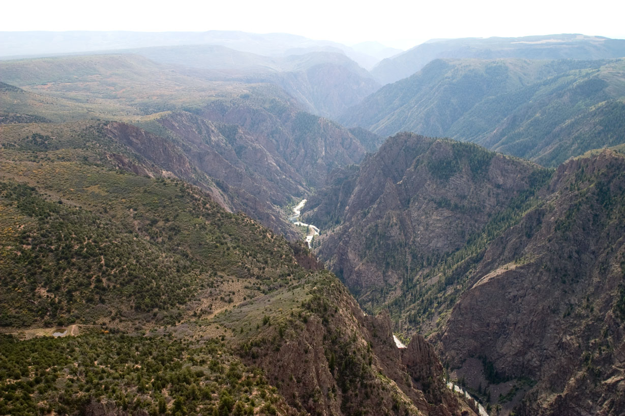
Black Canyon of the Gunnison National Park Weather: Weather
First-time visitors are often caught off guard by the temperature gradient between rim and river. Updated for 2026 with 5 Black Canyon of the Gunnison National
Sign in to join the conversation.
Sources & Attribution
Location data courtesy of the National Park Service (U.S. Department of the Interior). NPS data is public domain.
Images: NPS.
Map data © OpenStreetMap contributors.
Park operations alerts: NPS.gov · Weather and weather hazards: National Weather Service · Live conditions.
Information may change. Always verify fees, hours, and conditions directly with the official source before visiting.
Did this guide help? Share it with a friend.