The gravel crunches underfoot as you step out of the car at the Chisos Basin trailhead, and the temperature drops ten degrees in the minute it takes you to lace your boots. This is the first thing most visitors to Big Bend National Park notice - the sheer vertical variety of a place where the Rio Grande has carved canyons a quarter-mile deep while the Chisos Mountains rise a mile above sea level in the same park. If you're trying to figure out how to go to big bend national park, the honest answer is: you drive a long way, and then you drive some more. The payoff is a park that sees fewer annual visitors than Yellowstone does in a single July week.
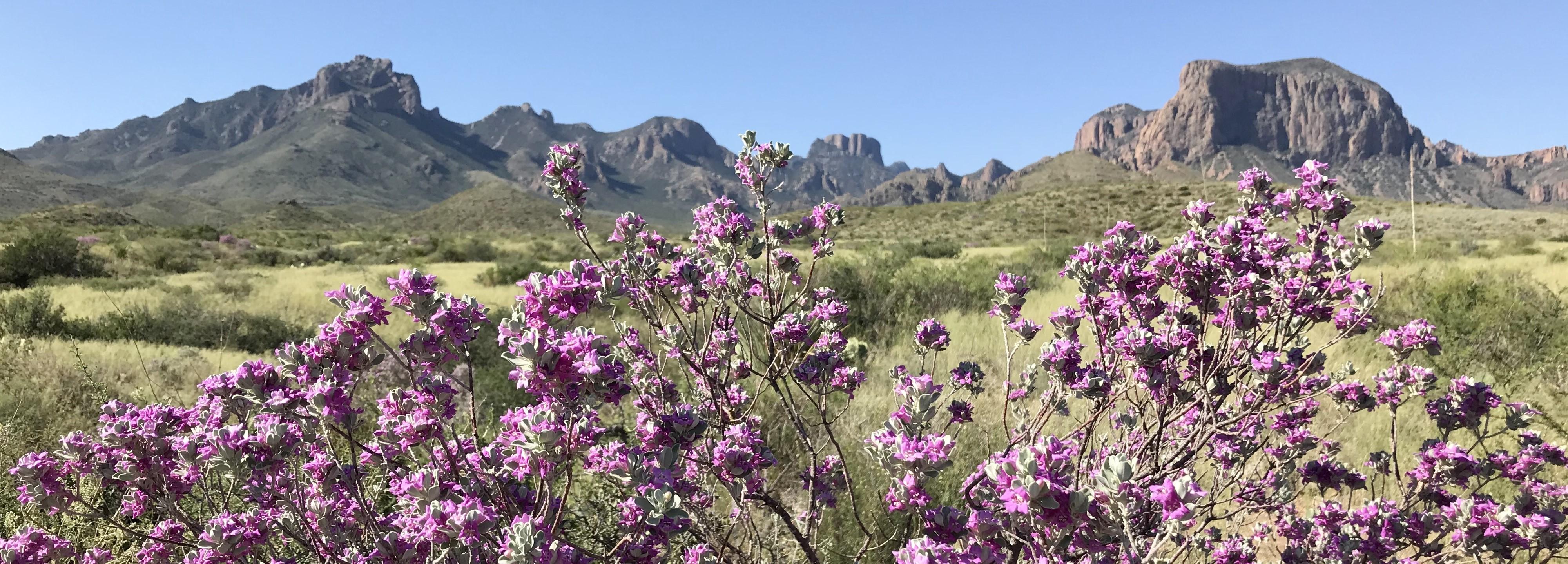
NPS via NPS.gov (Public Domain)
Big Bend National Park: River, Desert & Mountain at the Border - 2026 Guide
12 min read
Park Guide
The Chisos Basin sits at 5,400 feet, which means summer temperatures here run 10-15 degrees cooler than the desert floor.
Your plans
This article contains affiliate links — we may earn a small commission at no extra cost to you.
At a glance
Entrance Fee
Private vehicle $30 · Motorcycle $25 · Per person $15Full fee schedule
Hours
Big Bend National Park is always open. You can enter and exit at any time of the day or night. Park
Best Time
June-September (summer), September-October (fall colors)
Address
1 Panther Junction, Big Bend National Park, TX, 79834
Website
29.2982, -103.2298
Google MapsThe park covers 801,163 acres along the Texas-Mexico border, and the distances between things inside it are measured in hours, not miles. From the Santa Elena Canyon trailhead in the west to the Boquillas Canyon trailhead in the east is a 90-minute drive. The park has three distinct ecosystems - desert, river corridor, and mountain forest - compressed into a space you could cross in a single day if you wanted to, though you won't want to. Rangers will tell you that the common mistake is trying to see it all in one trip. They're right.
The Lay of the Land
Big Bend divides naturally into three zones, and understanding which one you're in matters more than knowing which trailhead you parked at.
The Chisos Mountains form the geographic and experiential heart of the park. The Chisos Basin sits at 5,400 feet, which means summer temperatures here run 10-15 degrees cooler than the desert floor. This is where the lodge, the most popular campground, and the park's premier hiking trails are concentrated. The Lost Mine Trail, the Window Trail, and the Emory Peak Trail all start from this basin. You'll drive up a winding road to get here, and the switchbacks demand attention - RVs over 24 feet are prohibited on the Basin Road for good reason.
The Rio Grande corridor runs along the southern edge of the park. This is where you'll find the three major canyons - Santa Elena, Boquillas, and Mariscal - and the two main river-adjacent campgrounds: Rio Grande Village in the east and Cottonwood Campground near Castolon in the west. The river itself is visible from multiple points, but the best views require walking into the canyons. Santa Elena Canyon Trail is the most accessible, and it's the hike most first-time visitors should prioritize.
The desert is everything else - the vast, open, sun-baked terrain between the mountains and the river. This is where the park's backcountry roads, primitive campsites, and most challenging hiking trails live. The Ross Maxwell Scenic Drive cuts through the western desert for 30 miles from the Maverick Entrance Station to Santa Elena Canyon, passing through the Castolon Historic District and offering views of Cerro Castellan, a volcanic formation that rises 1,000 feet from the desert floor. Cell service drops out at the entrance station and doesn't return until you're back in Study Butte.
The park headquarters is at Panther Junction, roughly the geographic center of the park. This is where you'll find the main visitor center, the only gas station inside the park, and the junction where the park's primary roads meet. From Panther Junction, it's 26 miles to the western entrance, 28 miles to the eastern entrance, and 8 miles up to the Chisos Basin.
Planning Your Visit
Entrance Fees and Passes
As of 2026, the standard entrance fee for a private vehicle is $30, valid for seven consecutive days. Motorcycles pay $25, and individuals entering on foot or bicycle pay $15. The America the Beautiful annual pass covers the vehicle entrance fee and is available at the entrance stations and visitor centers. If you're planning to visit multiple national parks in a year, it pays for itself by the third park.
When to Go
March and April are the busiest months for a reason: daytime temperatures in the 70s and 80s, wildflowers blooming, and all facilities open. The trade-off is that the popular trails and campgrounds fill up. The Chisos Basin Campground requires reservations months in advance during spring.
Summer (May through August) is genuinely unpleasant in the desert - temperatures regularly exceed 100°F by late morning, and hiking between 11 AM and 4 PM is not recommended. The Chisos Mountains remain viable for morning hikes, but the elevation gain will make you work for the cooler air.
Fall (October through November) is the park's best-kept secret. Temperatures moderate, crowds thin out after October, and the light turns golden. November is ideal for hiking and river trips.
Winter (December through February) brings cold nights - freezing is common - and occasional snow in the Chisos. Daytime temperatures are mild, usually in the 50s and 60s. This is the best season for backpacking and backcountry road exploration, provided you're prepared for cold camping.
Reservations
Campground reservations at Chisos Basin, Rio Grande Village, and Cottonwood Campground are handled through Recreation.gov and should be booked as far in advance as possible for spring and fall visits. Winter and summer are more flexible. The Chisos Mountains Lodge also requires advance booking - walk-in availability is rare.

Getting There & Getting Around
Big Bend is remote by any standard. The nearest commercial airport is in Midland/Odessa, about 200 miles north. El Paso is 320 miles west. Most visitors drive in from Dallas, Austin, San Antonio, or Houston - expect 6-8 hours from any of them.
From the north: Take US 385 south from Marathon, which runs 70 miles directly to the Persimmon Gap entrance station. This is the most straightforward route and drops you into the northern part of the park, about 35 miles from Panther Junction.
From the west: TX 118 from Alpine runs through Study Butte, then continues 26 miles east to the Maverick Entrance Station. This entrance gives you direct access to the Ross Maxwell Scenic Drive and Santa Elena Canyon.
From the east: US 90 to Marathon, then south on US 385, or take TX 118 south from Alpine. There is no eastern entrance station on the park's east side - you enter through Persimmon Gap in the north or Maverick in the west.
Gas and supplies: The gas station at Panther Junction is the only fuel inside the park. It operates during visitor center hours and prices are higher than outside. Fill up in Alpine, Marathon, or Study Butte before entering. There are no electric vehicle charging stations in Big Bend National Park. The closest EV charging is 130 miles away in Fort Stockton.
Road conditions: Paved roads inside the park are generally well-maintained, but the road between Castolon and Santa Elena Canyon can have mud and shallow water on the roadway - check conditions at the visitor center before heading out. Black Gap Road remains closed as of 2026 due to flood damage from 2025. The backcountry roads require high-clearance, four-wheel-drive vehicles and should not be attempted in standard sedans.
What to Do
Hiking
Big Bend hiking is the primary reason most people come here, and the variety is unusual for a single park. The big bend hiking trails range from the 0.5-mile Chihuahuan Desert Nature Trail to the 10.5-mile roundtrip Emory Peak Trail, which gains 2,500 feet and tops out at the highest point in the park.
The Lost Mine Trail is the most popular hike in the park, and for good reason. It's 4.8 miles roundtrip with 1,100 feet of elevation gain, climbing through pine-oak woodland to a ridge with views of Juniper Canyon and the Sierra del Carmen. Start before 8 AM in spring and fall - the parking lot fills by 7:30.
The Santa Elena Canyon Trail is the hike that makes first-time visitors understand what Big Bend is about. It's only 1.7 miles roundtrip, but it takes you between vertical limestone walls that rise 1,500 feet from the river. The trail crosses Terlingua Creek first - you'll get your feet wet if there's been recent rain - then climbs paved steps into the canyon mouth. The view from the turnaround point, looking back toward the canyon entrance with the river at your feet, is the single image that defines this park.
Best hikes in big bend national park beyond the famous ones include the South Rim Trail (12-14 miles roundtrip, 2,200 feet of elevation gain, views that stretch into Mexico), the Window Trail (5.6 miles roundtrip, mostly downhill on the way out, which means mostly uphill on the way back), and the Boquillas Canyon Trail (1.4 miles roundtrip, minimal elevation, great for late afternoon light).
River Activities
The Rio Grande is the park's southern boundary and its defining geographic feature. You can see it from overlooks, hike into the canyons that it carved, or float through them. The tours and guided experiences include commercial river trips through Santa Elena, Boquillas, and Mariscal canyons. These range from half-day floats to multi-day expeditions. The river level varies dramatically by season - spring snowmelt and summer monsoon rains create the best floating conditions.
Scenic Drives
The Ross Maxwell Scenic Drive runs 30 miles from the Maverick Entrance Station to the Santa Elena Canyon trailhead. Allow 2-3 hours with stops. The drive passes through the Castolon Historic District, offers views of Cerro Castellan and Tuff Canyon, and ends at the canyon. The paved road is suitable for all vehicles.
The drive from Panther Junction to Rio Grande Village takes about 30 minutes and follows the eastern edge of the park. The Boquillas Overlook, about 10 miles before the village, offers a view of the Mexican village of Boquillas directly across the river.
Wildlife and Birding
More bird species have been recorded in Big Bend than in any other national park - over 450 species. The Rio Grande corridor is the primary draw, with Cottonwood Campground and the Rio Grande Village Nature Trail consistently producing the highest counts. The wildlife viewing page will have more details, but expect to see javelina, roadrunners, black-tailed jackrabbits, and if you're lucky, a black bear or mountain lion in the Chisos.
Night Sky
Big Bend has some of the darkest night skies in the lower 48 states. The park is an International Dark Sky Park, and on moonless nights the Milky Way is visible as a distinct band of light from horizon to horizon. The Chisos Basin Amphitheater and the Rio Grande Village Nature Trail are popular stargazing spots. Bring a red-light flashlight and let your eyes adjust for 20 minutes.

Where to Stay
Inside the Park
Chisos Mountains Lodge is the only indoor lodging inside the park. Rooms are basic - think motel quality - but you're paying for the location, which is unbeatable. The lodge has a restaurant, a gift shop, and immediate access to the Basin's trailheads. Book months in advance.
Campgrounds: The park has four developed campgrounds, and camping options vary by location. Chisos Basin Campground (56 sites, $16/night) sits at 5,400 feet and offers the coolest temperatures and best mountain views. Rio Grande Village Campground (93 sites, $16/night) is near the river with the warmest winter temperatures and the best birding. Cottonwood Campground (22 sites, $16/night) is a quiet oasis near Castolon. Rio Grande Village RV (25 sites, $36/night) has full hookups.
All campgrounds require reservations through Recreation.gov as of 2026. The Chisos Basin fills first, then Rio Grande Village. Cottonwood is the least competitive but also the most exposed.
Backcountry camping is available with a permit, which you pick up at the visitor center. The park has over 100 primitive roadside campsites along backcountry roads and unlimited backpacking options for those willing to carry everything. Rangers will tell you that most visitors underestimate how much water they need - plan on one gallon per person per day minimum.
Outside the Park
The gateway communities of Study Butte, Terlingua, and Lajitas offer motels, rental cabins, and RV parks. Terlingua has a ghost-town atmosphere and a handful of excellent restaurants. Lodging and accommodations outside the park are generally cheaper and more available than inside, but add 30-60 minutes of driving each way to reach the main trailheads.
Seasonal Guide
Spring (March-May)
March and April are peak season. Daytime temperatures in the 70s and 80s, wildflowers blooming, and all facilities open. The trade-off is crowds - expect full parking lots at popular trailheads by 8 AM. May brings the first serious heat, with desert temperatures pushing 100°F by noon. The best time to visit for hiking is March-April; for solitude, try late April or early May when school groups have thinned out.
Summer (June-August)
Summer is for the committed. Desert temperatures exceed 100°F by late morning, and hiking after 10 AM is dangerous without extreme preparation. The Chisos Mountains remain 10-15 degrees cooler and are viable for early morning hikes. The Rio Grande is at its lowest flow. Crowds are minimal. If you come in summer, plan to hike before 9 AM, spend midday at elevation or in the car with AC, and resume activities after 5 PM.
Fall (September-November)
September retains summer heat but with the start of monsoon season, which brings dramatic afternoon thunderstorms. October is ideal - temperatures moderate, crowds thin, and the light turns that golden quality photographers chase. November is cool and quiet, with excellent hiking conditions. This is the best season for backpacking and river trips.
Winter (December-February)
Winter brings cold nights (20s and 30s are common) and mild days (50s and 60s). Snow falls in the Chisos a few times per year but rarely accumulates. The park is quiet, and you'll have trails to yourself. Some facilities operate on reduced hours. This is the best season for backcountry road exploration - the cooler temperatures make the exposed driving bearable. The Boquillas Port of Entry operates Friday-Monday 9 AM-4 PM, so plan cross-border visits accordingly.

Practical Takeaways
- Fill your gas tank in Alpine, Marathon, or Study Butte. The single gas station inside the park at Panther Junction is expensive and has limited hours. You will drive more miles than you think - the park is bigger than Rhode Island.
- Bring cash for park entrance fees. The entrance stations occasionally have card reader issues, and some smaller vendors outside the park are cash-only.
- Start hiking before sunrise in spring and fall. The Lost Mine Trail parking lot fills by 7:30 AM. Santa Elena Canyon parking fills by 9 AM. If you roll in at 10 AM expecting to walk right onto a popular trail, you're going to be disappointed.
- Carry one gallon of water per person per day. This is not an exaggeration. The dry air and sun dehydrate you faster than you realize, and there are no water sources on most trails. The trail register is full of comments from people who learned this the hard way.
- Drones are prohibited everywhere in the park. The NPS enforces this strictly. Leave the drone at home.
- Pets are extremely limited. They are not allowed on any trails, in the backcountry, or on the river. They can be in parking lots and developed areas only and may not be left unattended. If you're traveling with a dog, plan on boarding it outside the park.
- Cell service does not exist inside the park. There's a weak signal at Panther Junction and nowhere else. Download maps and information before you arrive. Tell someone your itinerary and expected return time.
- The Boquillas Crossing Port of Entry is open Friday-Monday 9 AM-4 PM only. If you want to visit the village of Boquillas, Mexico, bring your passport and plan your visit for those days and hours. The crossing is closed Tuesday-Thursday as of 2026.
- The park telephone system has had ongoing issues. As of April 2026, the automated answering system and voicemail are inoperable. If you need to reach the park, call during business hours and expect to stay on the line. For emergencies, dial 911.
- Check road conditions before you go. The road between Castolon and Santa Elena Canyon can have water on it. Black Gap Road is closed due to flood damage. Conditions change with weather, and the park website is the best source for current alerts.
Final Thoughts
Big Bend is not a casual park. It does not reward the unprepared or the rushed. The drive is long, the distances inside are longer, and the summer heat will punish mistakes. But for the visitor who comes ready - with water, with time, with a willingness to sit still and watch the light change on a canyon wall - Big Bend offers something that the crowded parks cannot: the experience of a place that still feels wild. The night sky looks the way it did a thousand years ago. The river is still cutting through the limestone at its own pace. The mountain lions and black bears and peregrine falcons are going about their business without much concern for yours.
Come prepared. Stay long. Leave the schedule loose. The park will tell you what to do when you get here.
For more information, see our complete National Park Guide.
Related: big bend hiking guide
Related: hiking big bend national park guide
Recommended Gear
What experienced visitors bring to Big Bend National Park: River, Desert & Mountain at the Border - 2026 Guide
Links may earn us a commission at no extra cost to you. We only recommend gear we believe in.
Hiking Essentials
Hydration Pack (3L)
Hands-free water for long trail days
Trekking Poles (Pair)
Save your knees on steep descents
Hiking Boots (Ankle Support)
Sturdy footwear for rocky, uneven trails
Sun & Heat Protection
Wide-Brim Sun Hat
Full coverage UPF 50+ protection at altitude
Insulated Water Bottle (32oz)
Keeps water cold in desert heat all day
Electrolyte Mix Packets
Replace what water alone cannot during intense heat
Winter Gear
Microspikes / Traction Devices
Essential for icy rim trails in winter months
Packable Down Jacket
Lightweight warmth that stuffs into a pocket
Sources
- Official source: NPS — Big Bend National Park nps.gov/bibe/index.htm
Explore More National Parks

Guadalupe Mountains National Park: Ancient Ocean Reef & Texas High Country - 2026 Guide
Discover an ancient Permian ocean reef now rising as Texas high country. Complete 2026 guide to Guad...

Where to Fly Into for Carlsbad Caverns
Discover nightly bat flights and vast underground cave chambers. Complete 2026 guide to Carlsbad Cav...

White Sands National Park: The World's Largest Gypsum Dune Field - 2026 Guide
Discover the world's largest gypsum dune field — pure white and vast. Complete 2026 guide to White S...

Saguaro National Park: The Sonoran Desert's Iconic Giant Cactus — 2026 Guide
Saguaro National Park splits into two distinct districts. 2026 tips for visiting—Rincon Mountain vs....
Photo Gallery
More to Explore

Park Guide
Acadia National Park: Carriage Roads, Cadillac Mountain & 2026 Guide
Discover carriage roads, Cadillac Mountain, and rugged Maine coast. Complete 2026 guide to Acadia National Park — trails, fees, lodging, permits, and what rangers recommend.

Hiking Guide
Grand Canyon Hiking Trails: Day Hikes, Water Sources & Rim to Rim
Compare Grand Canyon hiking trails: Bright Angel, South Kaibab, Hermit, Grandview, and rim to rim, with distances, elevation, water stops, and trailhead access for each.

Best Of
Best of Glacier Bay National Park
The best of Glacier Bay is reached by boat: ranger-led day tours up the bay to the tidewater glaciers. What's worth it, how to book, and when to go (2026).

Campsite Guide
White Sands Backcountry Camping: Closed for 2026 — What to Know
As of 2026, backcountry camping at White Sands National Park is closed for site rehabilitation. What that means, and where to camp nearby instead.

Weather Guide
Guadalupe Mountains National Park Weather: Weather
Guadalupe Mountains National Park: weather guide guide updated 2026. Practical visitor information, reservations, and seasonal tips worth bookmarking before

Best Of
Best of Cuyahoga Valley National Park: Best Things to Do
Seeing a Cleveland Orchestra concert with the woods as your backdrop is a uniquely Cuyahoga Valley experience.
Sign in to join the conversation.
Sources & Attribution
Location data courtesy of the National Park Service (U.S. Department of the Interior). NPS data is public domain. Official NPS page.
Images: NPS; NPS; NPS; NPS; NPS.
Map data © OpenStreetMap contributors.
Park operations alerts: NPS.gov · Weather and weather hazards: National Weather Service · Live conditions.
Information may change. Always verify fees, hours, and conditions directly with the official source before visiting.
Did this guide help? Share it with a friend.