The single best thing to do at Big Bend National Park is to stand inside Santa Elena Canyon at 9 AM on a winter morning. Not at the trailhead. Not at the overlook. Inside it, where the walls rise 1,500 feet on both sides, and the Rio Grande narrows to a green channel maybe thirty feet across. The light hits the limestone in phases - first the top quarter, then slowly working its way down as the sun clears the canyon rim. You'll hear your own footsteps echo off rock that's been cut for millions of years. That's the experience that justifies the five-hour drive from anywhere.
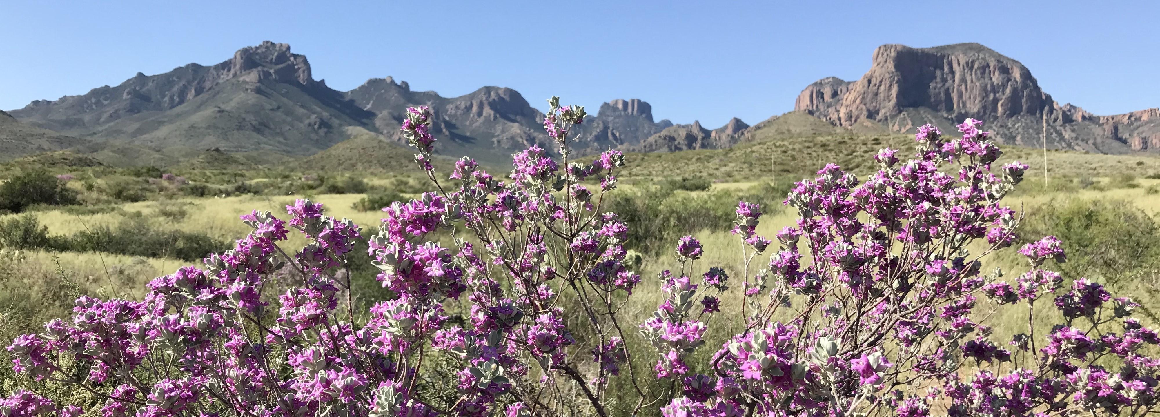
NPS via NPS.gov (Public Domain)
Best of Big Bend National Park: Best Way to See (2026)
10 min read
Best Of
Complete guide to best way to see big bend national park. Everything you need to know, updated for 2026.
This article contains affiliate links — we may earn a small commission at no extra cost to you.
For more, see hiking trails, camping options, and best time to visit.
Everything else at Big Bend supports this kind of moment. The park is remote, rugged, and requires real effort to access. That's not a flaw - it's the feature. At 801,163 acres, it's one of the largest national parks in the lower 48, and it gets fewer visitors in a year than Yellowstone gets in a week. The best way to see Big Bend National Park is to accept that remoteness and plan around it, not fight it.
If your time is short, this guide focuses on what matters. For full logistics, see the complete visitor guide. For trail details, check the hiking trails guide.
If You Only Have One Day
Arrive at the park's western entrance near Study Butte by 7:30 AM. The drive from the gate to Santa Elena Canyon takes about 45 minutes along Ross Maxwell Scenic Drive - don't stop at every pullout yet. Save them for the return.
Hit the Santa Elena Canyon Trailhead by 8:15. The trail is 1.7 miles roundtrip with minimal elevation gain. Cross Terlingua Creek first - it's usually dry or shallow enough to step across. Then the trail enters the canyon mouth on paved steps. Walk until the walls feel close enough to touch. Turn around whenever you want; the best views are in the first half-mile.
Back at the car by 9:30. Drive north to the Chisos Basin - about an hour. The road climbs 2,000 feet into the mountains. You'll feel the temperature drop.
The Lost Mine Trail is the best single hike in the park for a one-day visit. It's 4.8 miles roundtrip with 1,100 feet of elevation gain. The payoff is a ridgeline view into Juniper Canyon and the desert stretching to Mexico. Most first-time visitors underestimate how exposed this trail is - there's almost no shade after the first mile. Bring more water than you think you need. The trail register is full of comments from people who ran out halfway up.
Descend by 1 PM. Eat lunch at the Chisos Basin picnic area. The camp store sells basic supplies but nothing fancy.
Spend the afternoon on Ross Maxwell Scenic Drive heading back west. Stop at the Sotol Vista overlook, the Badlands Exhibit, and Tuff Canyon. Each takes 10-15 minutes. The light on the desert gets better as the afternoon wears on.
End at the Santa Elena Canyon overlook for sunset. The canyon walls catch orange and red light. Then drive out before dark - the road has no lighting and wildlife moves onto it after sunset.
The one decision that derails most single-day visits: trying to cover both the east and west sides of the park. The distance from Rio Grande Village to Santa Elena Canyon is 65 miles. That's an hour and a half of driving each way, minimum. Pick one side. The western side (Santa Elena, Chisos Basin, Ross Maxwell Drive) gives you more variety in less driving time.

The Top Experiences, Ranked
#1 - Santa Elena Canyon: The Essential Big Bend Experience
- Why it makes this list: No other place in the park so perfectly captures what makes Big Bend unique - the Rio Grande cutting through limestone that predates the Rocky Mountains. The scale is immediate and undeniable.
- What it requires: 45 minutes to an hour. Minimal fitness needed - the trail is flat with paved steps. A high-clearance vehicle helps if Terlingua Creek has recent runoff, but most sedans make it.
- The single best tip: Go in the morning. By 10:30 AM the canyon floor is in direct sun and the temperature difference is noticeable. By 11, the shade is gone entirely.
- What most visitors do wrong: They stop at the overlook and don't walk into the canyon itself. The overlook is good. The interior is better.
- Link to dedicated guide: See the hiking trails page for full trail details.
#2 - Lost Mine Trail: Best Return on Effort
- Why it makes this list: The ratio of effort to reward is the best in the park. 4.8 miles, 1,100 feet of gain, and views that stretch 30 miles into Mexico on clear days.
- What it requires: 3-4 hours. Moderate fitness. This is not a flat walk - the switchbacks are continuous.
- The single best tip: Start before 8 AM in summer, before 9 AM in winter. The parking lot fills by 8:30 in spring. Rangers will tell you the lot holds about 30 cars and there's no overflow parking on the narrow road.
- What most visitors do wrong: They underestimate the sun exposure. The first mile is in the trees. The rest is fully exposed. Pack extra water for this stretch.
#3 - Ross Maxwell Scenic Drive: The Park's Best Road
- Why it makes this list: 30 miles of paved road that passes through volcanic formations, desert flats, and ends at Santa Elena Canyon. It's the most efficient way to see the park's geological variety.
- What it requires: 2-3 hours with stops. Any vehicle. The road is paved and well-maintained.
- The single best tip: Drive it south to north in the afternoon. The sun is behind you, which makes photography easier and keeps the car cooler.
- What most visitors do wrong: They rush it. The pullouts between Mule Ears Viewpoint and the Castolon area have some of the best desert photography in the park.
#4 - Night Sky Viewing: What You Came Here For
- Why it makes this list: Big Bend has some of the darkest measured skies in the continental United States. The Milky Way is visible to the naked eye on moonless nights. The park is an official International Dark Sky Park.
- What it requires: Staying overnight. A clear night with no moon. A blanket or chair.
- The single best tip: Check the moon phase before you go. Full moon washes out the stars completely. New moon is ideal. Rangers at the visitor center can tell you when the best viewing nights fall during your visit.
- What most visitors do wrong: They try to stargaze from the developed campgrounds where ambient light from RVs and restrooms reduces visibility. Drive five minutes down any park road and pull over. The difference is immediate.
#5 - Boquillas Canyon Trail: The Quiet Canyon
- Why it makes this list: Santa Elena gets the attention. Boquillas Canyon is less crowded and the trail is easier. The canyon walls are equally impressive.
- What it requires: 1.5 miles roundtrip, flat, 45 minutes. No elevation gain.
- The single best tip: Go in late afternoon. The light hits the canyon walls at an angle that brings out the red and orange tones in the sandstone.
- What most visitors do wrong: They stop at the overlook and don't walk the full trail into the canyon. The trail continues past the obvious endpoint for another quarter mile.
#6 - Hot Springs Historic District
- Why it makes this list: A natural hot spring pool sits right on the Rio Grande, next to the ruins of a 1900s resort. You can soak in 105-degree water while looking at Mexico.
- What it requires: A 0.5-mile walk from the parking area. The road to the trailhead is unpaved but passable for most cars.
- The single best tip: Go early. The pool holds about six people comfortably. By 10 AM on weekends, there's usually a wait.
- What most visitors do wrong: They don't bring a towel or change of clothes. There are no facilities at the hot springs.
#7 - Boquillas Crossing Port of Entry (Mexico Visit)
- Why it makes this list: For a valid passport holder, this is the only place in the lower 48 where you can walk into Mexico from a national park. The village of Boquillas is a small mining town with a restaurant, craft vendors, and a cantina.
- What it requires: A valid passport. $5 for the boat ride across the Rio Grande. $5-10 for a horse or truck ride into town. 2-3 hours total. The port of entry is open Friday through Monday, 9 AM to 4 PM as of 2026.
- The single best tip: Bring cash in small bills. The village doesn't take cards.
- What most visitors do wrong: They assume they can go any day. Check the port hours - they've been reduced from daily operations.
#8 - Emory Peak: For the Fit and Determined
- Why it makes this list: At 7,825 feet, Emory Peak is the highest point in the park. The view from the summit covers the entire park and into Mexico.
- What it requires: 10.5 miles roundtrip, 2,500 feet of elevation gain. Full day. Excellent fitness required.
- The single best tip: The last 0.25 miles is a scramble over boulders. You'll need both hands. Leave your hiking poles at the base of the final climb.
- What most visitors do wrong: They underestimate the water requirement. Rangers recommend 4 liters minimum for this hike, even in winter.

What Most People Miss
The Window View Trail at Sunset. Most visitors drive to the Chisos Basin Lodge overlook for sunset. The Window View Trail is a short 0.3-mile paved path that ends at a railing looking through the notch in the mountains. The light show through the Window is better than any developed overlook. It takes ten minutes.
The Fossil Discovery Exhibit. Located on the road to Rio Grande Village, this is a small outdoor exhibit with actual fossils embedded in the display rocks. The park has one of the best Cretaceous fossil records in the country. Most visitors drive past without stopping.
Backcountry Road Exploration. If you have a high-clearance 4WD vehicle, the park has 160 miles of primitive roads that access areas most visitors never see. The Glenn Springs Road and River Road are the most accessible. Rangers at the visitor center emphasize checking road conditions before heading out - flash floods can make sections impassable.
Birdwatching at Cottonwood Campground. Big Bend has more bird species than any other national park - over 450 recorded. The cottonwood trees near the Rio Grande attract migrating species that don't appear anywhere else in the United States. Spring migration (April-May) is the peak.

What's Overrated (and Better Alternatives)
The Santa Elena Canyon Overlook (the one at the end of the paved road). This is the most photographed spot in the park. It's also where every tour bus stops. The view is good. But the actual trail into the canyon is 100 yards away and has 1/10th the crowd. Walk the trail. Skip the overlook photo line.
The Chisos Basin Lodge Restaurant. The food is fine. The prices are resort-level. The view from the patio is excellent. Better option: pack a lunch and eat at the picnic area near the Lost Mine Trail trailhead. Same view, $40 cheaper, no wait.
The "Window" from the Basin Floor. The popular photo spot looking up at the V-shaped notch in the mountains. It's pretty. It's also visible from the parking lot. The better experience is hiking the Window Trail, which goes down to the actual drainage where the water flows through. That's a 5.6-mile roundtrip hike that most visitors don't know exists.

Practical Takeaways
- The best way to see Big Bend National Park is to stay overnight. The park is too large and the distances too far for a satisfying day trip. Even a single night doubles what you can experience.
- Fill your gas tank before entering the park. The closest gas stations are in Study Butte (west entrance) and Marathon (north entrance). Inside the park, gas is available at Panther Junction and Rio Grande Village but costs more and has limited hours. There are no EV charging stations in the park - the closest is 130 miles away in Fort Stockton as of 2026.
- Bring water from home. The park sells bottled water at visitor centers and camp stores. It costs $4 a bottle. Bring a gallon per person per day. This is not negotiable.
- Cell service drops out at the park boundary. There's no reliable service inside the park. Download maps, directions, and this article before you leave home. The visitor centers have WiFi but it's slow.
- November through February is the best time to visit for hiking. Daytime temperatures range from 60-75°F. Summer (May-August) sees desert temperatures above 100°F by late morning. The Chisos Mountains are 10-15 degrees cooler but still hot.
- Reservations are required for all campgrounds as of 2026. Chisos Basin, Rio Grande Village, and Cottonwood Campground all require advance booking through Recreation.gov. Walk-up sites are not available. See the camping options guide for details.
- The best time to visit for avoiding crowds is December-February. Spring (March-April) is the busiest season. The park gets 400,000-500,000 visitors annually, but 40% of them come between March and May. Check the best time to visit guide for monthly breakdowns.
- Pets are not allowed on any trails, in the backcountry, or on the river. They can only go where vehicles can go. If you're traveling with a dog, you'll be limited to scenic drives and developed areas. Leaving pets unattended in vehicles is not recommended due to heat.
For more information, see our complete National Park Guide.
Related: big bend hiking guide
Related: hiking big bend national park guide
Recommended Gear
What experienced visitors bring to Best of Big Bend National Park: Best Way to See (2026)
Links may earn us a commission at no extra cost to you. We only recommend gear we believe in.
Hiking Essentials
Hydration Pack (3L)
Hands-free water for long trail days
Trekking Poles (Pair)
Save your knees on steep descents
Hiking Boots (Ankle Support)
Sturdy footwear for rocky, uneven trails
Sun & Heat Protection
Wide-Brim Sun Hat
Full coverage UPF 50+ protection at altitude
Insulated Water Bottle (32oz)
Keeps water cold in desert heat all day
Winter Gear
Microspikes / Traction Devices
Essential for icy rim trails in winter months
Packable Down Jacket
Lightweight warmth that stuffs into a pocket
Sources
- Official source: NPS — Big Bend National Park nps.gov/bibe/index.htm
Photo Gallery
More to Explore

Park Guide
Acadia National Park: Carriage Roads, Cadillac Mountain & 2026 Guide
Discover carriage roads, Cadillac Mountain, and rugged Maine coast. Complete 2026 guide to Acadia National Park — trails, fees, lodging, permits, and what rangers recommend.

Hiking Guide
Grand Canyon Hiking Trails: Day Hikes, Water Sources & Rim to Rim
Compare Grand Canyon hiking trails: Bright Angel, South Kaibab, Hermit, Grandview, and rim to rim, with distances, elevation, water stops, and trailhead access for each.

Best Of
Best of Glacier Bay National Park
The best of Glacier Bay is reached by boat: ranger-led day tours up the bay to the tidewater glaciers. What's worth it, how to book, and when to go (2026).

Campsite Guide
White Sands Backcountry Camping: Closed for 2026 — What to Know
As of 2026, backcountry camping at White Sands National Park is closed for site rehabilitation. What that means, and where to camp nearby instead.

Weather Guide
Guadalupe Mountains National Park Weather: Weather
Guadalupe Mountains National Park: weather guide guide updated 2026. Practical visitor information, reservations, and seasonal tips worth bookmarking before

Best Of
Best of Cuyahoga Valley National Park: Best Things to Do
Seeing a Cleveland Orchestra concert with the woods as your backdrop is a uniquely Cuyahoga Valley experience.
Sign in to join the conversation.
Sources & Attribution
Location data courtesy of the National Park Service (U.S. Department of the Interior). NPS data is public domain. Official NPS page.
Images: NPS; NPS; NPS; NPS; NPS.
Map data © OpenStreetMap contributors.
Park operations alerts: NPS.gov · Weather and weather hazards: National Weather Service · Live conditions.
Information may change. Always verify fees, hours, and conditions directly with the official source before visiting.
Did this guide help? Share it with a friend.