The single most important thing to understand about driving in Big Bend National Park is that you are committing to serious distances with no services in between. The park covers 801,163 acres, and the drive from the north entrance to the southernmost point is roughly 70 miles of pavement with zero gas stations, no cell service for most of it, and summer temperatures that push past 100°F by late morning. Plan your fuel and water before you enter.
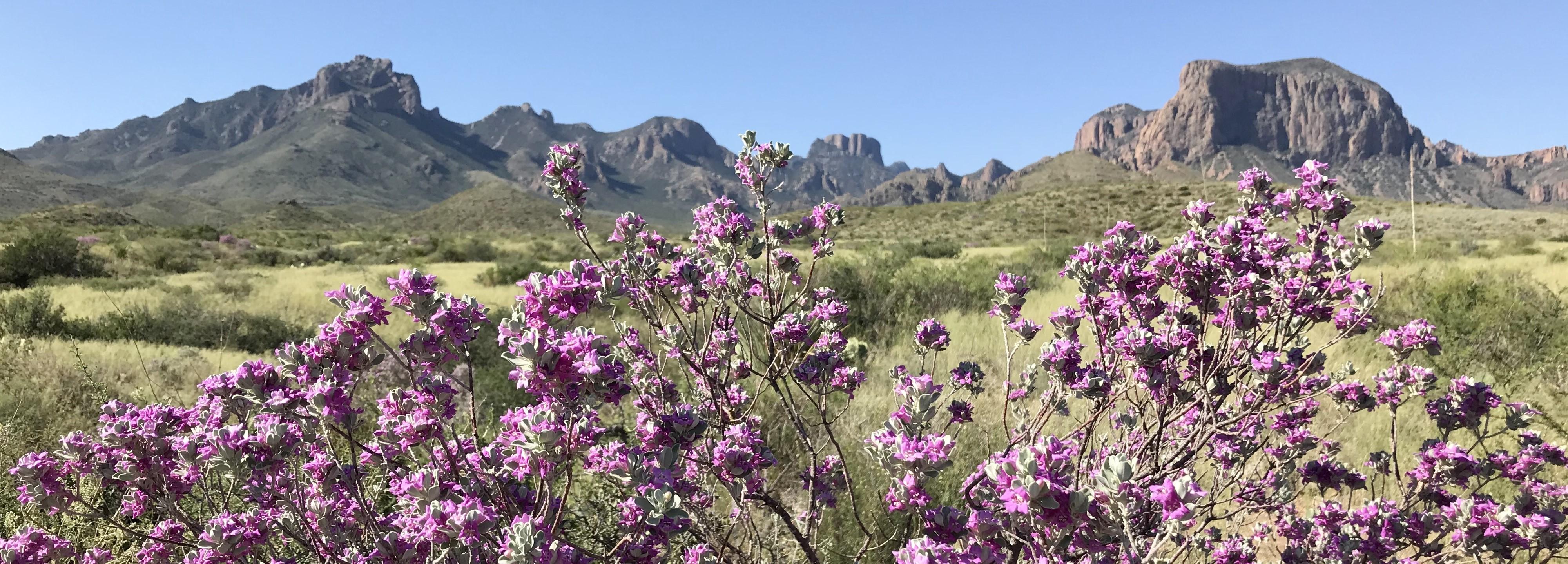
NPS via NPS.gov (Public Domain)
Big Bend National Park Scenic Drives: Driving Trails
7 min read
Scenic Drives
Explore Big Bend National Park's scenic drives, including the 30-mile Ross Maxwell Scenic Drive to Santa Elena Canyon.
If you're looking for a thorough overview of the park before hitting the road, check the complete visitor guide first. This guide focuses specifically on the driving routes themselves - what you'll see, when to go, and where to pull over.
The Drive at a Glance
Big Bend National Park has one primary paved scenic route - the Ross Maxwell Scenic Drive - plus two significant paved access roads (Chisos Basin Road and the road to Boquillas Canyon) and a network of primitive backcountry roads for high-clearance, four-wheel-drive vehicles.
Ross Maxwell Scenic Drive runs 30 miles one way from the junction near Panther Junction down to the Santa Elena Canyon trailhead. It's fully paved, suitable for any vehicle, and takes 2-3 hours with stops. Drive it southbound (toward the canyon) for the best light in the morning, or northbound in the afternoon if you want the sun behind you at the canyon.
Chisos Basin Road is a 6-mile paved road that climbs 1,500 feet from the desert floor into the Chisos Mountains. It's steep with tight switchbacks - RVs and trailers over 20 feet are restricted.
Boquillas Canyon Road runs 5 miles from the main park road east to the Boquillas Canyon trailhead and the Boquillas Port of Entry. Paved, easy driving.
The primitive backcountry roads (River Road, Old Maverick Road, Glenn Spring Road, Black Gap Road) require high clearance, four-wheel drive, and a backcountry permit for overnight use. Rangers at the visitor center can tell you current conditions before you head out - these roads change significantly after rain.

Stop by Stop: Ross Maxwell Scenic Drive
Sotol Vista Overlook
About 8 miles south of the main junction. From this overlook you can see the entire western half of the park - the flat desert floor dropping away toward the Rio Grande, with Cerro Castellan rising as a distinct volcanic peak to the south and the Sierra del Carmen range in Mexico across the river. The elevation here gives you a 15-degree temperature drop compared to the desert floor. Early morning is your best bet for photography - the low-angle light hits the volcanic cliffs directly.
Most visitors spend 10 minutes here and move on. The common mistake is not walking the short path past the first railing to the unshaded point farther out - that extra 50 yards opens up the view of Santa Elena Canyon in the distance.
Tuff Canyon Overlook and Trail
Mile marker 14, roughly. The "Anatomy of a Canyon" exhibit explains how this slot canyon formed from volcanic ash deposits. The overlook platform puts you directly above a 200-foot-deep cut in the tuff. You can see the layered ash deposits clearly in the canyon walls - gray-white layers alternating with darker volcanic rock.
This stop takes 15-20 minutes if you just do the overlook. A short trail descends into the canyon from here (linked to the hiking trails guide).
Castolon Historic District
Mile marker 22. This collection of adobe buildings dates to the early 1900s and includes the Castolon Store (still operating seasonally), the old cavalry quarters, and the Alvino House - the oldest intact adobe structure in the park. The store sells cold drinks, snacks, and ice, which matters more than most visitors realize in summer.
Parking here is limited - maybe 15 cars. Tour buses arrive between 11 AM and 1 PM. Get here before 10 AM or after 2 PM for a quieter experience.
Santa Elena Canyon Overlook and Trailhead
The end of the road at mile 30. The canyon walls rise 1,500 feet straight from the river, and the slot is so narrow in places that the sun reaches the canyon floor for only a few hours a day. From the overlook you can see the Rio Grande cutting through the Mesa de Anguila - the canyon mouth is roughly 100 feet wide at river level.
The parking lot fills by 9:30 AM in March and April. If you arrive after that, expect to park along the road shoulder for a quarter mile back. The trail into the canyon is the most popular short hike in the park (see the hiking guide for details).
The light hits the canyon mouth best between 10 AM and 2 PM. Before 10 AM, the canyon wall casts shadow across the entire entrance. After 2 PM, the sun shifts behind the opposite wall.

Timing and Crowds
March and April are the busiest months. The park saw record visitation in spring 2025, and 2026 is expected to be similar. The Ross Maxwell Scenic Drive gets heavy traffic between 10 AM and 3 PM, with tour buses running the route between 11 AM and 1 PM.
The counter-intuitive strategy: Drive the route southbound starting at 7:30 AM. You'll hit Sotol Vista and Tuff Canyon before the buses arrive, arrive at Santa Elena Canyon around 9:15 AM when parking is still available, and have the canyon mostly to yourself. By the time you head back north, you'll pass the crowds coming south.
Summer (May-August) sees far fewer visitors - daytime temperatures regularly exceed 100°F in the desert, and 110°F is not unusual by late afternoon. The Ross Maxwell drive is still doable, but carry at least a gallon of water per person in the car and avoid stopping in direct sun for more than 15 minutes. The Chisos Basin Road becomes the smarter choice on summer afternoons - temperatures are 10-15 degrees cooler at 5,400 feet.
Fall and winter (November-February) are mild and pleasant. Freezing occurs overnight occasionally, and snow is rare. The sun sits lower in the sky, which means the canyon overlooks get good light later into the day - 11 AM to 3 PM is prime photography window in December.

Driving Logistics
Gas: The last fuel before the park is in Study Butte (26 miles west of park headquarters) or Marathon (70 miles north). Inside the park, there is no gas station. Panther Junction has a small store with snacks and supplies but no fuel. Fill up before you enter.
Cell service: Drops out completely about 5 miles past the park entrance station. There is sporadic and unreliable service at the Chisos Basin Lodge and at the Rio Grande Village store. Assume you have no service for the entire Ross Maxwell drive. Download offline maps before you arrive.
RV restrictions: No vehicles over 20 feet on Chisos Basin Road - the switchbacks at the lower section are too tight. RVs up to 35 feet can manage Ross Maxwell Scenic Drive, but some pullouts are too short for trailers. The Santa Elena Canyon parking lot has a few oversized spots, but they fill by 9 AM.
No drones. The park enforces this strictly. Fines apply.
EV charging: None in the park. The closest charging station is 130 miles away in Fort Stockton. As of 2026, this has not changed. If you're driving an EV, this is not the park for it unless you have enough range for a round trip of roughly 200 miles of driving inside the park plus the 260-mile round trip to Fort Stockton.
Parking at key stops:
- Sotol Vista: 8 cars
- Tuff Canyon: 12 cars
- Castolon: 15 cars
- Santa Elena Canyon: 35 cars, plus shoulder parking for maybe 20 more

Practical Takeaways
- Fill your gas tank in Study Butte or Marathon before entering. There is no fuel inside the park - period.
- Carry 1 gallon of water per person per day in your vehicle, regardless of season. Heat exhaustion is the most common ranger response call on the scenic drive.
- Start the Ross Maxwell drive by 8 AM in spring and fall. By 9:30 AM the Santa Elena Canyon lot is full and you'll be parking on the shoulder.
- The drive is 30 miles one way with no shortcuts - if you forget something at the car, it's a full hour round trip to get back.
- Download offline maps and the NPS app before you arrive. Cell service drops at the entrance station and doesn't return until you're back at Panther Junction.
- The best time to visit for driving is November through February - mild temperatures, low crowds, and good light angles for photography.
- If you have a high-clearance, four-wheel-drive vehicle, the backcountry roads (River Road, Old Maverick) are worth the extra planning. Get a condition report from the visitor center first, and carry a spare tire - the volcanic rock along these roads punctures sidewalls regularly.
Sources
- Official source: NPS — Big Bend National Park nps.gov/bibe/index.htm
Photo Gallery
More to Explore

Park Guide
Acadia National Park: Carriage Roads, Cadillac Mountain & 2026 Guide
Discover carriage roads, Cadillac Mountain, and rugged Maine coast. Complete 2026 guide to Acadia National Park — trails, fees, lodging, permits, and what rangers recommend.

Hiking Guide
Grand Canyon Hiking Trails: Day Hikes, Water Sources & Rim to Rim
Compare Grand Canyon hiking trails: Bright Angel, South Kaibab, Hermit, Grandview, and rim to rim, with distances, elevation, water stops, and trailhead access for each.

Best Of
Best of Glacier Bay National Park
The best of Glacier Bay is reached by boat: ranger-led day tours up the bay to the tidewater glaciers. What's worth it, how to book, and when to go (2026).

Campsite Guide
White Sands Backcountry Camping: Closed for 2026 — What to Know
As of 2026, backcountry camping at White Sands National Park is closed for site rehabilitation. What that means, and where to camp nearby instead.

Weather Guide
Guadalupe Mountains National Park Weather: Weather
Guadalupe Mountains National Park: weather guide guide updated 2026. Practical visitor information, reservations, and seasonal tips worth bookmarking before

Best Of
Best of Cuyahoga Valley National Park: Best Things to Do
Seeing a Cleveland Orchestra concert with the woods as your backdrop is a uniquely Cuyahoga Valley experience.
Sign in to join the conversation.
Sources & Attribution
Location data courtesy of the National Park Service (U.S. Department of the Interior). NPS data is public domain. Official NPS page.
Images: NPS; NPS; NPS; NPS; NPS.
Map data © OpenStreetMap contributors.
Park operations alerts: NPS.gov · Weather and weather hazards: National Weather Service · Live conditions.
Information may change. Always verify fees, hours, and conditions directly with the official source before visiting.
Did this guide help? Share it with a friend.