For more, see hiking trails, camping options, lodging and accommodations, and best time to visit.
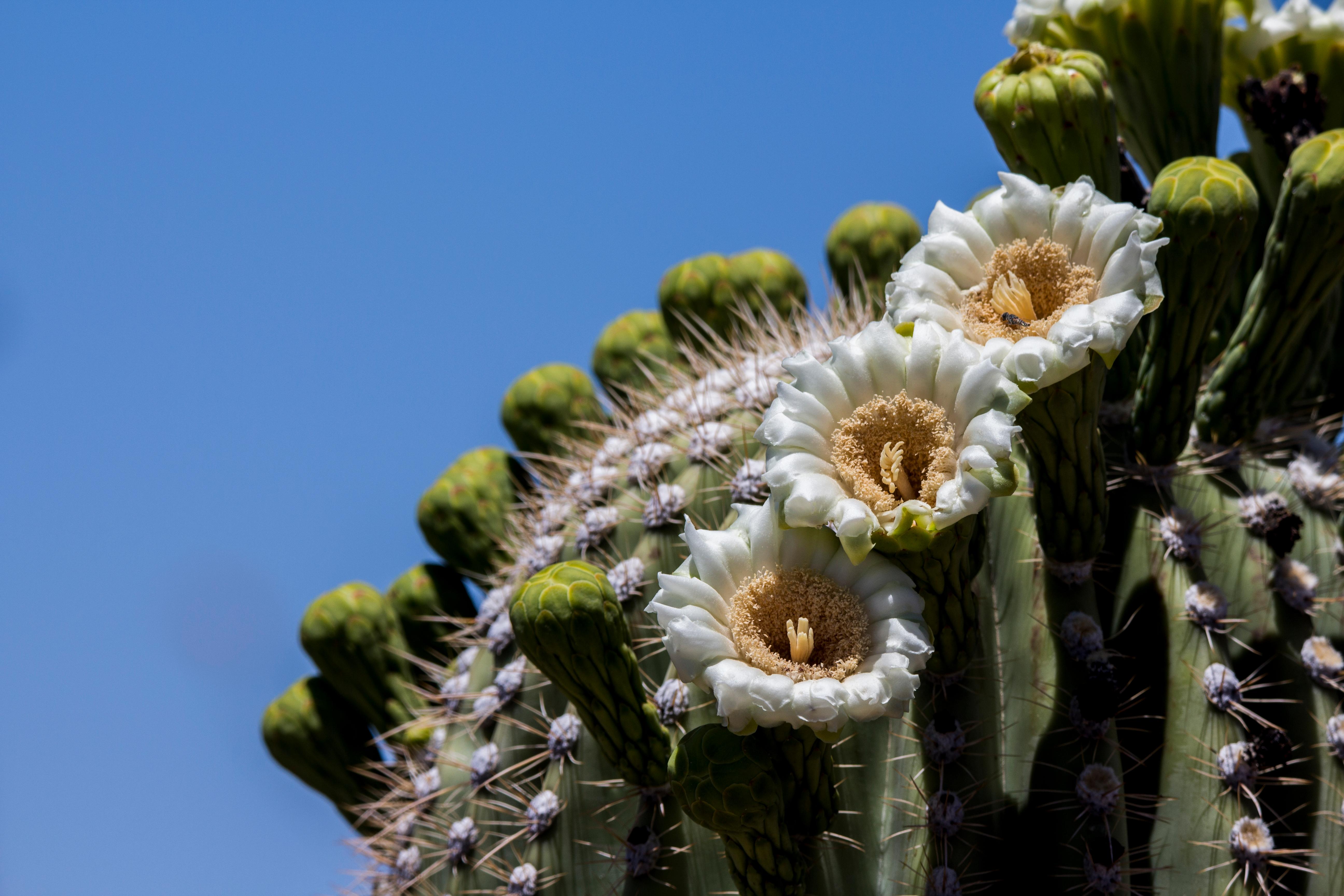
NPS via NPS.gov (Public Domain)
Saguaro National Park: The Sonoran Desert's Iconic Giant Cactus — 2026 Guide
10 min read
Park Guide
Saguaro National Park splits into two distinct districts. 2026 tips for visiting—Rincon Mountain vs. Tucson Mountain trails, and which side to choose first.
Your plans
This article contains affiliate links — we may earn a small commission at no extra cost to you.
At a glance
Entrance Fee
Private vehicle $25 · Per person $15 · Motorcycle $20Full fee schedule
Hours
The park is always open, except under emergency conditions. You can walk or bike into the park 24 ho
Best Time
June-September (summer), September-October (fall colors)
Address
3693 S Old Spanish Trail, Tucson, AZ, 85730
Website
32.2091, -110.7575
Google MapsSaguaro National Park protects the nation's largest cacti, but that's not the whole story. The park is split into two districts straddling Tucson, Arizona, each with its own character, trails, and views. Most first-time visitors don't realize the park has two entirely separate halves. That's the first thing to get straight.
Saguaros can live 200 years, grow arms only after 70, and reach heights of 40 to 60 feet. They're found only in a small portion of the United States, and Saguaro National Park is where you see them at their most dramatic. The park's two districts—the Tucson Mountain District (west) and the Rincon Mountain District (east)—offer very different experiences. The west is tighter, more accessible, and more popular. The east is bigger, higher in elevation, and quieter. Both are worth your time, but they require separate planning.
The Lay of the Land
Saguaro National Park is essentially two parks separated by 30 miles and the city of Tucson. You cannot drive between them without leaving the park and crossing through town. Plan accordingly.
Tucson Mountain District (West)
The west side is the one most visitors picture when they think of saguaro forests. The Bajada Loop Scenic Drive (Golden Gate Road and Hohokam Road) is a 6-mile unpaved road open to vehicles during daylight hours. It's the quickest way to see dense concentrations of saguaros without leaving your car. The road can accommodate vehicles up to 40 feet in total length, and RV parking is available at the visitor center. The road surface is graded dirt - fine for passenger cars in dry weather, but it gets rough after rain.
The west side visitor center is at 2700 N Kinney Rd. Most hiking trails here are short and start from the loop road or the visitor center. The landscape is open, with saguaros covering the hillsides like a forest of standing figures. The mountains here - the Tucson Mountains - are lower and more eroded than the Rincons to the east.
Rincon Mountain District (East)
The east side is larger, higher, and less crowded. The Cactus Forest Loop Drive is an 8-mile paved road open from 5:00 AM to 8:30 PM. It's a smooth drive with excellent viewpoints and trailheads spaced along the route. The terrain here climbs from desert floor up into pine forests at the highest elevations - the Rincon Mountains rise to over 8,000 feet.
The east side visitor center address is 3693 S Old Spanish Trail, Tucson, AZ 85730. This district has longer, more challenging trails, including routes that climb into the backcountry. If you want serious hiking in Saguaro National Park, this is where you go.
Planning Your Visit
As of 2026, entrance fees are straightforward. A private vehicle pass costs $25 and is valid for 7 days. Individual entry for hikers or bicyclists is $15 per person. Motorcycles pay $20. The America the Beautiful Annual Pass covers entry and is a good value if you plan to visit multiple federal sites in a year.
The park itself is open 24 hours a day for walk-in and bike-in access. Vehicle access follows the road hours above. Visitor centers operate 9:00 AM to 5:00 PM from October 1 to May 31, then shift to 8:00 AM to 4:00 PM from June 1 to September 30.
When to Go
The best time to visit is October through April. Daytime temperatures range from the low 50s to high 70s, making hiking comfortable. This is also when the park is busiest, but "busy" here means something different than at Yellowstone or the Grand Canyon. Even on peak weekends, the trails rarely feel crowded outside the immediate trailhead areas.
Summer is punishing. From June through September, temperatures range from mid-90s to low 110s. The park offers interpretive programs only intermittently during late spring and summer. If you visit in summer, hike at dawn or dusk. Carry at least a gallon of water per person for any hike over two miles. The heat is not a joke - it kills people every year.
Cell service drops out at various points on both loop drives. Download maps and directions before you arrive. The park specifically warns against using mobile mapping apps to search for either district. Use the physical addresses provided above instead.

Getting There & Getting Around
Tucson International Airport (TUS) is the closest major airport, about 20 minutes from either district. Phoenix's Sky Harbor is a 90-minute drive northwest.
To reach the west district, enter 2700 N Kinney Rd into your GPS. For the east district, use 3693 S Old Spanish Trail. Do not just type "Saguaro National Park" into a mapping app - it often sends people to the wrong district or to administrative offices.
Parking at trailheads on the west side fills early, especially on weekends from November through March. The lot at the Signal Hill trailhead is the first to go. East side trailheads have more capacity but the lots at the Douglas Spring and Tanque Verde Ridge trailheads still fill by 9 AM on Saturday mornings.
Rideshare services will drop you at the west side visitor center but usually won't pick you back up. No major trails start at the visitor center, so you risk being stranded. Coordinate two-way trips if you use rideshares.
What to Do
Hiking
Hiking is the main event here. The park has trails ranging from flat 0.5-mile interpretive walks to multi-day backcountry routes. On the west side, the Valley View Overlook Trail (0.8 miles) and the Signal Hill Trail (0.3 miles) offer quick rewards with petroglyphs and wide views. The Hugh Norris Trail (5 miles one way) climbs to the summit of Wasson Peak, the highest point in the Tucson Mountains.
On the east side, the Douglas Spring Trail (6.6 miles one way) is a classic, climbing through saguaro forests into pine woodlands. The Tanque Verde Ridge Trail (6.8 miles one way) offers ridge-line views across the entire district. For a shorter option, the Freeman Homestead Trail (1 mile) loops past a historic homestead site and through dense saguaro growth.
Pack extra water for any hike over 2 miles. The dry air and direct sun pull moisture out of you faster than you expect. See our full guide to hiking trails for detailed route descriptions and difficulty ratings.
Scenic Drives
If hiking isn't your thing, both loop drives are worth the trip. The Bajada Loop (west, unpaved, 6 miles) takes about 45 minutes without stops. The Cactus Forest Loop (east, paved, 8 miles) takes about an hour. Both have pullouts and short trails. The Cactus Forest Loop has better signage and more interpretive stops.
Stargazing
Saguaro National Park has excellent night sky conditions despite being next to a city of 500,000. The park's west side, facing away from Tucson's light dome, offers particularly dark skies. Rangers will tell you that the best stargazing is from the Bajada Loop Road after the vehicle gate closes. You can walk or bike in after dark. Bring a red flashlight and a chair.
Biking
Bicycles are allowed on paved roads and some dirt roads. The Cactus Forest Loop Drive is a popular bike route - 8 miles of pavement with minimal vehicle traffic in the early morning. The Bajada Loop Road is rideable on a mountain bike but rough on a road bike.
Junior Ranger Program
The park's Junior Ranger program is active and well-run. Kids can pick up activity books at either visitor center. The program takes about 90 minutes to complete and covers desert ecology, safety, and conservation.
For more on specialized activities, check our guides on wildlife viewing and tours and guided experiences.

Where to Stay
There is no lodging inside Saguaro National Park. There are no lodges, cabins, or hotels within either district. Camping is the only in-park overnight option.
The park has limited backcountry camping in the Rincon Mountain District. Permits are required and can be obtained at the east side visitor center. Sites are primitive - no water, no toilets. The hike to most sites is 4 to 8 miles one way with significant elevation gain.
For front-country camping, the closest options are in the Coronado National Forest adjacent to the park. Gilbert Ray Campground (west side) has 30 sites with water and flush toilets, no reservations required. On the east side, the Douglas Spring area has dispersed camping options in the forest.
Most visitors stay in Tucson. The city has every hotel chain you can name, plus a handful of historic motels and B&Bs. The west side is closer to downtown and the university area. The east side is closer to the suburbs of Tanque Verde and Vail. See our lodging and accommodations guide for specific recommendations, and our camping options page for detailed campground info.
Seasonal Guide
November through February: Cool and clear. Daytime highs in the 50s to 70s. Nights drop into the 30s. This is the most comfortable season for hiking. Trail conditions are excellent, but the saguaros look their starkest - less green, more gray-brown. Crowds are moderate.
March and April: Peak wildflower season. Temperatures climb into the 70s and 80s. The desert floor blooms with lupine, poppies, and brittlebush. This is the busiest time of year. Arrive at trailheads by 7 AM if you want parking.
May: Transition month. Days get hot (90s), nights stay pleasant. The park quiets down as summer visitors haven't arrived yet and spring crowds have thinned. Good month for early-morning hiking.
June through September: Extreme heat. Daytime temperatures regularly exceed 100°F. The park is open but most trails are dangerous from 10 AM to 4 PM. Hike before sunrise or after sunset. This is also monsoon season (July-September), bringing dramatic afternoon thunderstorms. Flash flooding is a real risk in washes and narrow canyons.
October: The best month. Temperatures drop back to the 70s and 80s. The monsoon rains have greened up the desert. The light is golden and long. Crowds are moderate. Everything is open. If you can only visit once, come in October.
For more detail on weather patterns and seasonal conditions, see our best time to visit guide.

Practical Takeaways
Here's what most visitors get wrong, and what you should do instead.
- Visit both districts if you have two days. They are different enough to justify separate trips. One day per district is enough for most visitors. Trying to do both in one day means rushed driving and shortchanged experiences.
- The west side loop road is dirt, not pavement. It's fine for sedans in dry weather, but a rental car with low-profile tires will feel every bump. Rain turns it into a greasy mess. Check conditions at the visitor center before driving it.
- Vehicle break-ins happen here. This is an urban park. Trailheads are targeted. Leave nothing visible in your car. Not a jacket, not a phone charger, not a water bottle. The park's official advice: "Don't make yourself a target."
- The Bajada Loop is one-way in sections. Pay attention to signs. If you miss a turn, you may have to drive the full loop before you can circle back.
- Cell service is unreliable. Download offline maps before you arrive. The NPS app has good trail maps for both districts. The parking situation here is also unpredictable - check the app for real-time lot conditions if you have signal.
- Rangers will tell you that the best wildlife viewing is at dawn. Javelina, coyotes, roadrunners, and Gila monsters are most active in the first hour of daylight. You will see more animals in one early morning than in a full day of midday hiking.
- The Cactus Forest Loop has a one-way section too. From the visitor center, the loop runs clockwise. You cannot turn left into the loop from the main road. Follow the signs.
- The elevation gain on east side trails is real. The Douglas Spring Trail gains 1,200 feet. The Tanque Verde Ridge Trail gains 2,000 feet. If you're coming from sea level, spend your first day on west side trails before attempting the east side climbs.
- Saguaro National Park does not sell water at trailheads. Fill up at the visitor center or bring your own. There are no water refill stations on either loop drive.
- The park is open 24 hours for walk-in and bike-in access. The night sky is extraordinary, especially on the west side. If you can arrange a moonlit walk or a pre-dawn bike ride, you'll have the place to yourself.
Final Thoughts
Saguaro National Park is not a destination for people who want dramatic mountain peaks or roaring waterfalls. It is a park for people who can appreciate slow, patient beauty. The saguaro took 70 years to grow its first arm. The desert floor looks barren until you kneel down and see the lichen, the tiny flowers, the tracks of a desert tortoise. This park asks you to slow down, pay attention, and respect the heat.
It rewards that attention generously. The light at sunset turns the saguaros a deep orange-gold. The silence on a backcountry trail is complete except for the wind and the crunch of gravel underfoot. The stars at night are so clear you can see the Milky Way's dust lanes.
If you come expecting a theme park, you'll be disappointed. If you come expecting a real desert - one that is alive, demanding, and ancient - you'll understand why this place is worth protecting.
For more information, see our complete National Park Guide.
Related: hiking in saguaro national park guide
Related: saguaro east trails guide
Recommended Gear
What experienced visitors bring to Saguaro National Park: The Sonoran Desert's Iconic Giant Cactus — 2026 Guide
Links may earn us a commission at no extra cost to you. We only recommend gear we believe in.
Hiking Essentials
Hydration Pack (3L)
Hands-free water for long trail days
Trekking Poles (Pair)
Save your knees on steep descents
Hiking Boots (Ankle Support)
Sturdy footwear for rocky, uneven trails
Sun & Heat Protection
Wide-Brim Sun Hat
Full coverage UPF 50+ protection at altitude
Insulated Water Bottle (32oz)
Keeps water cold in desert heat all day
Winter Gear
Microspikes / Traction Devices
Essential for icy rim trails in winter months
Sources
- Official source: NPS — Saguaro National Park nps.gov/sagu/index.htm
Explore More National Parks

Petrified Forest National Park: 225 Million Years of Ancient Forest — 2026 Guide
Skip I-40's 70 mph blur for 225-million-year-old fossils. How to enter Petrified Forest National Par...

Grand Canyon National Park: One of Earth's Greatest Wonders - 2026 Visitor Guide
Grand Canyon National Park: One of Earth's Greatest Wonders - 2026 Visitor Guide Overview Grand Cany...

White Sands National Park: The World's Largest Gypsum Dune Field - 2026 Guide
Discover the world's largest gypsum dune field — pure white and vast. Complete 2026 guide to White S...

Joshua Tree National Park: Desert Boulders & Starry Skies — 2026 Guide
Discover desert boulders, Joshua trees, and star-filled skies. Complete 2026 guide to Joshua Tree Na...
Photo Gallery
More to Explore

Park Guide
Acadia National Park: Carriage Roads, Cadillac Mountain & 2026 Guide
Discover carriage roads, Cadillac Mountain, and rugged Maine coast. Complete 2026 guide to Acadia National Park — trails, fees, lodging, permits, and what rangers recommend.

Hiking Guide
Grand Canyon Hiking Trails: Day Hikes, Water Sources & Rim to Rim
Compare Grand Canyon hiking trails: Bright Angel, South Kaibab, Hermit, Grandview, and rim to rim, with distances, elevation, water stops, and trailhead access for each.

Best Of
Best of Glacier Bay National Park
The best of Glacier Bay is reached by boat: ranger-led day tours up the bay to the tidewater glaciers. What's worth it, how to book, and when to go (2026).

Campsite Guide
White Sands Backcountry Camping: Closed for 2026 — What to Know
As of 2026, backcountry camping at White Sands National Park is closed for site rehabilitation. What that means, and where to camp nearby instead.

Weather Guide
Guadalupe Mountains National Park Weather: Weather
Guadalupe Mountains National Park: weather guide guide updated 2026. Practical visitor information, reservations, and seasonal tips worth bookmarking before

Best Of
Best of Cuyahoga Valley National Park: Best Things to Do
Seeing a Cleveland Orchestra concert with the woods as your backdrop is a uniquely Cuyahoga Valley experience.
Sign in to join the conversation.
Sources & Attribution
Location data courtesy of the National Park Service (U.S. Department of the Interior). NPS data is public domain. Official NPS page.
Images: NPS; NPS; NPS; NPS; NPS.
Map data © OpenStreetMap contributors.
Park operations alerts: NPS.gov · Weather and weather hazards: National Weather Service · Live conditions.
Information may change. Always verify fees, hours, and conditions directly with the official source before visiting.
Did this guide help? Share it with a friend.