First-time visitors to Saguaro National Park often choose the wrong district. The park splits into two distinct areas—Rincon Mountain District (east) and Tucson Mountain District (west)—separated by 30 miles and the city of Tucson. They are not the same experience, and a poor choice can mean spending your day in traffic rather than among the cacti you came to see.
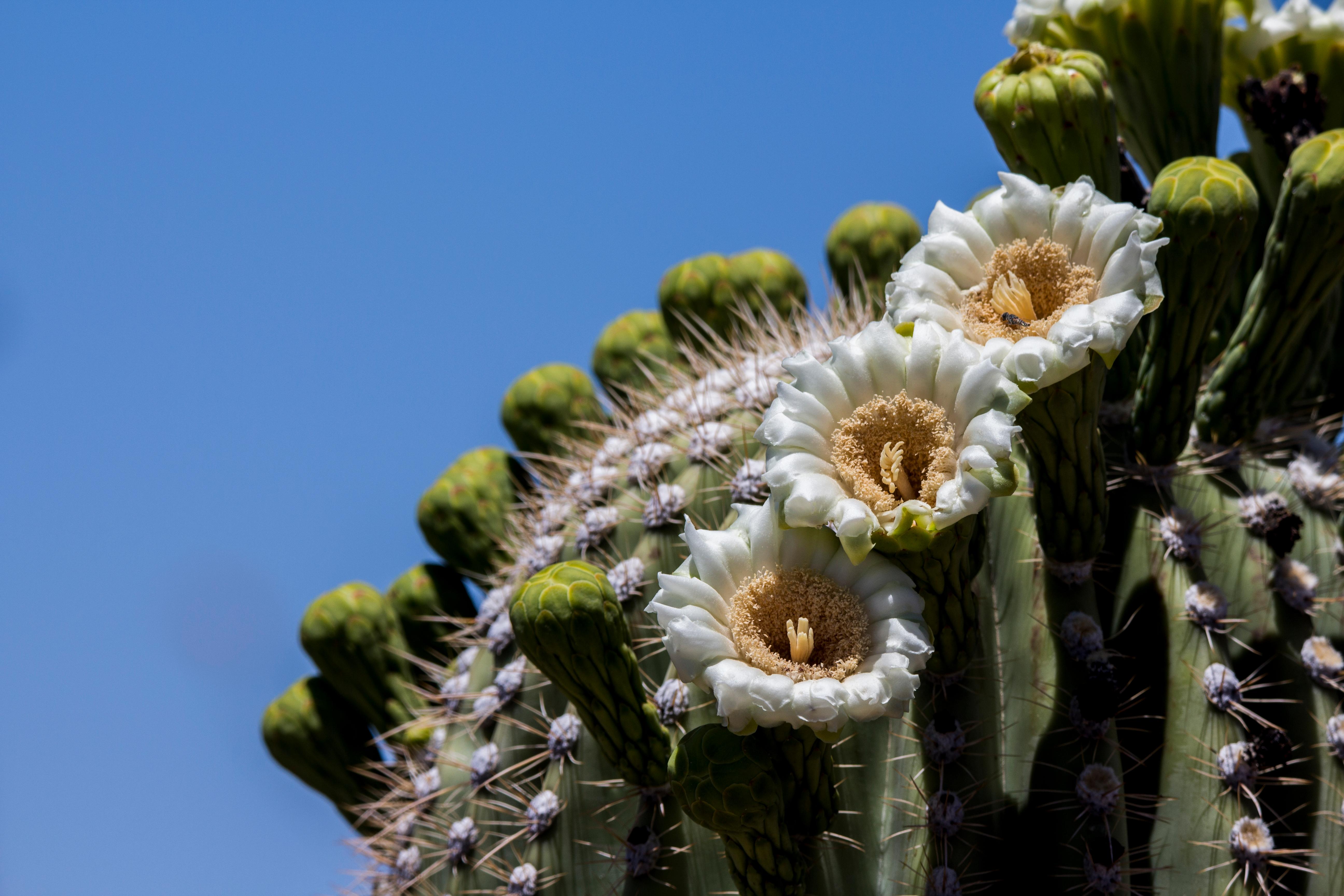
NPS via NPS.gov (Public Domain)
Best of Saguaro National Park: Which Part of Is Best (2026)
10 min read
Best Of
Choose wrong and waste time in Tucson traffic. East side wins for hiking solitude; west for saguaro density. 2026 guide to pick your perfect district.
This article contains affiliate links — we may earn a small commission at no extra cost to you.
This park splits into two distinct districts - Rincon Mountain District (east) and Tucson Mountain District (west) - separated by 30 miles and the city of Tucson. They're not the same experience, and choosing poorly can mean spending your day in traffic rather than among the cacti you came to see.
Here's the short answer on which part of saguaro national park is best: the east side (Rincon Mountain District) wins for hiking variety and solitude. The west side (Tucson Mountain District) wins for convenience and density of saguaros. Your ideal choice depends on how much time you have and what you're after.
The rankings below are based on return on effort, so you can decide quickly and get on the trail.
If You Only Have One Day
Arrive at the Rincon Mountain District entrance by 7:30 AM - parking at the most popular trailheads fills by 8:30 in peak season (October through April). Pay the $25 vehicle fee at the entrance station, grab a map, and drive the Cactus Forest Loop Drive (8 miles, paved, one-way) to orient yourself. The road opens at 5 AM and closes at 8:30 PM.
Your first stop: the Freeman Homestead Trail (1 mile loop, mostly flat). It takes 30 minutes, gives you close-up saguaro views without the crowd noise, and passes an actual 1930s homestead that puts the human history of this landscape in context. Most visitors skip this for the bigger names and miss the quietest stretch of morning in the park.
By 9 AM, hit the Douglas Spring Trail - specifically the first 1.5 miles out to the junction. This is the best payoff-to-effort ratio in the east district. The trail climbs gradually through dense saguaro forest, and by mile 1 you're looking across the entire Rincon Valley. Turn around here unless you're prepared for a 6+ mile commitment.
Lunch at the visitor center picnic tables (bring your own - the park has no restaurants). Then spend the afternoon on the Mica View Trail (1.2 miles round trip, accessible) or the Desert Ecology Trail (0.25 miles, interpretive signs). Both are short, shaded in spots, and give you a completely different perspective on the same landscape.
Leave by 3 PM. The light gets harsh, the afternoon heat peaks, and you'll want to be back in Tucson proper for the evening.
If you have a second day, do the west side. If you don't, you've seen the best version of this park with the single-day itinerary above.

The Top Experiences, Ranked
#1 - Cactus Forest Loop Drive: The Essential Orientation
- Why it makes this list: This 8-mile paved loop is the single best way to grasp the scale and density of the saguaro forest without getting out of your car. It's the park's greatest hit for a reason.
- What it requires: 45 minutes to 2 hours depending on how many pullouts you stop at. Zero fitness required. Works for any vehicle up to standard RV length.
- The single best tip: Drive it counterclockwise. The morning light hits the east-facing saguaro arms, and most visitors go clockwise, so you'll have the pullouts to yourself.
- What most visitors do wrong: They stop at the first three viewpoints and rush the rest. The best saguaro density is actually in the southern half of the loop, about mile 5-7. Pull over at every numbered stop - the Javelina Rocks pullout at mile 4.2 consistently has the most wildlife activity in early morning.
- Link: See the complete visitor guide for exact mile markers and turn-by-turn notes.
#2 - Douglas Spring Trail (First 3 Miles): Best Hiking in Saguaro National Park
- Why it makes this list: This is the trail that makes hikers understand why best hikes in saguaro national park conversations always start here. The first 3 miles gain about 800 feet of elevation through the densest saguaro corridor on the east side.
- What it requires: 2-3 hours for the out-and-back to the saddle. Moderate fitness - the grade is steady but never punishing. Bring a liter of water per hour in winter, two per hour in summer.
- The single best tip: Start at the Douglas Spring Trailhead, not the visitor center. The trailhead lot holds about 30 cars and fills by 8 AM on weekends. If it's full, use the Broadway Trailhead a quarter mile east - same trail network, less competition.
- What most visitors do wrong: They try to hike the full 6 miles to Douglas Spring. The payoff doesn't increase proportionally after mile 3. The best views are in the first half.
#3 - Signal Hill Petroglyphs: Best Short Stop on the West Side
- Why it makes this list: You can see 200+ Hohokam petroglyphs on a 0.3-mile walk. That's more cultural content per step than anything else in the park.
- What it requires: 20 minutes. Easy walking on a maintained gravel path. Located off the Bajada Loop Drive on the west side.
- The single best tip: Visit in late afternoon (3-5 PM). The low-angle sun hits the rock faces and makes the petroglyphs pop. Midday light washes them out completely.
- What most visitors do wrong: They rush through without reading the interpretive signs at the base of the hill. The signs explain what you're actually looking at - without context, the carvings just look like random scratches.
#4 - Bajada Loop Drive: The West Side's Answer to Cactus Forest
- Why it makes this list: This 5.5-mile unpaved loop through the Tucson Mountain District puts you in the middle of the densest saguaro concentrations in the park. The saguaros here are visibly older and more densely clustered than on the east side.
- What it requires: 1-2 hours. High-clearance vehicles recommended but not required in dry conditions. The road is rough gravel - plan for 15-20 mph max. Vehicle length limit of 40 feet.
- The single best tip: Skip the first pullout (everyone stops there). Drive to the Hohokam Road junction at mile 2.5, park, and walk the 0.5-mile Desert Discovery Trail. You'll see more saguaros in that half-mile than on the entire drive.
- What most visitors do wrong: They attempt this drive in a low-clearance sedan after rain. The road turns to greasy caliche clay when wet and will trap a Honda Civic. Check conditions at the visitor center before heading out.
#5 - Tanque Verde Ridge Trail: The Hard-Earned View
- Why it makes this list: This is the trail for people who want to earn their saguaro views. The first 2 miles climb 1,100 feet, and the ridge opens up views of the entire Rincon Valley with saguaros framing the foreground.
- What it requires: 3-4 hours for the first 3 miles out and back. Strenuous. June through September, start before 6 AM or don't start at all.
- The single best tip: The best photo spot is at mile 1.8, where the trail crests a small saddle and the entire valley drops away. The trail register at this point is full of comments about the view.
- What most visitors do underestimate: The elevation gain. This trail gains 300 feet per mile, which is significant for flatlanders. Your calves will have opinions about every switchback on the way back.
#6 - Freeman Homestead Trail: Best Short Hike for Families
- Why it makes this list: One mile, minimal elevation change, and it passes a genuine 1930s homestead with interpretive panels about desert living. Kids can read the signs, spot lizards, and not get exhausted.
- What it requires: 30-45 minutes. No special gear needed. Trailhead is off the Cactus Forest Loop Drive on the east side.
- The single best tip: Go in the first hour after sunrise. The trail faces east, and the morning light through the saguaro ribs creates a striped shadow pattern that photographers chase.
- What most visitors do wrong: They skip the short spur trail to the homestead foundation. The main loop is a figure-eight - take the left fork at the first junction to reach the actual homestead site.
#7 - Night Sky Viewing: The Overlooked Experience
- Why it makes this list: Saguaro National Park is an International Dark Sky Park, and the saguaro silhouettes against the Milky Way are unlike anything you'll see elsewhere. This is the park's best kept secret.
- What it requires: A clear night with no moon. Park hours technically allow 24-hour pedestrian access, but rangers recommend the Rincon Mountain District for safety - better lighting at the visitor center lot.
- The single best tip: The week of the new moon between April and June offers the clearest skies. The park occasionally hosts ranger-led astronomy programs during this window.
- What most visitors don't know: You can walk the Cactus Forest Loop Drive after dark. The road is closed to vehicles but open to pedestrians and bikes. The saguaros look completely different under starlight - more skeletal, more ancient.

What Most People Miss
The Desert Ecology Trail (East Side). A 0.25-mile paved loop with interpretive signs about the saguaro life cycle. Sounds boring. It's not. The signs explain that a saguaro doesn't grow its first arm until it's 50-70 years old, and a 50-foot saguaro has been standing since before the Civil War. Most visitors speed past this trail on the loop drive. Stop. It takes 10 minutes and changes how you see every cactus in the park.
The Loma Verde Trail (East Side). A 3.5-mile loop that most people skip because it's not listed on the main trail map. It's the quietest trail in the park - you'll see maybe 3-4 other hikers on a Saturday in season. The trail passes through a wash with ironwood and palo verde trees, offering a completely different desert ecosystem than the open saguaro slopes. Bring the saguaro east trail map from the visitor center - this trail isn't on the handout map.
The Rincon Mountain Visitor Center Exhibit Room. Not glamorous, but the room contains a 3D topographical map of the park that clarifies the relationship between the east and west districts better than any website. Rangers will tell you that most visitors spend 90 seconds in this room. Spend 10 minutes. You'll understand the landscape better.
The Arizona-Sonora Desert Museum (Private, Adjacent to West Side). Not technically part of the park, but it sits on the boundary and offers the best interpretive experience in the region. The museum has a walk-through aviary, a mountain lion exhibit, and a reptile house that covers Sonoran Desert species. Worth the separate admission ($26 as of 2026) if you're on the west side.

What's Overrated (and Better Alternatives)
The Cactus Forest Loop Drive at midday. Every park website sells this as a must-do. It is - but only in the first two hours after sunrise or the last two before sunset. Midday (10 AM-3 PM) turns the loop into a slow-moving car parade with harsh overhead light that flattens every photo. Better alternative: Use those hours for the shorter walking trails (Mica View, Desert Ecology) where you're out of the car and in the shade of the saguaros.
The West District on weekends. The Tucson Mountain District (west side) sees heavy traffic from October through April, especially on Saturdays. The Bajada Loop Drive can turn into a 90-minute crawl. Better alternative: Visit the west side on a weekday, or accept that you'll spend more time in your car than on the trail. If you only have a weekend, commit to the east side - it handles crowds better.
The full Douglas Spring Trail (12 miles round trip). The complete hike to Douglas Spring and beyond is a full-day commitment that most visitors aren't prepared for. The trail's best sections are the first 3 miles. After that, it becomes a long desert walk without the dramatic saguaro density. Better alternative: Hike the first 3 miles, turn around, and use the remaining time for the Freeman Homestead or Mica View trails.

Practical Takeaways
- Choose your district based on your priority. East side (Rincon Mountain District) for hiking variety and solitude. West side (Tucson Mountain District) for convenience and the densest saguaro concentrations. If you're asking which part of saguaro national park is best for a first visit with one day, choose the east side.
- Start before 8 AM. The park's best hours are 6:30-10 AM. After 10, the light gets harsh, the temperature climbs, and the trails fill with people who started too late.
- The $25 vehicle fee covers both districts for 7 days. Visit one side, then the other on a different day. Don't pay twice.
- Pack water like you mean it. The park recommends 1 gallon per person per day in warm months. The air is dry, and you won't feel yourself dehydrating until you're already behind.
- Cell service drops out at the trailheads in both districts. Download offline maps before you arrive. The NPS app has downloadable trail maps that work without service.
- Vehicle break-ins happen. The park is urban Tucson. Leave nothing visible in your car. Not a jacket. Not a water bottle. Not a phone charger.
- If you only have time for one trail, make it the first 3 miles of the Douglas Spring Trail on the east side. That stretch captures everything this park does best - saguaro density, elevation views, and genuine solitude - in under 3 hours. See the hiking trails page for full trail details and current conditions.
For places to stay near saguaro national park, Tucson has options at every price point concentrated along the Broadway/Speedway corridor (east side access) and the Ajo Way corridor (west side access). The camping options page covers the park's backcountry sites and nearby campgrounds if you want to sleep under the saguaros.
The best time to visit is October through April, when daytime temperatures run 60-80°F. Summer hiking is possible but requires a 5 AM start and serious heat management. The saguaros don't care when you show up - they've been standing for 150 years. But your comfort depends entirely on making the right call about timing and which side of the park you choose.
Recommended Gear
What experienced visitors bring to Best of Saguaro National Park: Which Part of Is Best (2026)
Links may earn us a commission at no extra cost to you. We only recommend gear we believe in.
Hiking Essentials
Hydration Pack (3L)
Hands-free water for long trail days
Trekking Poles (Pair)
Save your knees on steep descents
Hiking Boots (Ankle Support)
Sturdy footwear for rocky, uneven trails
Sun & Heat Protection
Wide-Brim Sun Hat
Full coverage UPF 50+ protection at altitude
Insulated Water Bottle (32oz)
Keeps water cold in desert heat all day
Electrolyte Mix Packets
Replace what water alone cannot during intense heat
Winter Gear
Microspikes / Traction Devices
Essential for icy rim trails in winter months
Packable Down Jacket
Lightweight warmth that stuffs into a pocket
Sources
- Official source: NPS — Saguaro National Park nps.gov/sagu/index.htm
Photo Gallery
More to Explore

Park Guide
Acadia National Park: Carriage Roads, Cadillac Mountain & 2026 Guide
Discover carriage roads, Cadillac Mountain, and rugged Maine coast. Complete 2026 guide to Acadia National Park — trails, fees, lodging, permits, and what rangers recommend.

Hiking Guide
Grand Canyon Hiking Trails: Day Hikes, Water Sources & Rim to Rim
Compare Grand Canyon hiking trails: Bright Angel, South Kaibab, Hermit, Grandview, and rim to rim, with distances, elevation, water stops, and trailhead access for each.

Best Of
Best of Glacier Bay National Park
The best of Glacier Bay is reached by boat: ranger-led day tours up the bay to the tidewater glaciers. What's worth it, how to book, and when to go (2026).

Campsite Guide
White Sands Backcountry Camping: Closed for 2026 — What to Know
As of 2026, backcountry camping at White Sands National Park is closed for site rehabilitation. What that means, and where to camp nearby instead.

Weather Guide
Guadalupe Mountains National Park Weather: Weather
Guadalupe Mountains National Park: weather guide guide updated 2026. Practical visitor information, reservations, and seasonal tips worth bookmarking before

Best Of
Best of Cuyahoga Valley National Park: Best Things to Do
Seeing a Cleveland Orchestra concert with the woods as your backdrop is a uniquely Cuyahoga Valley experience.
Sign in to join the conversation.
Sources & Attribution
Location data courtesy of the National Park Service (U.S. Department of the Interior). NPS data is public domain. Official NPS page.
Images: NPS; NPS; NPS; NPS; NPS.
Map data © OpenStreetMap contributors.
Park operations alerts: NPS.gov · Weather and weather hazards: National Weather Service · Live conditions.
Information may change. Always verify fees, hours, and conditions directly with the official source before visiting.
Did this guide help? Share it with a friend.