Saguaro National Park Hiking: Best Hikes In (2026 Guide)
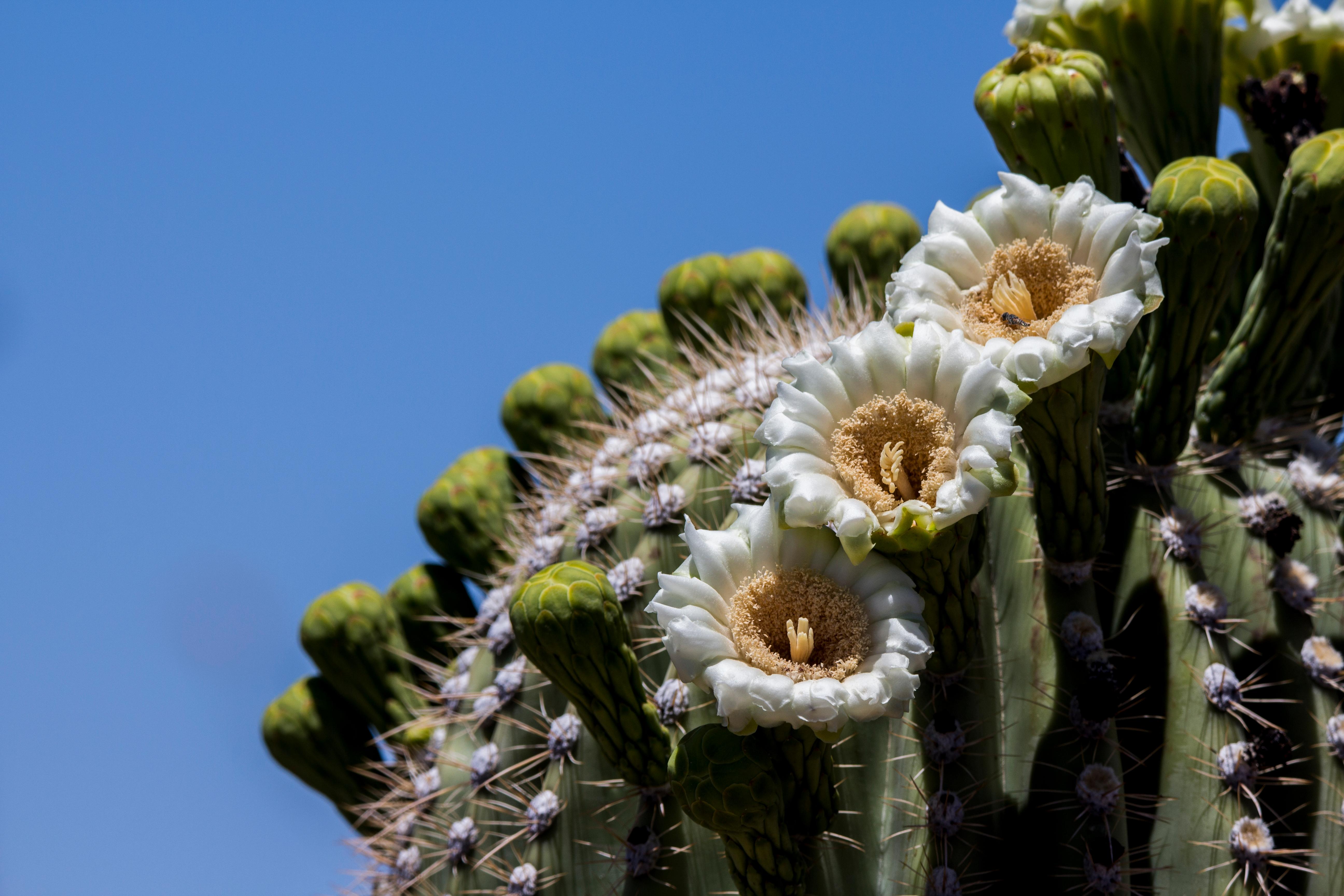
NPS via NPS.gov (Public Domain)
Best Hikes in Saguaro National Park
10 min read
Hiking Guide
Complete 2026 hiking guide for Saguaro National Park. Trails, difficulty ratings, seasonal conditions, and practical tips for every skill level.
This article contains affiliate links — we may earn a small commission at no extra cost to you.
What Hiking Here Actually Means
Hiking here means negotiating with the sun. Trails aren't long by mountain standards, and elevation gains are often modest. The real challenge is the environment—a dry, exposed landscape where a three-mile loop in July feels nothing like the same loop in January. Your pace is dictated by heat, not incline. Most first-timers underestimate two things: how quickly the sun drains your water reserves, and how the desert floor, a mosaic of loose rock and spiny plants, demands constant attention to footing. This isn't a place for mindless wandering. It's for deliberate movement, where the reward is the quiet company of giants.
The park divides into two districts separated by Tucson. The Rincon Mountain District (East) features longer trails climbing into sky islands, with pine trees and expansive views. The Tucson Mountain District (West) is lower, rockier, and densely packed with the classic, sprawling saguaro forests seen in photographs. Your choice isn't just about distance; it's about which version of the Sonoran Desert you want to experience. We see 90% of heat-related incidents involving people on trails under five miles with just a single 16-ounce water bottle. That's no exaggeration.
Tanque Verde Ridge Trail: The Sky Island Ascent
This is the park's definitive long-haul trek, a relentless climb from saguaro forest to pine woodland. It's less a hike and more a full-day geographic transect.
Distance: 12.2 miles out-and-back to Juniper Basin (common turnaround); the full trail continues 18+ miles.
Elevation Gain: 2,800 feet to Juniper Basin.
Trailhead & Parking:
Start at the Javelina Picnic Area in the East District. The lot is small, maybe 15 cars, and fills by 7:30 AM on weekends from November through April. Overflow spills along the Cactus Forest Loop Drive, adding a half-mile walk. There's a vault toilet at the trailhead. The park's alert about vehicle break-ins applies here - leave absolutely nothing visible in your car.
The Trail:
The first mile is gentle, winding through dense saguaros. Then the ridge proper begins. The trail narrows here, becoming a rocky spine with consistent, unrelenting incline. You'll switchback up slopes of loose schist and granite. There's no shade until you reach the first oak groves around mile 4. The surface is a mix of packed dirt, ankle-twisting scree, and exposed bedrock. Trekking poles are useful for the descent, which is hard on the knees.
The Moment:
Around mile 5.5, you crest a final rise and the vegetation shifts palpably. Saguaros thin out, replaced by juniper, oak, and eventually ponderosa pine. The air cools, and you look back over the entire Cactus Forest, now a green carpet 2,000 feet below.
What Most Underestimate:
The exposure and the wind. This ridge catches every breeze, which is a blessing in summer but can be a biting curse in winter. The return trip down is often more grueling than the climb up due to the constant impact on tired legs.
Best Time:
October through April, starting at first light. By 10 AM, the lower slopes are baking. Summer attempts are for experienced desert hikers only and require pre-dawn starts.

King Canyon Trail to Wasson Peak: The Western Summit
The highest point in the Tucson Mountain District (West), offering 360-degree desert panoramas. It's the most popular summit hike in the park for good reason.
Distance: 6.8 miles round-trip via the King Canyon & Hugh Norris trail loop.
Elevation Gain: 1,800 feet.
Trailhead & Parking:
The King Canyon trailhead is on Kinney Road, just past the Arizona-Sonora Desert Museum. The dirt lot holds about 20 cars and is usually full by 8 AM. Overflow parking lines the road shoulder. This is a known hotspot for vehicle break-ins - take the park's warning seriously.
The Trail:
King Canyon starts as a wide, rocky wash. You'll hike in the streambed for nearly a mile before the trail splits and the real climb begins via a series of well-constructed stone steps and switchbacks. The second half uses the Hugh Norris Trail, which is smoother and offers relentless, view-filled switchbacks to the summit. The trail narrows here with some exposure on the final approach.
The Moment:
Reaching the summit cairn and seeing the twin lobes of the park - the Rincons to the east, the Tucson Mountains to the west, and the city sprawl sandwiched between them. At sunset, the saguaros cast long, precise shadows across the bajadas.
What Most Underestimate:
The rocky wash at the beginning. It's slow going and hard on ankles. Many people blow their energy here before the actual climb. Hiking poles are a big help.
Best Time:
Late afternoon for a sunset summit. Carry a headlamp for the return. Winter mornings are ideal, but crowded.
Cactus Forest Loop Trail: The Saguaro Gallery
This isn't a wilderness trek; it's a curated walk through the heart of the iconic saguaro forest in the East District. Perfect for photography and a genuine desert immersion without major climbing.
Distance: 4.9 miles for the full loop. Can be shortened via connector trails.
Elevation Gain: Minimal, about 300 feet.
Trailhead & Parking:
Multiple access points, but the most direct is at the Broadway Trailhead. Parking is paved and ample, but it's also a popular trailhead for bikes sharing the loop road. The Mica View Picnic Area is another good start, with restrooms.
The Trail:
A wide, flat, sandy path that parallels the Cactus Forest Loop Drive but feels worlds away. The trail meanders through some of the densest, healthiest saguaro stands in the park. It's entirely exposed, with only the occasional palo verde for shade. The surface is easy, but summer heat radiates from the ground.
The Moment:
Golden hour, just before sunset. The low sun backlights the saguaros, creating that classic haloed silhouette against the Rincon Mountains. The light turns the spines to gold.
What Most Underestimate:
How magnetic this trail is for cyclists. You'll share the path, so keep an ear out for bikes coming up behind you. It's also more popular than backcountry trails, so expect company.
Best Time:
Early morning or the two hours before sunset, any time of year. Midday is punishingly hot.

Douglas Spring Trail to Bridal Wreath Falls: The Water Chase
A hike defined by its destination - a slender cascade that only flows after decent rains. It's a lesson in desert hydrology and a favorite for locals.
Distance: 5.8 miles round-trip to the falls.
Elevation Gain: 1,000 feet.
Trailhead & Parking:
East District, at the end of Speedway Boulevard. The paved lot is large but fills early on spring weekends when the falls might be running. A $6 self-pay fee (cash or check) is required at the trailhead as of 2026, separate from the park entrance fee.
The Trail:
A steady, moderate climb up a wide canyon. The trail is well-defined dirt and rock, with several dry creek crossings. You'll pass through zones of cholla, ocotillo, and eventually higher-elevation shrubs. The last half-mile to the falls is the steepest section.
The Moment:
Rounding the corner to see water, if you're lucky. The falls are often just a damp stain on the cliff face. After a good winter rain, however, it becomes a legitimate, 30-foot cascade - a shocking sight in the desert.
What Most Underestimate:
Checking flow conditions. The falls are dry 80% of the time. Call the visitor center or check recent trip reports before you go if the waterfall is your sole goal. The separate trailhead fee also catches people off guard.
Best Time:
December through March, within 1-3 days of a significant rainfall. Summer is brutally hot for this exposed canyon hike.
Sendero Esperanza Trail: The Ridge Runner
A connector trail in the West District that offers some of the best, continuous desert views without the summit crowds. It feels more remote than it is.
Distance: 5.2 miles point-to-point. Often done as part of a loop with the Hugh Norris or King Canyon trails.
Elevation Gain: About 800 feet of rolling gain.
Trailhead & Parking:
Northern end starts at the Sendero Esperanza trailhead on Bajada Loop Drive (dirt road, suitable for most cars). Southern end meets the Hugh Norris trail. Parking is limited to roadside pullouts.
The Trail:
This trail follows a long, undulating ridge. It's narrow, rocky, and completely exposed. The footing requires attention, but the 360-degree views are constant. You'll see the Avra Valley to the west and the Tucson Mountains to the east. It's a favorite for trail runners and solitude-seekers.
The Moment:
The light just after sunrise, when the entire valley to the west is soft and shadowed, and the saguaros on the slopes below are lit from the side.
What Most Underestimate:
The access road. Bajada Loop Drive is a graded dirt road, but it can be washboarded and dusty. RVs over 40 feet are prohibited, per the current park alert.
Best Time:
Fall, winter, or spring mornings. The exposure makes it a furnace by late morning.

Mica View Loop: The Easy Introduction
If you have one hour and want the quintessential saguaro experience, this is it. Ideal for families, seniors, or anyone testing their desert legs.
Distance: 2.1 miles for the full loop.
Elevation Gain: Negligible.
Trailhead & Parking:
The Mica View Picnic Area in the East District. Plenty of parking, flush toilets, and picnic tables. The trailhead is obvious.
The Trail:
A wide, flat, gravelly path. It's essentially a nature walk through superb saguaro stands with interpretive signs. Completely non-technical and accessible to almost anyone. You're never far from the road, but the saguaro density is impressive.
The Moment:
Seeing the variety of saguaro forms - the multi-armed adults, the young "spears" hiding under nurse trees, the ancient, collapsing giants. It's a perfect microcosm.
What Most Underestimate:
How satisfying a short walk can be. You don't need to hike 10 miles to feel the park's character. This loop proves it.
Best Time:
Any time, though early morning or late afternoon light is best for photos. It's a great sunset spot.
Seasonal Trail Conditions
Your hike is dictated by the month on the calendar. General park seasons don't cut it here.
December-February: Prime hiking season. Daytime temps 50s-70s. Nights drop below freezing occasionally. No water in the falls unless recent rain. Trails are busiest. Start early to secure parking.
March-May: Warming rapidly. By May, highs hit the 90s. This is wildflower season - look for poppies, lupine, and owl clover in washes and on south-facing slopes after wet winters. The Douglas Spring Falls have likely run dry.
June-September: The summer season. Rangers aren't kidding about the heat - lows in the 70s, highs 100-110+. Hiking is only safe in the first 90 minutes after sunrise or the last 2 hours before sunset. Carry a minimum of 1 gallon of water per person for any hike over 3 miles. Monsoon thunderstorms (July-August) bring dangerous lightning, flash floods in washes, and temporary dust storms. The trails can become slick with mud.
October-November: A second prime season. Heat breaks, crowds are thinner than winter. Mornings are crisp; afternoons are pleasant. A good window for longer hikes like Tanque Verde Ridge.

Trailhead Logistics
The parking situation defines your day. For the West District's popular trails (King Canyon, Hugh Norris), the dirt lots are full by 8 AM from November through April. If you arrive at 9 AM, plan on adding a half-mile walk from roadside parking. The park's alert about vehicle break-ins is not generic advice - it's a regular occurrence at these isolated trailheads. Leave your car empty, windows up, doors locked.
In the East District, the Broadway and Mica View lots have more space but still fill on perfect-weather weekends. The Douglas Spring trailhead has its own fee envelope.
Cell service drops out at most trailheads and is nonexistent on trails. Download maps beforehand. The only reliable water sources are at the visitor centers and picnic areas - there is no potable water on any trail. Treat all natural water sources.
For current trail conditions, call the specific district visitor center. The East District rangers will have the latest on Tanque Verde Ridge; the West District on Wasson Peak.
What to Carry
Forget the generic list. Here's what matters for Saguaro:
Water: Not bottles. A reservoir. For a 3-5 mile hike in temperatures above 80°F, carry at least 3 liters per person. For longer hikes like Tanque Verde, 4-5 liters is not excessive. Electrolyte tablets are a smart addition.
Footwear: Trail runners or hiking shoes with stiff soles. The terrain is rocky and ankle-twisting. The sharp spines of fallen cholla can pierce thin sneakers.
Sun Protection: A wide-brimmed hat, not a baseball cap. Your neck will thank you. Sunglasses. Mineral-based sunscreen (zinc oxide) - it doesn't melt into your eyes as easily in sweat.
Navigation: A physical map or offline GPS. Trails are well-signed at junctions, but the network can be confusing. The Saguaro East Trail Map or Saguaro West Trail Map is worth picking up at the visitor center.
The Extras: A small pair of tweezers or a comb for removing cactus spines. A headlamp, even for day hikes - if you twist an ankle, your slow exit will likely finish in the dark.
Practical Takeaways
- Your start time is your most important piece of gear. On all but the shortest winter loops, be walking within 30 minutes of sunrise.
- The $25 vehicle entrance fee is valid for both districts for seven days. The $15 per-person fee applies if you bike or ride-share in.
- Rideshare services are notoriously unreliable for pickups, especially in the West District. If you use one, pre-arrange your return trip.
- The best hikes in Saguaro National Park are often the ones that match the season and time of day you have available. A sunset on the Cactus Forest Loop can be more rewarding than a midday death march to a dry waterfall.
- For detailed planning, consult the park's official complete visitor guide for overarching park rules and district specifics.
- If you're considering an overnight, research the park's limited camping options well in advance - backcountry sites are few and require permits.
- Always check the best time to visit for seasonal breakdowns, but understand that "best" for wildflowers is different from "best" for comfortable hiking.
- The gift shops sell water. It's expensive. Fill up at your hotel or a Tucson grocery store.
- After your hike, the signal for "I'm okay" is sitting at a picnic table with your boots off, staring into the middle distance with a cold drink. You've earned it.
Recommended Gear
What experienced visitors bring to Best Hikes in Saguaro National Park
Links may earn us a commission at no extra cost to you. We only recommend gear we believe in.
Hiking Essentials
Hydration Pack (3L)
Hands-free water for long trail days
Trekking Poles (Pair)
Save your knees on steep descents
Hiking Boots (Ankle Support)
Sturdy footwear for rocky, uneven trails
Sun & Heat Protection
Wide-Brim Sun Hat
Full coverage UPF 50+ protection at altitude
Insulated Water Bottle (32oz)
Keeps water cold in desert heat all day
Electrolyte Mix Packets
Replace what water alone cannot during intense heat
Winter Gear
Microspikes / Traction Devices
Essential for icy rim trails in winter months
Packable Down Jacket
Lightweight warmth that stuffs into a pocket
Sources
- Official source: NPS — Saguaro National Park nps.gov/sagu/index.htm
Photo Gallery
More to Explore

Park Guide
Acadia National Park: Carriage Roads, Cadillac Mountain & 2026 Guide
Discover carriage roads, Cadillac Mountain, and rugged Maine coast. Complete 2026 guide to Acadia National Park — trails, fees, lodging, permits, and what rangers recommend.

Hiking Guide
Grand Canyon Hiking Trails: Day Hikes, Water Sources & Rim to Rim
Compare Grand Canyon hiking trails: Bright Angel, South Kaibab, Hermit, Grandview, and rim to rim, with distances, elevation, water stops, and trailhead access for each.

Best Of
Best of Glacier Bay National Park
The best of Glacier Bay is reached by boat: ranger-led day tours up the bay to the tidewater glaciers. What's worth it, how to book, and when to go (2026).

Campsite Guide
White Sands Backcountry Camping: Closed for 2026 — What to Know
As of 2026, backcountry camping at White Sands National Park is closed for site rehabilitation. What that means, and where to camp nearby instead.

Weather Guide
Guadalupe Mountains National Park Weather: Weather
Guadalupe Mountains National Park: weather guide guide updated 2026. Practical visitor information, reservations, and seasonal tips worth bookmarking before

Best Of
Best of Cuyahoga Valley National Park: Best Things to Do
Seeing a Cleveland Orchestra concert with the woods as your backdrop is a uniquely Cuyahoga Valley experience.
Sign in to join the conversation.
Sources & Attribution
Location data courtesy of the National Park Service (U.S. Department of the Interior). NPS data is public domain. Official NPS page.
Images: NPS; NPS; NPS; NPS; NPS.
Map data © OpenStreetMap contributors.
Park operations alerts: NPS.gov · Weather and weather hazards: National Weather Service · Live conditions.
Information may change. Always verify fees, hours, and conditions directly with the official source before visiting.
Did this guide help? Share it with a friend.