First-time visitors often underestimate the scale. Photographs of the Narrows and stories about Angels Landing can't convey the true verticality until you're on the canyon floor, looking up at 2,000-foot Navajo sandstone walls. Zion's essence isn't about viewing a canyon—it's about being enveloped by one. A reliable Zion National Park map is crucial, not only for navigation but for grasping the park's two distinct sections: the heavily visited Zion Canyon, accessible by shuttle, and the expansive, vehicle-friendly Kolob Canyons. As rangers note, a frequent oversight—one many make—is designing an itinerary focused solely on the former.
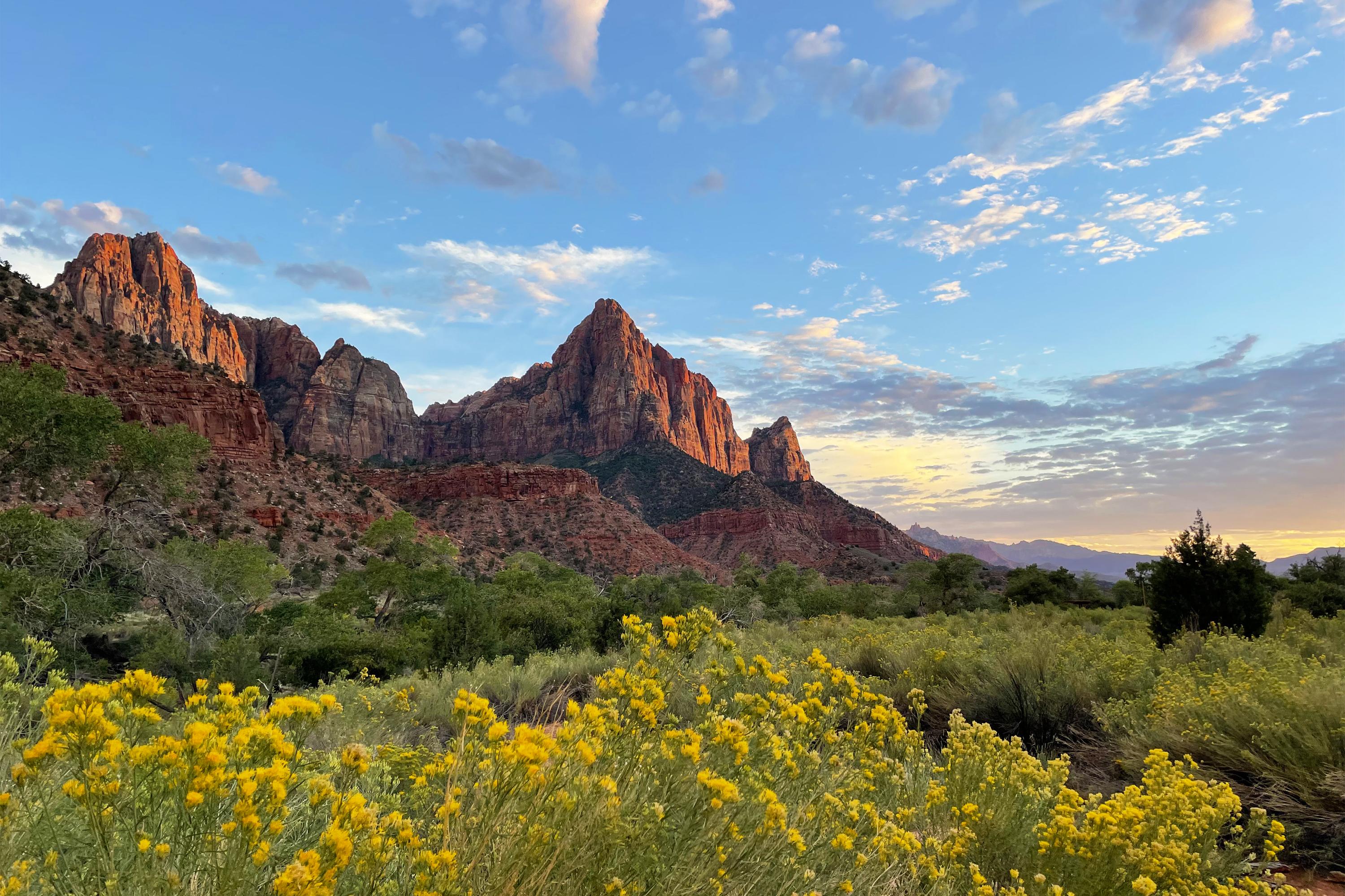
NPS via NPS.gov (Public Domain)
Zion National Park: Canyons, Angels Landing & Complete 2026 Guide
8 min read
Park Guide
Plan your Zion National Park trip with our 2026 guide: mandatory shuttle system, Angels Landing permits, Narrows hiking tips, and Kolob Canyons solitude.
Your plans
This article contains affiliate links — we may earn a small commission at no extra cost to you.
At a glance
Entrance Fee
Private vehicle $35 · Motorcycle $30 · Snowmobile $20Full fee schedule
Hours
Zion National Park is open every day of the year.
Best Time
June-September (summer), September-October (fall colors)
Address
Zion National Park, Springdale, UT, 84767
Website
37.2984, -113.0265
Google MapsFlow reliability
Seasonal consistency of median discharge from the curated USGS gauge for this place.
Spring
12%
year-to-year consistency
Summer
65%
year-to-year consistency
Fall
81%
year-to-year consistency
Winter
83%
year-to-year consistency
Median monthly discharge (cfs)
| Jan | Feb | Mar | Apr | May | Jun | Jul | Aug | Sep | Oct | Nov | Dec |
|---|---|---|---|---|---|---|---|---|---|---|---|
| 56.4 | 54.3 | 68.3 | 102 | 72.2 | 42.5 | 40.2 | 42.3 | 39.9 | 44.2 | 58 | 60.1 |
In the last 10 falls, roughly 2 of every 3 September–November weeks sat inside this band (41.4–69.7 cfs); typical flow in those weeks 48.4 cfs, median water temp 64°F (17.8°C).
Computed from 10 years of USGS daily records, station 09405500 (3,651 daily values). Last computed Oct 19, 2026.
Hydrological description only — not advice about wading, floating, or whether conditions are safe for recreation. Always check current USGS readings and local guidance before you go.
Zion demands careful planning. It's a landscape of stark contrasts: summer temperatures soaring above 100 degrees Fahrenheit alongside frigid river currents, crowded shuttle points versus profound solitude just a mile from the trailhead, and well-maintained paths giving way to chains anchored in sheer rock. Your visit depends entirely on timing, destination choices, and preparation. This park rewards those who don't arrive unprepared.
The Lay of the Land
Zion is functionally two separate parks connected by a highway. How you navigate them defines your trip.
Zion Canyon is the main event and the main congestion. This is where you find the iconic sights: Angels Landing, the Narrows, the Emerald Pools. For most of the year, you cannot drive your private vehicle up the Zion Canyon Scenic Drive. You must use the free, mandatory shuttle system. The canyon is a deep, narrow trench. Everything here involves looking up or hiking up. Distances on a map feel deceptive - a two-mile hike can gain 1,500 feet in elevation, which changes the effort level completely.
The Kolob Canyons section, accessed from I-15 near Cedar City, is the park's quieter sibling. Here, you drive your own car along a five-mile scenic road to trailheads that lead into the finger-like canyons of the Kolob. The scenery is similar - massive red cliffs - but the atmosphere is one of immediate solitude. It's for visitors who want to escape the shuttle queues. The two sections are about an hour's drive apart via Highway 9 through the park's east side, which features the Zion-Mt. Carmel Tunnel and slickrock landscapes.
The East Side, along Highway 9 between the east entrance and the Zion-Mt. Carmel Junction, is often treated as a pass-through but deserves time. This is high desert country, with rolling slickrock domes and formations like Checkerboard Mesa. You can drive yourself here, and trailheads like Canyon Overlook offer staggering views back into the main canyon without the shuttle requirement.
Seasonal Guide
April & May: The sweet spot. Days are warm (60s-80s°F), nights are cool. The cottonwoods are green, water flows in the waterfalls, and the crowds are manageable before Memorial Day. The Narrows may be closed due to high, cold water runoff from snowmelt. Check conditions.
June through August: Peak visitation and peak heat. Expect temperatures over 100°F in the sun. The monsoon season (mid-July into September) brings sudden, violent thunderstorms and flash flood risk - a serious concern in slot canyons. The shuttle system is in full swing. You must start hikes at dawn. Hydration isn't a suggestion.
September & October: Another excellent window. Crowds diminish after Labor Day, temperatures become pleasant again, and the cottonwood trees along the Virgin River turn a brilliant gold. A perfect time for hiking trails like Observation Point or the West Rim.
November through March: The quiet season. Daytime temperatures can be pleasant (50s°F), but nights drop below freezing. Ice can make trails like Angels Landing treacherous. The shuttle runs on a reduced weekend-only schedule for much of this period, meaning you can often drive your own car up Zion Canyon. A unique, starkly beautiful experience for the prepared.

Getting There & Getting Around
The closest major airport is Las Vegas McCarran (LAS), a 2.5 to 3-hour drive away. Salt Lake City is about 4.5 hours north. Most visitors enter through the south entrance near Springdale, Utah. For Kolob Canyons, use the separate entrance off I-15, Exit 40.
Parking is the day's first challenge. The main visitor center lot typically fills by 8:30 AM, sometimes earlier in peak season. Once it's full, you must park in Springdale and ride the town shuttle to the park entrance. The park alert is blunt: park legally in designated stalls or risk a ticket and tow. The parking situation here is the primary source of early morning stress.
From roughly March through November, and during winter holidays, the Zion Canyon Scenic Drive is accessible by shuttle bus only. You have two options: board the shuttle at the Zion Canyon Visitor Center (after you've parked, which is the problem) or board one of the free Springdale town shuttles from a town lot and take it to the park entrance. The park shuttle has nine stops up-canyon. Get on early, get a window seat, and listen to the narration. It's efficient, but it dictates the rhythm of your day.
Cell service drops out at the park boundaries. Expect little to no signal in Zion Canyon itself. Download your maps, permits, and shuttle schedules ahead of time.
Planning Your Visit
As of 2026, the entrance fee for a private vehicle is $35, valid for seven days. Motorcycles are $30, and individuals entering on foot, bike, or as part of a non-commercial group pay $20 per person. There's also a $100 fee for non-U.S. residents aged 16 and older, on top of the standard entrance fee. An America the Beautiful Annual Pass ($80) covers the standard entrance fee and waives the nonresident fee, making it a clear financial win for most international visitors planning to see more than one park.
Permits are your primary planning hurdle. The Angels Landing Pilot Permit Program is in effect. Everyone hiking beyond Scout Lookout needs a permit, obtained via a seasonal lottery or a day-before lottery. This is non-negotiable and heavily enforced. Separate permits are required for all overnight backpacking and for technical canyoneering routes. The park is open 24/7 year-round, but facilities and shuttle operations have seasonal hours.
The single most important planning factor is season. Summer (June-August) brings extreme heat, monsoon flash flood risk, and maximum crowds. It's the only time the full shuttle system runs, and it's a zoo. Spring (April-May) and fall (September-October) offer milder temperatures and thinner crowds, but be prepared for cold mornings and the chance of snow at higher elevations in late fall. Winter sees few visitors, possible ice on trails, and a reduced shuttle schedule, but offers a stark, quiet beauty.

What to Do
Hiking is the park's core activity, ranging from the paved, accessible Pa'rus Trail to the legendary, chain-assisted climb of Angels Landing. The hiking trails here demand respect for elevation gain and exposure. Rangers spend most of their summer reminding people that "moderate" in Zion can be brutal elsewhere.
Canyoneering is a major draw for the adventurous. This involves descending narrow slot canyons using a mix of hiking, scrambling, rappelling, and sometimes swimming. It requires technical skill, proper gear, and a permit. Not a casual undertaking.
Scenic drives offer beauty without the sweat. The Zion-Mt. Carmel Highway, which you can drive, features the historic tunnel and vistas. The Kolob Canyons Road is a short but spectacular five-mile out-and-back.
For a deeper dive, consider ranger-led programs or commercial tours and guided experiences. Stargazing programs are exceptional due to the park's dark skies. The Human History Museum and the Zion Canyon Visitor Center provide essential context on the park's geology and cultural stories, which enrich the visual spectacle.
Wildlife viewing is consistent. You'll almost certainly see mule deer and the ubiquitous rock squirrels (don't feed them). With patience, you might spot bighorn sheep on high cliffs or wild turkeys in the meadows. California condors are sometimes seen soaring on thermal updrafts along the canyon rim - a rare and thrilling sight.
Where to Stay
Inside the park, Zion Lodge is the only in-park hotel. It's right on the canyon floor, with cabins and hotel rooms. Bookings open a year in advance and sell out within minutes for peak seasons. It's your ticket to experiencing the canyon in the quiet early morning and evening hours after the shuttles stop running.
The park's three main campgrounds - South, Watchman, and Lava Point - are detailed in our guide to camping options. Watchman takes reservations six months out; South is first-come, first-served and fills by 9 AM most days. Lava Point is primitive, remote, and often has space when others are full.
The town of Springdale, just outside the south entrance, is packed with hotels, motels, vacation rentals, and restaurants. It's the overflow valve for the park. Staying here means dealing with the morning shuttle or parking scramble, but you get dining and amenities. For Kolob Canyons, look to the town of Cedar City to the northwest.

Practical Takeaways
- The shuttle is non-negotiable for Zion Canyon most of the year. Plan your entire day around its schedule. Be at the visitor center ready to board by 7 AM to beat the worst of the crowds and heat.
- Angels Landing requires a permit. You cannot hike the chain section without one. Apply for the seasonal lottery or the day-before lottery. Have the digital permit ready on your phone - rangers check.
- Check the flash flood forecast daily if you plan to enter any canyon, especially the Narrows. Risk levels are posted at the visitor center. A "Moderate" risk means conditions are dangerous.
- Parking is a competitive sport. The main lot is often full by 9 AM. Have a backup plan to park in Springdale and use the town shuttle.
- Large vehicle restrictions are strictly enforced on the Zion-Mt. Carmel Highway. If you're in an RV or large trailer, check the exact length, width, and height limits before you go. As of June 2026, oversized vehicles will be turned away.
- Water is everything. Carry at least one gallon per person per day, and drink it. The dry air dehydrates you faster than you realize. Refill stations are at the visitor center and Zion Lodge.
- The Narrows is a gear-intensive hike. Don't wear sneakers. Rent canyoneering shoes, neoprene socks, and a walking stick from a shop in Springdale. It makes a monumental difference in comfort and safety.
- Don't ignore Kolob Canyons. If the main canyon feels overwhelming, the one-hour drive to Kolob offers immediate solitude and spectacular, similar scenery on trails like Taylor Creek.
- Fire restrictions are almost always in effect. Open flames, including charcoal grills, are prohibited outside of developed campgrounds. Use camp stoves.
- The toxic cyanobacteria advisory for the Virgin River is serious. Do not submerge your head or drink unfiltered river water. Portable filters may not remove the toxins.
Final Thoughts
Zion is a park for the active visitor. It rewards those who are willing to get up early, carry water, and use their legs. It's less about passive sightseeing from a car window and more about immersion - feeling the cool shade of a slot canyon, the grit of sandstone under your palm, the burn in your calves on a set of switchbacks. It demands respect for its weather, its verticality, and its popularity. What it gives back is a sense of place that's both humbling and exhilarating. You don't just see Zion. You feel its scale, its history, and its quiet, persistent power long after you've left the canyon walls behind.
For more information, see our complete National Park Guide.
Related: trails zion national park guide
Related: zion hiking trails guide
Recommended Gear
What experienced visitors bring to Zion National Park: Canyons, Angels Landing & Complete 2026 Guide
Links may earn us a commission at no extra cost to you. We only recommend gear we believe in.
Hiking Essentials
Hydration Pack (3L)
Hands-free water for long trail days
Trekking Poles (Pair)
Save your knees on steep descents
Hiking Boots (Ankle Support)
Sturdy footwear for rocky, uneven trails
Sun & Heat Protection
Wide-Brim Sun Hat
Full coverage UPF 50+ protection at altitude
Insulated Water Bottle (32oz)
Keeps water cold in desert heat all day
Electrolyte Mix Packets
Replace what water alone cannot during intense heat
Winter Gear
Microspikes / Traction Devices
Essential for icy rim trails in winter months
Packable Down Jacket
Lightweight warmth that stuffs into a pocket
Sources
- Official source: NPS — Zion National Park nps.gov/zion/index.htm
Explore More National Parks

Bryce Canyon National Park: Hoodoos, Stargazing & Complete 2026 Guide
Bryce Canyon National Park: Hoodoos, Stargazing & Complete 2026 Guide Overview Figuring out where to...

Grand Canyon National Park: One of Earth's Greatest Wonders - 2026 Visitor Guide
Grand Canyon National Park: One of Earth's Greatest Wonders - 2026 Visitor Guide Overview Grand Cany...

Capitol Reef National Park: The Wrinkle in the Earth - Complete 2026 Guide
Discover what is capitol reef national park known for with our comprehensive guide. Expert tips, pra...

Great Basin National Park: Complete Guide (2026)
Great Basin National Park climbs from sagebrush valleys to 13,063-foot Wheeler Peak, pairing alpine...
Photo Gallery
More to Explore

Park Guide
Acadia National Park: Carriage Roads, Cadillac Mountain & 2026 Guide
Discover carriage roads, Cadillac Mountain, and rugged Maine coast. Complete 2026 guide to Acadia National Park — trails, fees, lodging, permits, and what rangers recommend.

Hiking Guide
Grand Canyon Hiking Trails: Day Hikes, Water Sources & Rim to Rim
Compare Grand Canyon hiking trails: Bright Angel, South Kaibab, Hermit, Grandview, and rim to rim, with distances, elevation, water stops, and trailhead access for each.

Best Of
Best of Glacier Bay National Park
The best of Glacier Bay is reached by boat: ranger-led day tours up the bay to the tidewater glaciers. What's worth it, how to book, and when to go (2026).

Campsite Guide
White Sands Backcountry Camping: Closed for 2026 — What to Know
As of 2026, backcountry camping at White Sands National Park is closed for site rehabilitation. What that means, and where to camp nearby instead.

Weather Guide
Guadalupe Mountains National Park Weather: Weather
Guadalupe Mountains National Park: weather guide guide updated 2026. Practical visitor information, reservations, and seasonal tips worth bookmarking before

Best Of
Best of Cuyahoga Valley National Park: Best Things to Do
Seeing a Cleveland Orchestra concert with the woods as your backdrop is a uniquely Cuyahoga Valley experience.
Sign in to join the conversation.
Sources & Attribution
Location data courtesy of the National Park Service (U.S. Department of the Interior). NPS data is public domain. Official NPS page.
Images: NPS; NPS; NPS; NPS; NPS.
Map data © OpenStreetMap contributors.
Park operations alerts: NPS.gov · Weather and weather hazards: National Weather Service · Live conditions.
Information may change. Always verify fees, hours, and conditions directly with the official source before visiting.
Did this guide help? Share it with a friend.