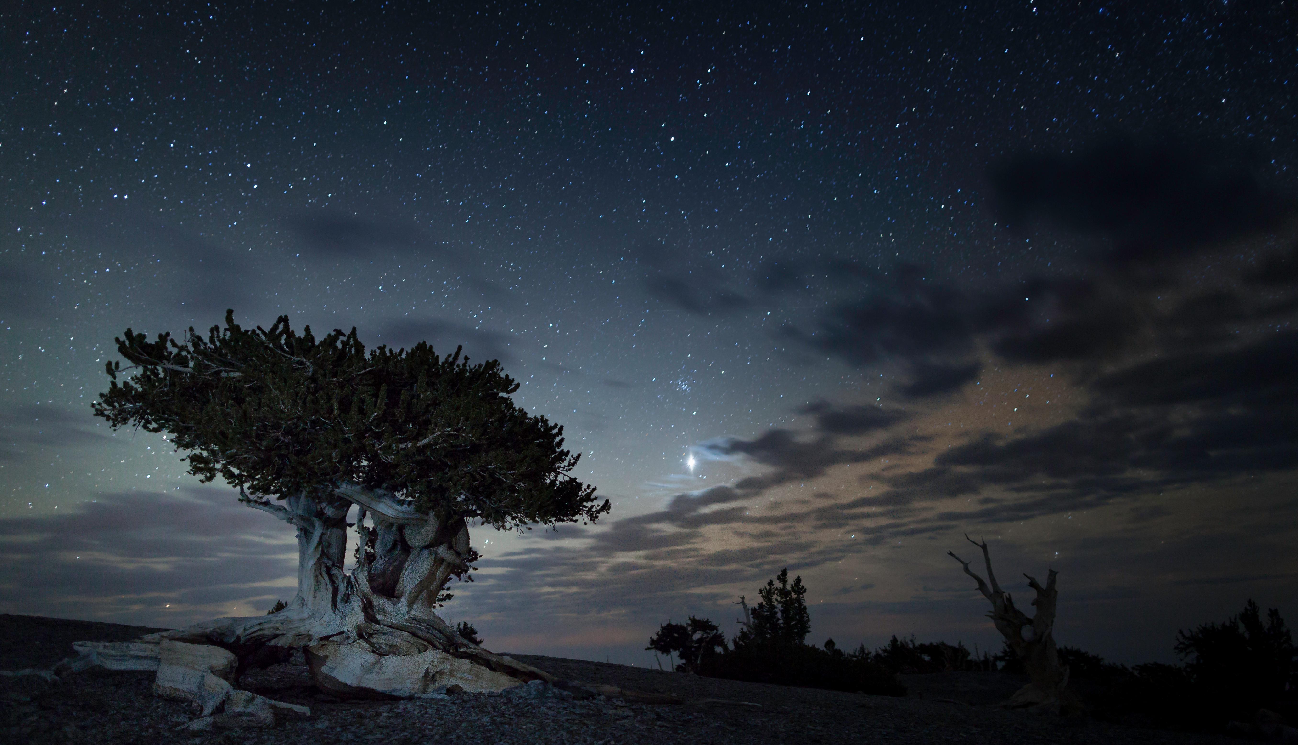
Before you pack, check the park alerts. At Great Basin National Park, Lehman Caves is entered on ranger-guided tours (reserve ahead; intermittent work windows can still interrupt), and there's no potable water in any campground. That's your first lesson about Great Basin National Park: conditions here are specific, stark, and demand preparation. This isn't a park you stumble into. You drive for hours through Nevada's wide, empty sagebrush to reach it, and what you find is a vertical desert. The landscape climbs from arid valley to 13,063-foot Wheeler Peak, compressing multiple ecosystems into one park road. Your visit hinges on understanding that elevation—and on embracing the profound quiet and the darkest night skies in the contiguous United States. This guide covers what's open, what to expect on the trails, and how to plan around the park's unique, often challenging, character.
Advertisement
The Lay of the Land: Elevation is Everything
Photo: NPS via NPS.gov (Public Domain)
The single most important fact about Great Basin National Park isn't in a brochure. It's the 8,000-foot elevation gain from the park entrance to the summit of Wheeler Peak. Rangers will tell you this changes everything, and they're understating it. In the valley near Baker, you might be in a t-shirt under a hot sun. Drive the Wheeler Peak Scenic Drive (closed in winter at the 3-mile mark) and you'll pass through zones of sagebrush, then pinyon-juniper woodland, then subalpine forest, and finally alpine tundra. Each zone has its own weather, its own trail conditions, and its own pace.
The common mistake - and almost everyone makes it - is packing for the valley. The temperature can drop 30 degrees from the Lehman Caves Visitor Center to the Bristlecone Pine trailhead. In late June, you can hike among wildflowers at 10,000 feet while post-holing through stubborn snow patches just off the trail. Summer afternoon thunderstorms roll in with little warning, bringing lightning to the exposed ridges. It can snow any month of the year up high.
Your strategy should be one of layering and timing. Start high-elevation hikes like the Wheeler Peak Summit Trail or the Bristlecone/Glacier Trail early. You want to be descending before those afternoon clouds build. Keep a rain shell and a warm layer in your pack even if the parking lot feels warm. And understand that "open" is a relative term. The park grounds are open 24/7, but the roads accessing the high country are snowbound from roughly November through May. For the full experience, aim for the accessible window from late June to early October.
What's Open (And What's Not)
Great Basin National Park rewards visitors who verify conditions before they drive in. Lehman Caves remains the park's signature ranger-guided experience — tickets go through Recreation.gov, walk-ups are limited, and intermittent lighting or infrastructure work can still pause routes. Check the NPS alerts and the Lehman Caves Tours page the week you travel rather than trusting a static seasonal summary.
The Great Basin Visitor Center near the park entrance is your surface-world hub for backcountry permits, weather, and trail conditions. Pair that stop with the Lehman Caves Visitor Center when you hold a tour reservation. The rest of the park — Wheeler Peak Scenic Drive (when open), bristlecone groves, and dark-sky overlooks — stays the core of a visit even if a specific tour slot is unavailable.
The other critical alert concerns water. There is currently no potable water available in any park campground. This isn't a minor inconvenience; it's a major planning point. You must bring all the drinking water you will need, or be prepared to drive to Baker to refill containers. The gift shop in Baker sells water, but at a premium. Bring your own.
Finally, respect the winter road closures. The Wheeler Peak Scenic Drive is gated at Upper Lehman Creek Campground. Snake Creek and Strawberry Creek Roads are closed at the park boundary. If you're visiting outside the summer season, your access is limited to the lower elevations. This makes fall and spring visits a gamble - you might get beautiful valley hiking, or you might get snowed on at 7,000 feet.
Hiking Among the Ancients: Bristlecones and Beyond
Photo: NPS via NPS.gov (Public Domain)
The hiking trails here are lessons in endurance, both yours and the landscape's. The star attractions are the ancient bristlecone pines. These aren't the oldest living things on earth by accident. They grow in a specific zone - high, dry, and windy - where almost nothing else can. The Bristlecone Pine Trail is a must-do. It's a moderate loop that takes you through a grove of these twisted, resilient trees, some over 3,000 years old. The wood feels like stone under your fingers. The trail continues to the remnant rock glacier and an overlook into the cirque below Wheeler Peak. The elevation gain is worth it.
For the ambitious, the Wheeler Peak Summit Trail is a full-day commitment. It's about 8.5 miles round-trip with nearly 3,000 feet of climbing. The trail narrows above the tree line, becoming a rocky scramble. The summit itself is a pile of quartzite boulders. On a clear day, the view stretches across the snake ranges of Nevada into Utah. Most visitors underestimate the effect of the altitude. You'll move slower than you expect. Drink water constantly.
Lower elevation options provide a different feel. The Lexington Arch Trail is a six-mile round-trip hike to a rare, massive limestone arch. The trailhead is accessed via a rough dirt road - check conditions at the visitor center first. The Alpine Lakes Loop, starting near the Wheeler Peak campground, is a shorter, scenic hike past Stella and Teresa Lakes, often reflecting the peak in their still surfaces.
Remember, this is remote country. Cell service drops out at the park boundary. Tell someone your plan, carry the ten essentials, and be prepared to self-rescue. The park's hiking trails offer more detail on distances and difficulty.
The Darkest Skies and Where to Watch Them
Photo: NPS via NPS.gov (Public Domain)
Great Basin National Park holds a Gold Tier designation from the International Dark-Sky Association. This means it has some of the least light-polluted night skies in the world. You haven't seen the Milky Way until you've seen it here - it appears as a thick, textured cloud of stars arching from horizon to horizon, casting faint shadows.
Rangers emphasize that you don't need a telescope to appreciate it. Just find a dark spot, let your eyes adjust for 20-30 minutes, and look up. The park's astronomy programs are legendary — schedules shift with staffing and season, so check at the Great Basin Visitor Center for any planned night sky talks or telescope viewings.
The best stargazing spots are away from any residual light. The Lehman Creek campground area works, but for truly dark skies, drive up the Wheeler Peak Scenic Drive as far as it's open and pull off at a turnout. The Mather Overlook is a popular choice. The temperature will drop sharply after sunset, even in summer. Pack a warm hat, gloves, and a thermos. A red-light headlamp preserves your night vision.
This dark sky resource is fragile. Use minimal light, point flashlights at the ground, and avoid car dome lights. Photographers should come prepared with a sturdy tripod and know their camera's manual settings. The experience is humbling. You'll see satellites tracking across the sky, frequent meteorites, and the sheer scale of our galaxy.
Planning Your Visit: Logistics and Nearby Resources
Photo: NPS via NPS.gov (Public Domain)
Great Basin National Park is remote. The nearest town is Baker, Nevada - a handful of buildings five miles from the park entrance. It has a small grocery store, a couple of restaurants, and limited services. Your major provisioning should be done in larger towns like Ely, Nevada (70 miles west) or Cedar City, Utah (about 150 miles southeast). Fill your gas tank before arriving.
There is no entrance fee for Great Basin National Park. None. This surprises people. Your costs will be for camping options or any future cave tour tickets. The park's campgrounds — like Lower Lehman Creek or Upper Lehman Creek — fill on peak weekends; Wheeler Peak is another high-country option. They fill most summer weekends. The no-water situation makes lodging and accommodations in Baker or Ely more appealing for some.
The best time to visit is generally July through September for full high-country access. September can be perfect, with cool nights and fewer people. Spring is muddy and unpredictable. Winter is for the prepared, offering solitude and snowshoeing in the lower valleys.
For wildlife viewing, dawn and dusk are key. You might see mule deer in the meadows, mountain cottontails near campsites, and hear the distinctive chatter of Clark's nutcrackers in the pines. Always store food properly.
Beyond cave tickets, check for naturalist walks or night sky programs. The schedule is fluid, so asking at the visitor center upon arrival is your best bet.
Practical Takeaways
Photo: NPS via NPS.gov (Public Domain)
Water is Non-Negotiable. As of 2026, no potable water is available in campgrounds. Bring all you need for drinking, cooking, and cleaning. Plan for at least one gallon per person per day.
Layer Your Clothing. Expect a temperature swing of 30+ degrees between day and night, and between the valley and the peaks. A moisture-wicking base layer, insulating mid-layer, and waterproof shell are essential.
Start High-Elevation Hikes Early. Be off exposed ridges by early afternoon to avoid lightning from common summer thunderstorms. Acclimate to the altitude; you will hike slower than usual.
Embrace the Dark. Bring a red-light headlamp for stargazing, warm clothes for the cold night air, and a sense of wonder. Let your eyes adjust for a full 30 minutes.
Verify Conditions. Check the official NPS website for the latest on cave tour schedules, water availability, and road status before you go. The alerts page is your most important planning tool.
Final Thoughts
Photo: NPS via NPS.gov (Public Domain)
Great Basin National Park asks more of you than most parks. It asks you to pay attention to elevation, to bring your own water, to drive for hours to reach its trails. In return, it gives you silence so deep you can hear your own heartbeat, night skies that rewire your sense of place, and trees that were ancient when Rome was founded. Whether you book a cave tour or stay above ground, the invitation is the same: move into the vast, vertical desert, onto the trails that wind through the thin air, and under the endless stars. This park doesn't cater to a casual visit. It rewards a deliberate one. Come prepared for that exchange, and you'll leave with more than photos. You'll leave with perspective.
Recommended Gear
What experienced visitors bring to Great Basin National Park: Complete Guide (2026)
Links may earn us a commission at no extra cost to you. We only recommend gear we believe in.