Zion National Park Hiking: Angels Landing, The Narrows & Canyon Trails (2026 Guide)
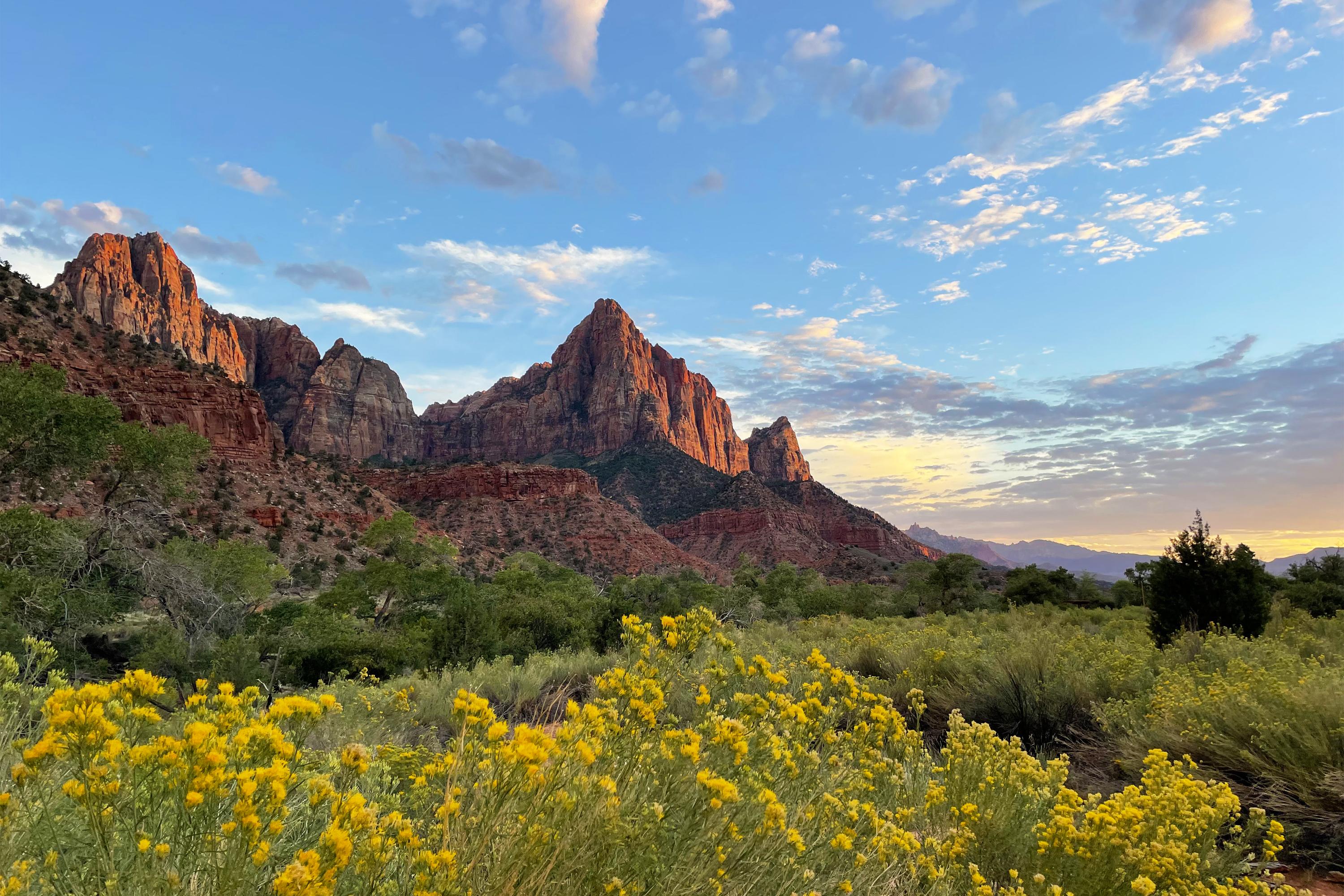
NPS via NPS.gov (Public Domain)
Best Hiking in Zion National Park
11 min read
Hiking Guide
Plan your Zion hike around sandstone, cold water, and crowds. Our 2026 guide details Angels Landing, The Narrows, and the mandatory shuttle.
This article contains affiliate links — we may earn a small commission at no extra cost to you.
Flow reliability
Seasonal consistency of median discharge from the curated USGS gauge for this place.
Spring
12%
year-to-year consistency
Summer
65%
year-to-year consistency
Fall
81%
year-to-year consistency
Winter
83%
year-to-year consistency
Median monthly discharge (cfs)
| Jan | Feb | Mar | Apr | May | Jun | Jul | Aug | Sep | Oct | Nov | Dec |
|---|---|---|---|---|---|---|---|---|---|---|---|
| 56.4 | 54.3 | 68.3 | 102 | 72.2 | 42.5 | 40.2 | 42.3 | 39.9 | 44.2 | 58 | 60.1 |
In the last 10 falls, roughly 2 of every 3 September–November weeks sat inside this band (41.4–69.7 cfs); typical flow in those weeks 48.4 cfs, median water temp 64°F (17.8°C).
Computed from 10 years of USGS daily records, station 09405500 (3,651 daily values). Last computed Oct 19, 2026.
Hydrological description only — not advice about wading, floating, or whether conditions are safe for recreation. Always check current USGS readings and local guidance before you go.
Choosing the best hike in Zion comes down to your comfort with exposure, cold water, and visitor density. You're selecting between climbing sandstone fins, wading a river through a slot canyon, or seeking solitude on the mesa. Newcomers consistently misjudge two factors: the physical toll of high desert heat and the operational necessity of the shuttle system. Arriving at a trailhead at 10 AM expecting parking is a recipe for disappointment. A successful day requires an early start and a firm grasp of each route's specific demands.
What Hiking Here Actually Means
Hiking in Zion is defined by sandstone. Your boots will crunch on its gravel, your hands will grip its chains, and you'll wade through the river that carved it. The terrain demands good balance and strong legs, not necessarily technical climbing skill. The most common mistake is treating a hike like Angels Landing as a casual stroll - it's a sustained climb with sheer drop-offs that demands focus. Preparation here is less about extreme fitness and more about managing sun exposure, carrying enough water, and respecting the shuttle schedule. Rangers will tell you that most search and rescue calls stem from dehydration and underestimating the return trip.
The park's trails split into three clear categories: the iconic canyon rim climbs, the river walks, and the high-eastern mesa routes that offer solitude. Your choice dictates your entire day. A river hike means specialized gear and checking flash flood forecasts. A rim hike means confronting exposure. A mesa hike means planning around the Zion-Mt. Carmel Tunnel restrictions. This guide covers the execution details for each.
Angels Landing: The Chain-Assisted Ascent
Everyone who hikes Angels Landing needs a permit. This isn't a suggestion - it's a mandatory pilot program enforced by rangers at the Scout Lookout chain section. The permit system has thinned the crowds, but it hasn't made the trail any less steep.
Distance: 5.4 miles round-trip
Elevation Gain: 1,488 feet
Trailhead & Parking: The trail starts at the Grotto Picnic Area (Shuttle Stop #6). The parking lot at the Zion Canyon Visitor Center fills by 7:30 AM on most days from March through October. Your only reliable option is to take the first shuttle from the visitor center, which typically starts running at 6:00 AM. There is no alternative parking at the trailhead.
The Trail: The first two miles are the relentlessly paved switchbacks of Walter's Wiggles. Your calves will feel every one of the 21 turns. The trail surface changes to exposed sandstone at Scout Lookout. This is where the permit check happens and where you decide to continue. The final half-mile is the chain section: narrow sandstone fins with 1,000-foot drops on either side. Traffic moves one direction at a time at bottlenecks. The rock is polished smooth by millions of hands and shoes.
The Takeaway: The true reward isn't the summit panorama—it's the relief of stable footing after that final narrow spine, glancing back at the slender path etched into the cliff face.
What Most Underestimate: The congestion. Even with permits, the chain section creates a bottleneck where you may wait 10-20 minutes for opposing traffic to clear. The descent is often more unnerving than the climb, as you face the exposure head-on.
Best Time: Early morning, as soon as the first shuttle drops you off. You want to be descending before the midday sun bakes the exposed rock and the shuttle lines swell. Spring and fall offer the most stable temperatures.
The Narrows (Bottom-Up): A River Hike
This isn't a trail in the conventional sense. It's a route following the Virgin River through Zion Canyon's narrowest section. You'll be wading—sometimes waist-deep—against the current, with canyon walls rising hundreds of feet on either side. Proper footwear and a walking stick are non-negotiable.ding, sometimes in water up to your waist. The distance you travel is entirely up to you, as you turn around whenever you choose.
Distance: Variable. To Wall Street (the iconic narrow section) is roughly 5 miles round-trip.
Elevation Gain: Minimal, but you gain elevation as you hike upstream against the current.
Trailhead & Parking: Starts at the Temple of Sinawava (Shuttle Stop #9). The same early shuttle strategy applies. The Riverside Walk is a paved, crowded one-mile path to the river's edge where the wading begins.
The Trail: The riverbed is your trail, composed of slippery, basketball-sized rocks. Water depth varies from ankle-deep to chest-deep depending on season and flow rate. The current is constant. The canyon walls close in until only a sliver of sky is visible overhead - this is the Wall Street section.
The Moment: The first time you round a bend and the canyon narrows so dramatically that the river fills the entire space between two soaring, water-stained walls. The sound changes, the light dims to a cool green, and the crowds seem to dissipate.
What Most Underestimate: The cold. Even in summer, the water temperature rarely exceeds 60°F. The combination of cold water and lack of direct sun can lead to hypothermia on longer hikes. Also, the sheer physical effort of stabilizing yourself on slippery rocks for miles.
Best Time: Late spring through early fall, when water levels are lower and air temperatures are warmer. Always check the flash flood forecast at the visitor center before entering. Rangers will tell you there is no safe place to hide in a flash flood in The Narrows.
Observation Point via East Mesa Trail: The Quiet Alternative
For a view that surpasses Angels Landing without the chains or the permits, this is the local's choice. You start on the forested plateau east of the canyon and walk to the rim.
Distance: 7 miles round-trip
Elevation Gain: About 700 feet (significantly less than Angels Landing)
Trailhead & Parking: The trailhead is outside the main canyon, reached via a rough dirt road (North Fork Road) east of the park. A high-clearance vehicle is recommended. There is a small, unmarked dirt lot that fits about 10 cars. It fills later than canyon lots, but aim to arrive by 8 AM.
The Trail: A flat, sandy path through ponderosa pine forest for most of the way. It feels entirely different from the canyon hikes - quiet, shaded, and soft underfoot. The final approach descends slightly to the overlook point.
The Moment: Stepping out onto the observation point and seeing Angels Landing directly across the canyon, looking like a tiny fin below you. The perspective is humbling.
What Most Underestimate: The road access. The dirt road can be deeply rutted and impassable when wet. Call the visitor center for current road conditions before relying on this route.
Best Time: Summer, as the higher elevation offers cooler temperatures. This trail is also a reliable winter hike when the canyon trails are icy.
Canyon Overlook Trail: The One-Hour Wonder
This short trail delivers one of the park's most efficient views-per-effort ratios. It's the only easy trail that gives you a true canyon perspective.
Distance: 1 mile round-trip
Elevation Gain: 163 feet
Trailhead & Parking: The trailhead is on the east side of the Zion-Mt. Carmel Tunnel, about a 15-minute drive from the canyon junction. There is a small parking lot that fills completely by 9 AM. Overflow parking along the highway is not permitted and vehicles will be ticketed.
The Trail: A well-maintained path with stairs, railings, and brief sections of exposed ledge. It winds along the cliff face, offering peek-a-boo views before opening to the main overlook.
The Moment: The full panorama of Pine Creek Canyon and the lower Zion Canyon road snaking below. It's particularly good in the late afternoon light.
What Most Underestimate: The parking scarcity. Most visitors assume because it's a short trail, they can pop in. The lot is tiny. Go at sunrise or later in the afternoon after the main wave has left.
Best Time: Late afternoon for photography. The overlook faces west, making sunset a popular time.
The Watchman Trail: A Leg-Stretcher from the Visitor Center
This is the trail you hike when you don't want to deal with the shuttle, or when you're waiting for a campground spot. It starts right from the visitor center area.
Distance: 3.3 miles round-trip
Elevation Gain: 368 feet
Trailhead & Parking: The trailhead is near the South Campground amphitheater, a short walk from the visitor center. You can park at the visitor center, but those spots are the first to fill in the park.
The Trail: A steady, winding climb on a well-defined dirt path with little shade. It switchbacks up to a plateau with continuous views of the lower canyon, the town of Springdale, and the Watchman spire.
The Moment: Reaching the final viewpoint bench and realizing you've gained enough elevation to see the whole valley laid out, without a strenuous all-day commitment.
What Most Underestimate: The sun exposure. There is virtually no shade. This trail feels much hotter than its elevation gain suggests.
Best Time: Early morning or evening. It's a good sunset hike.
Emerald Pools Trails: A Network of Oases
This is a system of three pools (Lower, Middle, Upper) fed by seasonal runoff. It's popular for a reason - water is a magnet in the desert.
Distance: Varies. To Lower Pool and back: 1.2 miles. To all three and back: 3 miles.
Elevation Gain: To Upper Pool: about 350 feet.
Trailhead & Parking: The trailhead is at the Zion Lodge (Shuttle Stop #5). You cannot park at the lodge unless you are a guest. You must take the shuttle.
The Trail: The Lower Pool trail is paved and accessible. The trail to the Middle and Upper Pools becomes rocky, steep, and can be slippery with spray from the waterfalls. The "pools" are often more damp grottos than swimming holes, but the waterfalls are active in spring and after rains.
The Moment: Standing behind the curtain of water at the Lower Pool on a hot day, feeling the cool mist.
What Most Underestimate: The crowds. This is one of the most congested trails in the park, especially the paved section to the Lower Pool. It feels more like a city park on a weekend than a wilderness experience.
Best Time: Spring, when the seasonal waterfalls are flowing. The trail can be dry and less impressive by late summer.

Seasonal Trail Conditions
Your hike is dictated by the month on the calendar. Zion's weather is extreme and specific.
March-May: This is prime hiking season. Daytime temperatures range from 60s to 80s (°F). The water in The Narrows is cold - often in the 40s - and swift from snowmelt. Canyoneering routes are dangerous. Wildflowers bloom on the plateaus in May. The shuttle system is running.
June-August: Heat. Temperatures in the canyon regularly exceed 100°F. Hiking after 10 AM is not just unpleasant, it's dangerous. You must start hikes at dawn. The monsoon season (mid-July into September) brings sudden, violent thunderstorms and a high risk of flash floods. Never enter a narrow canyon if storms are forecast. The water in The Narrows warms to the 60s, making it more comfortable for wading.
September-October: Another prime window. Crowds lessen slightly after Labor Day, and temperatures become ideal (70s-80s). The water in The Narrows begins to cool again. This is arguably the best time for the best hiking in Zion National Park.
November-February: Winter in the canyon is mild, with daytime temps in the 40s-50s. Ice is the main concern on trails like Angels Landing and the Upper Emerald Pools trail, where shaded sections become treacherous. The Narrows is a cold-weather adventure requiring drysuits. The park shuttle does not run; you can drive the scenic drive yourself, but parking at popular trailheads is still limited.

Trailhead Logistics
Your hiking plan is useless without a parking and shuttle strategy. The park's limited infrastructure is your primary obstacle.
The Shuttle is Non-Negotiable. From roughly March through November, you cannot drive to the Zion Canyon Scenic Drive trailheads (Angels Landing, The Narrows, Emerald Pools). You must park at the visitor center or in Springdale and ride the free shuttle. The first shuttle from the visitor center leaves at 6:00 AM. Be in line by 5:45 AM if you want to be on a trail at dawn. The line for the shuttle at the visitor center can exceed a two-hour wait by 9 AM.
Parking at the Visitor Center fills by 7:30 AM on most days. Once it's full, your only option is paid parking in Springdale and riding the town shuttle to the park entrance. The park alert for 2026 explicitly states: "Once all designated parking stalls in Zion are full, visitors should park in Springdale."
Large Vehicle Restrictions: Starting June 7, 2026, size limits are strictly enforced on the Zion-Mt. Carmel Highway. If you have an oversized RV or trailer, you will not be able to drive between Canyon Junction and the East Entrance. This affects access to the Canyon Overlook trailhead and the East Mesa trail. Check the park website for exact dimensions.
Cell Service drops out completely about a mile into the canyon from the south entrance. Do not rely on your phone for maps or communication on trail. The only reliable water sources are at the visitor center, Zion Lodge, and the campgrounds. Treat any water from the river - the park has an active alert for toxic cyanobacteria in the Virgin River. Do not submerge your head or filter drinking water from it.

What to Carry
Forget the generic list. Zion demands specific gear.
Footwear: This is the most important decision. For dry trails like Angels Landing or Observation Point, sturdy hiking boots with good traction are essential. For The Narrows, you need closed-toe water shoes with aggressive tread (like canyoneering shoes) or rented neoprene socks and canyoneering boots from an outfitter in Springdale. Hiking boots will be ruined and are dangerously slippery when submerged. Do not attempt The Narrows in sandals or old sneakers.
Water Carry: Most visitors underestimate their water needs by half. In summer, you need a minimum of one liter of water per hour of hiking. For a 4-hour hike, that's a 4-liter hydration bladder or multiple bottles. There are no water fill stations on any trail. The gift shop sells water for $4 a bottle. Bring your own.
Trekking Poles: Non-negotiable for The Narrows for stability on slippery rocks. Highly recommended for the descent from Angels Landing to save your knees.
Sun Protection: A wide-brimmed hat, sunglasses, and mineral-based sunscreen are mandatory. The sun reflects intensely off the pale sandstone.
For The Narrows Add: A dry bag for your phone/camera. Neoprene socks if hiking outside of peak summer. A change of clothes and shoes left in your car. Do not wear cotton - it stays wet and cold.

Practical Takeaways
- The shuttle line is your enemy. Be at the visitor center ready to board the first shuttle of the day.
- For Angels Landing, secure your permit well in advance through the online lottery. Rangers check at Scout Lookout.
- Hiking in summer means being on trail by 6:30 AM and finishing by 11:00 AM. The afternoon is for resting in the shade or the river.
- Always check the flash flood forecast at the visitor center before entering any canyon, especially The Narrows. A sunny sky upstream does not mean safety where you are.
- Parking illegally will get you towed. The 2026 park alert is explicit: vehicles outside designated stalls are subject to citation and towing.
- The water in the Virgin River is not drinkable under any circumstances due to toxic cyanobacteria. Do not filter it.
- Your feet will get wet in The Narrows. Embrace it and wear the right shoes.
- The best view of Angels Landing is from Observation Point. If you fear heights or miss the permit, that's your hike.
- Cell service is unreliable. Download offline maps and trail guides before you arrive.
- Fire restrictions are always in effect. No open flames outside designated grills.
For broader planning, including entrance fees and the shuttle schedule, consult the park's complete visitor guide. If you're considering staying overnight, research the camping options early, as they book months in advance. To understand the seasonal shifts that will define your trip, read our guide on the best time to visit for Zion National Park weather patterns.
Recommended Gear
What experienced visitors bring to Best Hiking in Zion National Park
Links may earn us a commission at no extra cost to you. We only recommend gear we believe in.
Hiking Essentials
Hydration Pack (3L)
Hands-free water for long trail days
Trekking Poles (Pair)
Save your knees on steep descents
Hiking Boots (Ankle Support)
Sturdy footwear for rocky, uneven trails
Sun & Heat Protection
Wide-Brim Sun Hat
Full coverage UPF 50+ protection at altitude
Insulated Water Bottle (32oz)
Keeps water cold in desert heat all day
Electrolyte Mix Packets
Replace what water alone cannot during intense heat
Winter Gear
Microspikes / Traction Devices
Essential for icy rim trails in winter months
Packable Down Jacket
Lightweight warmth that stuffs into a pocket
Sources
- Official source: NPS — Zion National Park nps.gov/zion/index.htm
Photo Gallery
More to Explore

Park Guide
Acadia National Park: Carriage Roads, Cadillac Mountain & 2026 Guide
Discover carriage roads, Cadillac Mountain, and rugged Maine coast. Complete 2026 guide to Acadia National Park — trails, fees, lodging, permits, and what rangers recommend.

Hiking Guide
Grand Canyon Hiking Trails: Day Hikes, Water Sources & Rim to Rim
Compare Grand Canyon hiking trails: Bright Angel, South Kaibab, Hermit, Grandview, and rim to rim, with distances, elevation, water stops, and trailhead access for each.

Best Of
Best of Glacier Bay National Park
The best of Glacier Bay is reached by boat: ranger-led day tours up the bay to the tidewater glaciers. What's worth it, how to book, and when to go (2026).

Campsite Guide
White Sands Backcountry Camping: Closed for 2026 — What to Know
As of 2026, backcountry camping at White Sands National Park is closed for site rehabilitation. What that means, and where to camp nearby instead.

Weather Guide
Guadalupe Mountains National Park Weather: Weather
Guadalupe Mountains National Park: weather guide guide updated 2026. Practical visitor information, reservations, and seasonal tips worth bookmarking before

Best Of
Best of Cuyahoga Valley National Park: Best Things to Do
Seeing a Cleveland Orchestra concert with the woods as your backdrop is a uniquely Cuyahoga Valley experience.
Sign in to join the conversation.
Sources & Attribution
Location data courtesy of the National Park Service (U.S. Department of the Interior). NPS data is public domain. Official NPS page.
Images: NPS; NPS; NPS; NPS; NPS.
Map data © OpenStreetMap contributors.
Park operations alerts: NPS.gov · Weather and weather hazards: National Weather Service · Live conditions.
Information may change. Always verify fees, hours, and conditions directly with the official source before visiting.
Did this guide help? Share it with a friend.