Ohanapecosh Campground Mount Rainier National Park (2026 Guide)
HomeCampsite GuideOhanapecosh Campground Mount Rainier National Park (2026 Guide)
Your plans
Advertisement
A Campground You Cannot Book This Year (and What That Means for Your Trip)
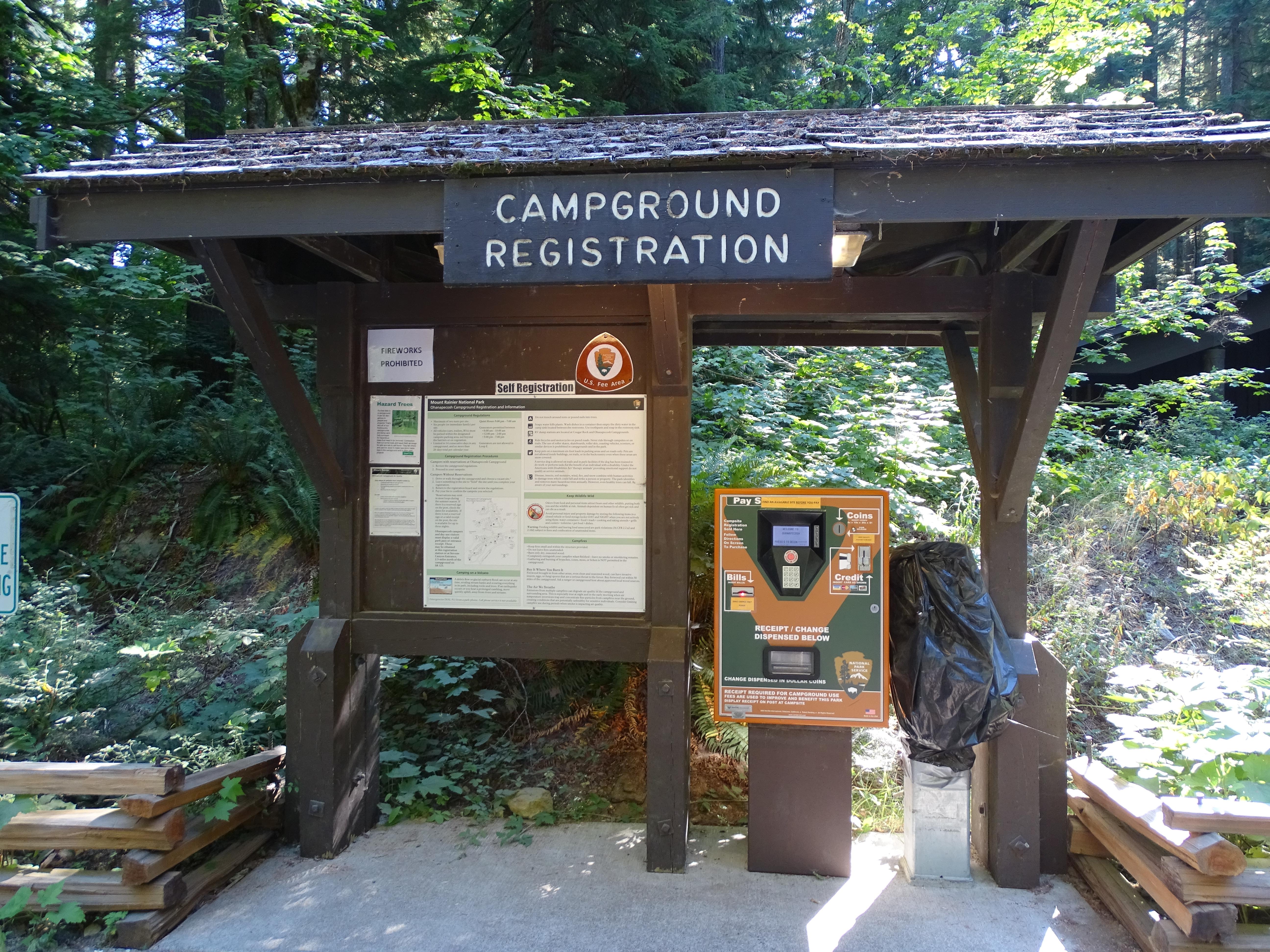
Here is the short version: Ohanapecosh Campground is closed for the 2025 and 2026 summer seasons. The entire area - all campsites, the visitor center, restrooms, picnic area, and river access along the Ohanapecosh River - is shut down for a major rehabilitation project. If you searched for "ohanapecosh campground mount rainier national park" expecting to reserve a site, you are not alone. This page gets heavy traffic from people planning south-side trips, and the closure catches a lot of them off guard.
The project started in 2025 and runs through at least October 2026. That means two full summers without access to this corner of the park.
The good news: you still have options at Mount Rainier, and the trails and viewpoints that make Ohanapecosh worth visiting are accessible from other entry points. This guide covers what is happening, where else you can camp, and how to make the most of the southeast side of the park while the campground is offline.
Photo: NPS via NPS.gov (Public Domain)
Why Ohanapecosh Matters (and Why They Are Rebuilding It)
Ohanapecosh Campground sits at 1,914 feet elevation in the southeast corner of Mount Rainier National Park, along State Route 123, about four miles north of where SR 123 meets SR 12. For context, that is roughly 17 miles northeast of Packwood, Washington, the nearest town of any size.
The campground occupies a forested river corridor along the Ohanapecosh River. In normal operation, it offers roughly 179 sites split between tent-only and RV spots, with group sites available by reservation from Memorial Day through Columbus Day. The standard site fee runs $20 per night, with a discounted $10 rate for holders of an America the Beautiful Senior or Access Pass. Group sites run $60 per night.
What makes Ohanapecosh distinct from Cougar Rock and White River - the park's other two reservable campgrounds - is its relative quiet. Cougar Rock sits between Longmire and Paradise on the busy south side, and White River serves as the basecamp for Sunrise visitors. Ohanapecosh draws a different crowd: people who want old-growth forest, river access, and proximity to Silver Falls and the Grove of the Patriarchs without the Paradise crowds.
The rehabilitation project addresses aging infrastructure. The original plumbing, electrical, and road systems date to the campground's construction decades ago. The park service is using this window to replace utility lines, repave roads, rebuild restrooms, and improve accessibility across the site. The work is extensive enough that keeping even a portion of the campground open was not feasible.
Photo: NPS via NPS.gov (Public Domain)
What You Lose (and What You Do Not) During the Closure
The closure is total. That means:
No camping at Ohanapecosh. All sites are unavailable.
The Ohanapecosh Visitor Center is closed. No exhibits, no information desk, no restrooms.
The picnic area along the river is closed.
River access points within the campground boundaries are closed.
The Silver Falls Trailhead, located inside the campground, is closed. Silver Falls itself is still reachable from other access points, but the direct route from the campground is off-limits.
What remains open in the area
The road through this part of the park - SR 123 and the Stevens Canyon Road corridor - stays open during summer months. You can still drive through, park at roadside pullouts, and access several key points of interest.
Backbone Ridge along Stevens Canyon Road remains open for its views of Mount Rainier and the Tatoosh Wilderness. Box Canyon, the impressive slot canyon carved by the Muddy Fork of the Cowlitz River, is accessible from its own parking area off Stevens Canyon Road. The Bench and Snow Lake Trailhead, located about 1.5 miles east of Reflection Lakes, is open during summer months (typically June through September).
The Grove of the Patriarchs trail, while accessed from a parking area near the Ohanapecosh entrance, remains accessible - the trailhead is outside the campground closure zone. Verify current conditions at the park website before heading out, as seasonal flooding can affect the footbridge.
Deer Creek Falls and the Deer Creek Trailhead, located off SR 123 south of Cayuse Pass, are also open.
Photo: NPS via NPS.gov (Public Domain)
Where to Camp Instead (For 2026 Trips)
You have two in-park alternatives, plus options in the surrounding national forest.
Cougar Rock Campground
Cougar Rock sits on the road between Longmire and Paradise, on the south side of the park. It operates 179 sites at the same fee structure: $20 standard, $10 with applicable pass, $60 for group sites. The campground is in a steep valley along the Nisqually River, which means it gets less direct sunlight than Ohanapecosh. Sites are wooded and private in the same old-growth character.
The trade-off: Cougar Rock is closer to the Paradise developed area, which means more traffic noise from the Paradise road and higher demand. Reservations open well in advance and fill fast - particularly for weekends and holiday periods. If you are reading this and planning a 2026 summer trip, check availability now.
White River Campground
White River is on the east side of the park, below Sunrise. It is smaller and more rustic than Cougar Rock, with no hookups and limited RV accommodations. The campground takes its name from the river beside it and sits at a higher elevation than Ohanapecosh, which means cooler nights and a later opening date. It typically opens in late June or early July, depending on snowmelt.
White River is the best basecamp for Sunrise-area hiking - the Emmons Moraine Trail, Burroughs Mountain, and the Wonderland Trail segments in this area all depart from near the campground. But it is a longer drive from the Ohanapecosh side of the park. If you planned your trip around the southeast corner, White River adds about 45 minutes of driving each way.
National Forest and Private Campgrounds
The Gifford Pinchot National Forest surrounds Mount Rainier on the south and east sides, and several Forest Service campgrounds operate along SR 12 and Forest Service roads near Packwood. These tend to be more primitive than the park campgrounds, with vault toilets and no reservations, but they work as overflow options.
La Wis Will Campground, about 12 miles east of Packwood on SR 12, is a common alternative. It sits along the Cowlitz River with basic amenities and first-come, first-served sites. Verify current status with the Cowlitz Valley Ranger District before relying on it.
Photo: NPS via NPS.gov (Public Domain)
Activities Worth Your Time (Even without Camping)
The southeast side of Mount Rainier has more than just the campground. Here is what still works in the Ohanapecosh area.
Day hiking
The park maintains over 260 miles of trails, and the southeast corner holds several good options. From the Bench and Snow Lake Trailhead, you get a moderate hike to two alpine lakes with views of Mount Rainier and the Tatoosh Range. The trail is about 2 hours round-trip and works well for families.
The Shriner Peak Fire Lookout trail departs from SR 123 south of the Ohanapecosh entrance. It is strenuous - expect 5 to 6 hours round-trip with significant elevation gain - but the view from the historic fire lookout at the top covers the mountain, the Cowlitz Valley, and on clear days, Mount Adams and Mount St. Helens.
Silver Falls is reachable from the Eastside Trail, accessible from the Deer Creek Trailhead or the Laughingwater Creek Trailhead. The direct Ohanapecosh Campground trailhead is closed, but the falls themselves are still visitable. Check the park's trail conditions page for current access routes and any seasonal washout issues.
Exploring Box Canyon
Box Canyon is worth a dedicated stop. The Muddy Fork of the Cowlitz River has carved a narrow slot canyon into volcanic bedrock, and three exhibit panels along the short walkway explain the canyon's formation, the glacial history of the area, and the forest regrowth patterns visible from the viewing platforms.
Stargazing
The Stevens Canyon Road corridor, including the area around Box Canyon and Backbone Ridge, is designated for stargazing during spring, summer, and fall. Light pollution is minimal, and the south side of the mountain offers clear sightlines to the southern sky. The park occasionally hosts ranger-led night sky programs - check the calendar at the park website.
What the park website does not mention
The parking situation at the roadside pullouts along Stevens Canyon Road can be tight by 10 AM on summer weekends. Backbone Ridge and Box Canyon share limited lots, and there is no overflow parking. If you arrive after mid-morning, expect to circle or skip the stop.
Cell service drops out at the park boundary and does not return reliably until you are back near Packwood or Enumclaw. Download maps and trail descriptions before you enter the park. The park's newspaper, The Tahoma News, has current conditions and is available at entrance stations and remaining visitor centers.
Practical Takeaways
Ohanapecosh Campground is closed through at least October 2026. Do not plan a camping trip around it. Verify reopening dates at the official park website before booking anything for 2027.
Book Cougar Rock or White River early. Reservations open on a rolling window, and summer weekends go fast. If you want a site, check availability at least four months out.
Alternative camping exists outside the park. Forest Service and private campgrounds near Packwood and along SR 12 can serve as fallback options, but they have fewer amenities and no reservation systems.
Day-use access to the southeast side remains open. Box Canyon, Backbone Ridge, Bench and Snow Lakes, and the Deer Creek trailhead are all accessible from SR 123 and Stevens Canyon Road. Arrive early for parking.
The Silver Falls Trailhead inside the campground is closed. Reaching Silver Falls requires a longer approach from the Eastside Trail or Laughingwater Creek Trailhead.
Check for trail impacts from winter storms. The research data notes that the Carter Falls footbridge over the Nisqually River has been dislodged and the Kautz Creek Trail is impassable at one mile due to washout. Other trails may have unreported damage. Check current conditions before any hike.
For a broader overview of visiting this area, check the complete visitor guide once it publishes. For information on all campgrounds in and near the park, that guide covers the alternatives in more depth.
Final Thoughts
A two-year campground closure is frustrating, especially if you planned a trip around this specific corner of the park. But the rehabilitation work at Ohanapecosh will extend the life of the campground by decades, and the rest of Mount Rainier National Park is still operating. Shift your camping to Cougar Rock or White River, use the southeast side for day trips, and treat the closure as an excuse to explore parts of the park you might have skipped otherwise.
Rangers at the Longmire and Paradise visitor centers can point you toward current trail conditions and less-crowded alternatives. Stop in. They know which routes are clear, which trailhead lots fill first, and which shortcuts the maps do not show. That is worth the detour.