The first sound you hear at Cougar Rock Campground is the Nisqually River running across the main road - not loud enough to keep you awake, but present enough that you notice when it fades. The campground sits in a steep forested valley on the south side of Mount Rainier National Park, along the road between Longmire and Paradise. For anyone looking to camp inside the park rather than outside the gates, this is one of only three in-park options for tent and RV camping (as of 2026, Ohanapecosh is closed for construction, which makes Cougar Rock and White River the only operating campgrounds in the park). The cougar rock campground mount rainier national park experience is defined by dense forest cover, quick access to the Wonderland Trail, and a location that puts both Longmire and Paradise within a 15-minute drive. This guide covers the specifics - site types, fees, reservation strategy, nearby trails, and the practical realities that will determine whether this campground suits your trip.
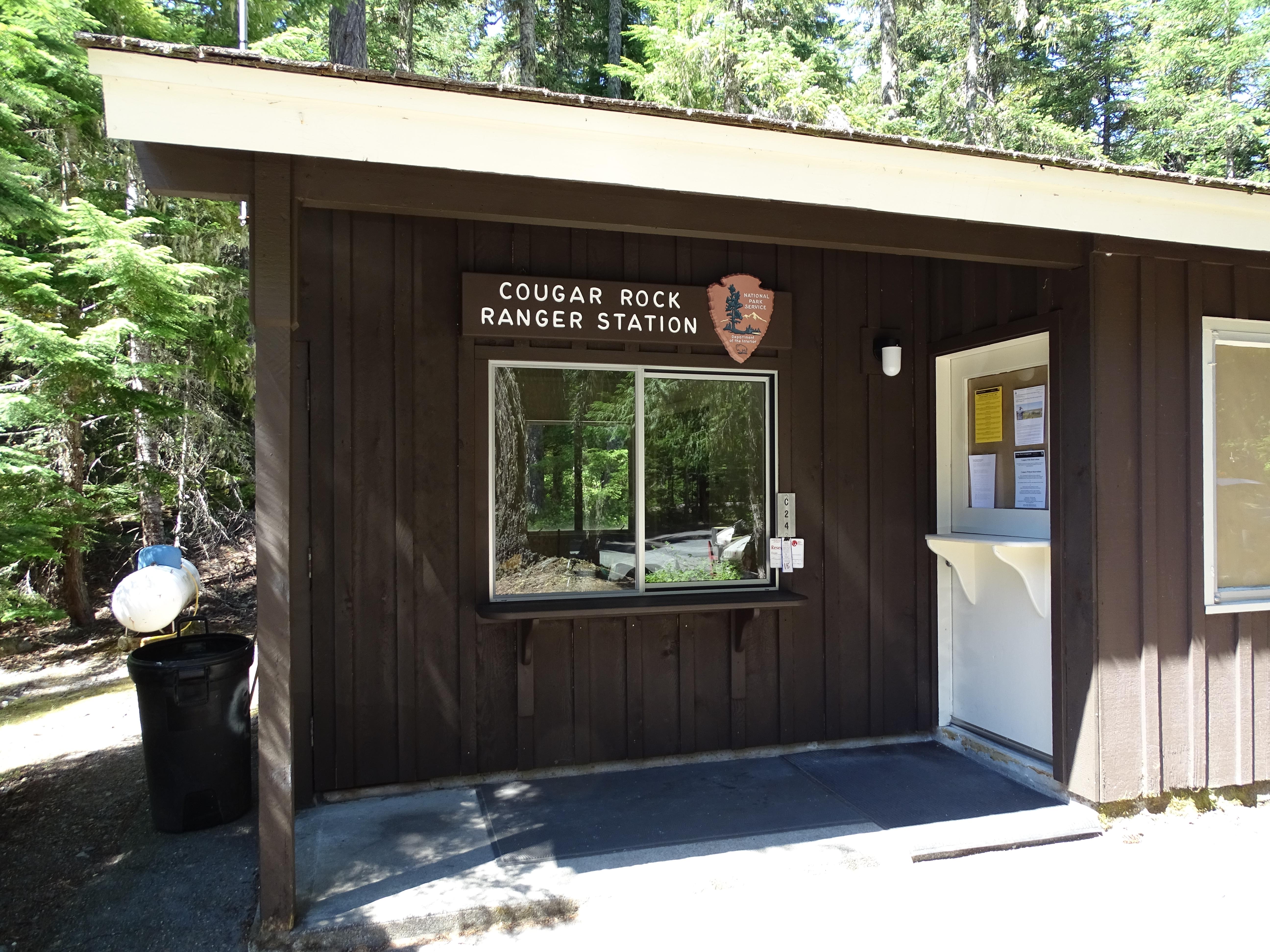
Cougar Rock Campground: 179 Sites, No Hookups (2026 Guide)
7 min read
Cougar Rock is 14 miles east of Ashford, Washington, on State Route 706 (Paradise Road), about two miles uphill from the Longmire historic district.
For more, see Mount Rainier National Park Guided Tour.
Location and Layout
Cougar Rock is 14 miles east of Ashford, Washington, on State Route 706 (Paradise Road), about two miles uphill from the Longmire historic district. The campground occupies a narrow valley floor with the Nisqually River just across the main road. Thick old-growth forest runs through the entire campground, and the spacing between sites is generous enough that you are not camping on top of your neighbors.
Site Types and Counts
The campground has 179 total sites:
- 78 tent-only sites - no vehicle parking at the site itself (separate parking area nearby)
- 24 RV sites - these accommodate vehicles up to specific lengths (check your rig against site dimensions when booking)
- The remaining sites accommodate both tents and small RVs or trailers
The forest canopy provides substantial shade, which matters in July and August when afternoon temperatures can climb. It also means sites stay damp longer after rain - something to factor into your gear choices. Most sites have a picnic table and fire ring. There are no hookups (no electric, no water, no sewer at individual sites). Dump stations and potable water are available in the campground.
Group Sites
Group sites are available and require separate reservations. The fee is $60 per night for groups of 12 or more. These sites are tent-only - RVs are not permitted in group areas. Parking is limited, so groups may need to coordinate with the campground ranger for additional parking arrangements.
Booking and Fees
Reservations are required at Cougar Rock. You cannot show up and hope for a first-come, first-served site - this is a reservation-only operation. Reservations open on a rolling basis through Recreation.gov.
Standard site fee: $20 per night for a single campsite (up to 2 tents and 6 people, unless immediate family).
Discounted site fee: $10 per night for the cardholder with an America the Beautiful Access Pass or Senior Pass. This is one of the better discounts in the national park system.
Group site fee: $60 per night.

Seasonal Timing and Availability
Cougar Rock operates on a summer-only schedule. The 2026 season runs from approximately late May through early October, with the official opening date set for May 23, 2026, based on current projections. The campground closes for the season on October 12, 2026.
When Sites Fill
Weekend sites during July and August book out quickly - often within minutes of becoming available on the reservation calendar. Midweek stays (Monday through Thursday) are significantly easier to secure. If you are planning a weekend trip, book exactly as far in advance as the system allows. Early June and late September offer the best balance of availability and reasonable weather.
Weather Realities
Even in summer, expect rain. The park averages measurable precipitation more days than not in June and early July. August is the driest month. Nighttime lows at this elevation (roughly 3,200 feet) can drop into the 40s even in midsummer. A 30-degree sleeping bag is not overkill.
Nearby Trails and Activities
The biggest advantage of Cougar Rock is location. You are positioned between Longmire (2 miles downhill) and Paradise (roughly 10 miles uphill). That means you can access trails on both sides of the park without extended drives.
From the Campground Itself
The Wonderland Trail crosses the road from the campground entrance. While a segment of the Wonderland Trail is currently closed due to bear activity between Narada Falls Trail and Stevens Canyon Road (check the current alert status), other sections remain open. A moderate hike from the campground leads to waterfalls along the Nisqually River within a few miles.
Rampart Ridge Trail (2-3 hours, moderate) starts near Longmire and loops through forest with intermittent views of the mountain. This trail works year-round and is a solid option for a shorter day.
Nisqually Vista Trail (45-60 minutes, easy) at Paradise offers glacier views and is open year-round. It is paved and accessible, making it a good option for evenings after a longer hike earlier in the day.
Waterfall Tour Between Longmire and Paradise
This is a practical itinerary from Cougar Rock: drive toward Paradise and stop at four waterfalls along the way - Christine Falls, Carter Falls, Narada Falls, and Comet Falls. The total driving distance is short, and the walks to viewpoints range from roadside to moderate half-mile trails. Allow 2-4 hours for the full tour.
Day Hiking Options
The park maintains over 260 miles of trails. From Cougar Rock, you can reach trailheads for:
- Bench and Snow Lakes (2 hours, summer only) - Stevens Canyon Road, about 1.5 miles east of Reflection Lakes
- Gobblers Knob Fire Lookout (6-7 hours, strenuous) - panoramic views from a historic fire lookout
- Shriner Peak Fire Lookout (5-6 hours, strenuous) - commanding mountain views
Stargazing
Paradise and Stevens Canyon offer stargazing opportunities on clear nights with minimal light pollution. The parking lot at Paradise stays open for late-night visitors. Bring a red-light headlamp and warm layers - it gets cold after sunset even in August.

What the Park Website Does Not Mention
A few realities that become clear only after you have spent time here:
The road noise is present but not intrusive. The campground runs parallel to Paradise Road, and you will hear vehicles during the day. Traffic drops off significantly after dark and picks up again around 7 AM.
The canyon traps cool air. Even when Paradise has mild temperatures, Cougar Rock can be noticeably cooler and damper in the morning and evening. Pack accordingly.
Cell service drops out once you enter the park from the Nisqually entrance. Do not count on having reception at the campground. Download maps, reservation confirmations, and directions before you lose signal near Ashford.
The dump station line gets long on Sunday mornings. Plan to fill water and dump tanks on Saturday or early Sunday if you are checking out.
Alerts and Conditions for 2026
As of the 2026 season, several important conditions apply:
- Ohanapecosh Campground is closed for the entire 2026 season due to construction. That closure includes all campsites, the visitor center, restrooms, picnic area, and river access. Cougar Rock and White River are the only in-park campgrounds operating.
- The SR 165 Carbon River/Fairfax Bridge is closed with no alternative route. Carbon River and Mowich Lake are inaccessible from this direction.
- Wonderland Trail is closed between Narada Falls Trail and Stevens Canyon Road due to bear activity. Check current conditions before planning a multi-day Wonderland itinerary.
- Expect entrance delays on weekends at the southwest entrance (SR 706). The line can back up significantly by mid-morning on Fridays through Sundays during July and August.
- Melting snow bridges create hazards for hikers, particularly in early season. Stay on established trails and be cautious near streams.

Practical Takeaways
- Reserve as early as the system allows if you want a weekend site in July or August. Midweek is easier.
- Bring a sleeping bag rated to 30°F minimum. The canyon gets cold at night even in summer.
- Fill your water bottles at the potable water station when you arrive. There are no water hookups at individual sites.
- Arrive before 3 PM on Fridays to avoid the worst of the entrance line. Early morning (before 9 AM) is also good.
- Download offline maps of the park before you lose cell service near Ashford.
- Check the NPS alerts page the day before your trip. Conditions change quickly - trail closures, bear activity, and weather events can shift your plans.
Final Thoughts
Cougar Rock is not the most dramatic campground in the park - it does not have the mountain views that Sunrise-area camping provides, and it lacks the river-adjacent feel of Ohanapecosh when that reopens. What it offers is the most practical basecamp for exploring the Longmire-to-Paradise corridor, the best waterfall access of any campground in the park, and a forest setting that provides genuine privacy between sites. For the 2026 season, with Ohanapecosh closed, it is also the most flexible option for anyone who wants to camp on the south side of the mountain. Book early, pack for cold and wet, and use that central location to get out the door early while the Paradise parking lots are still empty.
For more information, see our complete Mount Rainier National Park Guide.
Sources
- Official source: National Park Service nps.gov/mora/planyourvisit/campgrounds.htm
- Official source: NPS — Mount Rainier National Park nps.gov/mora/index.htm
Photo Gallery
More to Explore

Acadia National Park: Carriage Roads, Cadillac Mountain & 2026 Guide
Discover carriage roads, Cadillac Mountain, and rugged Maine coast. Complete 2026 guide to Acadia National Park — trails, fees, lodging, permits, and what rangers recommend.

Grand Canyon Hiking Trails: Day Hikes, Water Sources & Rim to Rim
Compare Grand Canyon hiking trails: Bright Angel, South Kaibab, Hermit, Grandview, and rim to rim, with distances, elevation, water stops, and trailhead access for each.

Best of Glacier Bay National Park
The best of Glacier Bay is reached by boat: ranger-led day tours up the bay to the tidewater glaciers. What's worth it, how to book, and when to go (2026).

White Sands Backcountry Camping: Closed for 2026 — What to Know
As of 2026, backcountry camping at White Sands National Park is closed for site rehabilitation. What that means, and where to camp nearby instead.

Guadalupe Mountains National Park Weather: Weather
Guadalupe Mountains National Park: weather guide guide updated 2026. Practical visitor information, reservations, and seasonal tips worth bookmarking before

Best of Cuyahoga Valley National Park: Best Things to Do
Seeing a Cleveland Orchestra concert with the woods as your backdrop is a uniquely Cuyahoga Valley experience.
Sign in to join the conversation.
Sources & Attribution
Location data courtesy of the National Park Service (U.S. Department of the Interior). NPS data is public domain. Official NPS page.
Images: NPS; NPS; NPS; NPS; NPS.
Map data © OpenStreetMap contributors.
Park operations alerts: NPS.gov · Weather and weather hazards: National Weather Service · Live conditions.
Information may change. Always verify fees, hours, and conditions directly with the official source before visiting.
Did this guide help? Share it with a friend.