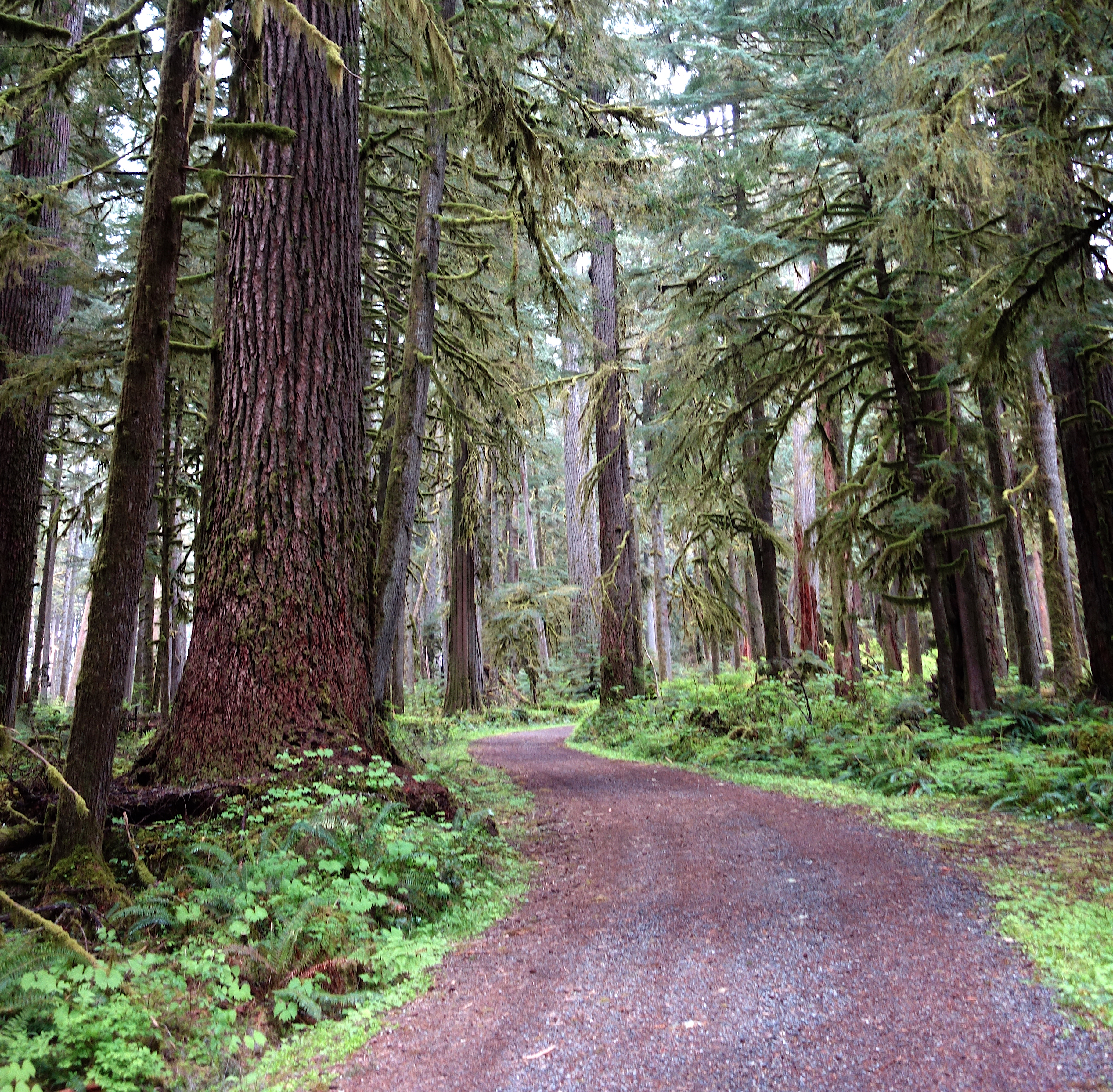
Step into the Carbon River valley and you'll notice the air immediately—heavy with moisture, cool on a summer day, carrying the scent of damp earth and decaying cedar. This is a temperate rainforest in Mount Rainier's remote northwest corner, a landscape defined by water and resilience. With the primary access road gone as of 2026, visiting here now demands careful planning and adaptability.
NPS via NPS.gov (Public Domain)
Carbon River: Rainforest Trails & Road Closure, Mount Rainier
9 min read
Places & Points of Interest
Plan your 2026 visit to Carbon River. Complete guide to trails, fees, lodging, best time to visit, and insider tips.
Your plans
Here you'll find the lowest-elevation glacier in the Lower 48 and one of the continent's rare inland temperate rainforests. This is a landscape in perpetual motion—the river constantly reshapes its channel while forests establish themselves on glacial till. Don't come expecting sweeping mountain views; the Carbon River experience is about immersion in a dense, green, and powerfully dynamic ecosystem. We rangers often say this place teaches you to understand process, not just admire scenery.
Quick Information
The most critical piece of information comes first: there is currently no vehicle, bicycle, or pedestrian access to the Carbon River area via State Route 165. The Fairfax Bridge is closed, with no established detour or timeline for reopening. This closure fundamentally changes how you plan a visit. Always check the park's official website for the absolute latest status before you make any plans.
If and when access is restored, here's what you need to know. The standard Mount Rainier National Park entrance fee applies. As of 2026, that's $30 per private vehicle for a 7-day pass. An annual park-specific pass is $55, and the America the Beautiful Interagency Annual Pass ($80) is also accepted. The Carbon River Ranger Station, when accessible, has flush toilets, potable water, information, and a small bookstore. Cell service is unreliable to nonexistent throughout the valley. Parking at the ranger station is limited to a few dozen vehicles and fills quickly on summer weekends.
Getting There
This is the complicated part. Under normal conditions, you'd drive SR 165 east from the town of Buckley. That road is currently closed at the Fairfax Bridge. The park service alert is unambiguous: no public access.
When the road reopens, the drive from Buckley to the Carbon River Entrance takes about an hour. From Seattle, budget at least two hours of drive time without traffic. There are no other park entrances that provide road access to the Carbon River valley; it's a geographically isolated corner. The nearest open park entrance is the Nisqually (Longmire) entrance, which is over two hours away by car via a circuitous route around the mountain.
Your GPS will likely try to route you via SR 165. Do not trust it. Rely on the official National Park Service website for current access information. The parking area at the ranger station is paved but not large. On a busy day, the lot is full by mid-morning.

What to Expect
Expect a world of green. The Carbon River valley receives over 70 inches of rain annually, fueling a temperate rainforest where Sitka spruce, western red cedar, and Douglas-fir grow to immense sizes. Moss blankets every surface, from fallen logs to the trunks of living trees. The understory is a tangle of ferns, devil's club, and salmonberry.
The terrain is flat near the old roadbed but becomes steep and rugged as you move toward the glacier. The river itself is a milky, gray-brown torrent, laden with glacial silt known as "rock flour." It's loud. You'll hear it constantly. The air is cool and damp, often 10-15 degrees cooler than in nearby lowland areas. Even on a sunny day, direct sunlight is patchy under the dense canopy.
Many first-timers are struck by the forest's overwhelming density and the absence of a clear Rainier vista. The mountain remains a hidden presence here—you sense it through the glacier and silt-laden river rather than seeing it on a postcard view. view. This is a place for close-looking: the patterns on a banana slug, the drip of water from a mossy branch, the sheer scale of a cedar's trunk.
Top Attractions & Points of Interest
Carbon Glacier
This is the star of the area. The Carbon Glacier is the lowest-elevation glacier in the lower 48 states, with its terminus dipping down to about 3,600 feet. It's also the longest and, by volume, the largest glacier on Mount Rainier. You won't see a sparkling white ice field; from the trail, it appears as a massive, grayish river of ice and rock debris pushing out from a deep, shadowy gorge. The scale is difficult to comprehend until you see the house-sized boulders it has pushed downvalley.
Carbon River Rainforest Trail
This is your best introduction to the ecosystem. It's a short, accessible 0.3-mile loop boardwalk and trail that starts right at the ranger station. A series of exhibit panels explain the layers of the rainforest canopy, the water cycle, and the specialized plants and animals that live here. It's the perfect first stop to get oriented. The boardwalk is generally accessible, though conditions can be slippery.
Chenuis Falls
A moderate hike (approximately 3.5 miles round-trip from the ranger station) leads to this graceful, two-tiered waterfall on Chenuis Creek. The trail follows the old Carbon River Road, which is now a hiking and biking corridor. The falls are most impressive in late spring and early summer with snowmelt, but they flow year-round, creating a cool, misty grotto surrounded by lush ferns.
The Old Mine Entrance
A relic of the area's human history, this sealed mine entrance is passed on the way to the Carbon Glacier. It's a tangible reminder that this landscape was once seen for its mineral extraction potential, not just its scenic value. Do not attempt to enter or approach the mine structure closely; it is unstable.
Ipsut Creek Campground
Once a drive-in campground, Ipsut Creek is now a backcountry camp, located about 5 miles up the valley from the ranger station. It serves as a basecamp for longer adventures toward the glacier or onto the Wonderland Trail. It has pit toilets and designated campsites. A backcountry permit is required for overnight stays.

Activities
Hiking and Biking the Old Road
The primary activity in the Carbon River area is hiking or mountain biking the old Carbon River Road. This gated road is now a wide, relatively flat trail that follows the river valley for about 5 miles to Ipsut Creek. It's the access corridor for everything else. Bicycles are permitted on this roadbed, offering a efficient way to cover the distance to the trailheads for the glacier or Chenuis Falls. They are not allowed on any of the single-track hiking trails that branch off it.
Backpacking and Overnighting
The Carbon River area is a major access point for the northern section of the 93-mile Wonderland Trail. Ipsut Creek Campground is a key stop. This is serious backpacking country, with significant elevation gain, river crossings, and unpredictable weather. A backcountry permit, obtained via the park's lottery or walk-up system, is mandatory for all overnight stays.
Rainforest Exploration
Beyond the short Rainforest Loop, simply walking the old road is an immersion. Take time to stop and look closely. Look for banana slugs on the path, listen for the varied thrush's eerie, single-note call, and feel the texture of the moss. This is a place for a slow pace.
Photography
The photographic challenges and rewards here are specific. It's about intimate landscapes, macro shots of fungi and moss, and capturing the moody, diffused light of the rainforest. A polarizing filter can help cut the glare off wet leaves. A tripod is essential for the low-light conditions under the canopy.
Seasonal Guide
Summer (July - September): This is the only reliable season for access, assuming the road is open. The rainforest is lush, waterfalls are flowing, and days are long. Afternoon temperatures might reach the 70s in the sun, but remain cool in the shade. This is peak season for visitors and backpackers. Mosquitoes and flies can be persistent, especially near Ipsut Creek.
Fall (October - November): A fantastic time for solitude and color. Vine maples turn brilliant red and yellow, contrasting with the evergreen canopy. Weather becomes more volatile, with frequent rainstorms and the possibility of early snow at higher elevations. Days grow shorter rapidly.
Winter (December - March): The Carbon River area is largely inaccessible. The road is not maintained for winter travel. Heavy snowfall, avalanche risk, and shortened daylight make this a destination for experienced winter mountaineers only, not casual visitors.
Spring (April - June): Access is typically blocked by snow on the road and trails well into June. This is the season of high, roaring water. The river is at its most powerful and dangerous. Many trails remain snow-covered and soggy.

Practical Information
All overnight stays in the backcountry, including at Ipsut Creek Campground, require a permit. These are available through the park's advanced lottery or, if available, as walk-ups. As of 2026, the cost is $6 per person per night for the permit reservation, plus a $45 per trip fee for climbing or multi-night wilderness trips.
The nearest frontcountry camping options are outside the park, in the Gifford Pinchot National Forest or at private campgrounds near Enumclaw. The park's own Cougar Rock Campground is over two hours away by car.
For lodging and accommodations, you'll need to look to the gateway communities of Enumclaw, Buckley, or Ashford. There are no hotels or lodges within an hour's drive of the Carbon River entrance. Pack in all food, water, and supplies. The last reliable gas and groceries are in Enumclaw or Buckley.
Safety & Preparation
Your safety here hinges on self-reliance. There is no cell service to call for help.
River Crossings: This is the paramount hazard. The Carbon River and its tributaries are cold, fast, and silty, hiding deep holes and unstable logjams. Do not attempt to cross the main river channel without specific knowledge of a safe route. Several trails require crossing smaller, but still hazardous, creeks. Water levels are lowest in the early morning before daily melt increases flow. Turning around is always a valid option.
Weather and Hypothermia: The damp cold is insidious. Even in summer, rain is always a possibility. Carry rain gear, warm layers, and a change of socks in a dry bag. Cotton clothing becomes dangerous when wet.
Wildlife: This is black bear country. Carry bear spray, know how to use it, and make noise on the trail. Store all food, trash, and scented items in park-approved bear canisters, which are required in this area. Smaller creatures like ticks are also present; do tick checks after your hike.
Trail Conditions: The old road is generally stable, but the single-track trails can be muddy, rooty, and slick year-round. Good traction footwear is essential. Downed trees are common after winter storms. Check at the ranger station for the latest trail condition reports.

Insider Tips
- The Early Rule: If the road is open, be at the parking lot by 8 AM. You'll get a spot, have the trail to yourself, and hit creek crossings at their lowest flow.
- Bike for Distance: If your goal is the Carbon Glacier trailhead, a mountain bike to cover the 5-mile road walk is a. It turns a very long day hike into a manageable one. Walk your bike on the single-track.
- The Sound Test: If you can't see the river but can hear a deep, roaring rumble through the trees, you're in the right place. That's the sound of glacial melt on the move.
- Skip the Main Viewpoint: The classic view of the glacier' terminus is from a rocky outcropping. Experienced hikers often find the view looking up the glacier's gorge from the trail just before that point to be more dramatic.
- Footwear is Everything: Waterproof boots are less important than shoes with aggressive tread. The constant moisture means everything is slick. Prioritize grip over Gore-Tex.
- Check the Register: The trailhead register isn't just for signing in. Scan the recent entries for comments on trail conditions, creek crossings, and wildlife sightings from the past few days. It's real-time beta.
- The Park Website Doesn't Mention: The damp quiet of the rainforest can play tricks. What sounds like a person walking just off the trail is almost always just water dripping from the canopy onto a broad fern leaf. You'll jump at the sound a dozen times.
The Carbon River area demands more from a visitor than other parts of Mount Rainier. It asks for flexibility, preparation, and a shift in expectations. In return, it offers a profound sense of immersion in one of the park's most unique and powerful landscapes. It's not the easiest place to reach, but that's precisely what keeps its quiet, green magic intact.
For more information, see our complete Mount Rainier National Park Guide.
Sources
- Official source: NPS — Mount Rainier National Park nps.gov/mora/index.htm
- Official source: National Park Service nps.gov/places/carbon-river.htm
- Official booking/facility record recreation.gov/permits/4675320
Photo Gallery
More to Explore

Park Guide
Acadia National Park: Carriage Roads, Cadillac Mountain & 2026 Guide
Discover carriage roads, Cadillac Mountain, and rugged Maine coast. Complete 2026 guide to Acadia National Park — trails, fees, lodging, permits, and what rangers recommend.

Hiking Guide
Grand Canyon Hiking Trails: Day Hikes, Water Sources & Rim to Rim
Compare Grand Canyon hiking trails: Bright Angel, South Kaibab, Hermit, Grandview, and rim to rim, with distances, elevation, water stops, and trailhead access for each.

Best Of
Best of Glacier Bay National Park
The best of Glacier Bay is reached by boat: ranger-led day tours up the bay to the tidewater glaciers. What's worth it, how to book, and when to go (2026).

Campsite Guide
White Sands Backcountry Camping: Closed for 2026 — What to Know
As of 2026, backcountry camping at White Sands National Park is closed for site rehabilitation. What that means, and where to camp nearby instead.

Weather Guide
Guadalupe Mountains National Park Weather: Weather
Guadalupe Mountains National Park: weather guide guide updated 2026. Practical visitor information, reservations, and seasonal tips worth bookmarking before

Best Of
Best of Cuyahoga Valley National Park: Best Things to Do
Seeing a Cleveland Orchestra concert with the woods as your backdrop is a uniquely Cuyahoga Valley experience.
Sign in to join the conversation.
Sources & Attribution
Location data courtesy of the National Park Service (U.S. Department of the Interior). NPS data is public domain. Official NPS page.
Images: NPS; NPS; NPS; NPS; NPS.
Map data © OpenStreetMap contributors.
Park operations alerts: NPS.gov · Weather and weather hazards: National Weather Service · Live conditions.
Information may change. Always verify fees, hours, and conditions directly with the official source before visiting.
Did this guide help? Share it with a friend.