Most first-time visitors to Lassen Volcanic National Park arrive expecting a quick drive-through of hydrothermal areas and a summit hike. What they miss is a backcountry that covers most of the park's 106,000 acres. Backcountry camping in Lassen's Wilderness offers access to terrain far from the paved roads and boardwalks - lava flows, alpine lakes, and the only place on the planet where all four volcano types sit within a single park boundary. The permit system is straightforward, but the planning takes more effort than the average overnight trip. This guide walks through what you need to know for a 2026 trip, from permits to pack weight.
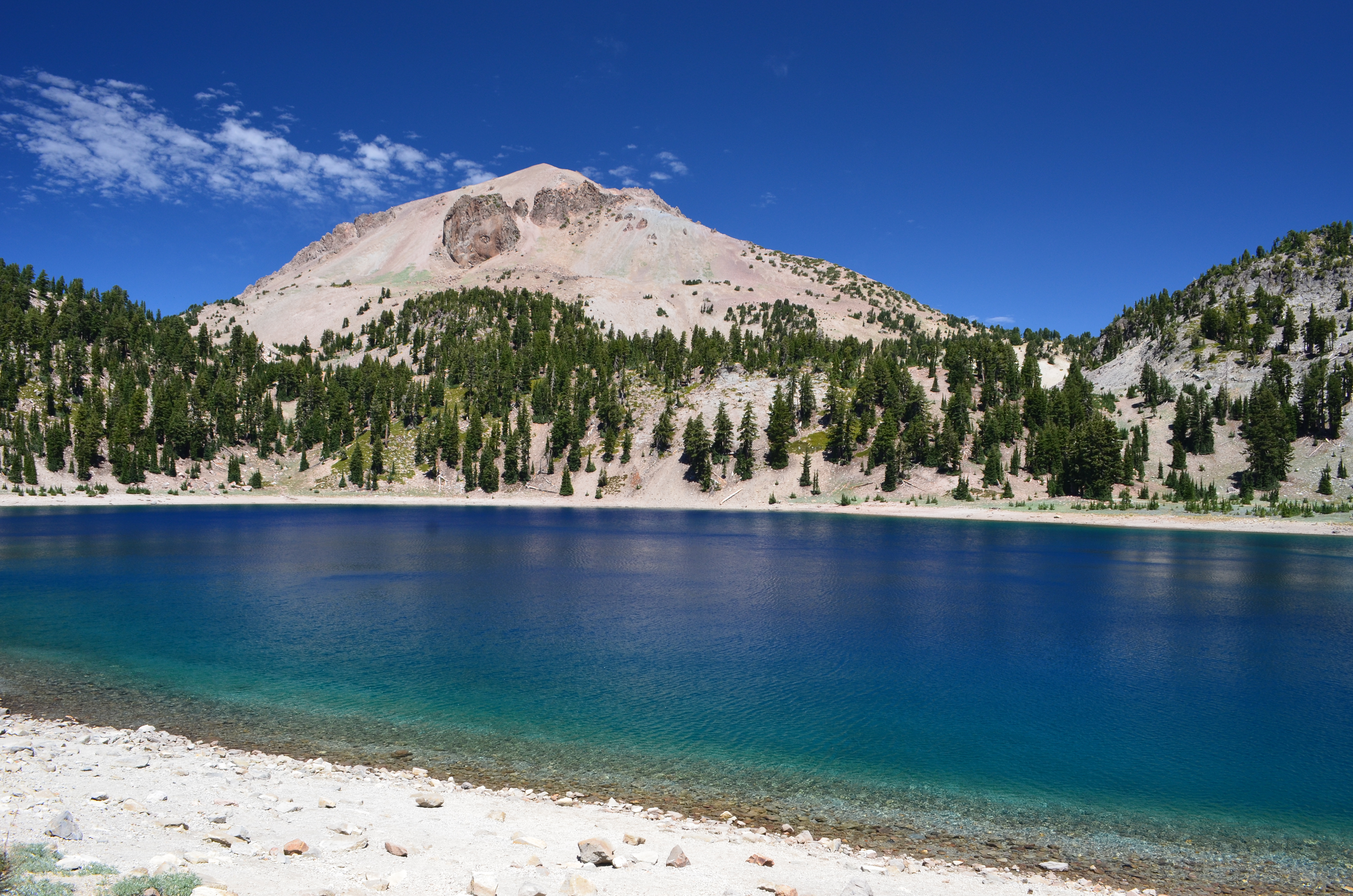
NPS via NPS.gov (Public Domain)
Campsites at Backcountry Camping in Lassen's Wilderness
5 min read
Campsite Guide
The permit is free but the entrance fee is $30 per vehicle, and you can reserve only 14 days out for 106,000 acres of wilderness.
Your plans
For more, see Campsites at Summit Lake North Campground (2026 Guide), Campsites at Summit Lake South Campground (2026 Guide), and Campsites at Warner Valley Campground (2026 Guide).
For more, see Campsites at Lost Creek Group Campground (2026 Guide) and Campsites at Southwest Campground - Winter/spring (2026 Guide).
For more, see Campsites at Butte Lake Campground (2026 Guide).
For more, see Lassen Volcanic National Park Guided Tour.
For more, see Best Month to Visit Lassen Volcanic National Park and Best of Lassen Volcanic National Park: Best Airport for (2026).
For more, see complete visitor guide, all campgrounds, hiking trails, lodging and accommodations, Campsites at Southwest Campground - Summer/fall (2026 Guide), and Campsites at Juniper Lake Campground (2026 Guide) (2026 guide).
Understanding the Permit System
The National Park Service requires a free backcountry permit for all overnight stays in Lassen's Wilderness. Permits are issued at the Kohm Yah-mah-nee Visitor Center or the Loomis Museum, and you can reserve up to 14 days in advance by phone or in person. As of 2026, no fee is charged for the permit itself, but parking in the park requires an entrance fee ($30 per vehicle, valid for seven days). Rangers will tell you that walk-up permits are often available for less popular trailheads, but summer weekends (July-August) fill fast.
What the website doesn't mention: The park caps party sizes at eight people per group and limits stays to 14 consecutive nights in the wilderness. Also, you must camp at designated sites or at least one mile from any maintained trail and 200 feet from water sources. Most first-time applicants underestimate how many nights they actually want - start with two nights to test your gear and the terrain.
How to Reserve
Call the park's backcountry office at (530) 595-4480 between 9 AM and 4 PM Pacific time. You'll need to provide:
- Group size (max 8)
- Entry date and approximate itinerary
- Trailhead you plan to start from
- Whether you're using a bear canister (required in all areas)
You cannot reserve online as of 2026. Phone or in-person only.
Choosing Your Route
Lassen's Wilderness is split into two main units: the Lassen Volcanic Wilderness (the bulk of the park) and the smaller Cinder Cone area near the northeast boundary. If you're new to backcountry camping in Lassen's Wilderness, the most accessible routes start from the Manzanita Lake or Warner Valley trailheads. The terrain varies from burned forests (the 2021 Dixie Fire left significant scars) to open volcanic slopes. Elevation gain is moderate on most trails - expect 1,000-2,000 feet per day unless you're heading up Lassen Peak itself.
Experienced visitors know that the far southeastern corner around Snag Lake offers the quietest camping. Fewer people make the long approach from Juniper Lake. The trail narrows here in places, and you'll share the path with deer and the occasional black bear. Cell service drops out at the trailhead, so download maps ahead of time.
Trailheads and Distances
- Manzanita Lake Trailhead - Gateway to the Lassen Peak and Chaos Crags area. The trail to Cinder Cone is 12 miles one way.
- Warner Valley Trailhead - Access to Boiling Springs Lake and Devil's Kitchen. About 4 miles to the first campsites.
- Juniper Lake Trailhead - The least used. A 7-mile hike to Snag Lake with steady climbing.
Most visitors underestimate how long these routes take given the elevation - the park's base elevation is around 6,000 feet, and many trails cross 7,500-foot passes. Pack extra water for this stretch. Purification tablets or a filter is mandatory; surface water sources are abundant but carry Giardia.
What to Expect on the Ground
The dominant feature of Lassen Volcanic National Park is Lassen Peak itself, a plug dome volcano rising 10,457 feet. But the backcountry is more than just the peak. You'll hike through pumice fields that crunch underfoot like coarse gravel, past sulfur vents that smell like a struck match, and across meadows that turn electric green in late June after the snowmelt. Keep an eye out for the distinctive white of obsidian chips - Lassen has several obsidian flows.
Early morning is your best bet for seeing wildlife. Mule deer feed in the meadows at sunrise, and Clark's nutcrackers pick through the pine duff. The black bears here are active from April through November; a bear canister is required, not optional. Rangers will tell you that the most common violation is leaving food in a tent overnight. They do check.
Weather Windows
The backcountry season runs roughly July through September. Snow lingers on north-facing slopes into early July. By August, daytime temperatures reach 75-80°F, but overnight lows can drop to 35°F even in summer. Thunderstorms build most afternoons above 8,000 feet - plan to be off exposed ridges by 2 PM.
Safety Considerations
Volcanic terrain has unique hazards. Unstable pumice slopes can slide underfoot. Hydrothermal areas have thin crusts that can collapse - stay on trails and heed warning signs. The park service reports that the most common backcountry injury is twisted ankles on loose rock. Trekking poles help.
Water is available from streams and lakes, but treat everything. The park's website recommends boiling for one minute or using a filter rated to 0.2 microns. Also, the sun at 8,000 feet is fierce. Sunscreen and a wide-brim hat aren't optional.
Practical Takeaways
- Get your permit early. Call the park 14 days before your trip. Walk-up permits exist but for limited capacity.
- Carry a bear canister. Hard-sided, 10-liter minimum. The park rents them at the visitor center if you don't own one.
- Pack for temperatures from 35°F to 85°F. A 20°F sleeping bag and a puffy jacket are fine for July.
- Bring a map and compass. Phone GPS dies in the backcountry. Download offline maps for redundancy.
- Check fire restrictions. During dry months, campfires are banned. A camp stove is required.
- Book a shuttle or second car. No loop trails exist in the wilderness except the Cinder Cone loop. Point-to-point routes require two vehicles or a shuttle service from a nearby outfitter.
For a broader overview of the park, see our complete visitor guide. If you're still deciding where to camp, our all campgrounds page compares frontcountry and backcountry options.
Final Thoughts
Backcountry camping in Lassen's Wilderness rewards the people who do the homework. The permit system is simple but rigid - no online reservations, no last-minute shortcuts. The terrain is volcanic and unforgiving in places, but the reward is solitude in one of the few places on Earth where you can see a plug dome, a shield volcano, a cinder cone, and a stratovolcano in a single afternoon. Plan your route, pack light, and leave the boardwalks behind.
Sources
- Official source: NPS — Lassen Volcanic National Park nps.gov/lavo/index.htm
More to Explore

Park Guide
Acadia National Park: Carriage Roads, Cadillac Mountain & 2026 Guide
Discover carriage roads, Cadillac Mountain, and rugged Maine coast. Complete 2026 guide to Acadia National Park — trails, fees, lodging, permits, and what rangers recommend.

Hiking Guide
Grand Canyon Hiking Trails: Day Hikes, Water Sources & Rim to Rim
Compare Grand Canyon hiking trails: Bright Angel, South Kaibab, Hermit, Grandview, and rim to rim, with distances, elevation, water stops, and trailhead access for each.

Best Of
Best of Glacier Bay National Park
The best of Glacier Bay is reached by boat: ranger-led day tours up the bay to the tidewater glaciers. What's worth it, how to book, and when to go (2026).

Campsite Guide
White Sands Backcountry Camping: Closed for 2026 — What to Know
As of 2026, backcountry camping at White Sands National Park is closed for site rehabilitation. What that means, and where to camp nearby instead.

Weather Guide
Guadalupe Mountains National Park Weather: Weather
Guadalupe Mountains National Park: weather guide guide updated 2026. Practical visitor information, reservations, and seasonal tips worth bookmarking before

Best Of
Best of Cuyahoga Valley National Park: Best Things to Do
Seeing a Cleveland Orchestra concert with the woods as your backdrop is a uniquely Cuyahoga Valley experience.
Sign in to join the conversation.
Sources & Attribution
Location data courtesy of the National Park Service (U.S. Department of the Interior). NPS data is public domain.
Images: NPS.
Map data © OpenStreetMap contributors.
Park operations alerts: NPS.gov · Weather and weather hazards: National Weather Service · Live conditions.
Information may change. Always verify fees, hours, and conditions directly with the official source before visiting.
Did this guide help? Share it with a friend.