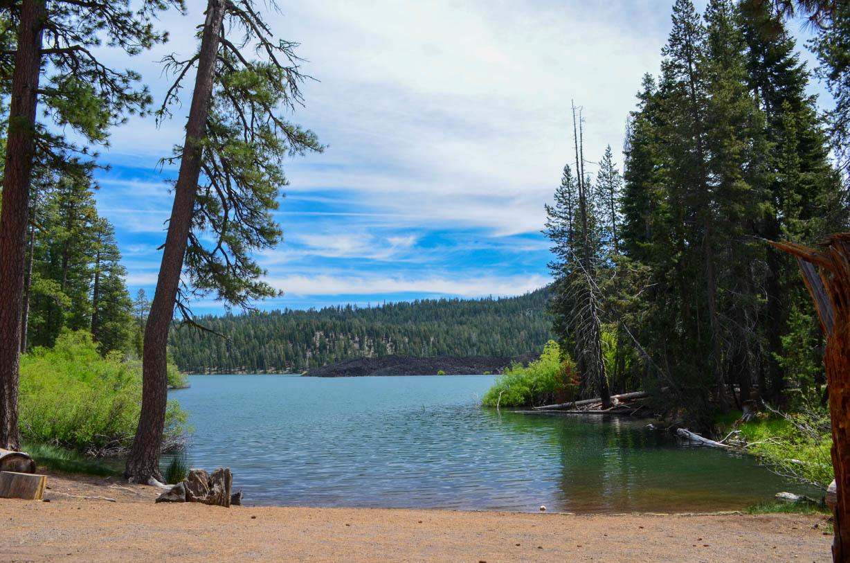
Why would anyone drive 45 minutes down a dirt road to camp with few amenities and a water supply that sometimes gets turned off? Because the trade-off at Butte Lake Campground is one of the better ones you will find in Lassen Volcanic National Park. You trade convenience for access to terrain most visitors never see - the Cinder Cone, the Painted Dunes, and a lake ringed by lava rock instead of pine forest. If you are planning a trip to the less-crowded northeast corner of the park, this is your only in-park camping option. Here is everything you need to know before you reserve a site.
NPS via NPS.gov (Public Domain)
Campsites at Butte Lake Campground (2026 Guide)
7 min read
Campsite Guide
Standard campsites run $22 per night during full-service season. When water is not available - typically early and late season - the rate drops to $15.
Your plans
For more, see Campsites at Summit Lake North Campground (2026 Guide), Campsites at Summit Lake South Campground (2026 Guide), and Campsites at Warner Valley Campground (2026 Guide).
Before booking, it is worth reading through the complete visitor guide for Lassen Volcanic - it covers the bigger picture of how this campground fits into a park-wide itinerary.
Location and Getting There
Butte Lake Campground sits in the northeast corner of Lassen Volcanic National Park, accessed exclusively via the 6-mile-long Butte Lake Road. That road is unpaved. It is graded regularly, but expect washboard sections and occasional potholes. Drive it slowly and you will be fine in a standard passenger vehicle. Drive it fast and you will spend the rest of your trip shaking dust out of everything you own.
From Highway 44, look for the park sign on the south side of the road marking the turn. The turnoff is roughly halfway between the town of Old Station and the junction with Highway 89. Once you turn, it is six miles straight to the campground.
The drive from the Northwest Entrance and Manzanita Lake Area takes about 45 minutes. That matters because the main park road (Highway 89) is under seasonal closure as of early 2026 - snow accumulation has shut it to through travel. You cannot cut across the park to reach Butte Lake from the southwest entrance. You have to come in via Highway 44 from the north.
Rangers will tell you this during peak season, and most visitors still underestimate the drive. It is not difficult. It is just longer than you think, and the dirt road adds time.
Campsite Layout and Reservations
The campground has 101 sites total. Reservations are required - no first-come, first-served walk-ups. Book through Recreation.gov, and book early. Butte Lake fills regularly during summer months, and the limited number of sites in this part of the park means availability disappears fast.
Standard Sites
Standard campsites run $22 per night during full-service season. When water is not available - typically early and late season - the rate drops to $15. That is a clear signal: check the water status before you go. The NPS does not keep the water on all season, and showing up with empty jugs expecting a working spigot is a mistake.
Group Sites and Stock Corral
Group campsites accommodate 10 to 25 people with up to six vehicles (or one bus or RV). Group rate is $62, dropping to $35 when water is off.
The stock corral is a useful feature if you are bringing horses or pack stock. It costs $37 per night and is located north of the campground via a short access road. Reservations required there too.
Seasonal Operations
The campground operates full-time from late May through early September. From September 2 through October 14, Loop B shifts to dry camping - meaning no water. The entire campground closes October 15 and does not reopen until May 29. All dates are subject to change based on weather, road conditions, and public safety. Check Recreation.gov for the most current projected dates.
Early season visitors (late May through mid-June) should expect cold nights. Freezing temperatures are common at this elevation well into June. Pack accordingly.
What You Are Actually Camping Near
The campground's main asset is not the campsites themselves. It is what you can reach from them on foot or by boat.
Cinder Cone
The hike up Cinder Cone is the signature experience of this area. It is a steep, loose climb - about 2 miles round trip, but the last stretch is pure cinder scree. You gain elevation fast, and your footing slides back about half a step for every step forward. The elevation gain is worth it. From the rim you can see the Painted Dunes below, the crater of the cone itself, and across to Lassen Peak on clear days. Early morning is your best bet for this hike. The light hits the dunes at an angle that makes the colors pop, and the heat has not yet made the climb miserable.
The trail narrows here - actually, it does not narrow so much as it disappears into loose cinder. Keep an eye out for the marker posts if dust reduces visibility.
Butte Lake
The lake itself is worth a paddle. The shoreline is lava rock, not sand, which gives the water an unusual dark clarity. Kayaks and canoes work well here. Motorboats are not the point. The lake is calm in the morning before the wind picks up.
Hiking beyond the cone
You can also pick up the Pacific Crest Trail from this area, though most campers stick to the shorter loops. The trail system connects to the broader Lassen backcountry, so longer trips are possible if you have the permits and the legs for it.

Practical Alerts and Conditions for 2026
As of early 2026, there are several active alerts that affect the Butte Lake area.
The Dixie Fire of 2021 left lasting effects across this part of the park. Some facilities and areas remain closed. In reopened areas, hazards exist - fallen trees, loose or falling rock, undefined trails, and hidden stump holes. This is not theoretical. Rangers emphasize that burn areas change fast, and what looked stable last month may not be stable today.
The roads to Juniper Lake and Warner Valley are closed for repairs. Those areas sustained significant damage outside the park boundary, and there is no estimated time for repair. If you were planning a trip that included those areas, adjust your route.
The main visitor phone line functions intermittently. If you cannot reach someone by phone, email lavo_information@nps.gov for general questions. For camping-specific inquiries, use lavo_fees@nps.gov.
Cell service drops out at the campground and along Butte Lake Road. Do not plan on making calls or using GPS navigation once you turn off Highway 44. Download maps and directions before you leave pavement.
What the Park Website Does Not Mention
The official NPS page tells you the basics. Here is what experienced visitors will tell you:
The dirt road dust gets everywhere. If you have allergies or asthma, bring a dust mask for the drive in and out. Pack extra water for this stretch - the six-mile road can feel longer when you are crawling at 15 mph behind someone who does not know where they are going.
The vault toilets are maintained but they are still vault toilets. Bring your own hand sanitizer and toilet paper as backup.
Site selection matters. Some sites are more exposed than others. If you can, look at photos on Recreation.gov before picking a specific site. Loop A tends to fill first because it is closest to the lake access.
The parking situation here is straightforward - each site has space for one or two vehicles - but RVs over 35 feet may have trouble on the access road and in some sites. Check the specific site dimensions when booking.
Practical Takeaways
- Book on Recreation.gov as early as possible. Sites sell out for summer weekends by early spring.
- Water status matters. Check if the water is on before you go. If it is off, bring everything you need. Fill jugs at Manzanita Lake or the Northwest Entrance before heading to Butte Lake Road.
- Prepare for cold. Even in July, overnight lows can dip into the 40s. In May and June, expect freezing.
- The dirt road is fine at slow speed. Allow 20-30 minutes for the six-mile drive. Do not rush it.
- Cell service is absent. Download everything. Tell someone when you expect to be back.
- Bear canisters are required for food storage in Lassen backcountry. Check current regulations on the NPS website.
- Fire restrictions may apply during dry months. Check before you build a campfire.
For a full listing of camping options across the park, including group sites and stock facilities, see the all campgrounds page.

Final Thoughts
Butte Lake Campground is not the most comfortable place to sleep in Lassen Volcanic National Park. The road is dirt, the water occasionally goes off, and you are a 45-minute drive from the nearest ranger station. But that remoteness is exactly the point. You wake up steps from a trailhead that leads to one of the most unusual volcanic landscapes in California. The Cinder Cone trail starts near the campground. The lake is a short walk from most sites. The crowds that fill the Manzanita Lake area do not make the drive out here.
If your goal is solitude, volcanic geology, and a campground that does not try to be anything more than a place to sleep between hikes, this is the right choice. Just bring dust masks, download your maps, and check the water status before you go.
For more information, see our complete Lassen Volcanic National Park Guide.
Sources
- Official source: NPS — Lassen Volcanic National Park nps.gov/lavo/index.htm
- Official source: National Park Service nps.gov/lavo/planyourvisit/butte-lake-campground.htm
Photo Gallery
More to Explore

Park Guide
Acadia National Park: Carriage Roads, Cadillac Mountain & 2026 Guide
Discover carriage roads, Cadillac Mountain, and rugged Maine coast. Complete 2026 guide to Acadia National Park — trails, fees, lodging, permits, and what rangers recommend.

Hiking Guide
Grand Canyon Hiking Trails: Day Hikes, Water Sources & Rim to Rim
Compare Grand Canyon hiking trails: Bright Angel, South Kaibab, Hermit, Grandview, and rim to rim, with distances, elevation, water stops, and trailhead access for each.

Best Of
Best of Glacier Bay National Park
The best of Glacier Bay is reached by boat: ranger-led day tours up the bay to the tidewater glaciers. What's worth it, how to book, and when to go (2026).

Campsite Guide
White Sands Backcountry Camping: Closed for 2026 — What to Know
As of 2026, backcountry camping at White Sands National Park is closed for site rehabilitation. What that means, and where to camp nearby instead.

Weather Guide
Guadalupe Mountains National Park Weather: Weather
Guadalupe Mountains National Park: weather guide guide updated 2026. Practical visitor information, reservations, and seasonal tips worth bookmarking before

Best Of
Best of Cuyahoga Valley National Park: Best Things to Do
Seeing a Cleveland Orchestra concert with the woods as your backdrop is a uniquely Cuyahoga Valley experience.
Sign in to join the conversation.
Sources & Attribution
Location data courtesy of the National Park Service (U.S. Department of the Interior). NPS data is public domain. Official NPS page.
Images: NPS; NPS; NPS.
Map data © OpenStreetMap contributors.
Park operations alerts: NPS.gov · Weather and weather hazards: National Weather Service · Live conditions.
Information may change. Always verify fees, hours, and conditions directly with the official source before visiting.
Did this guide help? Share it with a friend.