Why drive 72 miles of paved and unpaved road to camp at the base of California's tallest sand dunes, with no water, no electric, and only seven sites? That's precisely the question most first-time visitors to the eureka dunes campground (primitive) death valley national park wrestle with before committing to the trip. The answer is isolation, silence, and a landscape that feels less like Earth and more like a planet the solar system forgot.
NPS via NPS.gov (Public Domain)
Eureka Dunes Campground: 7 Primitive Sites at Death Valley
6 min read
Campsite Guide
Why drive 72 miles of paved and unpaved road to camp at the base of California's tallest sand dunes, with no water, no electric, and only seven sites?
Your plans
For more, see Campsites at Furnace Creek Campground (2026 Guide) and Campsites at Stovepipe Wells Campground (2026 Guide).
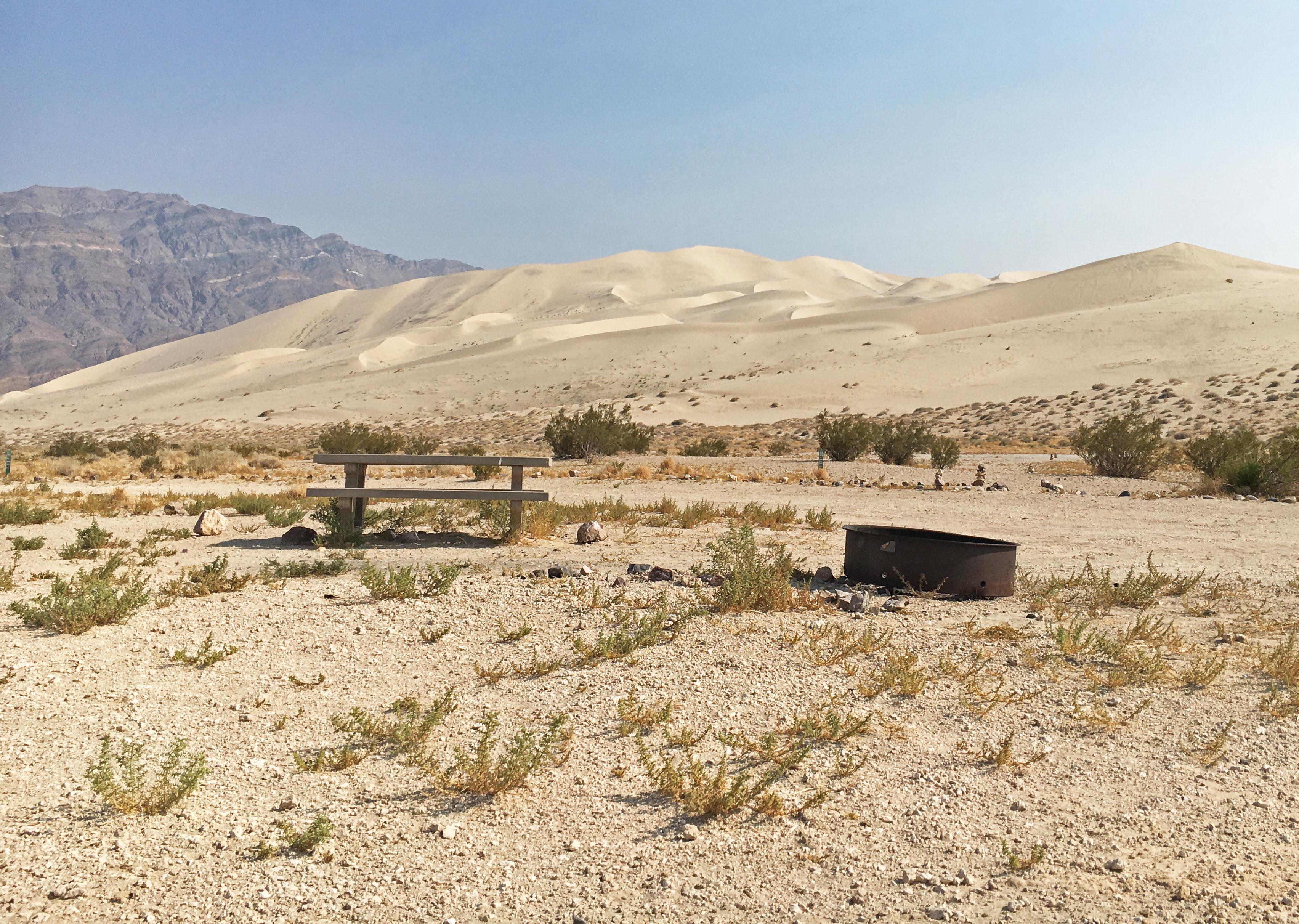
This primitive campground sits at 2,880 feet on the western edge of Eureka Valley, tucked against the foot of the Eureka Dunes - a 680-foot pile of quartz and feldspar that supports several endemic plant species found nowhere else on the planet. It's not a campground for everyone, and that's exactly the point. For those who understand the tradeoffs, it offers one of the most singular backcountry camping experiences in any national park. This guide covers everything you need to know before you point your high-clearance vehicle toward Big Pine Road.
Getting There: Remote Access That Filters Out the Casual Visitor
The drive to the eureka dunes campground (primitive) death valley national park is itself part of the experience - and a serious gatekeeper. From CA-190, you'll turn north at the junction for Scotty's Castle Road, then travel 38 miles. That's paved, though the pavement gets progressively more patched and cracked the farther north you go. At the signed turn, you'll take an unpaved road called Big Pine Road and continue for another 34 miles. The final left turn onto a short spur leads directly into the campground.
Park rangers will tell you the single most common mistake visitors make is underestimating the road conditions on Big Pine Road. The surface is graded gravel in better years and washboarded dirt in worse ones. A standard passenger car will not make it - the research data explicitly states this campground is accessible only to high-clearance vehicles. That means trucks, SUVs, and any crossover with at least 8-9 inches of ground clearance. Even then, drive slowly. The washboard sections jar loose anything not strapped down, and the fine dust penetrates everything.
Gas is a real concern. As of 2026, the pumps at Panamint Springs Resort operate only from 7 am to 9:30 pm daily. Outside those hours, your nearest 24-hour gas is at Furnace Creek or Stovepipe Wells - both well over an hour away. Fill up before you leave the main corridor of CA-190. Running out on Big Pine Road is not a quick fix. Nobody is coming. Cell service drops out somewhere around the Scotty's Castle turnoff and doesn't come back until you're well into the valley.

Camping at the Dunes: What You Actually Get (and Don't Get)
The Sites and Setup
Seven sites, first-come-first-served, no reservations accepted. That's it. There are no designated tent pads, no picnic tables, no fire rings, and certainly no hookups. You pull off the spur road onto a flat patch of compacted sand and gravel, park, and claim your spot. The sites are spaced far enough apart that you won't hear your neighbor's conversations, though the dunes do carry sound in unexpected ways.
Camping here during summer months is not recommended due to high temperatures. That's the NPS's polite way of saying June through September is genuinely dangerous. Daytime highs regularly exceed 110°F, and the sand surface can hit 150°F. Even the endemic plants go dormant. The sweet spot is October through April, with daytime temperatures ranging from 60-80°F and overnight lows dropping to the 30s. Bring a warm sleeping bag; the desert radiates heat fast after sunset.
What the Park Website Doesn't Mention
Most visitors underestimate how little shelter the dunes provide. There are no trees, no shade structures, nothing. If you're camping in a tent, you need a way to create shade for the afternoon hours when the sun is direct and brutal. A pop-up canopy or a tarp rigged between your vehicle and a sand anchor is essential. Without it, you'll be sitting inside your car with the AC running by noon.
The other surprise: how quiet it is. At night, with no wind, you can hear your own heartbeat. The absence of sound is so complete that it becomes a physical presence. Most first-time campers here lie awake for an hour just listening to nothing. It's disorienting in the best way.
Pack extra water for this stretch. There is no water at the campground. The nearest reliable source is back at Panamint Springs or Furnace Creek. Figure at least one gallon per person per day for drinking, plus another gallon for cooking and washing. If you plan to hike the dunes in the morning, add more.

The Dunes and the Fragile Ecosystem They Shelter
Eureka Dunes are the tallest sand dunes in California - roughly 680 feet from base to crest. But the real story is what lives on them. Three plant species are endemic to these dunes: the Eureka Dunes evening primrose, the Eureka Dunes buckwheat, and the Eureka Dunes grass. You'll see them scattered across the lower slopes, small and tenacious, holding on in a world of shifting sand.
The NPS emphasizes that these dunes are fragile. The thin biological soil crust - a living layer of cyanobacteria, lichens, and mosses - takes decades to recover from footprint damage. Rangers will tell you to stay on established roads and avoid driving on the dunes entirely. Foot traffic is fine on the main dune face, but stick to ridgelines where the sand is most compacted. Avoid the softer slopes where the endemic plants grow.
Early morning is your best bet for dune hiking. The sand is still cool, the light is golden, and the wind hasn't picked up yet. From the crest, you can see the entire Eureka Valley spread out below - the dry lake bed to the north, the Last Chance Range to the east, and the White Mountains faint on the western horizon. The view alone is worth the 34 miles of washboard road.

Practical Takeaways
- Vehicle requirements: High-clearance vehicle mandatory. Do not attempt in a sedan or low-clearance car. You will get stuck or damage the undercarriage.
- Fuel planning: Fill up at Panamint Springs (7 am-9:30 pm) before heading north. Furnace Creek and Stovepipe Wells have 24-hour pumps if you miss the window.
- Water: Bring every drop you'll need - at least one gallon per person per day, plus extra for emergencies.
- Campfires: Firewood is not available locally. Check current fire restrictions before you go. In dry conditions, campfires may be prohibited entirely.
- Reservations: None. First-come, first-served. On holiday weekends, the seven sites can fill by mid-afternoon. Arrive early.
- Fees: No camping fee beyond the standard park entrance pass. An America the Beautiful pass covers your entry. If you don't have one, the per-vehicle fee applies.
- Seasons: October through April are ideal. Summer is not recommended.
- What to bring: Shade structure, warm sleeping bag (overnight lows in the 30s), high-clearance jack or recovery boards, detailed map or GPS with offline topo (no phone signal), and a good headlamp.
For a broader look at the entire Death Valley camping experience, see the complete visitor guide. If you are comparing backcountry options, the all campgrounds page lists every primitive and developed site in the park.
Final Thoughts
The eureka dunes campground (primitive) death valley national park is not a destination you stumble into. It requires deliberate effort, careful planning, and a vehicle that can handle rough roads. The payoff is a night under a sky so clear that the Milky Way casts shadows, and a morning hike up a dune system that feels older and more elemental than almost anything you'll find in the lower 48.
Most visitors to Death Valley never make it this far north. The ones who do remember the silence long after the dust washes off the car. That's the real reason to come.
Sources
- Official source: NPS — Death Valley National Park nps.gov/deva/index.htm
- Official source: National Park Service nps.gov/deva/planyourvisit/eureka-dunes-campground-primitive.htm
Photo Gallery
More to Explore

Park Guide
Acadia National Park: Carriage Roads, Cadillac Mountain & 2026 Guide
Discover carriage roads, Cadillac Mountain, and rugged Maine coast. Complete 2026 guide to Acadia National Park — trails, fees, lodging, permits, and what rangers recommend.

Hiking Guide
Grand Canyon Hiking Trails: Day Hikes, Water Sources & Rim to Rim
Compare Grand Canyon hiking trails: Bright Angel, South Kaibab, Hermit, Grandview, and rim to rim, with distances, elevation, water stops, and trailhead access for each.

Best Of
Best of Glacier Bay National Park
The best of Glacier Bay is reached by boat: ranger-led day tours up the bay to the tidewater glaciers. What's worth it, how to book, and when to go (2026).

Campsite Guide
White Sands Backcountry Camping: Closed for 2026 — What to Know
As of 2026, backcountry camping at White Sands National Park is closed for site rehabilitation. What that means, and where to camp nearby instead.

Weather Guide
Guadalupe Mountains National Park Weather: Weather
Guadalupe Mountains National Park: weather guide guide updated 2026. Practical visitor information, reservations, and seasonal tips worth bookmarking before

Best Of
Best of Cuyahoga Valley National Park: Best Things to Do
Seeing a Cleveland Orchestra concert with the woods as your backdrop is a uniquely Cuyahoga Valley experience.
Sign in to join the conversation.
Sources & Attribution
Location data courtesy of the National Park Service (U.S. Department of the Interior). NPS data is public domain. Official NPS page.
Images: NPS; NPS; NPS; NPS.
Park operations alerts: NPS.gov · Weather and weather hazards: National Weather Service · Live conditions.
Information may change. Always verify fees, hours, and conditions directly with the official source before visiting.
Did this guide help? Share it with a friend.