Hiking in Death Valley National Park isn't about summit victories. It's about learning to read a landscape that works on its own terms. You'll find little vertical challenge here, but you'll face complete exposure across vast distances. Your real obstacles are the sun, the aridity, and the overwhelming scale of the terrain. Newcomers consistently misjudge two critical factors: how rapidly the sun depletes your water supply, and how a mile across the salt flats can feel like five in the midday heat. This environment doesn't tolerate improvisation—it demands methodical preparation.
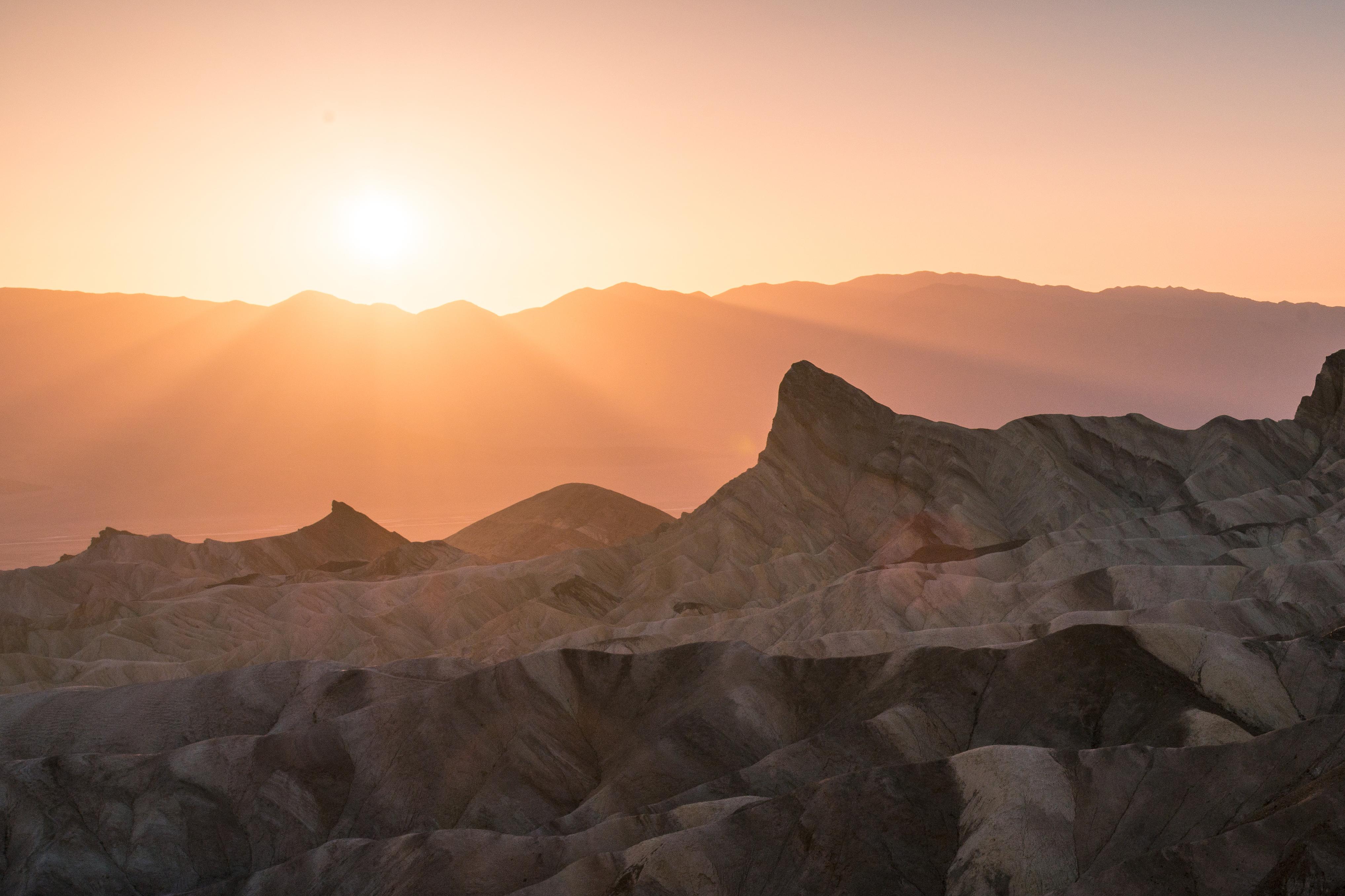
NPS via NPS.gov (Public Domain)
Death Valley National Park Hiking
11 min read
Hiking Guide
Death Valley hiking trades elevation for vast exposure. Learn the precise skills for sun, salt flats, and routes with zero shade in our 2026 guide.
This article contains affiliate links — we may earn a small commission at no extra cost to you.
What Hiking Here Actually Means
Here, hiking exchanges tree cover for boundless sky. You'll follow routes across alluvial fans, through tight canyons, or over salt pans, with minimal shade. The essential skills aren't about tricky footwork—they're about readiness for the environment and sound navigation. Train for heat endurance and stamina, not for elevation gain.
The common mistake - and almost everyone makes it - is planning hikes based on mileage alone. A three-mile loop at Badwater Basin in October is a pleasant stroll. That same distance in May can be a dangerous undertaking. Rangers will tell you that your pace slows by at least a third once temperatures climb above 90°F. You're not just carrying water; you're carrying your margin of safety. Cell service drops out at most trailheads, and the horizon line can play tricks on your sense of distance. Successful hiking here is a lesson in humility and specific, careful planning.
Badwater Basin Salt Flats: The Walk to Nowhere
Distance: 2 miles round trip to the salt polygon area (out and back). You can walk as far as you like.
Elevation Gain: Essentially flat. You start at -282 feet.
Trailhead & Parking: The Badwater Basin parking lot is a large pullout on Badwater Road. It fills by mid-morning from October through April. Overflow parking stretches along the road shoulder. The lot has pit toilets but no water. This is the busiest destination in the park, so expect company.
The Trail: There is no constructed trail. You walk directly onto the hard, cracked salt pan. A boardwalk leads from the parking lot to the basin edge. From there, you follow a line of posts marking the way toward the center. The surface is firm but uneven - ankle-turning cracks are everywhere. The farther you go, the more the geometric salt polygons dominate the landscape, and the crowds thin out. The trail narrows here to a single-file path in places where the salt has heaved up.
The Moment: The point where the parking lot shrinks to a tiny speck and you're surrounded by a silent, white, geometric plain that stretches to the mountains. The only sound is the crunch of salt under your boots.
What Most Underestimate: The reflective power of the white salt. Sunscreen is mandatory, even in winter. Sunglasses are a genuine necessity to prevent snow-blindness-like glare. And while it's flat, the surface is mentally monotonous and physically jarring on joints.
Best Time: Early morning or late afternoon, not for temperature but for light. The low sun casts long shadows that define the salt polygons. Midday light flattens everything. Avoid summer entirely.

Golden Canyon to Gower Gulch Loop: A Geology Primer
Distance: 4.3 miles for the full loop.
Elevation Gain: About 600 feet.
Trailhead & Parking: The Golden Canyon trailhead is a paved lot off Badwater Road. It's smaller than Badwater's and fills quickly. If full, you can park carefully along the road shoulder. No facilities here.
The Trail: This is the park's most popular canyon hike for good reason. You start in a wide, gravelly wash that quickly narrows into Golden Canyon's sculpted gold and red walls. The trail is a mix of soft sand and packed dirt. After about 1.5 miles, you'll climb out of the canyon via a series of tight switchbacks (the "Red Cathedral" side trail is worth the extra few minutes). The route then traverses open badlands before descending sharply into the narrow, sinuous Gower Gulch, a slot-like canyon that spits you back out onto the alluvial fan near the start.
The Moment: Emerging from the dark, narrow confines of Gower Gulch back into the wide-open valley. The visual shock highlights the contrast that defines this landscape.
What Most Underestimate: The descent into Gower Gulch is steep and loose. Trekking poles are useful. The entire loop has zero shade and can become an oven. Most visitors underestimate their water needs for this "moderate" hike.
Best Time: First light. You want to be climbing out of Golden Canyon before the sun hits the walls directly. By 10 AM, the canyon can feel like a convection oven.
Zabriskie Point to Gower Gulch (One-Way): The Badlands Traverse
Distance: 4 miles one-way. Requires a car shuttle or a 2-mile road walk along Badwater Road to complete the loop.
Elevation Gain: Net downhill (about 500 feet loss), but with several sharp climbs in the middle.
Trailhead & Parking: Start at the Zabriskie Point overlook parking. This lot is perpetually crowded with sunrise viewers. To do this as a hike, you need to arrive either very early or later in the morning after the photographers have left. The endpoint is the Golden Canyon trailhead.
The Trail: From Zabriskie, you descend directly into the heart of the badlands on a well-defined path. The trail winds through eroded hills of muted yellow, brown, and gold. It's a constant series of small dips and climbs over ridges. The route is exposed, confusing in places, and marked by small rock cairns. Pay close attention. It eventually drops into Manly Beacon's shadow and connects to the Golden Canyon trail network above Gower Gulch.
The Moment: Looking back at Zabriskie Point from deep within the badlands. The overlook, now a tiny speck on the ridge, gives you a true sense of the scale you've entered.
What Most Underestimate: The navigation. This isn't a sidewalk. Cairns can be spaced far apart, and the maze of washes looks similar. It's easy to take a wrong turn if you're not watching closely. Carry a map.
Best Time: Late afternoon. The light on the badlands is exceptional, and you'll be hiking opposite the crowds coming from Golden Canyon.

Desolation Canyon: Off-The-Radar Slot
Distance: 3.6 miles round trip.
Elevation Gain: About 600 feet.
Trailhead & Parking: An unmarked pullout on Badwater Road, about 3.5 miles south of the Furnace Creek Inn. Look for a few cars parked off the pavement. No signs, no facilities.
The Trail: You walk up a wide, gravelly wash for about a mile before the canyon walls begin to narrow. The route is entirely in the wash, requiring some easy scrambling over small dry falls and boulders. There's no single path - you pick your way upstream. The canyon deepens, with tight sections and high, smooth walls. It ends at a 20-foot dry fall that requires technical gear to pass.
The Moment: The first time the walls close in enough that you have to turn sideways. The temperature drops noticeably, and the outside world vanishes.
What Most Underestimate: The scramble. This is a hands-on hike. The rock is rough and can be sharp. Gloves are recommended. Flash flood danger is real here; check the weather forecast absolutely.
Best Time: Midday, oddly. The high walls provide shade for much of the canyon floor, making it a rare refuge from the sun.
Mosaic Canyon: Smooth Marble Slots
Distance: 4 miles round trip to the dry fall.
Elevation Gain: About 1,000 feet.
Trailhead & Parking: A paved lot at the end of a 2.5-mile graded gravel road off Highway 190 near Stovepipe Wells. The road is washboard but passable for all vehicles. The lot is medium-sized.
The Trail: The initial section is the highlight: a narrow, polished marble slot canyon so smooth it feels manufactured. You'll squeeze through tight passages and run your hands over the walls. Beyond the first half-mile, the canyon opens up into a wider, gravelly wash with high walls. The trail continues upstream, requiring more boulder-hopping, until it ends at a large dry fall.
The Moment: The first hundred yards inside the marble narrows. The contrast between the rough alluvial fan outside and this slick, cool, enclosed world is immediate and dramatic.
What Most Underestimate: The polish on the marble is slippery when sandy. Footwear with good grip is essential. The canyon can also get surprisingly crowded, as it's a primary stop for Stovepipe Wells visitors.
Best Time: Morning. The sun reaches the canyon floor later, keeping it cooler for the initial, best section.

Telescope Peak Trail: The Mountain Exception
Distance: 14 miles round trip.
Elevation Gain: 3,000 feet.
Trailhead & Parking: Mahogany Flat Campground at the end of Wildrose Canyon Road. The road is steep, narrow, and dirt. High-clearance is recommended; not suitable for RVs or trailers. The small campground has limited parking for hikers.
The Trail: This is a real mountain trail, a stark contrast to valley hikes. It starts in pinyon-juniper forest and climbs through bristlecone pine stands to the barren, wind-scoured summit ridge. The trail is rocky, sustained, and exposed near the top. The final approach follows a narrow spine with drops on both sides.
The Moment: Standing on the summit at 11,043 feet and looking down at Badwater Basin, 11,000 feet vertically below. It's the greatest vertical relief in the contiguous United States, and you can see it all.
What Most Underestimate: The altitude and weather. The trailhead is at 8,200 feet. Snow can linger into June. Summer afternoons bring thunderstorms. This is a spring or fall hike that requires checking conditions with the Furnace Creek Visitor Center first.
Best Time: June or October, aiming to summit by noon to avoid afternoon storms. Winter requires mountaineering gear and experience.
Seasonal Trail Conditions
Your Death Valley hiking plan lives or dies by the season. The park's elevation range - from below sea level to over 11,000 feet - means conditions vary wildly by location and month.
December - February: This is prime time for valley floor hikes (Badwater, Golden Canyon). Daytime temps are 60s-70s°F, nights drop below freezing. Snow closes the Telescope Peak trail and Wildrose Road. Canyon hikes are pleasant, but daylight hours are short. Start early.
March - May: The most popular hiking window. Wildflowers, if winter rains were adequate, peak in lower elevations in March and higher elevations in April-May. Crowds are significant. By May, valley temperatures are hitting the 90s and 100s, ending safe hiking there by late morning.
June - September: Hiking on the valley floor is not just discouraged; it's dangerous. Focus shifts to the higher elevations: Telescope Peak (in June before thunderstorms), Wildrose Peak, and the charcoal kilns. Even at 8,000 feet, afternoon temps can be warm. This is the season for very early, very short walks at places like Mesquite Flat Dunes at sunrise.
October - November: Autumn is a second prime season. Valley temperatures become manageable again by late October. Crowds are thinner than spring. It's the best time for longer, more strenuous valley hikes and for summiting Telescope Peak before early snows.

Trailhead Logistics
Parking strategy defines your day here. The lots at Badwater, Golden Canyon, and Zabriskie Point fill by 9 AM from fall through spring. Your options are to arrive before 8 AM or plan for late afternoon starts. Overflow parking is usually along road shoulders - park completely off the pavement. Rangers patrol and ticket vehicles blocking traffic.
There are no park shuttles. You are responsible for your own transportation and car shuttles for point-to-point hikes like Zabriskie to Golden Canyon.
Cell service is non-existent at trailheads and on trails. The only reliable service is near the Furnace Creek Ranch and Inn area. Do not rely on your phone for navigation or emergency communication. Carry a physical map and a satellite communicator if you have one.
There are no natural water sources on any trail in Death Valley. Every drop you need must be carried in. The only potable water fill stations are at the Furnace Creek Visitor Center, Stovepipe Wells Village, and the campgrounds. Fill all containers before heading to a trailhead.
For current trail conditions, particularly for Telescope Peak or after rain events, stop at the Furnace Creek Visitor Center. They post daily updates on road and trail status.
What to Carry
Forget the generic list. For Death Valley hiking, your pack has specific, non-negotiable additions.
Water: The rule is one gallon per person, per day, for mere survival. For hiking, add another half-gallon per person for every 2-3 hours of planned activity. For a 4-hour morning hike in spring, that's at least 3 liters per person. Carry it in multiple containers (bladder plus bottles) in case one fails. Electrolyte tablets or mix are a good idea.
Footwear: Trail runners or hiking shoes are fine for most trails. The terrain is mostly sand, gravel, and rock. Avoid heavy boots - they'll overheat your feet. The key feature is a grippy sole for slippery canyon rock and marble.
Sun Protection: This means a wide-brimmed hat, not a baseball cap. Sunglasses with UV protection. A lightweight, long-sleeved sun shirt (UPF rated) is better than sunscreen alone. Still, use mineral-based sunscreen on exposed skin and reapply often. The salt and sand reflect UV rays from below.
Navigation: A GPS device with pre-loaded maps or a detailed printed map and compass. The official National Geographic Death Valley trail map is excellent. Many "trails" are unmarked routes.
The Extras: Lip balm with SPF. A lightweight emergency bivy or space blanket. A headlamp, even for day hikes - canyons get dark fast if you're delayed. A bandana to wet and drape over your neck. Trekking poles for the badlands and canyon descents.
Practical Takeaways
- Mileage is a liar. Plan hikes by temperature and sun exposure, not distance. A 2-mile hike after 10 AM in May can be more taxing than a 6-mile hike at dawn in November.
- Your car is a support vehicle. Leave extra water, electrolytes, and snacks in a cooler. Your post-hike self will thank you.
- The best light for photography and tolerable temperatures are the same window: sunrise to 10 AM, and 4 PM to sunset. Plan around the harsh midday.
- Canyon hikes have flash flood risk. If there's rain in the forecast anywhere in the surrounding mountains, do not enter. Check at the visitor center.
- Footwear grip matters more than ankle support. The polished rock in Mosaic and Desolation Canyons is slicker than it looks.
- The "easy" hikes are the most deceptive. Badwater Basin's salt flats reflect heat and UV radiation. More people get sunburned and dehydrated there than on any mountain trail.
- For a complete visitor guide covering logistics beyond trails, including the complete visitor guide.
- If you're considering overnight stays, research your camping options well in advance - sites book up months ahead for the prime seasons.
- To understand the dramatic shifts in climate that dictate when you can hike what, our guide on the best time to visit breaks it down by month and elevation.
- Gas is available 24 hours at Furnace Creek and Stovepipe Wells, but as of 2026, Panamint Springs pumps close at 9:30 PM. Plan your fuel stops accordingly.
Recommended Gear
What experienced visitors bring to Death Valley National Park Hiking
Links may earn us a commission at no extra cost to you. We only recommend gear we believe in.
Hiking Essentials
Hydration Pack (3L)
Hands-free water for long trail days
Trekking Poles (Pair)
Save your knees on steep descents
Hiking Boots (Ankle Support)
Sturdy footwear for rocky, uneven trails
Sun & Heat Protection
Wide-Brim Sun Hat
Full coverage UPF 50+ protection at altitude
Insulated Water Bottle (32oz)
Keeps water cold in desert heat all day
Electrolyte Mix Packets
Replace what water alone cannot during intense heat
Winter Gear
Microspikes / Traction Devices
Essential for icy rim trails in winter months
Packable Down Jacket
Lightweight warmth that stuffs into a pocket
Sources
- Official source: NPS — Death Valley National Park nps.gov/deva/index.htm
Photo Gallery
More to Explore

Park Guide
Acadia National Park: Carriage Roads, Cadillac Mountain & 2026 Guide
Discover carriage roads, Cadillac Mountain, and rugged Maine coast. Complete 2026 guide to Acadia National Park — trails, fees, lodging, permits, and what rangers recommend.

Hiking Guide
Grand Canyon Hiking Trails: Day Hikes, Water Sources & Rim to Rim
Compare Grand Canyon hiking trails: Bright Angel, South Kaibab, Hermit, Grandview, and rim to rim, with distances, elevation, water stops, and trailhead access for each.

Best Of
Best of Glacier Bay National Park
The best of Glacier Bay is reached by boat: ranger-led day tours up the bay to the tidewater glaciers. What's worth it, how to book, and when to go (2026).

Campsite Guide
White Sands Backcountry Camping: Closed for 2026 — What to Know
As of 2026, backcountry camping at White Sands National Park is closed for site rehabilitation. What that means, and where to camp nearby instead.

Weather Guide
Guadalupe Mountains National Park Weather: Weather
Guadalupe Mountains National Park: weather guide guide updated 2026. Practical visitor information, reservations, and seasonal tips worth bookmarking before

Best Of
Best of Cuyahoga Valley National Park: Best Things to Do
Seeing a Cleveland Orchestra concert with the woods as your backdrop is a uniquely Cuyahoga Valley experience.
Sign in to join the conversation.
Sources & Attribution
Location data courtesy of the National Park Service (U.S. Department of the Interior). NPS data is public domain. Official NPS page.
Images: NPS; NPS; NPS; NPS; NPS.
Map data © OpenStreetMap contributors.
Park operations alerts: NPS.gov · Weather and weather hazards: National Weather Service · Live conditions.
Information may change. Always verify fees, hours, and conditions directly with the official source before visiting.
Did this guide help? Share it with a friend.