Wildrose Campground operates on a simple proposition: no reservations, no fees, and no water. That trade-off buys you a spot in the Panamint Mountains at 4,100 feet, where summer temperatures run 20-30°F cooler than the Death Valley floor below. As of 2026, this remains the only completely free developed campground in the park. First-time visitors often arrive unprepared for the lack of water or the wind, both of which define a stay here. This guide covers exactly what you need to know before pulling in.
NPS via NPS.gov (Public Domain)
Campsites at Wildrose Campground (2026 Guide)
6 min read
Campsite Guide
Reaching Wildrose requires a deliberate detour off CA 190. Turn south onto Emigrant Canyon Road about halfway between Stovepipe Wells and Panamint Springs.
Your plans
For more, see complete visitor guide, all campgrounds, hiking trails, lodging and accommodations, Campsites at Mesquite Spring Campground (2026 Guide), Campsites at Texas Springs Campground (2026 Guide), and Homestake Campground (primitive) at Homestake Campground.
For a full overview of Death Valley camping, see our complete visitor guide.
Why Stay at a Free Campground with No Water?
The short answer: elevation and solitude. Wildrose sits high enough that summer nights are tolerable, and the throngs that fill Furnace Creek and Stovepipe Wells rarely make the 12-mile drive up Emigrant Canyon Road. You trade convenience for quiet.
What You Get for Free
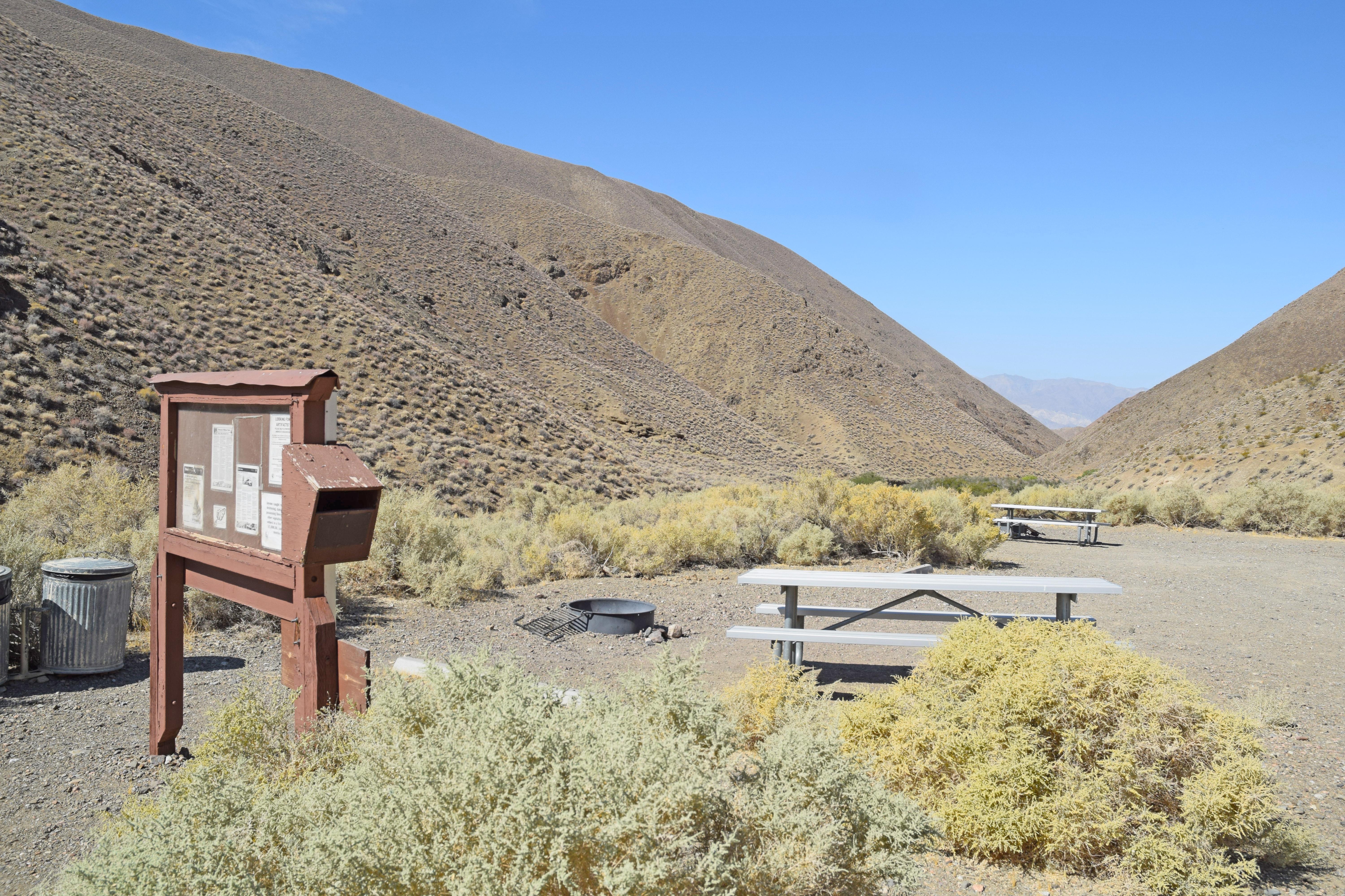
- 23 sites - dirt and gravel pads surrounded by mesquite bushes and rolling hills. Sites are spacious but unmarked; you pick one as you enter.
- Vault toilets - basic, no flush, but typically cleaner than the ones near the valley floor because usage is lower.
- No hook-ups - zero amenities. No electric, no sewer, no dump station. This is dry camping at its most fundamental.
- Generators allowed - between 7 AM and 7 PM. The campground is open and exposed, so generator noise carries. If you want quiet, you'll likely be annoyed. If you need power for a CPAP or to charge devices, you can run it during allowed hours.
Rangers will tell you that the biggest shock for first-timers is the wind. Wildrose is perched in a saddle between the Panamint Range and the valley. Afternoon winds regularly gust over 30 mph, and tents can collapse if not staked properly. Most visitors underestimate how much wind can drain the fun out of a campout.
Water: The Critical Detail
There is no water available at Wildrose. Not at the campground, not at the ranger station, not anywhere nearby. The closest potable water is roughly 31 miles north at Stovepipe Wells Village. That's 62 miles round trip. Fill every container you have before you leave the valley floor.
From this overlook you can see the absurdity of running out: you'd be driving an hour just to fill a jug. Pack extra water for this stretch - plan on a gallon per person per day for drinking and cooking, plus extra for washing.
The Driving Approach: What to Expect
Reaching Wildrose requires a deliberate detour off CA 190. Turn south onto Emigrant Canyon Road about halfway between Stovepipe Wells and Panamint Springs. The road climbs steadily, gaining over 2,000 feet in 12 miles. It's paved but narrow in sections, with no guardrails on some curves. RVs and trailers can manage it, but check conditions before heading up - flash floods can wash out portions in summer.
Gas Alert
Gas pumps at Panamint Springs Resort are closed overnight. Fuel is available there from 7 AM to 9:30 PM daily. If you're arriving after dark, fill up at Furnace Creek or Stovepipe Wells, both of which offer 24-hour credit-card pumps. Nothing ruins a Wildrose trip faster than running low on gas 3,000 feet above the nearest station.

When to Go and What to Pack
Seasonality
Open year-round, first-come first-served. The best months are October through April. Summer (June-August) sees highs near 90°F at 4,100 feet, but the valley floor cooks at 120°F - Wildrose becomes a heat refuge. November through February nights drop below freezing; a 20°F-rated sleeping bag is wise.
Packing Essentials
- Water - no less than 1 gallon per person per day.
- Wind shelter - a tarp or windbreak for your cooking area. Tents should be four-season or heavily staked.
- Food - no services within 30 miles. Bring everything, including cooking fuel (no wood collection allowed in the campground - firewood is not provided, and gathering is prohibited).
- Sun protection - even in winter, the thin, clear air means strong UV. Hat, sunglasses, SPF 50.
- Headlamp - the vault toilets are dark after sunset.
The parking situation here is straightforward - pull into any open site. No overflow lot, no registration board. Just find an empty spot and claim it.
What the Park Website Doesn't Mention
The official site lists basic facts but omits a few critical things:
- Wind is relentless - not occasional, not seasonal. Afternoon wind is the norm in spring and fall. If you're a hammock camper, you might not find two trees close enough, and what trees exist are low and wind-stunted.
- Cell service drops out about halfway up Emigrant Canyon Road. Wildrose itself has zero signal for most carriers. Download maps and directions before you leave pavement.
- The Wildrose Charcoal Kilns are a 2-mile drive up the road - these 10 beehive-shaped stone kilns from the 1870s are worth a short walk. Most visitors don't realize they're just around the corner from the campground.
- High winds can close Emigrant Canyon Road temporarily. Park alerts rarely mention it until it happens. If a big storm is forecast, consider staying on the valley floor.

Nearby Attractions and Day Hikes
Wildrose Peak Trail
From the charcoal kilns, the Wildrose Peak Trail climbs 4.2 miles one way to an 8,764-foot summit. Elevation gain is 2,100 feet. The trail narrows here near the top, with drop-offs that demand sure footing. Views from the summit are the best in the northern Panamints - you can see the entire Death Valley floor, the Sierras, and on clear days, Mount Whitney.
Aguereberry Point
A 3-mile dirt road leads to a 6,433-foot overlook that rivals Dante's View but sees maybe 5% of the traffic. The road is rough but passable for passenger cars if driven slowly. Early morning is your best bet for clear air - haze builds by midday.
Mahogany Flat and Telescope Peak
Mahogany Flat is a primitive camping area beyond Wildrose (check road conditions; the last 5 miles are unpaved and often washboarded). From there, the Telescope Peak Trail (7 miles one way, 3,000 feet gain) gains the highest point in the park at 11,049 feet. Snow often lingers into June. Rangers will tell you this is a full-day commitment - start at dawn.
Comparing Wildrose to Other Death Valley Campgrounds
For a wider view of your options, see our all campgrounds page.
| Campground | Fee | Water | Reservations | Elevation | Best For |
|---|---|---|---|---|---|
| Wildrose | $0 | No | No | 4,100 ft | Budget, quiet, cool summer nights |
| Furnace Creek | $22-$42 | Yes | Yes (Nov-Apr) | -190 ft | Center of park, services |
| Stovepipe Wells | $22 | Yes | No | 10 ft | Convenience, near dunes |
| Mesquite Spring | $22 | Yes | Yes (Nov-Apr) | 1,800 ft | Less crowded, Scotty's Castle access |
Wildrose is the outlier - free, dry, high. It suits self-sufficient campers who value space and silence over flush toilets and ice cream.

Practical Takeaways
- Bring all your water - at least one gallon per person per day. Nearest source 31 miles north.
- Arrive by noon in peak season (spring and fall) to secure a site. The campground rarely fills completely, but the best wind-sheltered spots go first.
- Stake everything down - loose objects will blow away. Secure your tent with heavy stakes or rock anchors. A windbreak tarp is worth its weight.
- Gas up before driving up - Panamint Springs pumps close at 9:30 PM; Furnace Creek and Stovepipe Wells are 24-hour credit-card pumps.
- Download offline maps - cell signal dies on the approach. No data means no navigation without a downloaded app or paper map.
- Check road conditions - Emigrant Canyon Road can be rough after storms. Call 760-786-3200 for current status.
Final Thoughts
Wildrose Campground isn't for everyone. If you need showers, power, or a guaranteed spot, look elsewhere. But if you can pack in your own water, cook on your own stove, and sit with the wind while the stars come out at 4,100 feet, this is one of the most underused campsites in the Death Valley system. The free price tag is a bonus - the quiet is the real draw.
Sources
- Official source: NPS — Death Valley National Park nps.gov/deva/index.htm
- Official source: National Park Service nps.gov/deva/planyourvisit/wildrose-campground.htm
Photo Gallery
More to Explore

Park Guide
Acadia National Park: Carriage Roads, Cadillac Mountain & 2026 Guide
Discover carriage roads, Cadillac Mountain, and rugged Maine coast. Complete 2026 guide to Acadia National Park — trails, fees, lodging, permits, and what rangers recommend.

Hiking Guide
Grand Canyon Hiking Trails: Day Hikes, Water Sources & Rim to Rim
Compare Grand Canyon hiking trails: Bright Angel, South Kaibab, Hermit, Grandview, and rim to rim, with distances, elevation, water stops, and trailhead access for each.

Best Of
Best of Glacier Bay National Park
The best of Glacier Bay is reached by boat: ranger-led day tours up the bay to the tidewater glaciers. What's worth it, how to book, and when to go (2026).

Campsite Guide
White Sands Backcountry Camping: Closed for 2026 — What to Know
As of 2026, backcountry camping at White Sands National Park is closed for site rehabilitation. What that means, and where to camp nearby instead.

Weather Guide
Guadalupe Mountains National Park Weather: Weather
Guadalupe Mountains National Park: weather guide guide updated 2026. Practical visitor information, reservations, and seasonal tips worth bookmarking before

Best Of
Best of Cuyahoga Valley National Park: Best Things to Do
Seeing a Cleveland Orchestra concert with the woods as your backdrop is a uniquely Cuyahoga Valley experience.
Sign in to join the conversation.
Sources & Attribution
Location data courtesy of the National Park Service (U.S. Department of the Interior). NPS data is public domain. Official NPS page.
Images: NPS; NPS; NPS; NPS; NPS.
Map data © OpenStreetMap contributors.
Park operations alerts: NPS.gov · Weather and weather hazards: National Weather Service · Live conditions.
Information may change. Always verify fees, hours, and conditions directly with the official source before visiting.
Did this guide help? Share it with a friend.