The St. Joseph River behaves like two fisheries sharing one main stem: lower water below Niles takes on Big Lake runs, while the middle reaches above Berrien Springs fish warmer and slower. Fall-window median discharge at Niles sits near 3,520 cfs, inside a wide reliable band between about 2,430 and 5,170 cfs. September monthly median drops near 1,975 cfs while April climbs toward 5,840 cfs — the bite follows those swings. Check USGS gauge 04101500 and the MDNR fishing regulations before you pick a put-in.
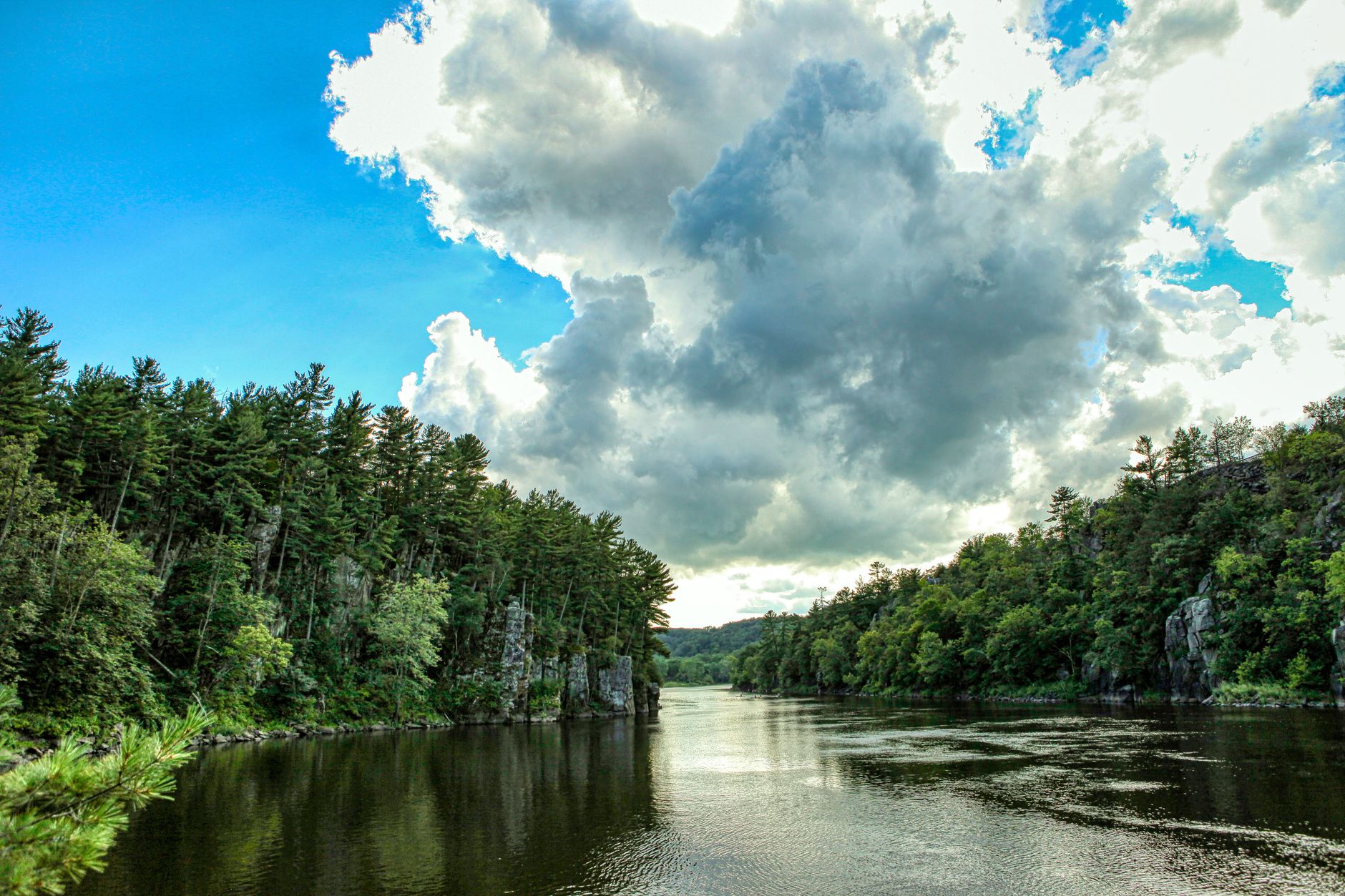
Photo by Mick Haupt on Pexels
St. Joseph River Fishing: Niles Gauge & Berrien Reaches
7 min read
Waterbody Guide
St. Joseph River: lower water below Niles takes on Big Lake runs while Berrien reaches fish warmer, with fall median discharge near 3,520 cfs at Niles.
Your plans
Flow reliability
Seasonal consistency of median discharge from the curated USGS gauge for this place.
Spring
78%
year-to-year consistency
Summer
79%
year-to-year consistency
Fall
65%
year-to-year consistency
Winter
74%
year-to-year consistency
Median monthly discharge (cfs)
| Jan | Feb | Mar | Apr | May | Jun | Jul | Aug | Sep | Oct | Nov | Dec |
|---|---|---|---|---|---|---|---|---|---|---|---|
| 3560 | 4185 | 5460 | 5840 | 4875 | 3740 | 3185 | 2500 | 1960 | 2505 | 2975 | 3120 |
In the last 10 falls, roughly 2 of every 5 September–November weeks sat inside this band (2410–5160 cfs); typical flow in those weeks 3570 cfs, median water temp 55°F (12.8°C).
Computed from 10 years of USGS daily records, station 04101500 (3,652 daily values). Last computed Oct 19, 2026.
Hydrological description only — not advice about wading, floating, or whether conditions are safe for recreation. Always check current USGS readings and local guidance before you go.
Conditions and Gauge
The USGS gauge at Niles (station 04101500) is the one to watch. It sits at river mile roughly 60, which means it reflects the lower river's behavior better than anything upstream. Check it before you drive, and check it again after a hard rain, because this watershed responds fast.
The ten-year picture breaks down like this: monthly medians run highest in April at 5,840 cfs and lowest in September at 1,975 cfs. August sits at 2,530 cfs, which is fishable but skinny in the shallow riffles. The fall window - September through November - shows a median discharge of 3,520 cfs with a typical band between 2,430 and 5,170 cfs. Water temperature in that fall window runs about 56°F (13.3°C), which is prime steelhead and salmon movement territory.
What the gauge won't tell you: localized clarity after storms, or how much pressure the river saw over the weekend. The gauge measures water volume, not color. After a heavy rain, give the river a day or two to clear even if the level looks fine. If flows are up, wait. The salmon and steelhead will still be there, and you'll catch more of them in water you can see into.
Seasonal reliability here is decent but not automatic. The fall window scores 0.634 on a reliability index, meaning roughly two years out of three will give you fishable fall conditions. Summer scores better at 0.793, and spring at 0.777. Winter is the weakest at 0.743. What that means practically: if you're planning a fall trip for salmon or steelhead, build in a rain date.
Access
Access here is not a given. The St. Joseph River has public launches, but they're spread out and some are easy to miss. The lower river below Niles has the most developed access because of the salmon fishery, but parking fills early on fall weekends. Get there before first light or plan to wait.
The river runs through a mix of public and private land, and the private shoreline is posted. Don't assume you can walk the bank just because you found a place to park. Stick to the DNR launches and the city parks that border the river. Bring a backup access. If your first choice is full, having a second option mapped out beats circling the lot.
Most anglers underestimate how much water sits between launches. This isn't a workable creek in the lower stretches; it's a real river with current that will push you around. If you're in a kayak or small boat, scout the launch before you commit. Some of the ramps are shallow in late summer when the river drops toward that 1,975 cfs September median. A ramp that works in April at 5,800 cfs may leave you dragging your hull over mud in August.
Seasons and Regulations
Pull the current MDNR page for the exact segment you will fish — date and gear rules are stretch-specific. The Michigan DNR manages the St. Joseph River under statewide regulations with some special designations, and those change. As of 2026, the official rules are posted at the MDNR fishing laws and regulations portal. Don't trust a friend's summary from three seasons ago.
The river has a mixed fishery, so the regs differ by species. Salmon seasons generally align with their runs, steelhead have their own windows, and the warmwater species like bass and walleye follow the statewide seasons. Read the stocking notes, then verify locally. The DNR's fish stocking database shows what went in and when, but the regs page is the final word on what you can keep.
One thing the regs page won't tell you: the river has sections with different access rules. Some stretches are boat-only, others have bank access. The MDNR stocking portal lists what's been planted where, which can help you decide which stretch matches the species you're after.
Species Presence
The St. Joseph River supports both the Big Lake runs and a resident warmwater fishery, and the species mix reflects that. iNaturalist observations along the river document nine fish species, with some clear patterns in what shows up and how often.
Largemouth Bass lead the observation count with 16 recorded sightings, which tracks with the river's slower stretches and backwater areas. Rainbow Trout follow with 9 observations, and Smallmouth Bass show 4. Coho Salmon and Lake Trout each have 4 observations, with Brown Trout, Chinook Salmon, Yellow Perch, and Lake Whitefish at 2 each.
That observation data tells a real story: the river holds both the migratory runs and the resident fish, but they occupy different stretches. The salmon and steelhead push through on their way to the dams and the hatchery, while the bass and perch hold in the current breaks and eddies year-round. If you're targeting chinook salmon, you're fishing the lower river in fall. If you want smallmouth, you're fishing the middle reaches in summer.
The steelhead run is the other anchor species here. Steelhead move through the system in fall and again in spring, and they're the fish most locals set their calendars by. Brown trout show up in lower numbers but are present year-round in the cooler stretches.
Tactics That Match Conditions
Match your tactics to the flow, not the calendar. At the August median of 2,530 cfs, the river is low and clear, and the smallmouth will be holding tight to structure. At the spring push of 5,840 cfs, the same holes will be blown out and the fish will be on the banks or behind the biggest rocks they can find.
For the fall salmon and steelhead run, the 56°F water temperature puts fish in a moving mood. They're not pinned in pools; they're on the move. Fish the seams and the heads of the runs, not the tails. A spawn sack or a bead drifted through the foam line will outfish anything you chuck across the river at this temperature.
For summer smallmouth, think like a bass fisherman, not a trout fisherman. The river's smallmouth are keyed on crayfish and baitfish, and they relate to cover. Target the outside of bends where the current carves the bank, and fish the downstream side of log jams and boulder fields. A tube jig or a shallow crankbait worked slow will draw strikes that a fast-moving spinner won't.
Walleye are the underrated option here. They're present but overlooked by most anglers, and they hold in the deeper holes during the day, moving to the flats at dusk. If you're fishing the evening bite, run a bottom-bouncing rig with a crawler or a minnow through the deeper runs. The walleye won't be in the same water as the salmon, so don't mix your presentations.
Water temperature drives everything in late summer. When the August water climbs, the bass go deep and the salmon wait offshore for cooler water. If you're fishing the lower river in August, start early and be off the water by noon. The afternoon bite on a 75-degree day is a waste of time.
For statewide orientation, see the Michigan fishing guide. To compare this river’s fall discharge consistency against other gauged Michigan rivers, see Michigan rivers ranked by fall flow reliability.
Practical Takeaways
- Confirm the Niles gauge (04101500) the morning you drive — late-summer lows near 1,975 cfs and spring pushes above 5,800 cfs change which stretches are workable.
- Treat the lower river (salmon/steelhead push) and the Berrien Springs middle river (smallmouth/walleye) as separate trip plans with separate put-ins.
- Pull current MDNR fishing regulations for the exact segment; gear and date rules are not uniform main-stem to mouth.
- Keep a backup launch on the calendar. Public access on the St. Joseph is real but scattered, and popular ramps fill on cool fall weekends.
- For statewide orientation, see the Michigan fishing guide. To compare fall discharge consistency against other gauged Michigan rivers, see Michigan rivers ranked by fall flow reliability.
Sources
- Official source: Michigan DNR michigan.gov/dnr/things-to-do/fishing/fishing-regulations
- Official source: Michigan DNR michigan.gov/dnr/things-to-do/fishing/laws-and-regs
- Official source: Michigan DNR dnr.state.mi.us/fishstock
- Official source: Michigan DNR michigan.gov/dnr/managing-resources/fisheries/stocking
More to Explore
Waterbody Guide
Grand River Fishing: Grand Rapids Gauge & November Push
Grand River at Grand Rapids: start with the gauge, not the calendar — fall median discharge near 3,570 cfs inside a wide 2,310–5,827.5 cfs band.
Waterbody Guide
Kalamazoo River Fishing: New Richmond Fall Flow Band
Kalamazoo River fishing: character shifts from headwaters to the Lake Michigan mouth, with fall median discharge near 1,770 cfs and water around 52°F (11.2°C).
Waterbody Guide
Rifle River Fishing: Sterling Gauge to Saginaw Bay
Rifle River toward Omer and Saginaw Bay: access limits the day more than desire, with fall median flow near 239.3 cfs and water around 47°F (8.5°C).
Waterbody Guide
Sturgeon River Fishing: Wolverine Gauge Autumn Band
Sturgeon River near Wolverine: September–November fall median discharge near 214.5 cfs, inside a reliable 197–259 cfs band for northern Lower Peninsula trips.
Waterbody Guide
Boardman River Fishing: Beitner Road Fall Consistency
Boardman River near Traverse City: fall median discharge near 259.5 cfs at Beitner Road, inside a reliable 234–307 cfs band for late-season trips.
Waterbody Guide
Muskegon River Fishing Guide: Access, Conditions & Seasons (2026)
Muskegon River fishing from Newaygo to the mouth: late-summer flows near 1,330 cfs, fall steelhead and salmon runs, plus access, seasons, and tactics for 2026.
Sign in to join the conversation.
Sources & Attribution
Fishing regulations and waters information should be verified with the relevant state wildlife agency before you fish.
Images: Photo by Mick Haupt on Pexels. Stock photos from Pexels / Unsplash license; links above point to each photo where available.
Map data © OpenStreetMap contributors.
Information may change. Always verify seasons, licenses, and local regulations with the official source before you fish.
Did this guide help? Share it with a friend.