The Kalamazoo River changes character completely from headwaters to the Lake Michigan mouth, so stretch choice matters as much as the calendar. Fall-window median discharge at New Richmond sits near 1,770 cfs, inside a reliable band between about 1,460 and 2,585 cfs, with median water temperature in that window around 52°F (11.2°C). That fall flow band is when most reaches stay fishable without waiting on a rain pulse. Check USGS gauge 04108660 and the MDNR fishing regulations before you pick which reach to fish.
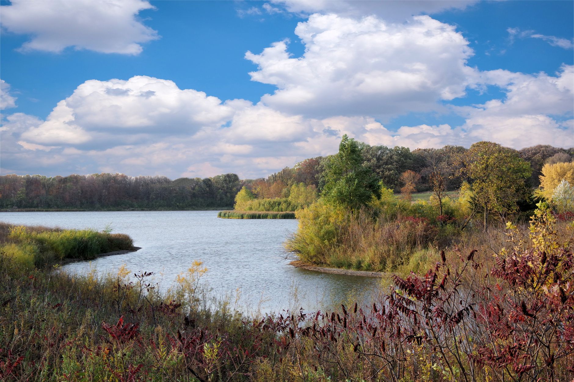
Photo by Sean Ewing on Pexels
Kalamazoo River Fishing: New Richmond Fall Flow Band
8 min read
Waterbody Guide
Kalamazoo River fishing: character shifts from headwaters to the Lake Michigan mouth, with fall median discharge near 1,770 cfs and water around 52°F (11.2°C).
Your plans
Flow reliability
Seasonal consistency of median discharge from the curated USGS gauge for this place.
Spring
80%
year-to-year consistency
Summer
84%
year-to-year consistency
Fall
75%
year-to-year consistency
Winter
78%
year-to-year consistency
Median monthly discharge (cfs)
| Jan | Feb | Mar | Apr | May | Jun | Jul | Aug | Sep | Oct | Nov | Dec |
|---|---|---|---|---|---|---|---|---|---|---|---|
| 2010 | 2265 | 2635 | 2875 | 2325 | 1830 | 1670 | 1420 | 1230 | 1605 | 1770 | 1935 |
In the last 10 falls, roughly 1 of every 2 September–November weeks sat inside this band (1440–2570 cfs); typical flow in those weeks 1770 cfs, median water temp 52°F (10.9°C).
Computed from 10 years of USGS daily records, station 04108660 (3,652 daily values). Last computed Oct 19, 2026.
Hydrological description only — not advice about wading, floating, or whether conditions are safe for recreation. Always check current USGS readings and local guidance before you go.
Reading Conditions

The USGS gauge at New Richmond is your best tool for understanding what the river is doing on any given morning. The current conditions page for station 04108660 gives you real-time flow data, and the 10-year discharge percentiles give you context for what's normal:
- 10th percentile: 1,160 cfs
- 25th percentile: 1,460 cfs
- 50th percentile (median): 1,900 cfs
- 75th percentile: 2,585 cfs
- 90th percentile: 3,630 cfs
Most anglers underestimate how much a few hundred cfs matters on this river. When the flow is below the 25th percentile, the river gets skinny and the fish tuck into the deeper holes. When it's above the 75th percentile, the water pushes fish to the banks and makes wading dangerous. The sweet spot is between 1,460 and 2,585 cfs, which is exactly where the fall window median of 1,770 cfs lands.
Water temperature matters too. The fall window median water temperature is 52°F (11.2°C), which is ideal for salmon and steelhead. If the water climbs much above 60°F, the migratory fish slow down and the bite dies. If it drops below 45°F, the fish still bite but they're slower and you need to slow your presentation down to match.
Wind and Weather
Wind changes the plan on the big water. The lower river near New Richmond is close enough to Lake Michigan that a strong west wind can push water up the river and change the current patterns for hours. The National Weather Service forecast for the area as of August 2026 shows a typical summer pattern: slight chance of showers and thunderstorms, then mostly sunny, high near 68°F, with winds 9 to 14 mph. That's a fishable day on the river.
In the fall, watch for the big cold fronts. The first hard cold front of October is usually the trigger that pushes the biggest push of chinook into the lower river. The fishing right before that front hits can be excellent, and the fishing right after it blows through is often slow while the fish adjust to the temperature drop.
Access

Access here is not a given. The Kalamazoo River has public access points, but they're not evenly spaced, and large sections of the river run through private property where you'll be walking the bank at your own risk. The most reliable public access is in the Allegan area, where the state manages the Allegan State Game Area and provides several launches and parking areas along the lower river.
The river's class is listed as "river" in the MDNR waterbody records, which tells you nothing you don't already know, but the GNIS identifier 629444 is what you'd use to cross-reference state records if you're digging into specific management plans or historical data.
Launch Options Worth Knowing
The lower river below Allegan has the best launch infrastructure, mostly because that's where the salmon and steelhead fishery draws the most pressure. The USGS gauge at New Richmond (station 04108660) is at the downstream end of the system, and the water around there is the last stretch before Lake Michigan.
Upstream, your options get thinner. The river through Kalamazoo has some city park access, but the launches are smaller and better suited to canoes and kayaks than to trailered boats. If you're planning to fish from a boat, focus your attention on the lower river below the Allegan Dam.
Bring a backup access. The river can change access reality quickly, especially after high water events that shift gravel bars and can make some of the smaller ramps unusable. The MDNR stocking portal and the FishStock database can help you understand what's been stocked where, but they won't tell you whether the ramp is usable today.
Bank Fishing Reality
Most bank anglers on the Kalamazoo River are fishing the lower river during the fall run, and they're competing for space at the same few public spots. The stretch around New Richmond and the Allegan Dam tailwaters see the most pressure. If you're willing to walk, you can find quieter water, but you need to be careful about property lines.
The middle river around Battle Creek and Kalamazoo has more bank access per mile, but the fish density is lower and the species mix is different. You're mostly looking at resident smallmouth bass, northern pike, and the occasional walleye in those stretches.
Species Presence

The iNaturalist observations for the Kalamazoo River document 11 water-associated species, and the observation counts tell you what anglers actually see and catch:
- Largemouth Bass: 24 observations
- Northern Pike: 15 observations
- Yellow Perch: 13 observations
- Rainbow Trout: 12 observations
- Chinook Salmon: 6 observations
- Walleye: 4 observations
- Smallmouth Bass: 3 observations
- Lake Trout: 3 observations
- Brown Trout: 1 observation
- Coho Salmon: 1 observation
- Muskellunge: 1 observation
The chinook salmon observations are concentrated in the fall run, and they're the main reason most anglers make the drive. The steelhead (rainbow trout) observations spread across both the fall and spring windows, and they're the more consistent target if you want to fish the river outside the salmon peak.
The largemouth bass numbers are higher than you might expect for a river system, which tells you the slower, weedy sections hold a solid resident fishery. The smallmouth bass observations are lower at just 3, but that likely reflects where observers are looking rather than the actual population. The middle river has good smallmouth habitat.
What the Stocking Data Shows
Read the stocking notes, then verify locally. The MDNR FishStock database and the stocking portal are searchable by waterbody, and they'll show you what the state has been putting in the Kalamazoo River. The river receives regular stocking of salmon and steelhead, with the specific plants varying by year and by section.
The state fishing guide has the broader context on how Michigan manages its river fisheries, and it's worth a read if you're new to fishing the state's west-side rivers. The Kalamazoo is managed differently than the Pere Marquette or the Manistee, and understanding those differences helps you plan.
For statewide orientation, see the Michigan fishing guide. To compare this river’s fall discharge consistency against other gauged Michigan rivers, see Michigan rivers ranked by fall flow reliability.
Practical Takeaways
- Check the gauge at New Richmond (station 04108660) before you drive. Target flows between 1,460 and 2,585 cfs. If flows are up above 3,000 cfs, wait a couple of days for the river to drop and clear.
- The fall window from September through November is your best bet for salmon and steelhead. The median discharge of 1,770 cfs and water temps near 52°F (11.2°C) make for consistent conditions.
- Confirm the season and size limit on the MDNR regs page. The river has special regulations in places, and the rules change. Don't assume last year's regs still apply.
- Focus your launch planning on the lower river below Allegan Dam. That's where the public access infrastructure is best and where the migratory fish are most concentrated.
- If you're chasing brown trout or walleye, plan for specific stretches. The single observations for brown trout and the 4 for walleye suggest these fish are present but not evenly distributed. Talk to local tackle shops about which sections hold them.
- Bring a backup access. The river changes after high water, and some ramps get buried. Have a second option scouted before you leave.
- The summer smallmouth and northern pike fishing is underrated. If you're not interested in fighting the fall salmon crowds, the middle river in July and August offers solid resident fishing with far less pressure.
- Watch the wind forecast for the lower river. A strong west wind can push lake water up the river and alter the current. On those days, focus on the slower inside bends.
Final Thoughts
Skip the drive when the river is above 3,000 cfs and falling, or when the gauge shows a rapid rise after heavy rain. The Kalamazoo River fishes best when it's stable, and the fish shut down when the water is bouncing around. If you catch the flow in the right band and the water temp in the mid-50s, you'll find the river fishing the way it's supposed to. If the conditions aren't there, don't force it. The river will still be there next week, and the gauge will tell you when it's ready.
When This Water Is Worth the Drive
The fall salmon run is the headline act. Chinook salmon show up in the lower river and the iNaturalist observations back that up with 6 recorded sightings, while coho salmon appear in smaller numbers with 1 observation. The steelhead follow later in the fall and again in the spring. As of 2026, the fall window between September and November holds the most consistent flows, with median discharges of 1,660 cfs in October and 1,770 cfs in November.
The river also fishes well in the spring. March and April push the highest median flows of the year at 2,635 and 2,875 cfs respectively, which spreads fish out and makes them harder to target but also puts fresh steelhead in the system. Summer is the slow season for the migratory species, though the resident smallmouth bass and northern pike fishing picks up.
Confirm the season and size limit on the MDNR regs page before you plan around a species. The Michigan DNR maintains the official regulations at their fishing laws page, and that's where you'll find current seasons, bag limits, and any special regulations that apply to the Kalamazoo River specifically. Don't trust a friend's word on this one, the regs change and the river has some special designations in places.
One thing worth noting: the river's seasonal reliability score for fall is 0.745, which is the weakest of the four seasons. That means year-to-year consistency is a bit lower in the fall than in summer (0.808) or spring (0.798). In practical terms, some falls give you perfect flows for weeks and others bounce around. Have a backup plan for the tributaries or the lower river below the dams when the main stem runs high and dirty.
Sources
- Official source: Michigan DNR michigan.gov/dnr/things-to-do/fishing/fishing-regulations
Photo Gallery
More to Explore
Waterbody Guide
Grand River Fishing: Grand Rapids Gauge & November Push
Grand River at Grand Rapids: start with the gauge, not the calendar — fall median discharge near 3,570 cfs inside a wide 2,310–5,827.5 cfs band.
Waterbody Guide
St. Joseph River Fishing: Niles Gauge & Berrien Reaches
St. Joseph River: lower water below Niles takes on Big Lake runs while Berrien reaches fish warmer, with fall median discharge near 3,520 cfs at Niles.
Waterbody Guide
Rifle River Fishing: Sterling Gauge to Saginaw Bay
Rifle River toward Omer and Saginaw Bay: access limits the day more than desire, with fall median flow near 239.3 cfs and water around 47°F (8.5°C).
Waterbody Guide
Sturgeon River Fishing: Wolverine Gauge Autumn Band
Sturgeon River near Wolverine: September–November fall median discharge near 214.5 cfs, inside a reliable 197–259 cfs band for northern Lower Peninsula trips.
Waterbody Guide
Boardman River Fishing: Beitner Road Fall Consistency
Boardman River near Traverse City: fall median discharge near 259.5 cfs at Beitner Road, inside a reliable 234–307 cfs band for late-season trips.
Waterbody Guide
Muskegon River Fishing Guide: Access, Conditions & Seasons (2026)
Muskegon River fishing from Newaygo to the mouth: late-summer flows near 1,330 cfs, fall steelhead and salmon runs, plus access, seasons, and tactics for 2026.
Sign in to join the conversation.
Sources & Attribution
Fishing regulations and waters information should be verified with the relevant state wildlife agency before you fish.
Images: Photo by Sean Ewing on Pexels; Photo by chandra diantara on Pexels; Photo by 424fotograf on Pexels; Photo by Meruyert Gonullu on Pexels. Stock photos from Pexels / Unsplash license; links above point to each photo where available.
Map data © OpenStreetMap contributors.
Information may change. Always verify seasons, licenses, and local regulations with the official source before you fish.
Did this guide help? Share it with a friend.