Access, not desire, is usually what limits a Rifle River day on the lower water toward Omer and Saginaw Bay. Fall-window median discharge near Sterling sits near 239.3 cfs, inside a reliable band between about 196 and 377 cfs, with median water temperature in that window around 47°F (8.5°C). Confirm USGS gauge 04142000 and the MDNR fishing regulations before you commit to a float.
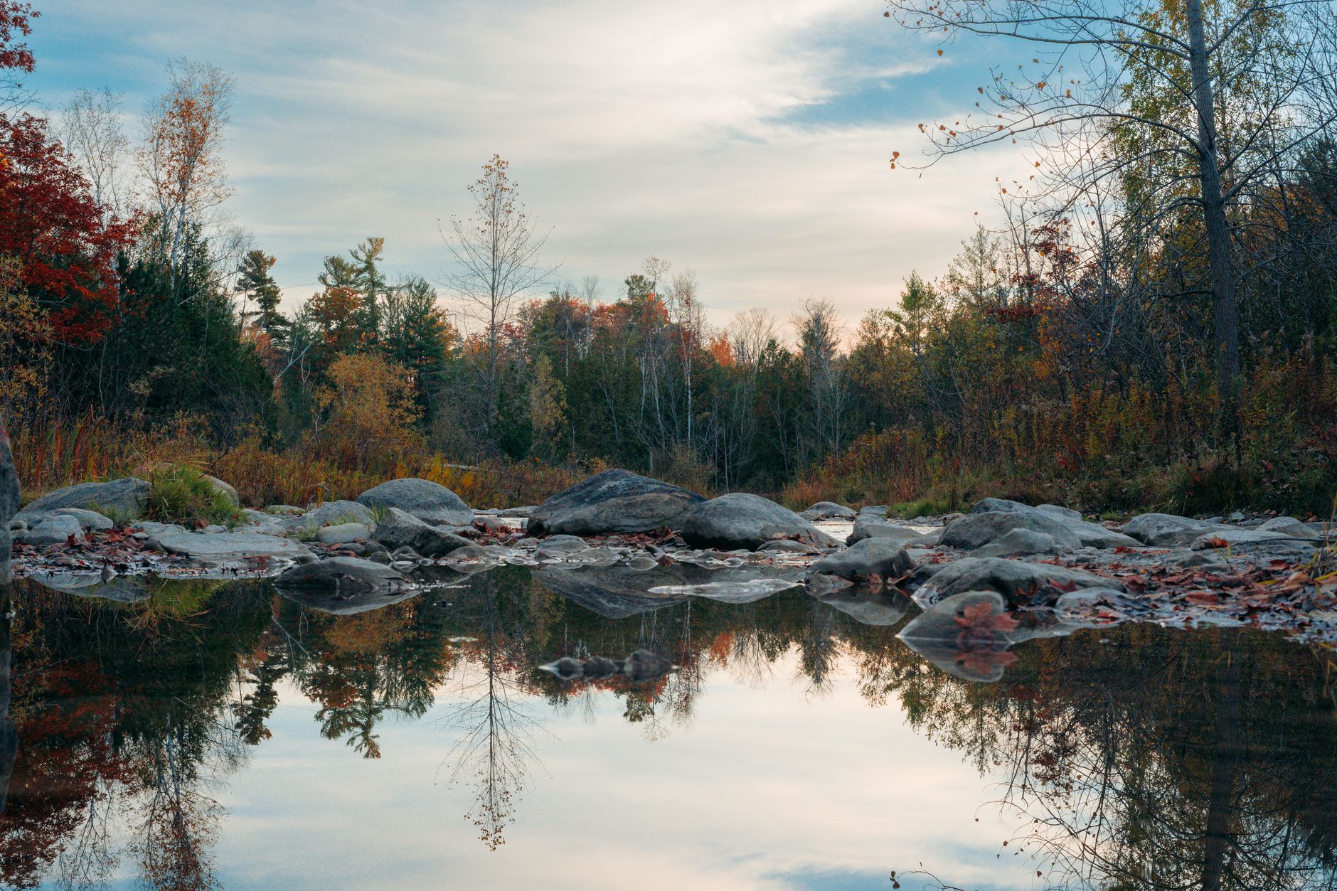
Photo by Mohammed Abubakr on Pexels
Rifle River Fishing: Sterling Gauge to Saginaw Bay
9 min read
Waterbody Guide
Rifle River toward Omer and Saginaw Bay: access limits the day more than desire, with fall median flow near 239.3 cfs and water around 47°F (8.5°C).
Your plans
Flow reliability
Seasonal consistency of median discharge from the curated USGS gauge for this place.
Spring
75%
year-to-year consistency
Summer
87%
year-to-year consistency
Fall
74%
year-to-year consistency
Winter
86%
year-to-year consistency
Median monthly discharge (cfs)
| Jan | Feb | Mar | Apr | May | Jun | Jul | Aug | Sep | Oct | Nov | Dec |
|---|---|---|---|---|---|---|---|---|---|---|---|
| 248 | 254 | 447 | 518 | 357 | 233 | 203 | 186 | 180 | 219 | 241 | 241 |
In the last 10 falls, roughly 1 of every 2 September–November weeks sat inside this band (198–377 cfs); typical flow in those weeks 239 cfs, median water temp 47°F (8.3°C).
Computed from 10 years of USGS daily records, station 04142000 (3,652 daily values). Last computed Oct 19, 2026.
Hydrological description only — not advice about wading, floating, or whether conditions are safe for recreation. Always check current USGS readings and local guidance before you go.
Conditions and Gauge
Check the gauge before you leave. The USGS station at 04142000 near Sterling is the reference point for the lower river, and it's been reporting daily flows for decades. The ten-year percentiles for this station give you a useful frame:
- 10th percentile: 167 cfs (skinny, tough floating)
- 25th percentile: 196 cfs
- 50th percentile: 248 cfs (median annual flow)
- 75th percentile: 377 cfs
- 90th percentile: 641 cfs (high, possibly blown out)
Monthly medians tell the seasonal story. The river runs lowest in late summer and early fall, with August and September medians around 182 and 174 cfs respectively. Things pick up in October (220 cfs) and November (241 cfs), then stay steady through winter in the 245-255 cfs range. Spring is the big water season, with March and April medians at 449 and 518 cfs. If you're planning a late-summer trip, you're fishing the lowest water of the year, and that changes both access and tactics.
The seasonal reliability scores from the ten-year dataset are worth noting. Summer reliability sits at 0.851, which means flows are fairly consistent year to year. Fall is less predictable at 0.726, and spring is similar at 0.737. In practical terms, you have a better chance of catching a normal flow window in July and August than you do in October, when a single big rain event can push the river out of shape for days.
Water temperature data for the fall window shows a median of 47°F (8.5°C), which is prime for steelhead moving up from Saginaw Bay. If flows are up, wait a day or two for the river to clear before wading or floating.
Access

Access here is not a given. The Rifle River is not lined with public launches, and much of the shoreline is private. Your primary public access points are tied to the Rifle River State Game Area, which manages several parcels along the upper and middle sections, and the lower river near Omer where the river meets Saginaw Bay.
The state game area offers the most reliable public access, but it's spread out and requires some scouting. Most anglers underestimate how much of the river runs through private land, especially in the middle sections between the game area and the bay. Bring a backup access. If you show up at a DNR lot and it's full or the launch is silted in, you need a plan B.
For the lower river, the public access near the mouth at Omer is your best bet for boat launching. The river is deep enough there for small aluminum boats and canoes, but the bay can change your day quickly if the wind kicks up. Wind changes the plan on the big water, and the stretch where the Rifle meets Saginaw Bay is exposed to a lot of fetch.
The game area has some walk-in spots that get far less pressure than the main launches. These are worth finding, but they're not signed from the road in every case. A county plat map or the DNR's online map tool will save you time. Do not count on pulling off at a bridge and fishing from the bank - most of those crossings are posted.
Seasons and Regulations

The Rifle River runs under Michigan inland water regulations, which means the standard statewide seasons apply unless a specific special regulation is in effect. As of 2026, the MDNR fishing regulations page is the authoritative source, and you should confirm the season and size limit on the MDNR regs page before you go. This is not a river where you want to guess.
The general inland trout season in Michigan runs from the last Saturday in April through September 30, with catch-and-immediate-release from October 1 through the day before opening day. The warmwater season for species like walleye, northern pike, and yellow perch runs year-round on inland waters, but size and bag limits vary by species and sometimes by water body.
Here's what the research data confirms about species presence, and what it doesn't. The iNaturalist observations for the Rifle River watershed show yellow perch (4 observations), largemouth bass (4), walleye (3), and northern pike (2). That's a modest data set, but it aligns with what the river is known for in its lower reaches. What the data doesn't show is a trout observation, which doesn't mean trout aren't there - the upper river is stocked - but it does mean the verified presence is weighted toward warmwater species in the lower system.
The MDNR fish stocking database is searchable online, and it's worth checking the stocking notes for the Rifle River before you plan a trip. The state has stocked this system historically, but the specific species, locations, and years change. Read the stocking notes, then verify locally. A stocking record from five years ago doesn't tell you what's in the river today.
Species Presence

The Rifle River is a two-tier fishery. Up in the state game area, the river runs cold enough to support trout, and the DNR has a history of stocking this section. Down near Saginaw Bay, the river transitions to a warmwater system where the species list looks like what you'd expect from a Great Lakes tributary.
Warmwater Species
The iNaturalist data gives you the verified list: yellow perch, largemouth bass, walleye, and northern pike. These are the species that move up from Saginaw Bay and hold in the deeper holes and slower stretches of the lower river. Walleye runs up the Rifle in spring and again in fall, and the river sees pressure from anglers targeting them during those windows.
Perch show up in the lower river and the bay mouth, and they can be reliable when the water is cool enough for them to push in. Northern pike use the weedy edges and slack water, especially in the lower stretches where the current slows.
Trout
The upper Rifle River, within and above the state game area, is the trout water. The river's gradient and cold groundwater influence make it suitable for brook and brown trout, and the state has stocked it over the years. If you're targeting trout, you want to be upstream of the warmwater transition zone, and you want to be there early in the season before summer heat pushes water temperatures up.
The research data doesn't confirm current trout stocking specifically, so don't assume a trout bite without checking the MDNR stocking portal. The state's FishStock database is searchable by water body and year, and it's the only reliable way to know what went in and when.
Tactics That Match Conditions
The tactics that work on the Rifle River follow directly from the conditions. In late summer, when the median flow is 182 cfs and the water is warm, you're fishing a low, clear river. That means lighter line, smaller presentations, and a focus on the deeper holes where fish hold when the water drops.
Low Water Tactics
When flows are in the 160-200 cfs range, the river is at its most fishable for wading anglers, but it's also at its clearest. Fish spook easily. Wade slowly, fish from the inside of bends where your silhouette is less visible, and use presentations that match the reduced current. A small spinner or a jig tipped with a crawler will outfish anything flashy in clear, low water.
For walleye, focus on the deeper runs and the outside of bends where the current has scoured out a hole. A jig and minnow worked slowly along the bottom is the standard approach, and it works. If you're fishing the lower river near Omer, the transition to Saginaw Bay creates a drop-off zone that holds fish moving in and out with the tide-like level changes from the bay.
Fall Steelhead Window
Once water temperatures drop toward the 47°F (8.5°C) median that the ten-year data shows for the fall window, the steelhead push becomes the show. Flows in the 196-377 cfs band are the target zone. That's the 25th to 75th percentile range, and it's where the river is high enough to move fish through but low enough to fish effectively.
Steelhead in the Rifle are a fall and spring proposition. In the fall, they move up from Saginaw Bay when the water cools, and they'll hold in the deeper runs waiting for a push of water to continue upstream. If flows are up, wait a day for the river to stabilize, then fish fresh water in the lower section. A spawn sack or a bead drifted through the deeper runs is the most consistent approach.
Spring Run
Spring is the highest water of the year, with March and April medians at 449 and 518 cfs. This is the window for walleye moving up from the bay, and the high water means you need a different approach. Boat access is easier with the extra water, but wading is limited. Focus on the edges where the current breaks, and fish the mouths of any tributaries that are adding stained water to the main river.
For statewide orientation, see the Michigan fishing guide. To compare this river’s fall discharge consistency against other gauged Michigan rivers, see Michigan rivers ranked by fall flow reliability.
Practical Takeaways
- Check the USGS gauge at 04142000 before you drive. Ten-year median flow is 248 cfs; anything below 170 cfs is skinny, anything above 640 cfs is likely too high.
- Know which section you're fishing. Trout are an upper-river game within the state game area; walleye, perch, pike, and bass dominate the lower river toward Saginaw Bay.
- Confirm the season and size limit on the MDNR regs page. Inland rules apply, and the trout season has a catch-and-release window in fall.
- Access is limited. The state game area and the launch near Omer are your reliable public points. Bring a backup access in case your first choice is full or silted.
- If flows are up, wait. The river clears quickly, and fishing fresh water after a spike beats fighting a muddy current.
- Fall is the most reliable window for steelhead, with median water temps around 47°F (8.5°C) and flows in the 196-377 cfs band.
- Read the stocking notes on the MDNR FishStock database, then verify locally. A five-year-old stocking record is not a current fishing report.
- Wind changes the plan on the big water. If you're fishing the mouth at Omer, check the forecast before you commit to a boat day on Saginaw Bay.
Final Thoughts
The Rifle River is a workhorse Michigan stream, not a destination fishery. It rewards anglers who check the gauge, scout the access, and match their tactics to the section they're fishing. If you're looking for a reliable steelhead river with easy access and predictable conditions, this isn't it. If you want a river where a little homework pays off, and where you can fish trout upstream and walleye downstream in the same day, the Rifle delivers. Skip it during the low, warm weeks of August if you're after trout, and skip it entirely if you're not willing to verify the access situation before you go. Otherwise, it's worth the drive.
Sources
- Official source: Michigan DNR michigan.gov/dnr/things-to-do/fishing/fishing-regulations
Photo Gallery
More to Explore
Waterbody Guide
Grand River Fishing: Grand Rapids Gauge & November Push
Grand River at Grand Rapids: start with the gauge, not the calendar — fall median discharge near 3,570 cfs inside a wide 2,310–5,827.5 cfs band.
Waterbody Guide
Kalamazoo River Fishing: New Richmond Fall Flow Band
Kalamazoo River fishing: character shifts from headwaters to the Lake Michigan mouth, with fall median discharge near 1,770 cfs and water around 52°F (11.2°C).
Waterbody Guide
St. Joseph River Fishing: Niles Gauge & Berrien Reaches
St. Joseph River: lower water below Niles takes on Big Lake runs while Berrien reaches fish warmer, with fall median discharge near 3,520 cfs at Niles.
Waterbody Guide
Sturgeon River Fishing: Wolverine Gauge Autumn Band
Sturgeon River near Wolverine: September–November fall median discharge near 214.5 cfs, inside a reliable 197–259 cfs band for northern Lower Peninsula trips.
Waterbody Guide
Boardman River Fishing: Beitner Road Fall Consistency
Boardman River near Traverse City: fall median discharge near 259.5 cfs at Beitner Road, inside a reliable 234–307 cfs band for late-season trips.
Waterbody Guide
Muskegon River Fishing Guide: Access, Conditions & Seasons (2026)
Muskegon River fishing from Newaygo to the mouth: late-summer flows near 1,330 cfs, fall steelhead and salmon runs, plus access, seasons, and tactics for 2026.
Sign in to join the conversation.
Sources & Attribution
Fishing regulations and waters information should be verified with the relevant state wildlife agency before you fish.
Images: Photo by Mohammed Abubakr on Pexels; Photo by chandra diantara on Pexels; Photo by Abduljaleel tijjani Muhammad on Pexels; Photo by Meruyert Gonullu on Pexels. Stock photos from Pexels / Unsplash license; links above point to each photo where available.
Map data © OpenStreetMap contributors.
Information may change. Always verify seasons, licenses, and local regulations with the official source before you fish.
Did this guide help? Share it with a friend.