Gates of the Arctic National Park: Complete Guide (2026)
7 min read
Park Guide
Gates of the Arctic National Park, America's northernmost park, has no roads or trails. Reach it by air taxi from Fairbanks or by hiking from the Dalton Highway.
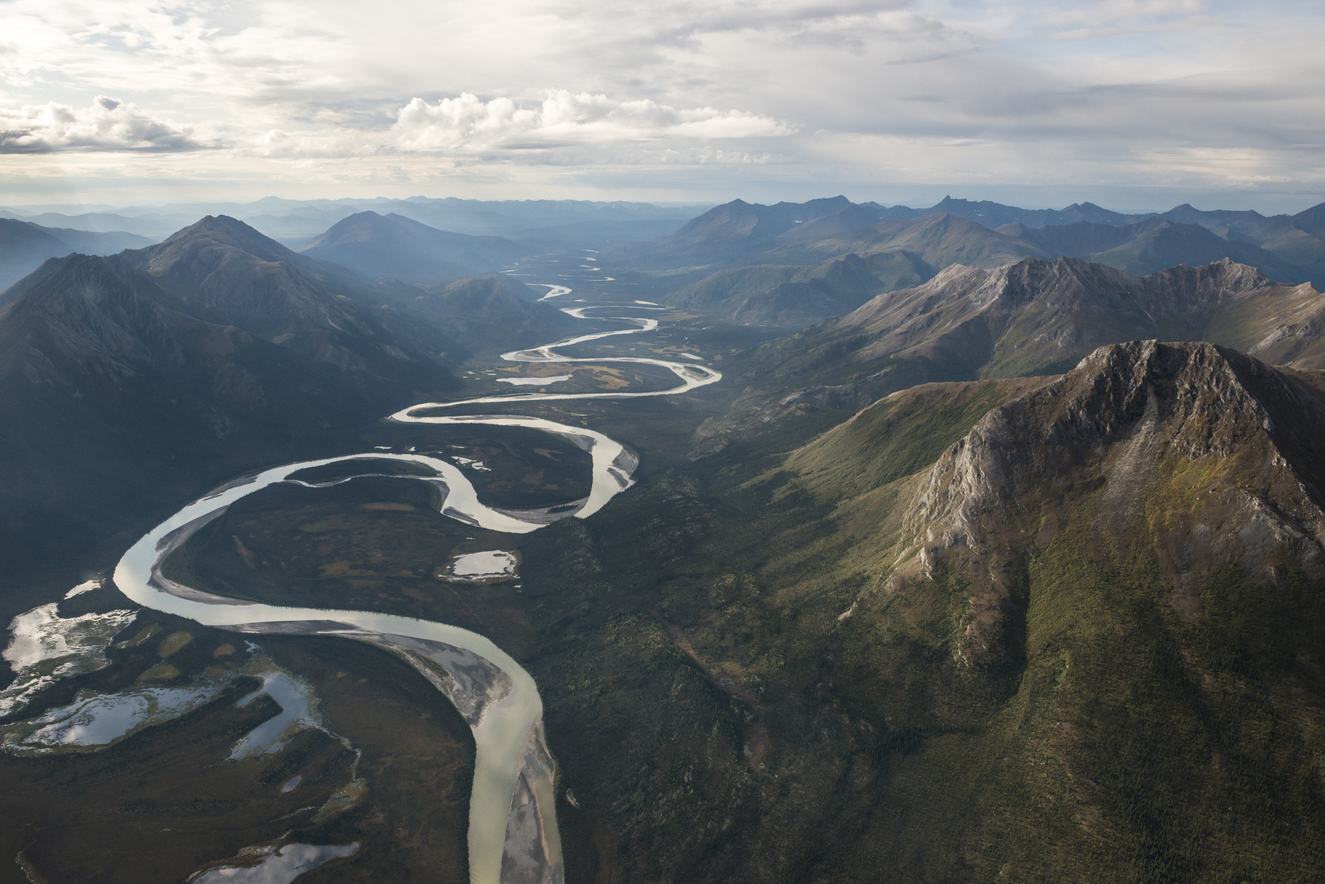
Congress designated this a national park in 1980, but the land has served as a corridor for caribou and people for millennia. Gates of the Arctic is our northernmost park, defined by its absences: no roads, no maintained trails, no campgrounds, no cell service. Your first real challenge is access—either a flight from Fairbanks or a trek from the Dalton Highway. You don't visit this park; you commit to it. This guide outlines what that commitment demands, from securing an air taxi to preparing for arctic conditions, for those drawn to America's last true wilderness.
Advertisement
Photo: NPS via NPS.gov (Public Domain)
The Reality of Access and Logistics
Most visitors underestimate the first, most fundamental step: getting in. There is no entrance station, no gate, no parking lot. The park's physical address in Fairbanks is merely an administrative office. Your journey to Gates of the Arctic National Park begins with a decision point in Fairbanks: fly or walk.
The Air Taxi Route
This is the most common method. Several small airlines operate daily flights from Fairbanks into the gateway communities of Bettles, Anaktuvuk Pass, and Coldfoot. From there, you typically hire an air taxi - a small, wheeled or float-equipped plane - to drop you at a specific lake, river gravel bar, or tundra landing strip within the park boundaries. You will coordinate a pickup date and time, often using a satellite communication device, as there is no other way out. The sound of that plane engine fading into the distance is the moment the wilderness becomes absolute. Rangers at the visitor centers in these towns are your final chance for permits, bear canister rentals, and critical weather updates.
The Hike-In Route
The other option is to walk. You can start from the Dalton Highway, the lone road that skirts the park's eastern edge, or from the village of Anaktuvuk Pass within the park. Either choice involves immediate, un-bridged river crossings. The water is cold, even in August, and the current is stronger than it looks from shore. This method requires significant pre-trip planning for food caches and route-finding across trackless tundra. The park service recommends this only for experienced wilderness travelers.
Nearly every visitor makes the same error: underestimating the cost and complexity of access. Plan your budget around the flights first—everything else follows from that.
Photo: NPS via NPS.gov (Public Domain)
Navigating a Trackless Landscape
The park service has verified that trails exist here, but that statement requires context. There are no constructed, maintained paths like in other parks. The "trails" are caribou migration routes, game paths, and the occasional route used by the local Nunamiut people. Your map and compass skills aren't a bonus here; they are your primary means of navigation. GPS devices are useful, but batteries fail and screens break.
Terrain and Travel
Tussock tundra defines much of the travel. Picture uneven, grassy hummocks, each about the size of a football, spaced just far enough to threaten an ankle with every step. It's exhausting terrain, often cutting daily mileage to what feels disappointingly short. Mountain passes offer clearer footing on talus and scree, but bring their own hazards: abrupt weather shifts and unstable, steep rock. The path narrows to a caribou-width track along a ridge. Watch for peregrine falcons riding the updrafts.
Rivers as Highways
Many experienced travelers prefer the rivers. Floating a wild and scenic waterway is a signature park experience for good reason. Rivers such as the Noatak or the Alatna provide a natural thoroughfare through glacier-carved valleys. You'll need solid whitewater skills or a guide, as these are remote, cold, and technically challenging waterways. A canoe or kayak lets you cover distances that would take weeks on foot, passing from wide glacial valleys to rolling tundra vistas. The put-in is usually via air taxi drop on a lake at the river's headwaters.
Photo: NPS via NPS.gov (Public Domain)
Key Destinations and What to Expect
Without trails or signs, points of interest are more about regions and landmarks than specific stops. These are the places you navigate toward.
The Gates Themselves
Frigid Crags and Boreal Mountain form the literal Gates of the Arctic, the iconic passage described by early explorer Robert Marshall. You won't drive up to a viewpoint. To see them, you must be on the ground, likely somewhere along the North Fork of the Koyukuk River, looking up at these granitic sentinels. They mark a transition, not a destination.
The Arrigetch Peaks
Located in the western part of the park, the Arrigetch Peaks - "fingers of the hand extended" - are a cluster of dramatic granite spires. This is an exceptional destination for technical alpine climbing and serious backcountry hiking. The approach is a multi-day hike through dense brush and across rivers just to reach the base. The payoff is a landscape of sheer rock and alpine cirques that feels utterly primordial.
Anaktuvuk Pass
This is the notable exception to the rule of no human presence. Anaktuvuk Pass is a living Nunamiut Iñupiat village situated inside the park boundaries, atop a 2,000-foot mountain pass. It's a cultural hub and a potential starting point for hikes. The ranger station here is staffed in summer. The village offers a rare glimpse into a life sustained by the caribou migration for generations.
Walker Lake
On the south slope of the Brooks Range, Walker Lake is a striking example of a mountain lake at the northern limit of tree growth. Its deep blue waters are framed by rugged peaks, and it's a popular drop-off point for air taxis. It serves as a base for camping options and treks into the surrounding high country. From this overlook you can see the clear demarcation where the boreal forest gives way to open tundra.
Photo: NPS via NPS.gov (Public Domain)
The Arctic Environment: Weather, Wildlife, and Readiness
The climate is classified as arctic and sub-arctic. That means exceptionally cold winters, relatively mild summers, low precipitation, and high winds that can spring up without warning. "Relatively mild" for summer means daytime temperatures in the 50s and 60s (Fahrenheit), with nights dipping near freezing. Snow can fall in any month.
Packing for Self-Sufficiency
You must carry everything you need and plan to manage all waste. This includes a bear-resistant food container (required), a repair kit for gear and inflatable boats, water filtration for giardia, and clothing for every conceivable condition. Cotton is a liability. Your shell jacket should be genuinely waterproof, not just water-resistant. Pack extra water for any stretch away from known water sources, as the tundra can be deceptively dry.
Wildlife Encounters
Wildlife viewing here is less about checking species off a list and more about understanding your place in the food web. Grizzly bears, wolves, and moose inhabit these valleys. Caribou herds, numbering in the tens of thousands, move through the park in seasonal pulses - you might see none, or you might be surrounded by hundreds for days. The park is also home to Dall sheep and wolverines. The rule is simple: make noise in brushy areas, store all food and scented items properly, and carry bear spray where you can reach it instantly.
The 24-Hour Sun
In summer, the sun circles the sky but never sets. This endless light can disrupt sleep patterns and obscure the passage of time. Experienced visitors know to use wristwatch alarms for meals and to force rest periods. It's easy to hike until you're exhausted because it never gets dark. Blackout sleep masks are considered essential gear.
Practical Takeaways
Start in Fairbanks. All logistical planning begins here. Visit the Fairbanks Alaska Public Lands Information Center for exhibits, films, and last-minute advice from rangers who know the region.
Book Flights First. Secure your air taxi and commercial flights to Bettles or Anaktuvuk Pass before anything else. These services book up months in advance for the short summer season.
Master Map and Compass. Assume your GPS will fail. Practice navigating off-trail with a topographic map before you arrive. Your intended hiking trails are just lines on that map.
Prepare for Wet Feet. Waterproof boots are a fantasy here. You will cross cold, knee-deep rivers. Bring sturdy hiking shoes and multiple pairs of wool or synthetic socks. Neoprene socks are a popular insider choice.
Communicate Your Plan. File a detailed trip plan with a reliable contact and with the park service. Carry a satellite messenger or personal locator beacon (PLB). Cell service does not exist within the park.
Embrace the Season. The best time to visit is generally June through September, with July and August offering the warmest (but buggiest) conditions. September brings fewer insects and fall colors, but faster-changing weather.
Final Thoughts
Gates of the Arctic National Park resists the very concept of a typical park visit. There is no checklist of sights, no scenic drive, no gift shop at the trailhead. The value here is in the immersion itself - in the silence so complete you hear the blood pulse in your ears, in the scale that reduces you to a slow-moving dot on a vast green and gray canvas. It demands more preparation, more self-reliance, and more humility than perhaps any other park in the system. The reward is a sense of place that is increasingly rare: land that operates on its own terms, unchanged except by the forces of nature. Your visit is a brief footnote. The wilderness continues.
Recommended Gear
What experienced visitors bring to Gates of the Arctic National Park: Complete Guide (2026)
Links may earn us a commission at no extra cost to you. We only recommend gear we believe in.