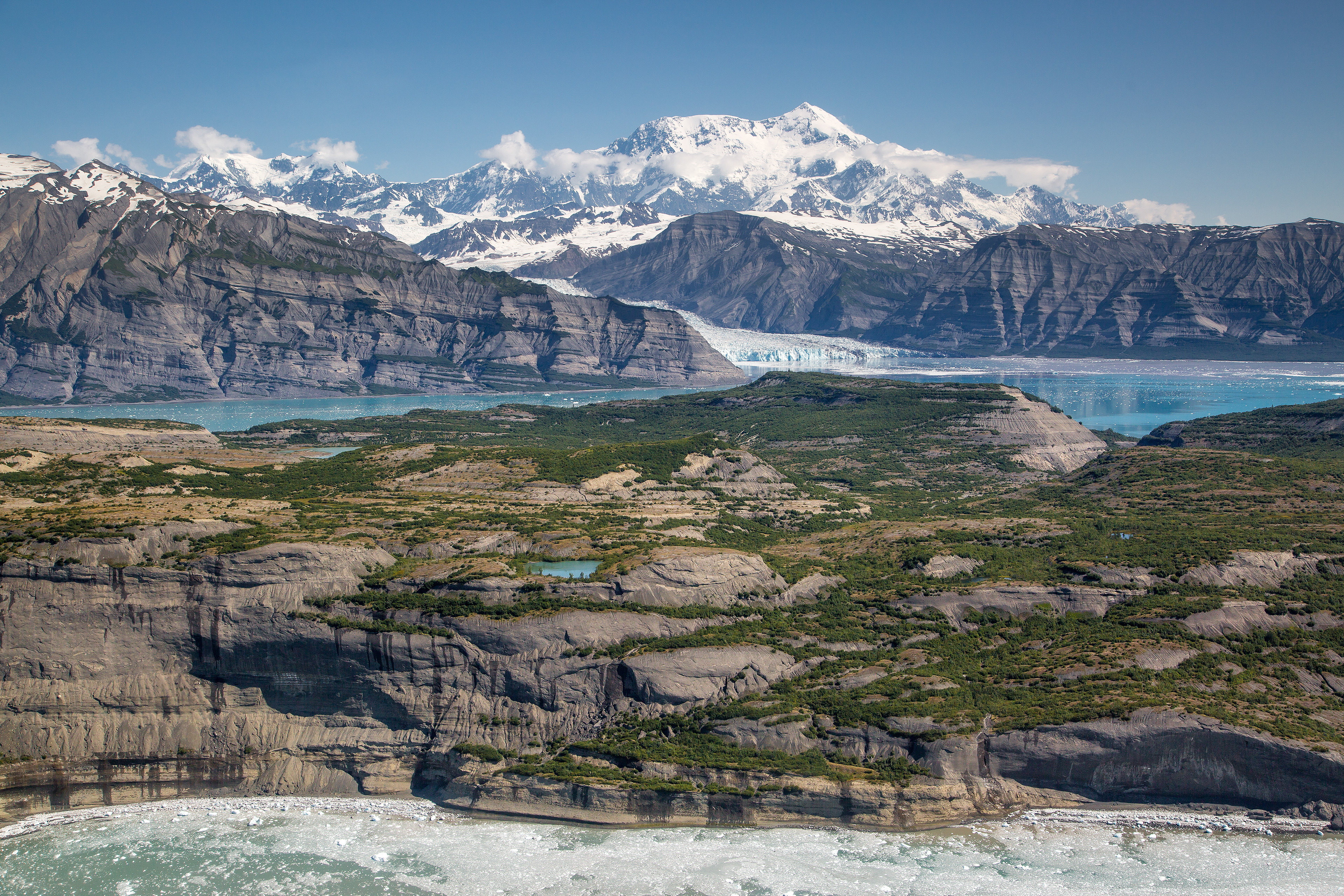
Wrangell-St. Elias National Park & Preserve announces itself not with grandeur, but with quiet. It's the quiet of immense space that absorbs sound, where a raven's call echoes across ridges and the wind carries the scent of wet spruce and cold stone. At 13.2 million acres, it's the largest unit in the national park system—a statistic that only makes sense when you're standing there. This park equals Yellowstone, Yosemite, and Switzerland combined. You don't just visit Wrangell-St. Elias; you navigate it. This guide covers the practical realities of planning a trip to this Alaskan wilderness: how to get there, what to expect, and how to approach a park where visitor centers are seasonal and real adventure begins where pavement ends.
Advertisement
The Scale and Reality of Access
Photo: NPS via NPS.gov (Public Domain)
First-time visitors often underestimate the logistics. Wrangell-St. Elias isn't a park with scenic loops and pullouts. It's a collection of access points to a vast interior, and your experience depends entirely on which corridor you choose and how far you're willing to travel.
The administrative heart is along the Richardson Highway, roughly 200 miles east of Anchorage. The headquarters visitor center in Copper Center is your first stop for orientation, but check the season. As of 2026, it's closed from mid-September through April. The park lands are always open, but the services are not. Rangers here will tell you that 95% of visitors see about 5% of the park - the parts reachable by maintained road.
There are two primary dirt-road corridors that plunge into the park. The McCarthy Road, 60 miles of graded gravel following an old railway bed, leads to the historic Kennecott Mines and the footbridge into McCarthy. The Nabesna Road, 42 miles long, offers a quieter, more dispersed entry to the northern reaches. Both roads are adventures in themselves. You'll need a vehicle with good clearance, a full-size spare tire, and the patience to drive 25-35 mph. The common mistake is budgeting drive time as if it were pavement. It is not.
Cell service drops out within the first few miles of either road and doesn't return. The park service recommends you file a travel plan with someone back home. They aren't being overly cautious. This is standard procedure for traveling in remote Alaska.
Choosing Your Adventure: Corridors and Activities
Photo: NPS via NPS.gov (Public Domain)
Your trip is defined by choosing between the McCarthy and Nabesna corridors—each offers a fundamentally different experience of the park.
The McCarthy Road & Kennecott
This is the park's social hub, relatively speaking. The road ends at a parking area across the Kennicott River from the towns of McCarthy and Kennecott. You walk across a footbridge, then catch a shuttle or walk the remaining mile into Kennecott. The payoff is the, preserved ghost town of the Kennecott Copper Mill, a 14-story industrial relic clinging to the mountainside. Rangers at the Kennecott Visitor Center lead tours into the mill, and the history is palpable. This corridor is the gateway for guided glacier hikes on the Root Glacier, flightseeing tours that put the scale of the icefields into terrifying perspective, and more structured tours and guided experiences.
The trail from Kennecott to the Root Glacier is about two miles one-way. The surface changes from rocky path to the ice itself. Early morning is your best bet for calm conditions and clearer views before the afternoon clouds stack up against the peaks. Crampons or microspikes are non-negotiable for walking on the glacier; guided groups provide them.
The Nabesna Road
This is the road less traveled, literally. It's narrower, has fewer services (read: none), and offers a raw, solitary experience. The road traverses through boreal forest, crosses several streams via fords or culverts (check conditions at the Slana Ranger Station), and ends at a private lodge. This is the corridor for anglers, for those seeking true backcountry solitude, and for wildlife viewing away from any crowds. Moose are common in the wetlands, and you might spot Dall sheep on the high slopes.
The trailheads along Nabesna Road, like the one for Caribou Creek, are true backcountry launches. The trail narrows here, often to little more than a game path. You are on your own. This is where the park's listing for activities like hunting, gathering, and unguided mountain climbing becomes a tangible reality, not just a brochure bullet point.
Beyond the Roads
For the vast interior, your options are air or foot. Fixed-wing air taxis from McCarthy, Glennallen, or Chitina can drop you at a remote lake or gravel bar for a backcountry camping trip. This is serious wilderness travel. The park's alert system, as of 2026, includes a caution about a landslide across the Lakina River creating a dynamic debris hazard for packrafters. That's the level of specific, evolving condition you must research. The landscape is alive and changing.
Practicalities of Visiting a Frontier Park
Photo: NPS via NPS.gov (Public Domain)
The romantic notion of Alaska wilderness crashes into practical reality at the gas pump and the grocery store. Planning here is about contingency, not just itinerary.
Season and Weather: The accessible season is short. June through September offers the most reliable weather, but "reliable" is relative. Snow can fall any month. Coastal areas near the Gulf of Alaska are wet; the interior valleys are drier. Temperatures can swing 40 degrees in a day. Your packing list must include layers for rain, wind, cold, and sun - often all in the same afternoon. For a detailed breakdown, our guide on the best time to visit is essential reading.
Supplies: There are no supermarkets in the park. Glennallen, at the junction of the Glenn and Richardson Highways, is your last major resupply for fuel, groceries, and hardware. Chitina, at the start of the McCarthy Road, has a small store with limited (and expensive) supplies. Once you're on the McCarthy or Nabesna Roads, you're committed. Pack extra water, food, bug spray, and a tire repair kit.
Lodging and Services: Options range from basic camping options at park-maintained sites to historic lodging and accommodations in Kennecott. Everything books up far in advance for the summer season. The park's private inholdings mean there are lodges and guiding operations scattered throughout, particularly in McCarthy/Kennecott. Don't expect cell service or Wi-Fi to be part of the package.
Fees and Passes: As of 2026, Wrangell-St. Elias does not charge an entrance fee. However, activities like guided mill tours in Kennecott, flightseeing, and shuttle rides have separate costs. The America the Beautiful Annual Pass doesn't apply to entrance here, but it's still good to have for other parks on your Alaskan itinerary.
Navigating the Wild: Safety and Mindset
Photo: NPS via NPS.gov (Public Domain)
Safety here isn't about rules; it's about mindset and preparation. Rangers emphasize self-reliance.
River crossings are a primary hazard. Many hiking trails require fording glacial rivers that are cold, fast, and opaque with silt. Water levels rise dramatically on warm afternoons as glacial melt increases. Cross in the early morning if possible, unbuckle your pack's waist strap, and use trekking poles for stability. Turning back is always a valid option.
Wildlife is present but rarely a problem if you're smart. Store all food and scented items in bear-resistant containers, which are required for backcountry camping. Make noise in brushy areas. Give moose, especially cows with calves, a very wide berth.
The most underestimated risk is the weather and remoteness combined. A sprained ankle on a trail miles from the road is a major incident. A broken axle could mean a multi-day wait. Your vehicle is your lifeline. Carry more food, water, and warm clothing than you think you'll need. Tell someone your plan and when to call for help if you don't check in.
Practical Takeaways
Photo: NPS via NPS.gov (Public Domain)
Vehicle is Key: Rent or drive a vehicle with high clearance, all-terrain tires, and a full-size spare. A 2WD sedan on the McCarthy Road is a bad idea waiting to happen.
Communicate Your Plan: File a detailed travel plan (route, trailheads, expected return) with a contact outside Alaska. Satellite messengers or personal locator beacons are highly recommended for any travel beyond the main road corridors.
Pack for Self-Sufficiency: Assume you will get stuck, wet, or delayed. Your kit should include: 2+ gallons of water per person, water purification, 2 extra days of food, a comprehensive first-aid kit, tire repair kit, extra fuel, bug head nets, and layers for freezing and wet conditions.
Respect the Rivers: Check current river conditions at a ranger station before any hike involving a crossing. Plan to cross glacial rivers early in the day. If it looks dangerous, it is.
Book Everything Early: As of 2026, the summer season sees high demand for flights, lodging, tours, and even rental cars in Anchorage. Secure your major bookings months in advance.
Adjust Your Pace: This park rewards slow travel. Don't try to "do" both the McCarthy and Nabesna corridors in a rushed two-day trip. Pick one, go deep, and absorb the pace of the place.
Final Thoughts
Wrangell-St. Elias doesn't offer easy consolation. It doesn't hand you a curated experience. It presents a landscape of raw, functioning geology - glaciers that grind mountains into silt, rivers that change course overnight, weather that writes its own rules. The reward for engaging with it on its own terms is a sense of scale that recalibrates your internal compass. You leave understanding that wilderness isn't a picture; it's a presence. The gift shops sell bumper stickers that read "I Survived the McCarthy Road." The real souvenir is quieter: the memory of that immense, swallowing quiet, and the knowledge of what still exists, vast and untamed, on the map.
Recommended Gear
What experienced visitors bring to Wrangell-St. Elias National Park: 13.2 Million Acres (2026)
Links may earn us a commission at no extra cost to you. We only recommend gear we believe in.