Deer Mountain's 10,013-foot summit offers one of the park's most accessible high-altitude experiences. The trail delivers panoramic views without the technical demands of higher peaks. Starting at Deer Ridge Junction, you'll make a manageable climb through ponderosa pines that release a sweet, vanilla-like scent on warm days, reaching a summit with clear sightlines to Longs Peak and the Mummy Range. It's an ideal first hike for visitors adjusting to the elevation. Newcomers often remark how quickly the trail leaves roadside activity behind for quiet forest. The paved parking lot fills early—plan accordingly. This guide covers the essential trailhead logistics and summit views for your 2026 visit.
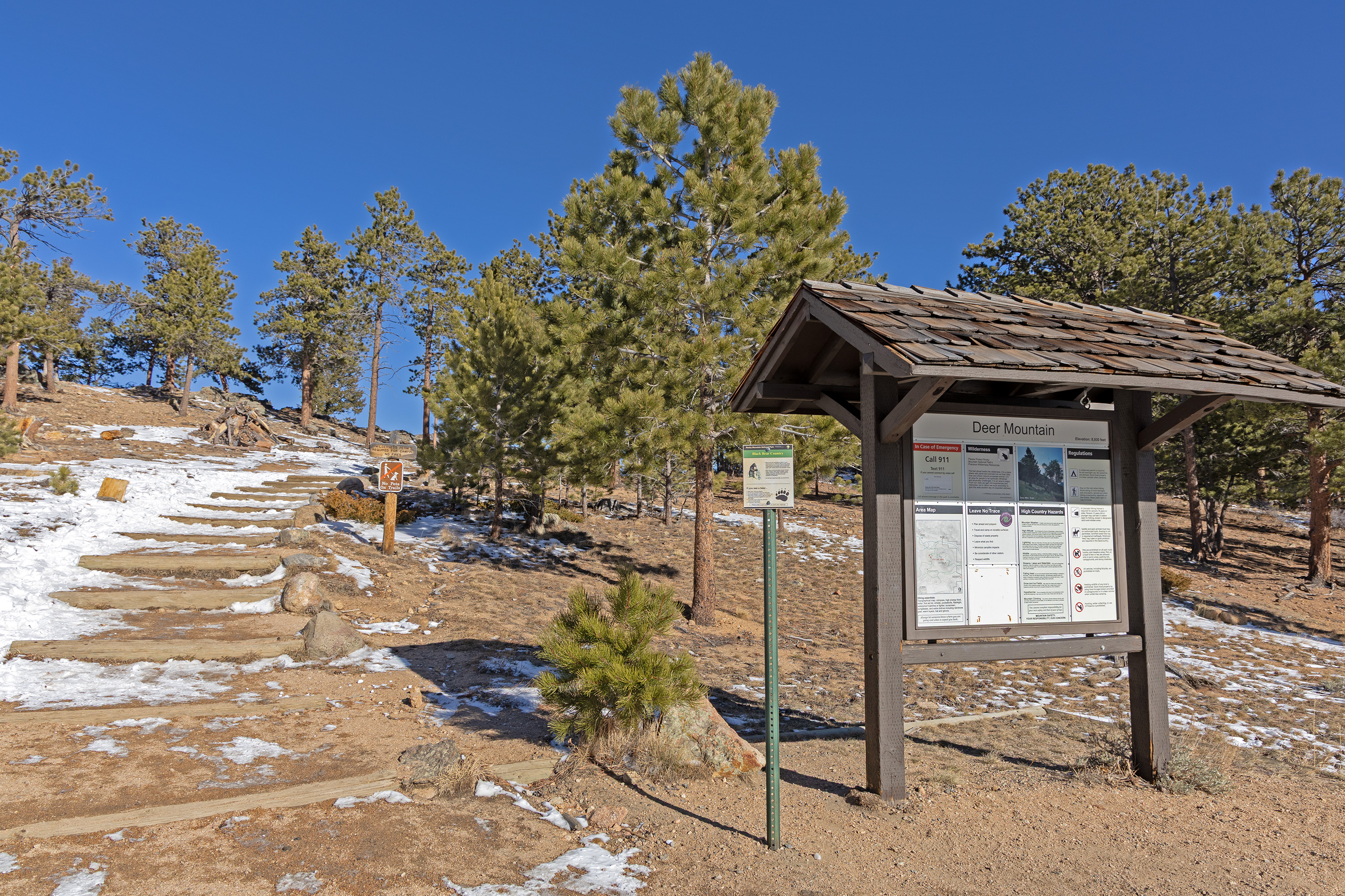
NPS via NPS.gov (Public Domain)
Deer Mountain: Complete 2026 Travel Guide & Visitor Information
9 min read
Places & Points of Interest
Plan your 2026 visit to Deer Mountain. Complete guide to trails, fees, lodging, best time to visit, and insider tips.
Your plans
Overview
At 10,013 feet, Deer Mountain isn't the park's highest peak, but its position at Deer Ridge Junction gives it strategic value. The summit provides a 360-degree lesson in park topography: Longs Peak anchors the southern horizon, Moraine Park and Upper Beaver Meadows spread out below, and the Mummy Range extends northward. The 6.2-mile out-and-back trail gains 1,410 feet at a steady, manageable grade. On warm afternoons, the ponderosa pine forest emits a distinct vanilla-butterscotch scent—a detail many hikers overlook while concentrating on the ascent. Seasoned visitors use this hike as both a weather gauge and acclimatization route; when clouds obscure higher peaks, Deer Mountain frequently stays clear.
Quick Information
- Entrance Fee: Rocky Mountain National Park requires a timed entry permit reservation for most of the year, in addition to the park entrance fee. As of 2026, the park entrance fee is $35 per private vehicle (valid for 7 days). Timed entry permits cost $2.00 and are required to enter most areas of the park during peak hours.
- Hours: The Deer Mountain trailhead is accessible 24/7, but park entrances are open year-round. Timed entry reservations are typically required from late May through mid-October.
- Best Time to Visit: July through September. July and August offer the most reliable trail conditions, while September brings cooler air, fewer afternoon thunderstorms, and the start of fall color in the aspen groves lower down.
- Location: Rocky Mountain National Park, Colorado. Nearest town is Estes Park. The trailhead is at Deer Ridge Junction, where US Highway 34 (Trail Ridge Road) meets US Highway 36.
- Accessibility: The trailhead parking is paved. The Deer Mountain trail itself is a natural surface trail with rocks and roots and is not wheelchair accessible.
- Cell Service: Cell service drops out at the trailhead. Do not rely on your phone for navigation or emergency communication on this hike.
- Restrooms: There are no restrooms at the Deer Mountain trailhead. The nearest vault toilets are at the Beaver Meadows Visitor Center, a few miles east.
- Parking: A paved parking lot for about 25-30 vehicles. It fills by 8:30 AM on summer weekends. Overflow parking is not available; if the lot is full, you'll need a backup plan.

Getting There
The Deer Mountain trailhead is one of the most straightforward to find in the park. From Estes Park, take US Highway 36 west into Rocky Mountain National Park through the Beaver Meadows Entrance. After passing the Beaver Meadows Visitor Center, continue for approximately 3 miles to Deer Ridge Junction. Turn left (west) onto US Highway 34 (Trail Ridge Road). The trailhead parking lot will be immediately on your right. If you're coming from the west side of the park (Grand Lake), drive east on Trail Ridge Road for about 20 miles from the Grand Lake Entrance; the trailhead will be on your left just after the junction with Highway 36. The drive from Denver International Airport takes about 2.5 hours without traffic. A common mistake is to confuse this with other "Deer" locations; this is the only Deer Mountain trailhead in the park.
What to Expect
You start at an elevation just above 8,900 feet. The air is thin and dry. The trail begins with a series of well-graded switchbacks through a mixed forest of ponderosa pine, Douglas fir, and some aspen. The surface is packed dirt and gravel with occasional embedded rocks. About a mile in, the trail narrows here and the trees begin to thin, offering your first framed glimpses of the surrounding peaks. The sound changes from the rustle of roadside traffic to the wind in the pines and the scuff of your own boots on the trail. You'll feel the climb in your lungs before your legs - this is normal at this altitude. The final half-mile to the summit is more exposed, with steeper, rockier steps. The summit itself is a broad, rocky dome with plenty of space to sit, have a snack, and take in the view. On a clear day, you can identify most of the major peaks in the park's eastern section. The return trip is all downhill, which can be tough on knees; trekking poles are recommended.

Top Attractions & Points of Interest
Deer Mountain Summit
The summit is the entire point. At 10,013 feet, it provides a panoramic view that helps orient you to the entire eastern side of the park. Longs Peak (14,259') is the obvious giant to the south. Directly east, you look down onto the meadows and the town of Estes Park. To the north, the rounded summits of the Mummy Range (Mounts Chiquita, Ypsilon, and Fairchild) are visible. Rangers often recommend this as a first summit for newcomers because the view is so comprehensive. Early morning is your best bet for clear skies and calm winds. Pack extra water for this stretch as the exposure is full sun.
Deer Ridge Junction Overlook
Not a formal overlook, but the pullout at the trailhead offers a surprisingly good view itself. From the parking lot, you can see across the Beaver Meadows area to the peaks above Bear Lake Road. It's a common spot for photographers at sunrise and sunset, as the light hits the high peaks. Most visitors underestimate this free view in their hurry to start hiking.
The Transition Zone Forest
The forest you hike through is a classic example of the Montane ecosystem. The ponderosa pines have thick, puzzle-piece bark and long needles. On warm days, the scent of the pine resin is strong and sweet. Keep an eye out for Abert's squirrels, which are common here, with their tufted ears and tendency to chatter at hikers. This section of trail is also where you're most likely to see mule deer, especially in the early morning or late evening.
Activities
Hiking
The Deer Mountain Trail is the primary activity here. It's rated as moderate. The 3.1 miles one-way distance and 1,410-foot gain are manageable for most people in decent shape, but the altitude is the wild card. Allow 3-5 hours for the round trip. In winter, this trail becomes a snowshoe or traction device hike; the snowpack can be deep and the route less obvious. For more details on this and other routes, see our guide to hiking trails in the area.
Wildlife Viewing
This is a reliable area for seeing mule deer, Abert's squirrels, and a variety of birds, including Steller's jays and mountain chickadees. The meadows below the trail are elk habitat, especially during the fall rut. For dedicated wildlife viewing, bring binoculars and practice quiet observation from the trail.
Photography
The summit offers 360-degree panoramic opportunities. A wide-angle lens is useful, but even a smartphone can capture the scale. The best light is early morning or late afternoon, when the sun casts long shadows and highlights the texture of the peaks. The trail through the pine forest also offers intimate shots of light filtering through the trees.

Seasonal Guide
June: Trail is usually clear of snow by mid-month. Afternoon thunderstorms begin; start your hike early to be off the exposed summit by noon.
July & August: Peak season. Wildflowers like paintbrush and lupine dot the meadows near the trailhead. Days are warm, but temperatures at the summit can be 15-20 degrees cooler than at the trailhead. Timed entry permits are mandatory.
September: Arguably the best month. Crowds diminish, air is crisp, and aspen trees at lower elevations turn gold. Afternoon storms become less frequent.
October to May: Winter conditions. The trail may be packed snow or ice from November through April. Traction devices like microspikes are essential. Snowshoes may be needed after fresh snow. The road to the trailhead (Trail Ridge Road) is closed just west of the junction in winter, but the trailhead itself remains accessible from Estes Park. For a detailed monthly breakdown, check our guide on the best time to visit.
Practical Information
You must pay the park entrance fee and, during peak season, have a Timed Entry Permit Reservation. These can be booked at Recreation.gov. As of 2026, vehicle passes are $35 for 7 days. The America the Beautiful Interagency Annual Pass ($80) covers the entrance fee but not the timed entry reservation. For camping options, the nearest campground is Moraine Park (244 sites, $35/night), which is open for winter camping on a first-come, first-served basis through May 18, 2026. Summer reservations are essential. For lodging and accommodations, the town of Estes Park has everything from hotels to cabins. There are no services at the trailhead. The closest gas, food, and supplies are in Estes Park.

Safety & Preparation
Altitude: The trailhead is at 8,900 feet. Headaches, nausea, and shortness of breath are signs of altitude sickness. The only cure is to descend. Acclimate in Estes Park (7,500 feet) for a day before attempting this or any hike.
Weather: Mountain weather changes rapidly. Clear mornings can turn to lightning storms by afternoon. Check the forecast, but be prepared for anything. Carry rain gear and extra layers.
Hydration: The air is dry and you'll be exerting yourself. Carry at least 2 liters of water per person. There is no reliable water source on the trail.
Wildlife: This is bear and mountain lion country, though sightings are rare. Make noise while hiking, carry bear spray, and know how to use it. Never approach wildlife.
Emergency: Cell service is unreliable. Tell someone your plans and expected return time. In an emergency, dial 911 if you have a signal, or send someone to contact a ranger at the Beaver Meadows Visitor Center.
Insider Tips
- The Parking Tell: If the main lot is full, don't park on the roadside shoulders. Rangers patrol and ticket. Your best bet is to drive to the Beaver Meadows Visitor Center, use the restroom, and take the park shuttle back if it's running, or try again later in the afternoon when the early hikers are returning.
- The Acclimatization Hike: Locals use Deer Mountain as a gauge. If you're struggling significantly on this trail, reconsider any plans for longer, higher hikes like Flattop Mountain or Longs Peak. It's an excellent fitness and altitude check.
- Skip the Midday Hike: The trail faces south and west, meaning it gets full sun and heat in the middle of the day. An 7 AM start means cooler temperatures, better light for photos, and a parking spot.
- Summit Windbreak: The summit is exposed and often windy. The best shelter is on the east side of the summit rocks, just below the high point. It's a common lunch spot for regulars.
- What the Sign Doesn't Say: The trail register at the summit is full of comments about the weather. It's worth a quick look to see what conditions were like for hikers earlier in the day.
- Post-Hike Refuel: The gift shop at the Beaver Meadows Visitor Center sells water for $4 a bottle. Bring your own. For a better post-hike meal, drive into Estes Park.
- Winter Shortcut: In deep winter, some experienced snowshoers cut the first series of switchbacks by heading straight up the slope from the parking lot. This is not recommended for beginners; the summer trail route is safer and more packed down.
The elevation gain is worth it. Deer Mountain delivers a classic Rocky Mountain National Park summit experience with a margin of safety and accessibility that few other peaks offer. It's a hike that respects your effort with a view that explains exactly where you are in this vast landscape. Just remember to check for that timed entry permit before you go.
For more information, see our complete Rocky Mountain National Park Guide.
Sources
- Official source: NPS — Rocky Mountain National Park nps.gov/romo/index.htm
- Official source: National Park Service nps.gov/places/romo_deermountain.htm
Photo Gallery
More to Explore

Park Guide
Acadia National Park: Carriage Roads, Cadillac Mountain & 2026 Guide
Discover carriage roads, Cadillac Mountain, and rugged Maine coast. Complete 2026 guide to Acadia National Park — trails, fees, lodging, permits, and what rangers recommend.

Hiking Guide
Grand Canyon Hiking Trails: Day Hikes, Water Sources & Rim to Rim
Compare Grand Canyon hiking trails: Bright Angel, South Kaibab, Hermit, Grandview, and rim to rim, with distances, elevation, water stops, and trailhead access for each.

Best Of
Best of Glacier Bay National Park
The best of Glacier Bay is reached by boat: ranger-led day tours up the bay to the tidewater glaciers. What's worth it, how to book, and when to go (2026).

Campsite Guide
White Sands Backcountry Camping: Closed for 2026 — What to Know
As of 2026, backcountry camping at White Sands National Park is closed for site rehabilitation. What that means, and where to camp nearby instead.

Weather Guide
Guadalupe Mountains National Park Weather: Weather
Guadalupe Mountains National Park: weather guide guide updated 2026. Practical visitor information, reservations, and seasonal tips worth bookmarking before

Best Of
Best of Cuyahoga Valley National Park: Best Things to Do
Seeing a Cleveland Orchestra concert with the woods as your backdrop is a uniquely Cuyahoga Valley experience.
Sign in to join the conversation.
Sources & Attribution
Location data courtesy of the National Park Service (U.S. Department of the Interior). NPS data is public domain. Official NPS page.
Images: NPS; NPS; NPS; NPS; NPS.
Map data © OpenStreetMap contributors.
Park operations alerts: NPS.gov · Weather and weather hazards: National Weather Service · Live conditions.
Information may change. Always verify fees, hours, and conditions directly with the official source before visiting.
Did this guide help? Share it with a friend.