Loft Mountain Campground opened for the 2026 season on April 30, and anyone who has stayed here before knows exactly why they mark their calendars. Perched at mile 79.5 on Skyline Drive, this 207-site campground sits on top of Big Flat Mountain in the southern section of Shenandoah National Park. If you are looking for a basecamp that puts you close to some of the park's best waterfall hikes and wilderness trails without the crowds of the central district, this is worth a serious look.
NPS via NPS.gov (Public Domain)
Loft Mountain Campground: 207 Sites at Mile 79.5 (2026 Guide)
8 min read
Campsite Guide
Browns Gap trailhead (mile 83) gives access to Upper and Lower Doyles River Falls and Jones Run Falls via a 6.5-mile circuit.
Your plans
For more, see complete visitor guide, all campgrounds, hiking trails, lodging and accommodations, Campsites at Big Meadows Campground (2026 Guide), and Lewis Mountain Campground at Shenandoah National Park (2026 Guide).
The campground sits at roughly 3,500 feet elevation, which means summer nights run noticeably cooler than the valley floor - expect lows in the 50s even when Charlottesville is sweltering. The complete visitor guide for the park covers the full scope of what to know before you arrive, but this article zeroes in on what makes Loft Mountain Campground at Shenandoah National Park distinct from the other campgrounds along the Drive.
Location and Layout
Loft Mountain Campground sits between the Rockfish Gap entrance station (Waynesboro, I-64) and the Swift Run Gap entrance station (Elkton, US 33). That southern location matters. Visitors coming from Richmond, Charlottesville, or anywhere along the I-64 corridor will find this campground a shorter drive than the central or northern options. The physical address is Loft Mountain Road, Crozet, VA, 22932, though you will not find signage for a town - the campground is very much inside the park boundary.
The campground has 207 total sites, with 50 designated as tent-only. That mix matters for different types of visitors. Tent campers get their own loops away from the generator hum and RV lights, while RV travelers (up to a reasonable length - the park website has specific vehicle length limits) have dedicated spots with easier pull-through access. Sites are a combination of reservable and first-come, first-served. The park releases reservable sites in sections throughout the booking window, so if your first date shows no availability, check back. The system is not a single bulk release.
Site Selection Tips
The loops on the east side of the campground catch morning light and have views toward the Piedmont. West-facing sites get the evening sun and Shenandoah Valley views. Neither is bad, but pick based on when you actually plan to be at your site. If you will be out hiking all day and return at dusk, the west side gives you sunset from your picnic table. If you are an early riser who likes coffee with the sunrise, go east.
Sites near the restroom buildings fill first, and for good reason. The walk from the far loops to the bathhouse is legitimate - not a quick stumble in the dark at 2 AM. Pack a headlamp and plan accordingly.

What Makes This Campground Different
Rangers will tell you that Loft Mountain has a different character than Big Meadows or Mathews Arm. The southern location means fewer day-trippers passing through. The campground attracts people who are here specifically for the hiking in the southern district, not just driving Skyline Drive for an afternoon.
The Frazier Discovery Trail starts right at the Loft Mountain Wayside parking area. It is a 1.3-mile loop that gives you several overlooks with east and west views. Pets are not allowed on this trail, which is worth noting if you are traveling with a dog. The trail passes through woodlands of varying ages - evidence of the park's ongoing forest regeneration after decades of recovery from earlier land use. The interpretive signs along the way explain the fire history and regrowth patterns in ways that make sense even if you are not a forestry person.
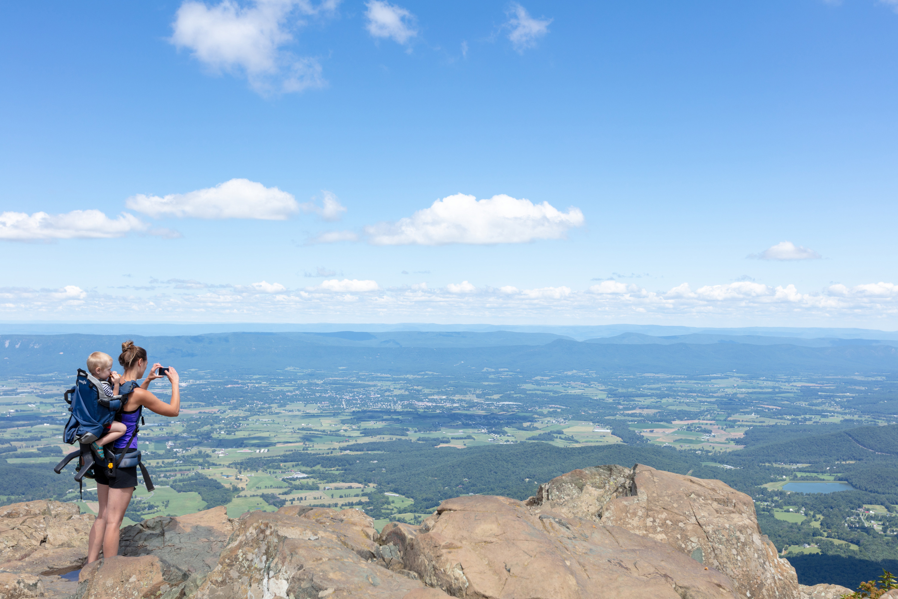
Blackrock Summit trailhead is at mile 84.4, a short drive south. The hike is less than a mile round trip and leads to a viewpoint on top of a rocky talus slope. This is one of the park's most accessible viewpoints with a genuine sense of exposure - you are standing on a slope of fractured greenstone that feels precarious until you find your footing. The view west across the Shenandoah Valley to Massanutten Mountain is about as good as it gets for minimal effort.
Waterfall Access
Two waterfall hikes sit within a short drive of the campground. Browns Gap trailhead (mile 83) gives access to Upper and Lower Doyles River Falls and Jones Run Falls via a 6.5-mile circuit. Jones Run Falls drops 42 feet over a rock face, and the trail follows the stream through a cool, damp hollow that stays shaded even in July. The Doyles River Falls trail is a 3.3-mile round trip to two separate falls - Upper Doyles drops 63 feet, and the lower section has its own cascade about a quarter mile downstream.
The common mistake - and almost everyone makes it - is underestimating the hike back uphill. These trails descend into drainages and you earn every foot of elevation on the return. Pack extra water for this stretch. The grade is unrelenting for the last mile back to the parking area.

Nearby Trails Worth the Drive
Turk Mountain
At mile 94.1, the Turk Mountain trailhead is a 2.2-mile round trip to the 2,981-foot summit. The view west from the top is broad and open - the Shenandoah Valley, Massanutten Mountain, and on clear days the Allegheny Front in the distance. The trail is moderate but has a few rocky sections near the summit where you will use your hands for balance. Allow 2-3 hours.
Blackrock Summit
Already mentioned above but worth calling out separately: this is the single most accessible viewpoint in the southern district. 1.0-mile round trip, minimal elevation gain, and you are standing on a talus slope looking at a 180-degree view of the valley and mountains. Early morning is your best bet for clear visibility before haze builds. The parking area at mile 84.4 is small - maybe 15 cars - and it fills by 9 AM on weekends from May through October.
Riprap - Wildcat Ridge
This is the serious hike of the southern district. A 8-9 mile loop starting at either the Riprap parking (mile 90) or Wildcat Ridge parking (mile 92.1). The trail takes you through Shenandoah Wilderness, past Chimney Rock viewpoint, and along a ridgeline with continuous views for about two miles. The elevation gain per mile is moderate but sustained - nothing steep, nothing easy, just constant up and down on rocky trail. Plan for 8-9 hours if you stop for lunch and photos.
Cell service drops out at the trailhead. Download your map before you leave the campground.

Campground Logistics
Fees and Reservations
As of 2026, a standard nonelectric campsite costs $30.00 per night. That covers up to six people per site (or one immediate family) and one RV or tent. The park transitioned to fully cashless fee collection in July 2025 - credit cards, debit cards, and mobile payments only. No cash accepted at entrance stations.
Reservations open on a rolling basis. The park releases reservable sites in blocks throughout the spring and summer. If you are planning a specific weekend, book as early as possible. The first-come, first-served sites are released each morning, and the camp host can tell you which loops still have availability. Arriving on a Thursday rather than a Friday dramatically improves your odds of getting a walk-up site.
Operating Season
The campground opens in late spring and closes in the fall. In 2025, the opening date was April 30. Closing dates vary year to year based on weather, but typically run through late October or early November. The hours listed as "closed" all week in the data reflect the off-season - when the campground is closed, camping is not permitted anywhere in the campground. Do not attempt to stay during closed periods; rangers patrol and fines apply.
What to Bring
The camp store at Loft Mountain Wayside carries basic supplies - ice, firewood, some groceries - but prices are higher than what you will find in Crozet or Waynesboro. The grab-and-go kiosk inside the wayside has sandwiches and snacks. The gas station at Big Meadows (mile 51.2) is the only fuel stop in the park, and as of 2026 the pumps are closed for upgrades until further notice. Fill your tank before entering the park.
Water spigots are scattered throughout the campground loops. They are seasonal - turned on when the campground opens, turned off when it closes. In early spring and late fall, expect the water to be very cold. Bring a collapsible bucket for hauling water to your site if you are in a far loop.

Wildlife and Quiet Hours
Deer are everywhere in this campground. They are accustomed to people and will wander through sites without much concern. Keep your food stored in the hard-sided cooler or vehicle - the park service does not have bear issues as severe as Great Smoky Mountains, but raccoons and rodents are persistent and clever. Lock your food up.
Quiet hours are 10 PM to 6 AM. The park enforces this. Generators are allowed during specified hours only - typically 8 AM to 10 AM and 5 PM to 7 PM - but check the campground bulletin board for the current season's rules. The tent-only loops are quieter by design, with no generators permitted.
Practical Takeaways
- Reserve early if you have a specific date in mind. Check back for released blocks if first search shows no availability.
- Arrive on Thursday for first-come, first-served sites. Friday and Saturday arrivals often find full campgrounds by noon.
- Bring cashless payment only. No cash accepted at entrance stations as of July 2025.
- Fill your gas tank before entering the park. The only gas station is at Big Meadows and was closed for upgrades as of 2026.
- Download maps before you drive south. Cell service drops out at multiple points along Skyline Drive and at trailheads.
- Pack a headlamp. The walk from far loops to restrooms is longer than you expect.
- The Frazier Discovery Trail is worth the 90 minutes but does not allow pets. Plan dog hikes elsewhere.
- Blackrock Summit at sunrise is the best low-effort view in the southern district. Arrive before 8 AM for parking.
Final Thoughts
Loft Mountain Campground does not get the attention that Big Meadows gets, and that is part of its appeal. The southern district of Shenandoah National Park has some of the best hiking in the entire park - the Big Run Wilderness area, the Doyles River and Jones Run falls, the open summit of Turk Mountain - and this campground puts you within a 15-minute drive of all of them. The views from the campground itself, east toward the Piedmont and west toward the Shenandoah Valley, are a reminder that you are sleeping on a mountain, not just in a forest.
If you want quiet, easy access to waterfalls, and a campground that does not feel like a staging area for a theme park, this is your spot. The all campgrounds page has details on the other options in the park, but for the southern district, Loft Mountain is the right choice. Book early, pack smart, and give yourself at least three days to explore the trails within a 10-mile radius. You will not run out of things to do.
Sources
- Official source: NPS — Shenandoah National Park nps.gov/shen/index.htm
- Official source: National Park Service nps.gov/shen/planyourvisit/loft-mountain-campground.htm
Photo Gallery
More to Explore

Park Guide
Acadia National Park: Carriage Roads, Cadillac Mountain & 2026 Guide
Discover carriage roads, Cadillac Mountain, and rugged Maine coast. Complete 2026 guide to Acadia National Park — trails, fees, lodging, permits, and what rangers recommend.

Hiking Guide
Grand Canyon Hiking Trails: Day Hikes, Water Sources & Rim to Rim
Compare Grand Canyon hiking trails: Bright Angel, South Kaibab, Hermit, Grandview, and rim to rim, with distances, elevation, water stops, and trailhead access for each.

Best Of
Best of Glacier Bay National Park
The best of Glacier Bay is reached by boat: ranger-led day tours up the bay to the tidewater glaciers. What's worth it, how to book, and when to go (2026).

Campsite Guide
White Sands Backcountry Camping: Closed for 2026 — What to Know
As of 2026, backcountry camping at White Sands National Park is closed for site rehabilitation. What that means, and where to camp nearby instead.

Weather Guide
Guadalupe Mountains National Park Weather: Weather
Guadalupe Mountains National Park: weather guide guide updated 2026. Practical visitor information, reservations, and seasonal tips worth bookmarking before

Best Of
Best of Cuyahoga Valley National Park: Best Things to Do
Seeing a Cleveland Orchestra concert with the woods as your backdrop is a uniquely Cuyahoga Valley experience.
Sign in to join the conversation.
Sources & Attribution
Location data courtesy of the National Park Service (U.S. Department of the Interior). NPS data is public domain. Official NPS page.
Images: NPS; NPS; NPS; NPS; NPS.
Map data © OpenStreetMap contributors.
Park operations alerts: NPS.gov · Weather and weather hazards: National Weather Service · Live conditions.
Information may change. Always verify fees, hours, and conditions directly with the official source before visiting.
Did this guide help? Share it with a friend.