For more, see hiking trails, camping options, and lodging and accommodations.
NPS via NPS.gov (Public Domain)
Channel Islands: How to Actually Get There & What to Do When You Arrive (2026)
7 min read
Park Guide
Getting to Channel Islands requires a ferry and planning most visitors skip. Here's the complete access guide — which island, which ferry, and what's worth the trip.
Your plans
This article contains affiliate links — we may earn a small commission at no extra cost to you.
At a glance
Hours
The park is open 24 hours a day. Services and facilities have separate hours. Please see description
Best Time
June-September (summer), September-October (fall colors)
Address
1901 Spinnaker Drive, Ventura, CA, 93001
Website
33.9868, -119.9113
Google MapsChannel Islands National Park: California's Galapagos - 2026 Visitor Guide
First, understand you cannot drive to Channel Islands. The park is 75% ocean; the five islands comprising its landmass are accessible only by boat or small plane. This isn't a park you stumble upon—it's a destination requiring commitment. That isolation defines the place. It has fostered what biologists term a "Galapagos of North America," hosting 145 endemic species, from the island fox to the island night lizard. The most common error visitors make—and nearly everyone does—is underestimating the logistics separating them from the trailhead. Your journey begins not at a park gate, but at a boat dock in Ventura or Oxnard.
The Lay of the Land
Think of the park in two distinct parts: the mainland gateway and the island chain. The Robert J. Lagomarsino Visitor Center in Ventura Harbor is your planning hub, with exhibits, a film, and the concessionaire ticket offices. The islands themselves are spread across 160 miles of ocean. For practical purposes, visitors group them by access.
Santa Cruz Island is the main entry point for most. The Scorpion Anchorage landing on the east end is served by daily boats and offers the most developed network of hiking trails, the Scorpion Canyon Campground, and kayak launch access to sea caves. Prisoners Harbor on the north shore is another landing point, quieter and the gateway to the island's rugged interior.
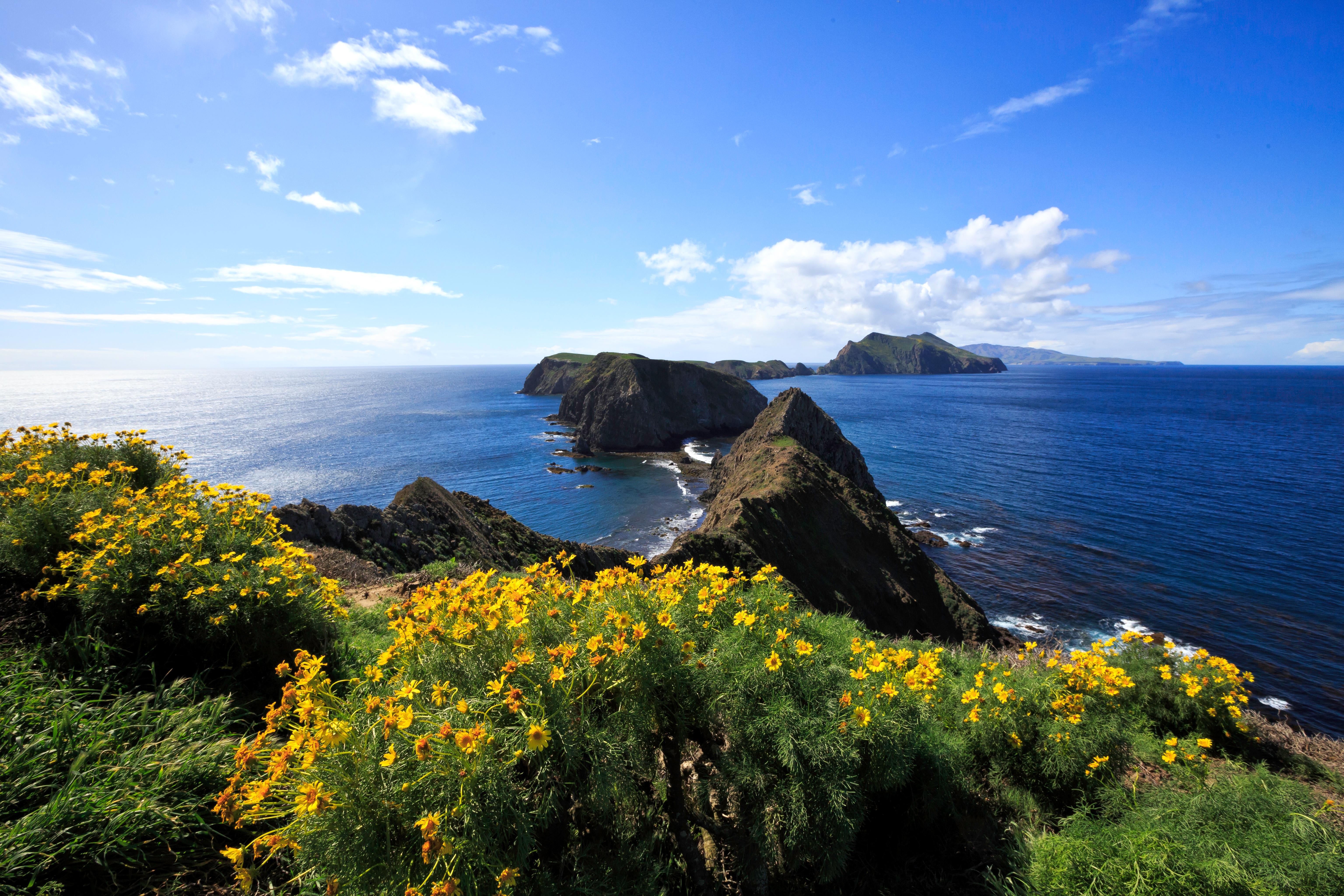
Anacapa Island is the closest, a 12-mile, one-hour boat ride. It's actually three small islets; you land on East Anacapa. This is a day-hiker's island, with a flat 2-mile loop trail past the iconic Arch Rock and the historic lighthouse. The trail narrows here to a paved path flanked by coreopsis.
The outer islands - Santa Rosa, San Miguel, and Santa Barbara - require more commitment. Boat crossings are longer (3+ hours), weather cancellations are more frequent, and visits often demand an overnight stay. These are for backpackers, serious kayakers, and those seeking profound solitude. San Miguel, the westernmost, feels like the edge of the world, with caliche forests and elephant seal rookeries accessible only by ranger-guided hike.
Planning Your Visit
There is no entrance fee to Channel Islands National Park. Your cost is transportation. As of 2026, round-trip ferry fares with the park concessionaire run approximately $60-$90 per adult, depending on the island. Camping fees are separate and range from $10 to $15 per night per site for primitive island campgrounds. The America the Beautiful annual pass does not cover these concessionaire fees.
Permits are required for all island camping, and sites book up months in advance, especially for summer weekends. The reservation window typically opens six months ahead. For San Miguel Island, you must also attend a mandatory pre-landing briefing on the boat regarding unexploded ordnance - a remnant of the island's military past.
The park is open 24/7, but the boats are not. Ferry schedules are seasonal, with the most frequent service from April through October. A winter visit means fewer departures and a higher chance of cancellation due to Pacific swells. You must plan around the boat schedule; missing the return trip is not an option.

Getting There & Getting Around
All trips originate at the harbor. The primary concessionaire docks are located at 1691 Spinnaker Drive in Ventura (Channel Islands Harbor) and 3600 South Harbor Boulevard in Oxnard. From Los Angeles International Airport (LAX), expect roughly a 90-minute drive north via US-101. Note that no public transportation reliably connects the airports to the harbor while accommodating gear for an island expedition; a rental car is necessary.
Parking at the harbor lots is typically $10-$15 per day. The lots fill early for morning departures, especially on Saturdays. Arrive at least 45 minutes before your scheduled boat time to check in, load gear, and find parking.
Once on an island, you travel by foot or kayak. There are no roads, services, stores, or transportation systems. Everything you need for the day - water, food, sun protection, layers - must be on your back. Cell service drops out at the harbor. On the islands, it is almost universally nonexistent. Inform someone of your itinerary and expected return time.
What to Do
This park rewards active engagement. Passive sightseeing from a boat deck is possible, but the real experience is earned.
Hiking is the primary access to island interiors. Trails range from the paved loop on Anacapa to strenuous, exposed climbs across Santa Cruz. The payoff is silence and vistas where the only company is circling ravens. For a detailed breakdown, see our guide to the park's hiking trails.
Kayaking is the best way to experience the park's famed sea caves and kelp forests. At Scorpion Anchorage on Santa Cruz, you can rent kayaks or join guided tours to paddle into massive caverns like the famous Painted Cave. This is a cold-water, ocean environment; experience or a guide is recommended.
Snorkeling & Diving reveal the park's submerged half. The kelp forests are some of the healthiest in the world, creating underwater cathedrals filled with garibaldi, sea stars, and bat rays. Water temperatures range from the low 50s in winter to mid-60s in late summer. A wetsuit is essential year-round.
Wildlife Watching is constant. On the crossing, look for common dolphins, bottlenose dolphins, and from April to November, migrating gray, blue, and humpback whales. On land, island foxes trot through campgrounds, and seabird colonies blanket cliffs. For seasonal patterns, our wildlife viewing guide has specifics.
Camping transforms a day trip into an immersion. Falling asleep to the sound of waves and waking to fog-shrouded canyons is the park's definitive experience. Review all camping options to choose between developed canyon sites and remote backcountry beaches.

Where to Stay
Your choices are on the islands or on the mainland. There are no hotels, lodges, or roofed accommodations within the park.
Island Camping is primitive. You'll find pit toilets, picnic tables, and food storage boxes. There is no running water, electricity, or shade structures at most sites. You must pack in all water (1 gallon per person per day minimum) and pack out all trash. The seven island campgrounds range from 7 to 31 sites, creating an intimate experience. Securing a spot requires planning; our lodging and accommodations guide details the reservation process for each.
Mainland Gateway Towns like Ventura and Oxnard offer full hotel services. This is the practical base for day trips to the islands. Many visitors book a harbor-adjacent hotel for the night before an early boat departure. It beats a 4 AM drive from Los Angeles.
Seasonal Guide
The islands operate on an oceanic calendar, not a terrestrial one. Summer sun does not guarantee calm seas.
June through September offers the most reliable weather and the fullest boat schedules. Daytime highs on the islands hover in the low 70s, but the sun is intense with little shade. This is peak season for visitors, camping, and wildlife viewing like whale watching. The ocean is at its warmest (mid-60s), still requiring a wetsuit. Afternoon winds are common, especially on Santa Rosa and San Miguel.
October through November is a sweet spot. Crowds diminish, boat schedules begin to taper, but the water remains relatively warm and the skies clear. This is the best time for hiking in Channel Islands National Park without summer heat. It's also the start of the northern elephant seal haul-out on San Miguel.
December through March is the quiet season. Ferry service is minimal, often running only to Santa Cruz and Anacapa. This is when storms roll through, bringing rain, wind, and the potential for multi-day trip cancellations. It's also when gray whales are most visible on their migration, and the islands are lush and green. Only the well-prepared and flexible should attempt a winter visit.
April through May is the spring bloom. The hillsides, especially on Anacapa, explode with yellow coreopsis and lavender ice plant flowers. Wildlife is active, temperatures are mild, and the summer crowds haven't yet arrived. Ocean temperatures, however, are at their coldest, in the low to mid-50s.

Practical Takeaways
- Book your boat passage and campsite first, then plan the rest of your trip. They are the limiting factors.
- Pack all the water you will need. A general rule is one gallon per person per day. There is no water available on the islands.
- Dress in layers. A sunny, calm morning can become a windy, foggy afternoon in under an hour. A waterproof shell is never a bad idea.
- Wear sturdy, closed-toe shoes with good traction. Trails are rocky, and poison oak is present in some canyons.
- Bring cash. Some concessionaire transactions and parking fees are cash-only.
- Pack out everything you pack in, including all trash. There are no garbage services on the islands.
- Monitor the marine forecast, not just the island weather. A "perfect" sunny day on land can mean unsafe swells for the crossing.
- If you are prone to motion sickness, take medication before the boat departs. The crossing can be rough even on good days.
- For day trips to Anacapa or Scorpion Cove on Santa Cruz, the ferry schedule usually allows 3-4 hours on land. Plan your hike accordingly.
- Leave drones, pets, and wheeled coolers at home. None are permitted on the islands to protect the fragile ecosystem.
Final Thoughts
Channel Islands National Park is for the self-sufficient traveler. It asks you to carry your own water, mind the weather, and respect a ferry schedule. It offers no easy vistas from a parking lot. In return, it gives you the sound of wind over grass-covered bluffs, the sight of a fox curiously inspecting your camp, and the feeling of being genuinely remote while just off the coast of millions. It's a reminder of what Southern California's coastline once was, preserved in a sea of time. Your effort to get there is the first step into that other world.
For more information, see our complete National Park Guide.
Related: how to go to channel islands national park guide
Related: hiking the channel islands guide
Recommended Gear
What experienced visitors bring to Channel Islands: How to Actually Get There & What to Do When You Arrive (2026)
Links may earn us a commission at no extra cost to you. We only recommend gear we believe in.
Hiking Essentials
Hydration Pack (3L)
Hands-free water for long trail days
Trekking Poles (Pair)
Save your knees on steep descents
Hiking Boots (Ankle Support)
Sturdy footwear for rocky, uneven trails
Sun & Heat Protection
Wide-Brim Sun Hat
Full coverage UPF 50+ protection at altitude
Insulated Water Bottle (32oz)
Keeps water cold in desert heat all day
Winter Gear
Microspikes / Traction Devices
Essential for icy rim trails in winter months
Packable Down Jacket
Lightweight warmth that stuffs into a pocket
Sources
- Official source: NPS — Channel Islands National Park nps.gov/chis/index.htm
Explore More National Parks

Sequoia National Park: Home of the World's Largest Trees — 2026 Guide
Sequoia National Park protects General Sherman, the largest living thing on Earth. 2026 tips for vis...

Pinnacles National Park: Condors, Caves & Volcanic Spires - 2026 Guide
Discover California condors, talus caves, and volcanic spire formations. Complete 2026 guide to Pinn...

Kings Canyon National Park: Complete Guide (2026)
Discover giant forests and deep granite canyons. Complete 2026 guide to Kings Canyon National Park —...

Joshua Tree National Park: Desert Boulders & Starry Skies — 2026 Guide
Discover desert boulders, Joshua trees, and star-filled skies. Complete 2026 guide to Joshua Tree Na...
Photo Gallery
More to Explore

Park Guide
Acadia National Park: Carriage Roads, Cadillac Mountain & 2026 Guide
Discover carriage roads, Cadillac Mountain, and rugged Maine coast. Complete 2026 guide to Acadia National Park — trails, fees, lodging, permits, and what rangers recommend.

Hiking Guide
Grand Canyon Hiking Trails: Day Hikes, Water Sources & Rim to Rim
Compare Grand Canyon hiking trails: Bright Angel, South Kaibab, Hermit, Grandview, and rim to rim, with distances, elevation, water stops, and trailhead access for each.

Best Of
Best of Glacier Bay National Park
The best of Glacier Bay is reached by boat: ranger-led day tours up the bay to the tidewater glaciers. What's worth it, how to book, and when to go (2026).

Campsite Guide
White Sands Backcountry Camping: Closed for 2026 — What to Know
As of 2026, backcountry camping at White Sands National Park is closed for site rehabilitation. What that means, and where to camp nearby instead.

Weather Guide
Guadalupe Mountains National Park Weather: Weather
Guadalupe Mountains National Park: weather guide guide updated 2026. Practical visitor information, reservations, and seasonal tips worth bookmarking before

Best Of
Best of Cuyahoga Valley National Park: Best Things to Do
Seeing a Cleveland Orchestra concert with the woods as your backdrop is a uniquely Cuyahoga Valley experience.
Sign in to join the conversation.
Sources & Attribution
Location data courtesy of the National Park Service (U.S. Department of the Interior). NPS data is public domain. Official NPS page.
Images: NPS; NPS; NPS; NPS; NPS.
Map data © OpenStreetMap contributors.
Park operations alerts: NPS.gov · Weather and weather hazards: National Weather Service · Live conditions.
Information may change. Always verify fees, hours, and conditions directly with the official source before visiting.
Did this guide help? Share it with a friend.