Most first-time visitors to Badlands National Park head straight for the Cedar Pass area - paved roads, flush toilets, a visitor center with a real roof. Not everyone wants that. If you're here for the quiet, for the bison grazing twenty feet from your tent, for a night sky that doesn't compete with a single artificial light, Sage Creek Campground is where you're supposed to be. There are no fees, no reservations, no hookups, and no water. There are 22 sites spread across a flat stretch of prairie on the park's west side, and if you show up on a Wednesday afternoon in June you'll likely find one open.
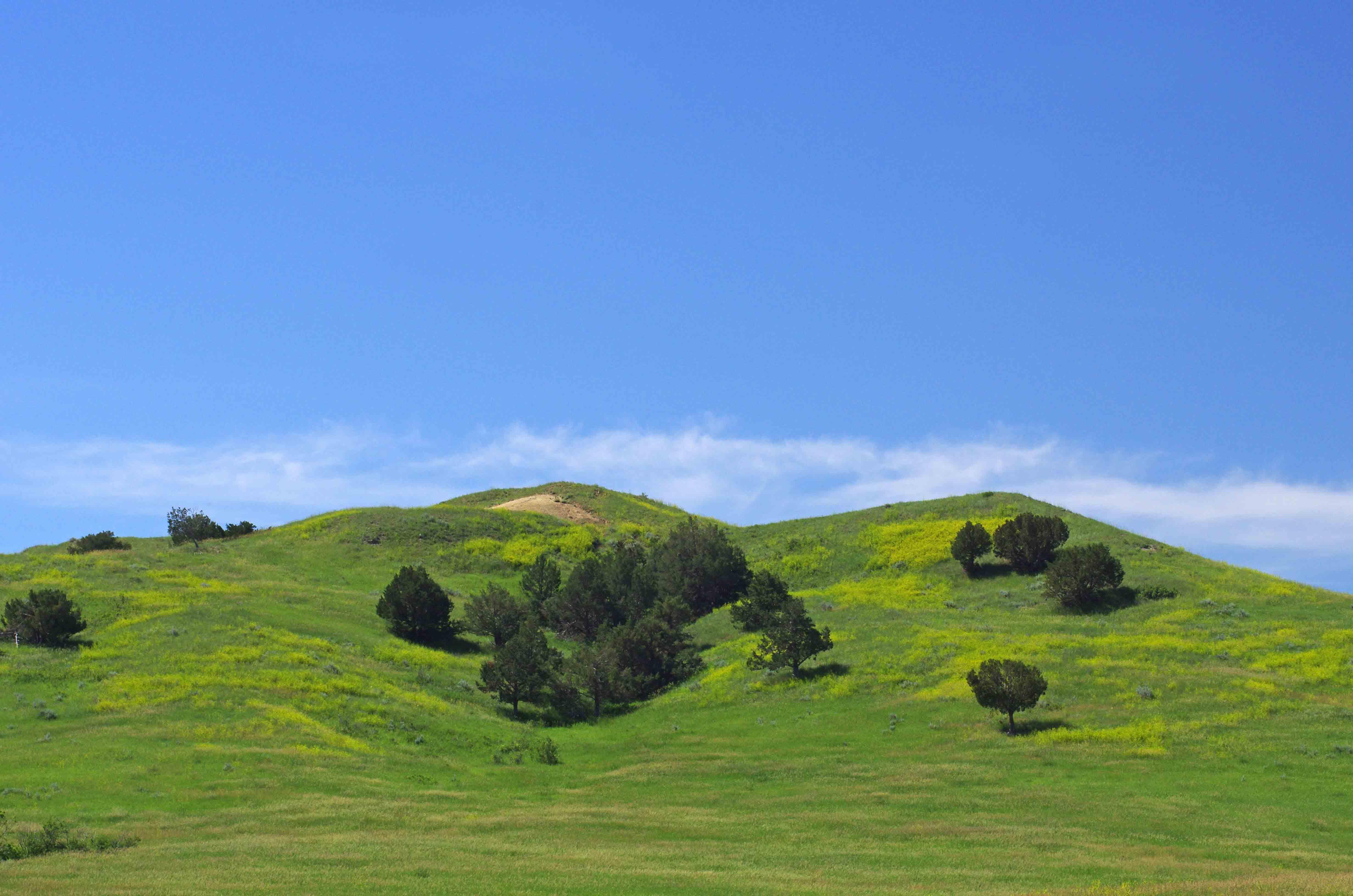
NPS via NPS.gov (Public Domain)
Campsites at Sage Creek Campground (2026 Guide) — Planning Tips
7 min read
Campsite Guide
Most first-time visitors to Badlands National Park head straight for the Cedar Pass area - paved roads, flush toilets, a visitor center with a real roof.
Your plans
For more, see Badlands Guided Tours: Ranger Programs & Private Options (2026).
For more, see Best Badlands National Park Photography Permit and Badlands National Park Weather.
For more, see complete visitor guide, all campgrounds, hiking trails, and lodging and accommodations.
Sage Creek Campground sits inside the Sage Creek Wilderness, which means you're not just camping near the Badlands - you're camping in them. The road in is gravel. The campsites are unmarked pull-offs along a loop. The only facilities are two pit toilets and a handful of covered picnic tables. Bison wander through regularly, and the rangers will tell you to keep at least 100 yards between you and them. That's not a suggestion. As of 2026, the campground remains free and first-come, first-served, and it rarely fills to capacity - though holiday weekends can change that.
If you want a complete visitor guide to this area, start with what the NPS publishes online. But what follows is the information most people need before they load the car.
Getting There - The Road Matters
Sage Creek Campground is not accessible from the main Badlands Loop Road. You'll need to take Highway 44 or Highway 240 to reach the Sage Creek Rim Road, which is unpaved. That unpaved road is the only way in.
The condition of the Sage Creek Rim Road changes with weather. Dry conditions mean a washboard surface that rattles your teeth but is passable for most vehicles. After rain, the bentonite clay turns slick and sticky. Rangers will tell you to avoid it entirely if rain is forecast. The road can close temporarily after winter storms or spring rains. If you're towing anything longer than a small trailer, check the turnaround options before committing. There are limited turnarounds for large RVs along the rim road.
The NPS alert as of 2026 specifically warns not to rely on GPS digital navigation to find the campground. GPS directions often direct drivers to closed or incorrect roads. Use the visitor center at 25216 Ben Reifel Road, Interior, SD 57750, as your reference point. It sits just off I-90. From there, head west on Highway 240 to the Sage Creek Rim Road access.
Most visitors underestimate the driving time from the park's main entrance to the campground. From the Pinnacles Entrance (near Wall), it's roughly an hour, half of it on gravel. Plan accordingly.

Camping at Sage Creek - What to Expect
Sites and Setup
There are 22 sites. They are not numbered in any intuitive way. You drive the loop, find a cleared spot with a fire ring (well, they used to be fire rings - open flames are not permitted), and claim it. Covered picnic tables provide shade, but they're fixed in place, so you orient your tent accordingly.
The terrain is mostly flat with short grass and scattered sagebrush. You'll be sharing the ground with prairie dogs, beetles, and occasionally bison. The soil is sandy and drains quickly after rain. Stakes go in easily - bring the short, angled kind rather than the plastic screw-in ones that need hard dirt.
Water - Bring All of It
This is the most important logistical detail: there is no water at Sage Creek Campground. None. Not a spigot, not a hand pump, not a water bottle fill station. You need to carry every drop you plan to drink, cook with, and wash with. The park service recommends at least one gallon per person per day, and that's conservative for July. Figure two gallons if you're hiking during the day.
The nearest water is at the White River Visitor Center (limited hours) or back at the Interior gas station. Do not count on finding potable water anywhere along the Sage Creek Rim Road.
Fires and Stoves
No fires or open flame permitted. That includes campfires, charcoal grills, and candles. Propane stoves are allowed. Wind can be a factor - bring a windscreen or a stove designed for exposed conditions.
Toilets
Two pit toilets serve the entire campground. They are cleaned periodically but are still pit toilets. Pack hand sanitizer (and toilet paper, because it runs out). The vault toilets are functional but not pleasant in August heat.
Wildlife - Real Encounters
Bison are the headline. They wander through the campground at any hour. You might wake to find a herd bedded down fifty feet from your tent. The park service instruction is clear: stay at least 100 yards away. That's the length of a football field. If a bison changes its posture (head drops, tail goes up, it stomps a foot), you're too close.
Prairie dogs are everywhere. They'll investigate your campsite but generally keep their distance. Coyotes yip at night. Pronghorn antelope graze on the rim. Rattle snakes are present but rarely seen. Keep your tent zipped.
Noise and Light
This is a primitive campground, not a party spot. Quiet hours aren't strictly enforced because they're assumed. Cell service drops out past the rim road. You'll have no signal and no artificial light from any direction for miles. The stars are the point.

Seasonal Considerations
Spring (April-May)
Spring brings unpredictable weather. Snow is possible in April. Rain turns the rim road to grease. Fewer campers, but prepare for cold nights (30s to 40s°F). Bison calving begins - cows are protective.
Summer (June-August)
Highs in the 90s°F are common. No shade except the picnic tables. Heat radiates off the prairie. Pack extra water and a shade structure. Afternoon thunderstorms roll in fast. Lightning on the open plains is dangerous - if you hear thunder, get in your vehicle.
Fall (September-October)
The best season by most accounts. Days are warm (70s°F), nights cool. Fewer insects. The road firms up. Bison are more active in the cooler hours.
Winter (November-March)
The campground remains open, but the road can be impassable after snow. Temperatures drop below zero. Only experienced winter campers should attempt it. No services, no water, and the pit toilets freeze.

Alternatives and Backup Plans
If Sage Creek is full (rare but possible on Memorial Day or Labor Day weekend), your options within the park are limited. Cedar Pass Campground charges a fee and takes reservations. It has water, flush toilets, and RV hookups - a different experience entirely.
If you want to see all the camping options in the park, check the all campgrounds page. There are backcountry options for hikers, but Sage Creek is the only drive-up primitive site.

What the NPS Website Doesn't Mention
A few things that catch people off guard:
- The wind. It's constant and strong. Stake everything. Weight down your picnic table items.
- The smell. Bison and prairie dogs mean dust and dung. It's not offensive, but it's not what most people expect from "camping."
- The isolation. If you have a medical emergency, help is an hour away. Carry a first aid kit and know basic backcountry medicine.
- The bison traffic jams. Bison on the road are not uncommon. They have the right of way. You may wait ten minutes for a herd to cross. Do not honk.
- The pit toilet schedule. They get cleaned, but not daily. If you're staying multiple days, bring your own toilet paper and hand sanitizer. The stalls have no lights.
Practical Takeaways
- Bring all your water. One gallon per person per day minimum. Two in summer.
- No reservations. First come, first served. Midweek arrival is your best bet. Friday and Saturday afternoons see more competition.
- No fires. Propane stove only.
- Navigation. Set your GPS to the Ben Reifel Visitor Center, then follow signs to Sage Creek Rim Road. Do not trust digital maps past that point.
- Prepare for weather. Rain can strand you on the gravel road. Check the forecast and be willing to leave early.
- Wildlife distance. Keep 100 yards from bison. No exceptions.
- Pit toilets. Bring toilet paper, hand sanitizer, and a headlamp.
- RVs. Small to medium trailers possible if you're comfortable on gravel. Large rigs will struggle with the road and the turnaround.
- Cell service. It's dead past the rim. Download maps and information before you lose signal.
- Leave no trace. Pack out all trash. There are no dumpsters.
Final Thoughts
Sage Creek Campground isn't for everyone. If you want a shower, a camp store, and a paved pad, stay at Cedar Pass. But if you want to wake up with bison outside your tent, with no sound but the wind and the distant yip of coyotes, and with a sky full of stars that seems close enough to touch - this is the spot. It's unapologetically primitive, and that's exactly why it works.
As of 2026, the campground remains free and open. That could change. No ranger is stationed here; the site is self-regulating. You police your own behavior. You pack your own water. You keep your distance from the wildlife. In return, you get a night in the Badlands that most visitors never experience. That trade is worth the gravel road.
For more information, see our complete Badlands National Park Guide.
Sources
- Official source: National Park Service nps.gov/thingstodo/backcountry-camping-badl.htm
- Official source: NPS — Badlands National Park nps.gov/badl/index.htm
Photo Gallery
More to Explore

Park Guide
Acadia National Park: Carriage Roads, Cadillac Mountain & 2026 Guide
Discover carriage roads, Cadillac Mountain, and rugged Maine coast. Complete 2026 guide to Acadia National Park — trails, fees, lodging, permits, and what rangers recommend.

Hiking Guide
Grand Canyon Hiking Trails: Day Hikes, Water Sources & Rim to Rim
Compare Grand Canyon hiking trails: Bright Angel, South Kaibab, Hermit, Grandview, and rim to rim, with distances, elevation, water stops, and trailhead access for each.

Best Of
Best of Glacier Bay National Park
The best of Glacier Bay is reached by boat: ranger-led day tours up the bay to the tidewater glaciers. What's worth it, how to book, and when to go (2026).

Campsite Guide
White Sands Backcountry Camping: Closed for 2026 — What to Know
As of 2026, backcountry camping at White Sands National Park is closed for site rehabilitation. What that means, and where to camp nearby instead.

Weather Guide
Guadalupe Mountains National Park Weather: Weather
Guadalupe Mountains National Park: weather guide guide updated 2026. Practical visitor information, reservations, and seasonal tips worth bookmarking before

Best Of
Best of Cuyahoga Valley National Park: Best Things to Do
Seeing a Cleveland Orchestra concert with the woods as your backdrop is a uniquely Cuyahoga Valley experience.
Sign in to join the conversation.
Sources & Attribution
Location data courtesy of the National Park Service (U.S. Department of the Interior). NPS data is public domain. Official NPS page.
Images: NPS; NPS; NPS; NPS; NPS.
Map data © OpenStreetMap contributors.
Park operations alerts: NPS.gov · Weather and weather hazards: National Weather Service · Live conditions.
Information may change. Always verify fees, hours, and conditions directly with the official source before visiting.
Did this guide help? Share it with a friend.