The Pere Marquette River is a West Michigan stream that runs about 66 miles from Lake and Mecosta county headwaters to Lake Michigan at Ludington, and the fishing here changes character completely depending on which stretch you pick and what time of year you show up. Check the gauge before you leave, because this river can be wadable in August and push you off your feet by November. The USGS gauge at Scottville (station 04122500) is the one most anglers watch, and the Michigan DNR manages the fishery with a mix of natural reproduction and stocked fish.
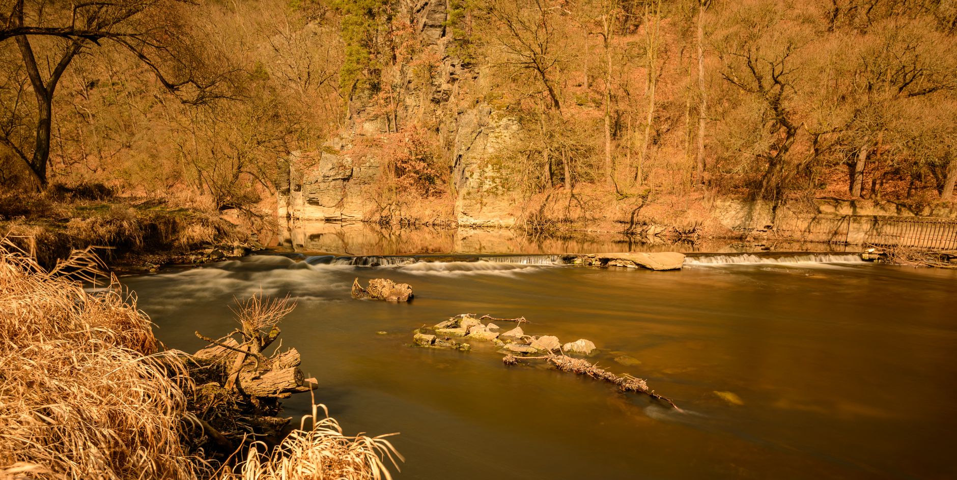
Photo by Petr Ganaj on Pexels
Pere Marquette River Fishing Guide: Access, Conditions & Seasons
7 min read
Waterbody Guide
Fishing Pere Marquette River in 2026: access, seasons, conditions, and what anglers need before they wet a line. Clear local guidance for a productive day.
Your plans
Flow reliability
Seasonal consistency of median discharge from the curated USGS gauge for this place.
Spring
83%
year-to-year consistency
Summer
82%
year-to-year consistency
Fall
66%
year-to-year consistency
Winter
83%
year-to-year consistency
Median monthly discharge (cfs)
| Jan | Feb | Mar | Apr | May | Jun | Jul | Aug | Sep | Oct | Nov | Dec |
|---|---|---|---|---|---|---|---|---|---|---|---|
| 703 | 697 | 894 | 1020 | 805 | 638 | 560 | 519 | 504 | 603 | 658 | 685 |
In the last 10 falls, roughly 1 of every 2 September–November weeks sat inside this band (553–889 cfs); typical flow in those weeks 628 cfs.
Computed from 10 years of USGS daily records, station 04122500 (3,650 daily values). Last computed Oct 19, 2026.
Hydrological description only — not advice about wading, floating, or whether conditions are safe for recreation. Always check current USGS readings and local guidance before you go.
Conditions and Gauge
The Pere Marquette is a classic Michigan trout stream in its upper reaches and a steelhead and salmon river in its lower sections. Flow matters more here than almost any other factor. The river runs clear and low in summer, often in the 200-400 cfs range at Scottville, and that's when the wading is easiest and the trout fishing is at its most technical. Fall rains and salmon runs push flows up, and by late fall the river can be running several times its summer volume.
Check the USGS gauge at Scottville before you commit to the drive. It gives you real-time flow data, and it's the closest thing the river has to an official report. When flows are below 300 cfs, the wading is straightforward on most sections. Between 300-600 cfs, you'll want to be careful on the bigger bends. Above 600 cfs, plan on bank fishing or drifting unless you know the river well.
Water temperature is the other number to track. The Pere Marquette gets warm by late July and August, especially in the lower stretches. Trout push toward cooler tributary mouths and deeper holes when surface temps climb past 68-70°F. If the river has been hot for a week straight, the morning bite is often the only reliable one.
Rain changes the plan here fast. The watershed is mostly agricultural and sandy, so runoff comes quick. After a hard rain, the river can cloud up for a day or two. If flows are up, wait. The fish won't be feeding predictably, and the wading gets sketchy.
Access
Access here is not a given. The Pere Marquette flows through a mix of public land and private property, and some of the best-looking water sits behind posted signs. The good news is that the state owns substantial stretches, especially in the Mason-Lake and Manistee National Forest sections. The bad news is that you can't just pull off any road and walk to the river.
The most reliable public accesses are the DNR launches and Forest Service sites. The lower river below the town of Pere Marquette Highway has several developed launches, and the upper river around Baldwin has a handful of walk-in accesses. Bring a backup access, because the small dirt lots fill early on summer weekends, and some of the more popular sites have limited parking.
Wading is the name of the game on most of the river. The bottom is a mix of sand, gravel, and occasional clay, and you'll want felt soles or studs because the algae-coated rocks get slick. The river is narrow enough to cross in most summer flows, but don't underestimate the current in the deeper runs. A wading staff is worth carrying.
For drift boats, the Pere Marquette has a well-established float culture. The section from the M-37 bridge down to the mouth at Pere Marquette Lake is the most popular float, and it has enough deep water to keep a boat off the bottom in normal flows. In low summer water, you'll scrape in places. Check the gauge and talk to the local outfitters before you commit to a float.

Seasons and Regulations
Confirm the season and size limit on the MDNR regs page before you fish. The state fishing guide at the Michigan DNR website is the authoritative source, and the Pere Marquette has some special regulations that differ from the statewide standard.
As of 2026, the river operates under a mix of regulation types depending on the section. The upper river above the confluence with the Little South Branch is managed under Type 3 regulations in many stretches, which means catch-and-release for trout with artificial lures only. Below that, the regulations shift to Type 4 in some areas, which allows harvest within specific size and bag limits. The exact boundaries matter, so read the regs carefully before you pick your stretch.
The steelhead and salmon seasons run on the Great Lakes schedule. Fall salmon typically start showing in September and peak in October. Winter steelhead start in November and run through March, with the best fishing often in February and March when the water is cold and clear. Spring steelhead follow the spawn in April and May.
The MDNR stocks the river with various species, and you can look up the exact stocking history through the FishStock database linked from the DNR website. The stocking notes tell you what went in, where, and when. Read the stocking notes, then verify locally, because the fish move around and the stocking records won't tell you where they are today.
Species Presence
The Pere Marquette supports a solid mix of species, and the iNaturalist observation data gives a rough sense of what shows up. Chinook salmon have the most documented observations, which tracks with the fall run that draws anglers from across the state. Largemouth bass and northern pike show up in the slower, warmer sections, and yellow perch are present in the lower river and the lake at the mouth.
Walleye are present but less commonly reported, and smallmouth bass have a dedicated following on the lower stretches. The river also sees coho salmon, rainbow trout, and lake trout in the system, though the lake trout are mostly a Lake Michigan fish that occasionally pushes into the river mouth.
For trout, the river is best known for its brown trout and steelhead. The brown trout population is largely wild, and the river has a reputation for producing fish in the 14-20 inch range. The steelhead are a mix of wild fish and hatchery fish, and the winter and spring runs draw the most dedicated anglers.
The chinook salmon run in the fall is the river's headline event. These are big fish, often 15-25 pounds, and they push up from Lake Michigan to spawn. The fishing is not subtle - it's chucking big plugs or skein under a float and hanging on. If you want subtle, wait for the winter steelhead.

Tactics That Match Conditions
Summer Trout
Low, clear water means light leaders and small flies. The brown trout here see a lot of pressure, and they're not easy. Size 16-20 nymphs in the riffles, and dry flies in the evenings when the hatches come off. The Sulfur hatch in June is the classic dry fly window, and the terrestrial bite in August - hoppers and ants - can be excellent along the grassy banks.
Fall Salmon
When the chinook are in, the river gets crowded. The fish stack in the deeper holes and runs, and the most effective approach is a 8-10 weight rod with a floating line and a big fly or a bait rig. Swinging streamers through the lies where the fish hold works, but most anglers fish skein or spawn sacs under an indicator. The fish aren't feeding, so it's about getting the offering in front of them and triggering a reaction strike.
Winter Steelhead
Cold water means slow presentations. The steelhead hold in the deepest holes and the tailouts, and the most consistent approach is a float rig with a small yarn or bead pattern drifted through the run. Water temps in the mid-30s to low-40s mean the fish are sluggish, so cover water slowly and fish each drift thoroughly.
Spring Steelhead
As the water warms into the 40s and 50s, the steelhead get more active. Swinging streamers becomes viable, and the fish respond to faster presentations. The spring run overlaps with the brown trout season, so you can catch both species on the same stretch.
For statewide orientation, see the Michigan fishing guide.
Practical Takeaways
- Check the USGS gauge at Scottville (station 04122500) before you leave. Flows above 600 cfs change the wading and the fishing.
- Confirm the season and size limit on the MDNR regs page. The Pere Marquette has section-specific regulations that differ from the statewide standard.
- Bring a backup access. The popular launches fill early, and some of the best water requires a walk.
- Pack for the weather. Rain showers are common, and the wind can be stiff, especially on the lower river. Check the forecast for the day, not the week.
- Match your gear to the season. A 4-6 weight rod for summer trout, an 8 weight for steelhead, and a 9-10 weight for fall salmon.
- If flows are up, wait. The river fishes best at stable or dropping levels, and the wading is safer.
- Read the stocking notes, then verify locally. The DNR FishStock database tells you what went in, but local fly shops know where the fish are today.
- Wind changes the plan on the big water. The lower river and the lake at the mouth get blown out easily, so have a sheltered plan for windy days.

Final Thoughts
The Pere Marquette River is worth the drive when the conditions line up. Summer low water offers some of the most challenging and rewarding brown trout fishing in the Lower Peninsula, and the fall salmon run is an event that draws anglers from across the state. The winter steelhead fishery is the quiet gem, with fewer anglers and fish that will test your patience and your knot-tying.
Skip it when the river is blown out, when the gauge is climbing fast, or when the summer heat has pushed the water temps too high. There are other rivers that fish better under those conditions. But when the flows are stable and the seasons align, the Pere Marquette delivers. Check the gauge, read the regs, and go.
Sources
- Official source: Michigan DNR — Natural Rivers program michigan.gov/dnr/managing-resources/fisheries/natural-rivers · retrieved Aug 29, 2026
- Official source: USGS — Pere Marquette River at Scottville (04122500) waterdata.usgs.gov/monitoring-location/04122500 · retrieved Aug 29, 2026
Photo Gallery
More to Explore
Waterbody Guide
Grand River Fishing: Grand Rapids Gauge & November Push
Grand River at Grand Rapids: start with the gauge, not the calendar — fall median discharge near 3,570 cfs inside a wide 2,310–5,827.5 cfs band.
Waterbody Guide
Kalamazoo River Fishing: New Richmond Fall Flow Band
Kalamazoo River fishing: character shifts from headwaters to the Lake Michigan mouth, with fall median discharge near 1,770 cfs and water around 52°F (11.2°C).
Waterbody Guide
St. Joseph River Fishing: Niles Gauge & Berrien Reaches
St. Joseph River: lower water below Niles takes on Big Lake runs while Berrien reaches fish warmer, with fall median discharge near 3,520 cfs at Niles.
Waterbody Guide
Rifle River Fishing: Sterling Gauge to Saginaw Bay
Rifle River toward Omer and Saginaw Bay: access limits the day more than desire, with fall median flow near 239.3 cfs and water around 47°F (8.5°C).
Waterbody Guide
Sturgeon River Fishing: Wolverine Gauge Autumn Band
Sturgeon River near Wolverine: September–November fall median discharge near 214.5 cfs, inside a reliable 197–259 cfs band for northern Lower Peninsula trips.
Waterbody Guide
Boardman River Fishing: Beitner Road Fall Consistency
Boardman River near Traverse City: fall median discharge near 259.5 cfs at Beitner Road, inside a reliable 234–307 cfs band for late-season trips.
Sign in to join the conversation.
Sources & Attribution
Fishing regulations and waters information should be verified with the relevant state wildlife agency before you fish.
Images: Photo by Petr Ganaj on Pexels; Photo by chandra diantara on Pexels; Photo by Abduljaleel tijjani Muhammad on Pexels; Photo by Meruyert Gonullu on Pexels. Stock photos from Pexels / Unsplash license; links above point to each photo where available.
Map data © OpenStreetMap contributors.
Information may change. Always verify seasons, licenses, and local regulations with the official source before you fish.
Did this guide help? Share it with a friend.