North Cascades National Park demands earned perspectives: its 300-plus glaciers and jagged peaks sit three hours from Seattle, but access is the real challenge. Plan around the SR 20 corridor's 9 AM trailhead fill-up and the ferry-dependent Stehekin Valley, where schedules dictate everything.
NPS via NPS.gov (Public Domain)
North Cascades National Park: America's Alps & Glacier Wilderness - 2026 Guide
9 min read
Park Guide
Plan your North Cascades visit with tips on SR 20 closures, trailhead parking before 9 AM, and Stehekin ferry access. Essential 2026 guide to trails, fees, and permits.
Your plans
This article contains affiliate links — we may earn a small commission at no extra cost to you.
At a glance
Hours
North Cascades National Park Service Complex is open year-round. The park operational season is late
Best Time
June-September (summer), September-October (fall colors)
Address
810 State Route 20, Sedro-Woolley, WA, 98284
Website
48.7117, -121.2069
Google MapsNavigating the Park Complex: Highways, Ferries, and Trailheads
Most first-time visitors are caught off guard by the park's structure. North Cascades National Park itself is flanked by two National Recreation Areas - Ross Lake and Lake Chelan - creating a large, administratively complex region. Your access point dictates your entire experience.
The State Route 20 Corridor
This is the park's paved spine. SR 20, the North Cascades Highway, runs east-west, connecting I-5 at Burlington to the dry east side near Twisp. It's your gateway to the majority of frontcountry campgrounds, major trailheads, and the iconic Diablo Lake Overlook. The highway closes each winter between the Ross Dam Trailhead and Lone Fir Campground, typically from November to April or May. As of 2026, check the Washington State DOT site for real-time closure status. The parking situation here is straightforward but competitive: trailhead lots along SR 20 fill by 9 AM on summer weekends. Rangers will tell you that break-ins at these lots are not uncommon. Remove every visible item from your car, including charging cords and empty bags.
The Stehekin Valley
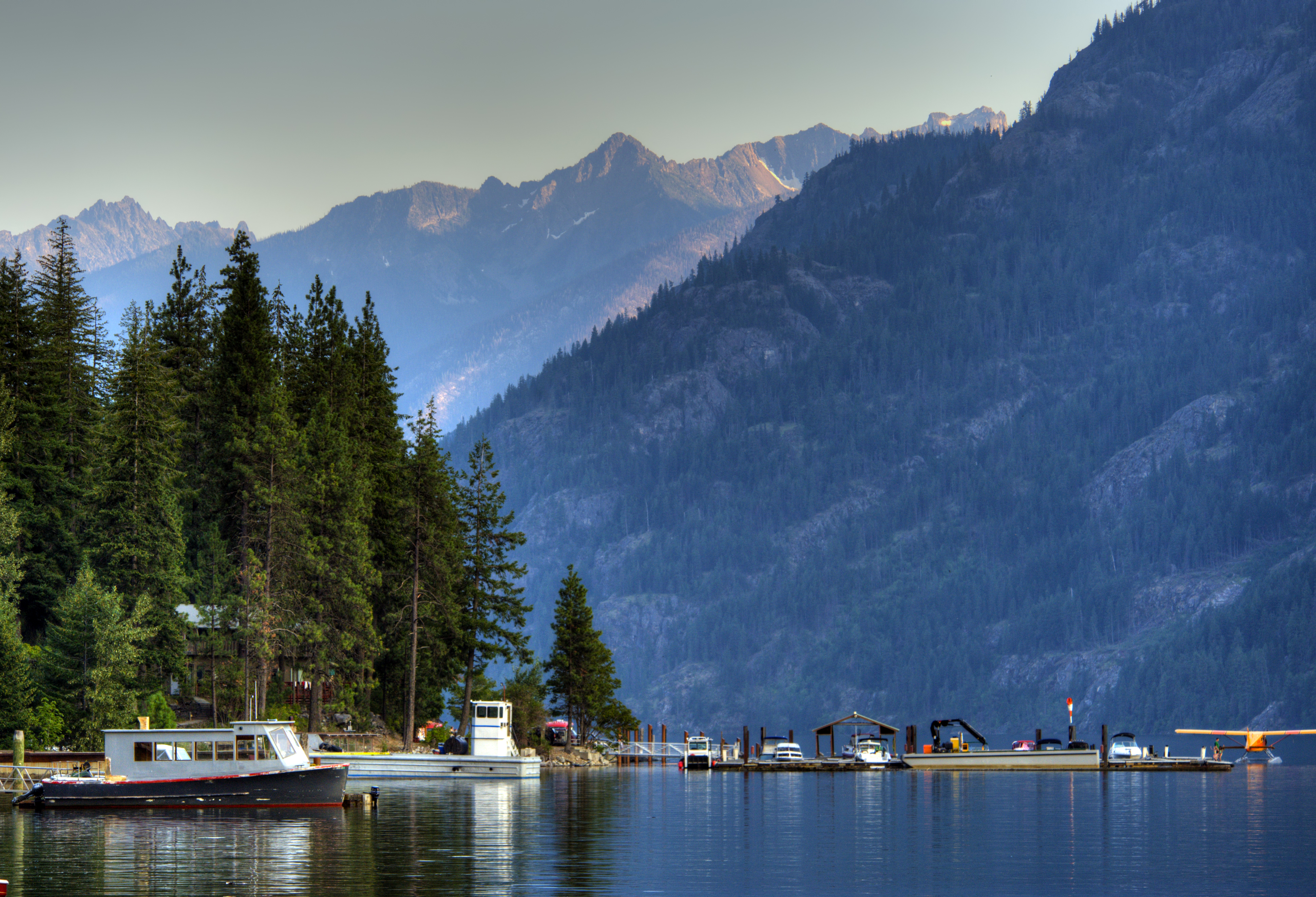
This is the park's remote heart. Stehekin, at the head of 55-mile-long Lake Chelan, has no road access. You get there by ferry from Chelan, by plane, or by hiking in. It's a different world - warmer, drier, and operating on river time. The Stehekin Valley Road runs 23 miles up-valley from the landing, serviced by a seasonal shuttle. Planning here revolves around the ferry schedule. The common mistake is underestimating the time and cost of the boat ride; it's not a quick hop but a journey that becomes part of the adventure.
Current Access Alerts
Always check the park's alerts page before you go. As of March 2026, several conditions affect access: SR 20 is closed at milepost 130 at Colonial Creek due to severe weather damage from late 2025. The Cascade River Road is gated two miles before the trailhead, adding a walk or bike to your hike. The Hozomeen gate from Canada remains closed. And the Diablo Lake boat launch is silted in, making it unusable for most powerboats. This is normal. Conditions here change weekly.

Hiking the High Country: From Strolls to Summits
The park protects some of the continent's most rugged mountain terrain, and its trail system is the primary draw. The routes divide neatly into two types: the calf-straining climbs to high passes and the gentler walks through river valleys and along lake shores.
The Iconic Day Hikes
Cascade Pass Trail is the park's signature day hike for a reason. It's a 7.4-mile roundtrip with a steady, switchbacking climb that rewards you with a panoramic view of jagged peaks and hanging glaciers. The trail narrows here at the pass, with options to continue toward Sahale Arm or Doubtful Lake for the ambitious. It's popular. I mean, really popular. Arriving after 8 AM on a Saturday in August means you'll be parking a mile down the road.
Easy Pass Trail is the alternative for those seeking equal views with slightly fewer people. The name is a tease - it's a steep 7.4-mile roundtrip grind. The payoff is a wide, rocky pass looking directly into the immense Fisher Basin. Wildflowers here in late July are a distraction in the best way.
Thunder Knob Trail is the family-friendly ace up the sleeve. It's a moderate 3.6-mile loop with manageable elevation gain that ends at a knob directly above Diablo Lake. The view of the lake's turquoise water backed by pyramid peaks is the postcard shot, without a 2,000-foot climb.
Stehekin Valley Walks
On the east side, hikes feel different. The Agnes Gorge Trail is an easy 5-mile roundtrip through dry pine forest to the rim of a deep, roaring gorge. The Lakeshore Trail heading north from Stehekin is flat, follows the water, and is perfect for an evening stroll. For a taste of history mixed with effort, the Company Creek Trail climbs steeply for views of the valley and Bonanza Peak, the state's tallest non-volcanic summit.
The Backcountry Network
For those planning overnight trips, the wilderness is vast. The Bridge Creek Trail connects to the Pacific Crest Trail, offering endless possibilities. The East Bank Trail along Ross Lake provides relatively flat mileage with options to camp at boat-in sites. Permits are required for all overnight stays in the backcountry and are issued at the Wilderness Information Center in Marblemount. Competition for popular zones like the Ptarmigan Traverse is fierce; the early summer lottery is a ritual for experienced alpinists. For more detail, see our guide to backcountry camping.

On the Water: Lakes, Rivers, and a Turquoise Reservoir
If the mountains define the skyline, the water defines the experience. The park's complex holds three major reservoirs (Gorge, Diablo, Ross) and the massive Lake Chelan, each offering distinct ways to play.
Paddling and Powerboating
Diablo Lake is the star, its surreal turquoise color caused by glacial flour - fine rock sediment suspended in the water. Paddling in the North Cascades here means putting in at the Colonial Creek Campground (the boat launch issue only affects powerboats) and exploring the steep, forested shorelines. You can paddle to the base of Thunder Arm for a sense of scale. Ross Lake is the motorboating and fishing hub, with the unique Ross Lake Resort offering floating cabins. You can rent boats at the resort or launch from the Hozomeen access at the north end (when the border access reopens). Lake Chelan is a destination itself, with the 4-hour ferry ride offering sightseeing before you even dip a paddle in Stehekin.
Whitewater and Fishing
The Skagit River below Ross Dam and the Stehekin River offer rafting in the North Cascades, primarily in the summer runoff season. These are cold, technical rivers best tackled with a guide if you're not experienced. Fishing in the North Cascades is a quieter pursuit. Dozens of alpine lakes and rivers hold trout. The park service asks anglers to help protect native species; know the regulations and consider barbless hooks. The Diablo Lake area is a popular starting point.

Where to Stay: Campgrounds, Lodges, and the Stehekin Shuttle
Your choice of lodging dictates the rhythm of your trip. The park has frontcountry campgrounds, one iconic lodge, and a legendary floating resort.
Campgrounds Along SR 20
The nine drive-in campgrounds along the highway corridor are your most reliable bet. They operate on a mix of reservation and first-come, first-served systems.
* Newhalem Creek Campground (107 sites, $24 as of 2026) is the largest and most convenient, near the visitor center. It's often full.
* Colonial Creek North and South Campgrounds (131 sites combined, $24) are the most scenic, situated in old-growth forest right on the thunderous creek feeding into Diablo Lake. The south campground's loops have a deeper, darker woods feel.
* Goodell Creek ($20) is a good overflow option, quieter and right on the Skagit River.
All these fill daily in summer. Have a backup plan. For a complete breakdown of all camping options, including backcountry, see our dedicated guide.
The Stehekin Experience
In Stehekin, you have four walk-in campgrounds (Harlequin, Purple Point, Lakeview, and Weaver Point - all $20) and the North Cascades Lodge at Stehekin. The lodge is simple, clean, and books up a year in advance for summer. The real magic is at Ross Lake Resort, a cluster of floating cabins on Ross Lake accessible only by boat or a steep hike. It's not cheap, and it's booked 18 months out, but for a certain type of visitor, it's the only place to stay. For more on lodging and accommodations inside and near the park, we have a full resource.

Planning Your Visit: Seasons, Permits, and the Unpredictable
This isn't a park you wing. The best time to visit north cascades national park is a short, precious window with big asterisks.
The Seasonal Reality
The operational season is late May to late September. Snow lingers on high trails often through mid-July. Early autumn (September-October) can be glorious for color and crisp air, but storms roll in quickly, and the first snow can close the highway anytime after October. Winter is for ski tourers and snowshoers on a limited road network. The east side (Stehekin) is consistently warmer and drier; summer temperatures there can hit the 90s F, while the west side might be in the 70s.
Permits and Passes
No entrance fee is required for North Cascades National Park. However, you do need a Northwest Forest Pass or America the Beautiful Pass for parking at most trailheads along SR 20. This catches many people off guard. The $5 day pass or the annual interagency pass covers it. Backcountry permits are required for all overnight trips and are your biggest planning hurdle. Reservations are available for some areas, while others are walk-in only at the Wilderness Information Center.
Gearing Up
The weather changes fast. You need layers - a moisture-wicking base, an insulating mid-layer, and a waterproof shell. The sun is intense at altitude; bring a hat, sunglasses, and sunscreen. Footwear is non-negotiable: sturdy hiking boots with good ankle support for the rocky, uneven trails. Trekking poles are worth their weight on the descents. And water. Always more water than you think. The gift shop sells it for $4 a bottle. Bring your own.
Practical Takeaways
- Verify Access. Before you leave home, check the park's official website for current alerts on road closures (like SR 20 at MP 130), trail conditions, and fire restrictions. Assume what you read a month ago is outdated.
- Master the Parking Pass. You need a Northwest Forest Pass or America the Beautiful Pass for trailhead parking along Highway 20. Buy it online beforehand or at the Wilderness Information Center in Marblemount.
- Target the Shoulders. Aim for late June (for wildflowers) or September (for fall color and fewer bugs) to avoid the peak July-August crowds. Weekdays are always better.
- Plan Around the Ferry. If Stehekin is your goal, book your ferry ticket and lodging simultaneously. The last boat out dictates your schedule.
- Pack for All Conditions. Even on a sunny forecast, carry a rain jacket, warm layer, and extra food. Mountain weather is independent and often wet.
- Start Early. This is the single most effective strategy for a better experience. An 8 AM start beats a 10 AM start by miles of solitude and available parking.
- Leave No Trace, Seriously. Pack out all trash, including toilet paper. Use established campsites. Protect the fragile alpine meadows by staying on durable surfaces.
Final Thoughts
North Cascades National Park doesn't cater to the casual drive-through tourist. It asks for effort - early mornings, steep climbs, meticulous planning, and a tolerance for weather that can turn on a dime. In return, it gives you a raw, untamed version of the American wilderness that feels increasingly rare. You come here not just to see glaciers, but to hear them groan. Not just to see peaks, but to feel your legs ache on the way up to meet them. It's a place that reminds you of scale, of climate, and of the quiet reward that follows a well-earned view. Check the alerts page one more time, then go.
Recommended Gear
What experienced visitors bring to North Cascades National Park: America's Alps & Glacier Wilderness - 2026 Guide
Links may earn us a commission at no extra cost to you. We only recommend gear we believe in.
Hiking Essentials
Hydration Pack (3L)
Hands-free water for long trail days
Trekking Poles (Pair)
Save your knees on steep descents
Hiking Boots (Ankle Support)
Sturdy footwear for rocky, uneven trails
Sun & Heat Protection
Wide-Brim Sun Hat
Full coverage UPF 50+ protection at altitude
Insulated Water Bottle (32oz)
Keeps water cold in desert heat all day
Winter Gear
Microspikes / Traction Devices
Essential for icy rim trails in winter months
Packable Down Jacket
Lightweight warmth that stuffs into a pocket
Sources
- Official source: NPS — North Cascades National Park nps.gov/noca/index.htm
Explore More National Parks

Olympic National Park: Rainforests, Peaks & Wild Coast - 2026 Guide
Discover rainforests, wild coastline, and glacier-capped peaks. Complete 2026 guide to Olympic Natio...

Mount Rainier National Park: Wildflowers, Glaciers & Cascade Views - 2026 Guide
Discover wildflowers, glaciers, and Cascade views. Complete 2026 guide to Mount Rainier National Par...

Glacier National Park: Going-to-the-Sun Road & Complete 2026 Guide
Discover the Going-to-the-Sun Road and 700 miles of trails. Complete 2026 guide to Glacier National...

Glacier Bay National Park: Tidewater Glaciers & Southeast Alaska - 2026 Guide
Discover tidewater glaciers meeting the sea in Southeast Alaska. Complete 2026 guide to Glacier Bay...
Photo Gallery
More to Explore

Park Guide
Acadia National Park: Carriage Roads, Cadillac Mountain & 2026 Guide
Discover carriage roads, Cadillac Mountain, and rugged Maine coast. Complete 2026 guide to Acadia National Park — trails, fees, lodging, permits, and what rangers recommend.

Hiking Guide
Grand Canyon Hiking Trails: Day Hikes, Water Sources & Rim to Rim
Compare Grand Canyon hiking trails: Bright Angel, South Kaibab, Hermit, Grandview, and rim to rim, with distances, elevation, water stops, and trailhead access for each.

Best Of
Best of Glacier Bay National Park
The best of Glacier Bay is reached by boat: ranger-led day tours up the bay to the tidewater glaciers. What's worth it, how to book, and when to go (2026).

Campsite Guide
White Sands Backcountry Camping: Closed for 2026 — What to Know
As of 2026, backcountry camping at White Sands National Park is closed for site rehabilitation. What that means, and where to camp nearby instead.

Weather Guide
Guadalupe Mountains National Park Weather: Weather
Guadalupe Mountains National Park: weather guide guide updated 2026. Practical visitor information, reservations, and seasonal tips worth bookmarking before

Best Of
Best of Cuyahoga Valley National Park: Best Things to Do
Seeing a Cleveland Orchestra concert with the woods as your backdrop is a uniquely Cuyahoga Valley experience.
Sign in to join the conversation.
Sources & Attribution
Location data courtesy of the National Park Service (U.S. Department of the Interior). NPS data is public domain. Official NPS page.
Images: NPS; NPS; NPS; NPS; NPS.
Map data © OpenStreetMap contributors.
Park operations alerts: NPS.gov · Weather and weather hazards: National Weather Service · Live conditions.
Information may change. Always verify fees, hours, and conditions directly with the official source before visiting.
Did this guide help? Share it with a friend.