North Cascades National Park Hiking: Cascade Pass, Diablo Lake & Alpine Trails (2026 Guide)
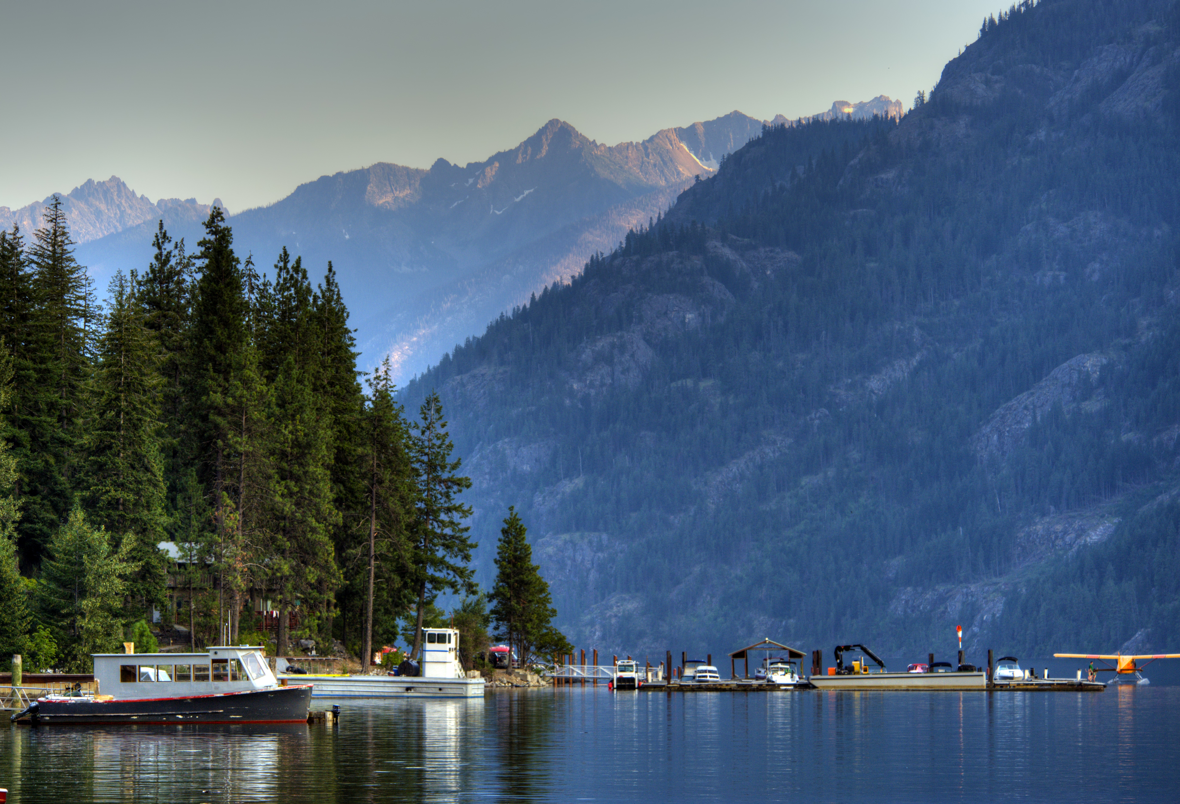
NPS via NPS.gov (Public Domain)
Hiking in North Cascades National Park
12 min read
Hiking Guide
Complete 2026 hiking guide for North Cascades National Park. Trails, difficulty ratings, seasonal conditions, and practical tips for every skill level.
This article contains affiliate links — we may earn a small commission at no extra cost to you.
Most visitors planning a day of hiking in North Cascades National Park underestimate one thing: the vertical scale. You're not walking to a viewpoint. You're climbing into the alpine, where trails are carved into the sides of mountains that rise 7,000 feet straight up from valley floors. The hiking here is defined by long, steady climbs through dense forest that suddenly erupt into open, rocky basins. It demands strong legs, a tolerance for exposure, and a willingness to turn around if the weather changes - which it does, often. This isn't a park for casual strolls. It's for earned views.
What Hiking Here Actually Means
Hiking in North Cascades National Park means committing to elevation. The signature trails aren't loops; they're ascents. You'll spend the first hour or two in a tunnel of fir and cedar, the trail a consistent, unrelenting grade. Then, you break through treeline onto slopes of loose rock and heather. The air thins. The wind picks up. Your world becomes a 180-degree panorama of jagged, glacier-hung peaks. This transition - from forest floor to alpine kingdom - is the park's defining experience. It's also what first-timers consistently misjudge. A 6-mile round-trip hike with 2,500 feet of gain here feels significantly more strenuous than the same stats at a lower-elevation park.
The terrain is raw and the maintenance is minimal. Expect rough, rocky tread, stream crossings without bridges, and sections of trail that cling to steep slopes. Rangers will tell you that "moderate" here often includes a stretch that would be labeled "difficult" elsewhere. Your success depends less on fitness and more on preparation: checking the trail conditions report, packing layers for every season, and starting early enough that afternoon thunderstorms don't catch you on an exposed ridge. For a broader context, our complete visitor guide covers the park's layout and districts.
Cascade Pass & Sahale Arm: The Definitive Ascent
This is the hike that defines the North Cascades experience. It's a long drive on a rough road for a relentless climb that ends on a narrow spine of rock with some of the most commanding views in the Lower 48. Worth every step.
Distance: 7.4 miles round-trip to Cascade Pass; 11.8 miles round-trip to Sahale Arm
Elevation Gain: 1,800 feet to the Pass; 4,000 feet to Sahale Arm
Trailhead & Parking: The trailhead is at the end of Cascade River Road. As of spring 2026, the road is closed to vehicles at milepost 21, two miles before the trailhead, adding a 4-mile round-trip walk or bike ride just to start. The small lot at the actual trailhead fills by 7 AM on summer weekends. If the gate is open, get there early.
The Trail: The first section is a relentless series of switchbacks through forest. The trail narrows here, with a consistent, calf-burning grade. After about 2.5 miles, you emerge at Cascade Pass - a wide, sloping meadow with jaw-dropping views of the Johannesburg Mountain massif. Most people stop here. To continue onto Sahale Arm, the trail climbs steeply through heather and talus fields. The final push to the Sahale Glacier camp is a steep, rocky scramble.
The Moment: Standing on Sahale Arm, looking down the sheer east face to Doubtful Lake, 2,000 feet below, with the jagged peaks of the Ptarmigan Traverse stretching to the horizon.
What Most Underestimate: The exposure and thin air on Sahale Arm. The final climb is steep, the trail is loose, and the altitude (over 7,500 feet) can cause shortness of breath even for fit hikers.
Best Time: Mid-July through September, once the snow has melted from the upper arm. Start by 6 AM to secure parking and avoid afternoon clouds.
Maple Pass Loop: The Crowd-Pleasing Classic
A nearly perfect loop hike that delivers maximum scenery for moderate effort. It's popular for a reason, which means you'll have company.
Distance: 7.2-mile loop
Elevation Gain: 2,200 feet
Trailhead & Parking: Rainy Pass trailhead on Highway 20. This is one of the most competitive parking situations in the park. The lot is often full by 8 AM on a sunny Saturday. Overflow parking spills along the highway shoulders for nearly a mile. Rangers patrol and ticket for illegal parking. Your best bet is to arrive by 7 AM or plan an afternoon start after the early birds depart.
The Trail: Most hikers go counter-clockwise, tackling the steeper climb first through forest before emerging at Heather Pass. The trail then contours around the basin above Lake Ann, offering non-stop views of the lake and Black Peak. The high point is Maple Pass, with a panoramic view that includes Glacier Peak on a clear day. The descent is longer and gentler, through larch groves that turn brilliant gold in early October.
The Moment: The first full view of Lake Ann, a perfect teal-blue oval set in a deep, rocky cirque, from the trail high on the slope above it.
What Most Underestimate: The sheer number of people. This is a social trail. If you seek solitude, you won't find it here. Also, the "moderate" rating includes some steep, rocky sections with significant exposure.
Best Time: Late July for wildflowers, early October for golden larches. The loop is usually snow-free by mid-July.

Diablo Lake Trail: The Lake-Level Perspective
This trail gives you the iconic view of Diablo Lake's turquoise water, but from its shoreline, not the highway overlook. It's a shadier, lower-elevation option for a hot day or when the high country is socked in.
Distance: 7.6 miles round-trip
Elevation Gain: 1,400 feet
Trailhead & Parking: The trailhead is at the North Cascades Environmental Learning Center, just off Highway 20. Parking is limited but turnover is decent. If full, you cannot park along the road; you may need to use the large Colonial Creek Campground lot a mile south and walk back.
The Trail: A steady climb through dense forest with occasional glimpses of the lake far below. The trail narrows here as it contours along the steep hillside. About 2.5 miles in, you reach a rocky promontory with the classic view directly across to Diablo Lake and the glaciated peaks behind it. The trail continues another mile to a suspension bridge over the Thunder Arm, but the main viewpoint is the promontory.
The Moment: That first clear sightline where the unreal, milky-turquoise water fills the valley floor, contrasted against the dark green forest.
What Most Underestimate: The bugs. This is prime mosquito and fly habitat in July and August. Bring repellent. The view is also somewhat weather-dependent; overcast skies mute the lake's famous color.
Best Time: A good shoulder-season hike in June or September. On a sunny summer afternoon, it can be quite warm.
Hidden Lake Lookout: The Firewatch Perch
A relentless climb to a historic fire lookout perched on a dramatic granite dome. The final scramble is not for the faint of heart, but the 360-degree payoff is.
Distance: 9.0 miles round-trip
Elevation Gain: 3,300 feet
Trailhead & Parking: The trailhead is accessed via a rough, potholed forest service road (FS Road 1540) that requires high clearance. The small lot fills early. There is no water source at the trailhead.
The Trail: The first two miles are a brutal, unshaded climb through an old burn area. Then you enter beautiful alpine basin with creeks and wildflowers before the final rocky ascent to the lookout. The last quarter-mile requires hands-on scrambling up granite slabs. The lookout itself is first-come, first-served for overnight stays.
The Moment: Sitting on the lookout's catwalk, looking down at Hidden Lake 1,500 feet below, with a sea of North Cascades peaks in every direction.
What Most Underestimate: The road and the scramble. The drive to the trailhead can take longer than you think and demands a suitable vehicle. The final scramble is exposed and requires confident footing on granite.
Best Time: August and September, when the snow has fully melted from the upper basin and the granite slabs are dry. Never attempt in wet or icy conditions.
Thornton Lakes & Trappers Peak: The Leg Burner
A steep, direct climb to a razor-edge summit with some of the most dramatic views of the Northern Picket Range. This is for strong hikers who don't mind a rough trail.
Distance: 10.0 miles round-trip
Elevation Gain: 3,100 feet
Trailhead & Parking: Thornton Lakes trailhead, off Highway 20 near Newhalem. The parking area is small and fills quickly. The access road is narrow and rough.
The Trail: The trail to the lower lakes is a straightforward, steep forest climb. The path to Trappers Peak branches off and becomes a steep, rocky, and often faint scramble up a narrow ridge. The final approach involves some easy but exposed class 3 scrambling. Route-finding skills are helpful.
The Moment: The summit of Trappers Peak, which is essentially a large, flat rock. From here, you look straight into the deep, glaciated cirque holding Thornton Lakes, with the sheer walls of the Pickets filling the northern skyline.
What Most Underestimate: How rough and steep the trail to the peak is. This is not a maintained park service trail for much of the way. It's a rugged route.
Best Time: Late July through September. The north-facing slope holds snow late into the summer.

Sourdough Mountain: The Steep Grind
A historic lookout trail that is essentially one long, punishing switchback from valley floor to mountain summit. It's a fitness test with a huge reward.
Distance: 10.4 miles round-trip
Elevation Gain: 5,100 feet
Trailhead & Parking: The trailhead is in the town of Diablo, near the dam. Parking is very limited. Do not block any gates or roads.
The Trail: There's no subtle way to put it: you climb 5,000 feet in just over 5 miles. The switchbacks are endless, through forest that slowly transitions to subalpine. The final push to the lookout site (the structure is gone) is across an open, rocky slope. The grade is relentless from the first step to the last.
The Moment: Reaching the summit ridge and seeing Diablo Lake look like a puddle 5,000 feet directly below you, with the entire crest of the North Cascades laid out.
What Most Underestimate: The sheer physical toll. This is one of the steepest sustained climbs in the park. Most people take 4-6 hours just to get up. Pack extra water for this stretch - there is none on trail.
Best Time: August to early October. The trail faces south and loses snow early, but can be brutally hot on a summer afternoon. Start at dawn.
Blue Lake: The Accessible Gem
A relatively short, family-friendly hike to a alpine lake surrounded by larches. It's the perfect introduction to North Cascades scenery without a major climb.
Distance: 4.4 miles round-trip
Elevation Gain: 1,000 feet
Trailhead & Parking: Right off Highway 20 at Washington Pass. The lot is large but still fills by 9 AM on weekends due to the trail's popularity. Overflow is along the highway.
The Trail: A well-graded, smooth trail through forest and open meadows with constant views of Liberty Bell and Early Winters Spires. It's a consistent but manageable climb. The lake appears suddenly, its deep blue water backed by towering cliffs.
The Moment: The first view of the lake, especially in late September when the surrounding larch trees are a blazing gold.
What Most Underestimate: How crowded it gets. This is the park's most popular short hike. For a quieter experience, go on a weekday or in the evening.
Best Time: July through October. The larch display in late September/early October is a major draw.
Seasonal Trail Conditions
Your hike depends entirely on the month. The park's operational season is late May to late September, but "summer" on the trails is much shorter.
June: High-elevation trails (Cascade Pass, Maple Pass, Sahale Arm) are still under significant snow. You'll need traction devices (microspikes) and possibly an ice axe for safe travel. Lower trails like Diablo Lake are snow-free and prime for wildflowers. Mosquitoes emerge with a vengeance.
July: Snow melts rapidly. By mid-July, most trails are largely snow-free, though persistent snowfields often remain on north-facing slopes above 6,000 feet (like the final climb to Sahale Arm). This is peak wildflower season in the alpine basins. Afternoon thunderstorms become frequent.
August: The most reliable month for dry, snow-free trails. Weather is generally stable, though smoke from regional wildfires can become an issue, obscuring views. Bugs start to subside. This is the prime window for high climbs like Hidden Lake and Trappers Peak.
September: Arguably the best month for hiking in North Cascades National Park. Stable weather, no bugs, cooler temperatures, and smaller crowds. The alpine larches begin turning gold in late September. Nights start to get cold.
October: A roll of the dice. You can have brilliant, crisp days with fall colors, or early winter storms that dust the high country with snow. Highway 20 typically closes for the season between late October and November, cutting off access to eastern trailheads like Blue Lake and Maple Pass. Always check the park's weather page for the latest forecasts before you go.

Trailhead Logistics
The parking situation dictates your entire day. Break-ins at trailheads along Highway 20 are, unfortunately, not uncommon. Remove all valuables, electronics, and even charging cords from your vehicle. Leave nothing in sight.
For the Highway 20 corridor trailheads (Maple Pass, Blue Lake, Diablo Lake), the lots fill by 8 AM on summer weekends. Your options are to arrive extremely early, visit on a weekday, or plan a late afternoon start. Rangers do ticket illegally parked cars that block traffic or gates.
For Cascade Pass, the road closure adds a significant layer. As of 2026, you must walk or bike the final two miles to the trailhead. Factor this into your distance, time, and energy calculations.
Cell service drops out at the Marblemount area and is nonexistent for the entire length of Highway 20 through the park. Download maps, trail info, and your parking pass (if required) beforehand.
Backcountry permits are required for all overnight stays. They are available online via Recreation.gov or in person at the Wilderness Information Centers in Marblemount and Sedro-Woolley. Bear canisters are required for all food storage in the backcountry; they can be rented at the Wilderness Information Centers.
What to Carry
Forget the generic list. Hiking in North Cascades National Park demands specific gear for its specific conditions.
Footwear: Sturdy hiking boots with aggressive tread are non-negotiable. The trails are rocky, rooty, and often wet. Trail runners are insufficient for the ankle-twisting terrain and heavy packs if you're camping.
Layers: The temperature difference between the trailhead and the summit can be 30 degrees Fahrenheit. A moisture-wicking base layer, a warm insulating layer (fleece or puffy), and a waterproof, windproof shell are the absolute minimum. Gloves and a beanie are wise year-round for high elevations.
Water: Many trails have no reliable water sources, or the sources are glacial silt that will clog your filter. Carry all the water you'll need for the entire hike. For a full-day hike like Sahale Arm, that's at least 3 liters per person.
Traction: From June through early August, carry microspikes in your pack. A seemingly dry trail can have an icy, sloping snowfield around the corner that is dangerously slippery without them.
Navigation: A physical map and compass (and the knowledge to use them) are recommended. Many trail junctions are unsigned, and trails above treeline can fade into talus fields. A GPS device with pre-loaded maps is a reliable backup.
Sun Protection: The alpine sun is intense, and reflection off snow and rock doubles the exposure. Sunglasses, a wide-brimmed hat, and high-SPF sunscreen are critical.
Practical Takeaways
- Start Early. This is the single most important rule. Aim to be at the trailhead by 7 AM, both for parking and to be off high, exposed ridges before afternoon thunderstorms build.
- The Road Defines Access. Highway 20 closes seasonally. Cascade River Road often has a late spring gate. Always check the Washington State DOT site and the park alerts for current road status before you drive.
- Pack for Winter, Even in Summer. A sunny morning can turn into a cold, windy, rainy afternoon at 7,000 feet. Your shell jacket is your most important piece of gear.
- Mileage is Deceptive. A 6-mile hike here is not equivalent to a 6-mile hike elsewhere. Factor in the elevation gain, rough terrain, and altitude. Add 25-50% to your usual pace.
- Water is Heavy but Necessary. When in doubt, carry more. There are few reliable streams on the high trails, and glacial silt clogs filters quickly.
- Leave No Trace, Seriously. This is federally designated wilderness. Pack out all trash, including toilet paper. Use WAG bags or dig catholes 200 feet from water and trails.
- Bears are Present. Carry bear spray, know how to use it, and make noise on blind corners. All food must be stored in bear canisters in the backcountry.
- Your Car is a Target. Heed the park's warning: remove every single valuable and electronic accessory. A visible empty charging cord is enough to invite a break-in.
- Know Your Turnaround Time. Pick a time - like 1 PM - and stick to it. If you haven't reached your summit or pass by then, turn around. The descent always takes longer than you think.
- The Visitor Center is for Intel. Stop at the North Cascades Visitor Center in Newhalem or the Wilderness Information Center in Marblemount for the latest trail condition reports from rangers. They know which trails have dangerous snow bridges or washed-out sections. This five-minute stop can save your hike.
Recommended Gear
What experienced visitors bring to Hiking in North Cascades National Park
Links may earn us a commission at no extra cost to you. We only recommend gear we believe in.
Hiking Essentials
Hydration Pack (3L)
Hands-free water for long trail days
Trekking Poles (Pair)
Save your knees on steep descents
Hiking Boots (Ankle Support)
Sturdy footwear for rocky, uneven trails
Sun & Heat Protection
Wide-Brim Sun Hat
Full coverage UPF 50+ protection at altitude
Insulated Water Bottle (32oz)
Keeps water cold in desert heat all day
Winter Gear
Microspikes / Traction Devices
Essential for icy rim trails in winter months
Packable Down Jacket
Lightweight warmth that stuffs into a pocket
Sources
- Official source: NPS — North Cascades National Park nps.gov/noca/index.htm
Photo Gallery
More to Explore

Park Guide
Acadia National Park: Carriage Roads, Cadillac Mountain & 2026 Guide
Discover carriage roads, Cadillac Mountain, and rugged Maine coast. Complete 2026 guide to Acadia National Park — trails, fees, lodging, permits, and what rangers recommend.

Hiking Guide
Grand Canyon Hiking Trails: Day Hikes, Water Sources & Rim to Rim
Compare Grand Canyon hiking trails: Bright Angel, South Kaibab, Hermit, Grandview, and rim to rim, with distances, elevation, water stops, and trailhead access for each.

Best Of
Best of Glacier Bay National Park
The best of Glacier Bay is reached by boat: ranger-led day tours up the bay to the tidewater glaciers. What's worth it, how to book, and when to go (2026).

Campsite Guide
White Sands Backcountry Camping: Closed for 2026 — What to Know
As of 2026, backcountry camping at White Sands National Park is closed for site rehabilitation. What that means, and where to camp nearby instead.

Weather Guide
Guadalupe Mountains National Park Weather: Weather
Guadalupe Mountains National Park: weather guide guide updated 2026. Practical visitor information, reservations, and seasonal tips worth bookmarking before

Best Of
Best of Cuyahoga Valley National Park: Best Things to Do
Seeing a Cleveland Orchestra concert with the woods as your backdrop is a uniquely Cuyahoga Valley experience.
Sign in to join the conversation.
Sources & Attribution
Location data courtesy of the National Park Service (U.S. Department of the Interior). NPS data is public domain. Official NPS page.
Images: NPS; NPS; NPS; NPS; NPS.
Map data © OpenStreetMap contributors.
Park operations alerts: NPS.gov · Weather and weather hazards: National Weather Service · Live conditions.
Information may change. Always verify fees, hours, and conditions directly with the official source before visiting.
Did this guide help? Share it with a friend.