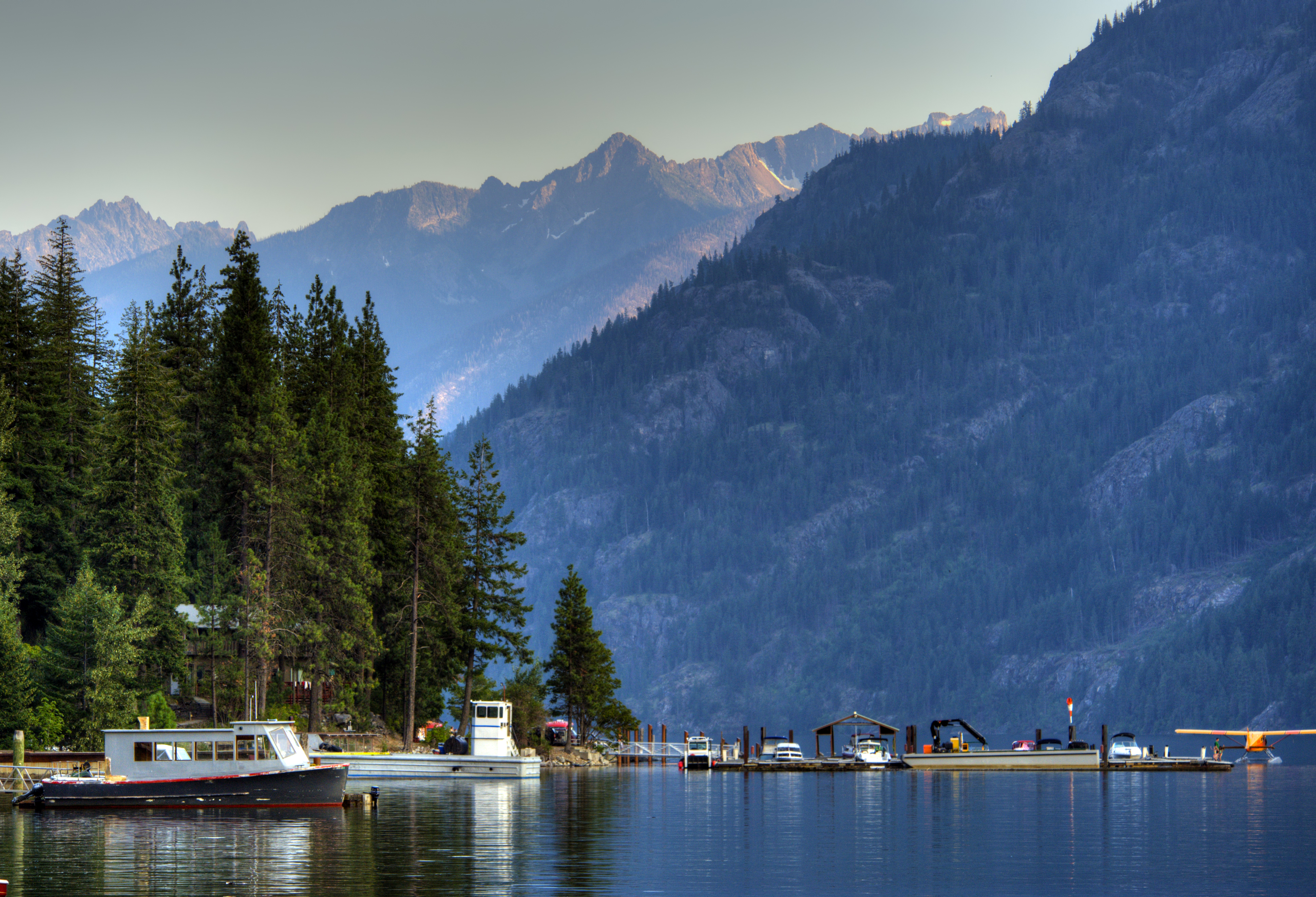
North Cascades National Park receives more precipitation than any other national park in the lower 48. That's the truth most first-time visitors miss when they look at photos of jagged peaks and blue lakes online. The west side of the park catches Pacific storms directly, dumping 80-100 inches of rain annually at lower elevations and over 600 inches of snow at the highest peaks. The east side, past the crest, is a different world - drier, warmer, and sunnier. You can drive from rainforest to semi-arid conditions in about 45 minutes on State Route 20.
Advertisement
This split personality defines the best season to visit North Cascades National Park. There isn't one answer. It depends entirely on what you want to do and which side of the crest you're aiming for. The park's operational season runs late May through late September, with limited services outside that window. Most visitors come June through September, but the optimal timing for good trail conditions and tolerable weather is narrower than you'd expect.
Photo: NPS via NPS.gov (Public Domain)
Month by Month
January through March
Deep winter. State Route 20 closes between Ross Dam Trailhead and Lone Fir Campground - the Washington State Department of Transportation handles this closure, and it's not a suggestion. The road typically stays closed until late April or early May. Temperatures at lower elevations hover in the 30s and 40s F. Above 3,000 feet, expect snowpack measured in feet, not inches.
The park complex is open year-round, but "open" means the physical land exists and you can access it if you're willing to ski or snowshoe in. The North Cascades Visitor Center in Newhalem is closed. No services. No plowed roads beyond the closure gates.
This is avalanche terrain. Rangers will tell you that winter backcountry travel here requires advanced skills, not just enthusiasm. If you're experienced with winter camping and snow travel, the silence of the park in January is something else - no engines, no crowds, just the creak of frozen trees and the occasional boom of ice shifting on the glaciers.
Not the best season to visit North Cascades National Park for most people.
April
The transition month. Snow lingers at all but the lowest elevations. State Route 20 might open late in the month, but there's no guarantee. Temperatures range from 35-55°F at the valley floor. Rain is frequent - expect it.
The lower-elevation trails near Newhalem and Marblemount start to emerge from snow, but they'll be muddy. The Trail of the Cedars and the River Loop are doable for short walks. Anything with elevation gain is still snow-covered.
What makes April worth considering: the waterfalls. Snowmelt turns every drainage into a cascade. The roar of water is constant. If you want to see the park at its most raw and loud, this is the time. Just bring rain gear and expect to get wet.
May
State Route 20 typically opens by early May, but the timing varies annually based on snowpack and avalanche danger. Check WSDOT before planning anything. Even when the highway opens, most trailheads remain snowbound above 3,500 feet.
Temperatures at low elevations reach the 50s and low 60s F. Rain is still the dominant weather pattern on the west side. The east side, around Stehekin and Lake Chelan, starts warming up - expect 60s and 70s there.
The North Cascades Visitor Center opens for the season, typically late May. This is when the park starts feeling operational again. But don't plan on serious hiking in North Cascades National Park yet unless you're comfortable with snow travel and route finding.
Wildflowers begin appearing at lower elevations - trillium, bleeding heart, and western spring beauty along the forest floor. The big alpine flower displays are still weeks away.
June
The window starts opening. By mid-June, most lower-elevation trails are clear of snow. Temperatures reach the 60s and 70s F at valley level. Rain is still possible - expect some - but the frequency drops compared to spring.
The catch: snow lingers above 5,000 feet through most of June. The popular North Cascades trails like Cascade Pass and Sahale Arm typically aren't snow-free until mid-July. If you want to hike high country in June, bring traction devices and be prepared to post-hole through softening snow in the afternoon.
This is a great month for lower elevation hikes: Thunder Creek, the Diablo Lake area, Ross Dam. The water levels are high, the greenery is intense, and the crowds haven't peaked yet.
Crowds are moderate. Parking at popular trailheads fills by 9 AM on weekends but is manageable on weekdays.
July
Peak season begins. By mid-July, snow has melted off most trails. This is the month when the full range of North Cascades National Park hiking options becomes available. Cascade Pass, Sahale Arm, Maple Pass, Hidden Lake - they're all accessible.
Daytime temperatures average in the 70s F at mid-elevations. At the Stehekin valley on the east side, expect 80s and 90s. The west side stays cooler and cloudier. Afternoon thunderstorms develop regularly - you'll want to be off exposed ridges by early afternoon.
Crowds are heavy. The parking situation at trailheads along State Route 20 is genuinely difficult. The lots at Cascade Pass, Rainy Pass, and Washington Pass fill by 7:30-8 AM. If you arrive later, you'll be parking along the highway shoulder, which comes with its own risks. Rangers will tell you that break-ins are not uncommon at trailheads along SR 20 - remove your valuables and take associated electronic cords.
Mosquitoes peak in July, especially in the Thunder Creek basin and other wet areas. Bring repellent. The bugs can be intense enough to ruin a lunch stop.
This is the best season to visit North Cascades National Park for high country hiking. The trade-off is crowds and bugs.
August
Similar to July but slightly warmer and drier. Daytime temperatures reach the 70s and low 80s at mid-elevations. Stehekin hits 90+ regularly. Afternoon thunderstorms still develop, but with slightly less frequency than July.
Trail conditions are at their best. Snow is gone from all but the highest north-facing slopes. Stream crossings are manageable. The alpine meadows are green and full of wildflowers - lupine, paintbrush, aster, and heather in the high country.
Crowds remain heavy through mid-August, then taper slightly toward Labor Day. Still, the parking situation demands an early start. The Diablo Lake Overlook is a popular stop, but be aware that as of 2026, State Route 20 has a closure at milepost 130 near Colonial Creek Campground, making the overlook inaccessible. Check current conditions.
This is the best month for climbing. The park's 300+ glaciers are more accessible with the snow cover thinned. Technical routes on peaks like Eldorado, Forbidden, and Boston Peak see their highest traffic.
September
The sweet spot for many experienced visitors. Crowds drop significantly after Labor Day. Daytime temperatures in the 60s and 70s F. Nights get cold - expect 30s and 40s at higher elevations, even freezing.
The larch trees in the eastern part of the park begin turning gold in late September. The Larch March - a hike through alpine larch stands near Rainy Pass - is one of the most spectacular seasonal displays in the park. The needles turn a brilliant yellow before dropping.
Trail conditions remain excellent through September. Snow typically doesn't return until October. The afternoon thunderstorm pattern weakens. The light gets lower and warmer, making for better photography conditions.
Wildlife activity picks up. Deer and elk are more visible as they move to lower elevations. Black bears are actively feeding in berry patches - keep an eye out and make noise on the trail.
This is arguably the best season to visit North Cascades National Park for people who want good hiking conditions without peak crowds. The window is narrow - September 1 through the third week is ideal.
October
The shoulder season. State Route 20 remains open but can close temporarily with early snowstorms. Temperatures drop to 40s and 50s at low elevations, 30s and 40s higher up. Rain returns in earnest on the west side.
The larch display peaks in early October. The Maple Pass Loop and Cutthroat Pass are prime locations for golden larch views. After mid-October, the needles drop and the high country starts looking bare.
Most facilities close by late October. The visitor center shuts down. Campgrounds transition to self-service or close entirely.
Hiking in North Cascades in October requires flexibility. You might get a week of beautiful fall weather. You might get a snowstorm. Check conditions before heading out.
November and December
Winter returns. State Route 20 closes for the season, usually by late November. The park goes quiet. Temperatures in the 30s at low elevations, snow at higher ones. Daylight is short.
The Stehekin area remains accessible by ferry or plane, but service is limited. The winter ferry schedule runs fewer trips.
Only the most dedicated winter recreationists visit during these months. If you're not experienced with Pacific Northwest winter conditions, this isn't the time for your first visit.
Photo: NPS via NPS.gov (Public Domain)
Best Times for Specific Activities
High Country Hiking
Mid-July through September. The window for snow-free trails above 5,000 feet runs roughly July 15 to October 1, with some variation based on snowpack. August is the most reliable month. September offers better crowds and fall color but carries some risk of early snow.
The Cascade Pass trail is a classic North Cascades National Park trail that typically clears by mid-July. The Sahale Arm extension adds elevation and requires comfort with exposed terrain. Maple Pass Loop is another standout, with 360-degree views of the surrounding peaks.
Wildlife Viewing
Spring (May-June) and fall (September-October) offer the best wildlife viewing. Animals are more active at lower elevations during these transitional periods. Black bears are commonly seen along the Stehekin Valley Road and in the Thunder Creek area in late summer and fall when berries are ripe.
Mountain goats occupy the high country throughout summer. Look for them on the ridges near Cascade Pass and along the Ptarmigan Traverse. They're most visible in early morning and late evening.
Bird activity peaks during spring migration, May through early June. The park hosts a variety of species including gray jays, Clark's nutcrackers, and the occasional golden eagle.
Wildflower Peak
Timing varies by elevation. Lower elevation wildflowers peak in June. The alpine meadows hit their stride in late July through early August. The Heather Meadows area and the trail to Hidden Lake are prime locations for alpine blooms.
Species to look for: lupine (purple), paintbrush (red), avalanche lily (white), and western anemone (white with a purple center). The display is intense but brief - two to three weeks at most in any given location.
Fall Color
Late September through mid-October. The alpine larch display is the main event, concentrated in the eastern part of the park near Rainy Pass and Washington Pass. The Maple Pass Loop offers the best combination of larch views and easy access.
Lower elevation vine maple and huckleberry bushes turn red and orange in September. The Stehekin Valley puts on a good show with mixed deciduous trees along the river.
Stargazing
The park has minimal light pollution, particularly on the east side near Stehekin and Ross Lake. The best stargazing conditions occur on clear nights from September through February, when the nights are longest and the air is driest.
The new moon period offers the darkest skies. Summer nights are short but warm - July and August provide comfortable conditions for late-night viewing, though the sun doesn't set until after 9 PM.
Winter Sports
December through March, but only for those willing to work for access. Cross-country skiing and snowshoeing are possible on closed sections of State Route 20 once the snowpack stabilizes. The area near Rainy Pass is popular with backcountry skiers, but avalanche danger is serious - this is complex terrain with significant slide paths.
Photo: NPS via NPS.gov (Public Domain)
What to Pack by Season
Summer (June-September)
The standard summer packing list for the North Cascades has specific requirements that differ from other parks. Rain gear isn't optional - it's essential even on clear mornings. Afternoon thunderstorms develop quickly, and you'll want a waterproof shell that can handle sustained rain, not just a light drizzle layer.
Temperatures can swing 30+ degrees between morning and evening. A puffy jacket or insulated layer lives in your pack all summer. At higher elevations, wind is a constant factor - exposed ridges can feel 15-20 degrees colder than the valley floor.
Sun protection matters more than you'd expect for a cloudy region. UV intensity increases with elevation, and the combination of snowmelt runoff and clear windows between storms leads to sunburn. Sunglasses, sunscreen, and a wide-brim hat are standard.
Mosquito repellent is non-negotiable in July and August. The wet forest breeds heavy bug populations. DEET or picaridin formulations work best. A head net costs little and can save a trip.
Water filtration is required for all backcountry travel. Giardia is present in surface water. Carry a filter or treatment tablets.
Spring and Fall (May, June, October)
Add extra insulation. A warm mid-layer (fleece or synthetic) and a heavier jacket are necessary. Gloves and a hat aren't overkill in October, even on day hikes.
Traction devices (microspikes) are useful for early season hiking when trails have snow patches or ice. Trekking poles help with stability on muddy, slick trails.
Bring more layers than you think you need. The forecast can change in an hour. A sunny morning can turn into a cold, windy afternoon with rain.
Winter (November-April)
Full winter mountaineering gear if you're traveling beyond the road closure. Avalanche safety equipment (beacon, probe, shovel) and the training to use it. Insulated boots, gaiters, and waterproof outerwear. Expect wet snow at lower elevations - it's heavy and exhausting to move through.
Photo: NPS via NPS.gov (Public Domain)
What the Forecast Doesn't Tell You
1. The west side is much wetter than the forecast suggests. The National Weather Service forecast for Marblemount or Newhalem often understates the actual precipitation. The mountains wring moisture out of passing systems, and the localized rain can be double what the town forecast predicts.
2. Clouds can trap you at a viewpoint. The classic scenario: you drive up SR 20 toward Washington Pass under clear skies, but a cloud deck sits at 5,500 feet. You arrive at the overlook and see nothing but gray. The forecast won't tell you about these localized cloud layers until you're in them. Check the webcam at Washington Pass before driving up.
3. Afternoon thunderstorms develop faster than you expect. The standard advice is to be off exposed ridges by noon. This isn't an exaggeration. Storms can build from scattered cumulus to lightning-producing cells in under an hour. The exposed granite ridges of the park are terrible places to be during an electrical storm.
4. SR 20 can close with very little notice in shoulder season. A single October snowstorm can shut the highway for 24-48 hours. The closure happens at the state level, not the park level. If you're visiting in October, have a backup plan and check WSDOT before driving.
5. The east side is a completely different climate. Stehekin and the Lake Chelan area get 20-30 inches of annual precipitation compared to 80-100 on the west side. The difference is dramatic enough that you can drive from rainforest to semi-arid pine forest in under an hour. Pack for both sides if you're doing a through-trip.
6. Snow lingers on north-facing slopes well into July. A trail might be clear on the south-facing approach but hold snow patches on the north side of a ridge. This catches hikers who assume "snow-free trail" means uniform conditions. The melt-out is uneven.
7. The water is always cold. Every lake, stream, and river in the park is fed by snowmelt and glacier runoff. Even in August, swimming in Diablo Lake or Ross Lake is a brief experience. The water temperature rarely exceeds 50°F.
Practical Takeaways
The best season to visit North Cascades National Park for high country hiking is August. Trails are clear, weather is most stable, and the alpine wildflowers are at peak. Arrive at trailheads before 7:30 AM or expect to park on the highway.
Mid-September through early October offers the best balance of good conditions and low crowds. The larch display is worth the trip alone, and the cooler temperatures make for more comfortable hiking.
Don't visit in July and August if you hate crowds and parking frustration. The park sees its heaviest use during these months, and the popular trailheads are genuinely overwhelmed.
Check trail conditions and road status the morning of your trip. The NPS website and WSDOT real-time map are your best resources. Conditions change rapidly, and old information can waste your day.
Pack rain gear every single time you visit. Even in August. Even if the forecast says clear. The North Cascades makes its own weather, and dry forecasts turn wet with regularity.
Plan for the east-west climate split. If your trip includes both the SR 20 corridor and the Stehekin area, you need clothing for two different climates. The east side is hotter, drier, and sunnier in summer.
The operational season is May through September. Outside those months, expect closed facilities, limited access, and winter conditions. The park is open year-round, but "open" doesn't mean "accessible" in the same way.