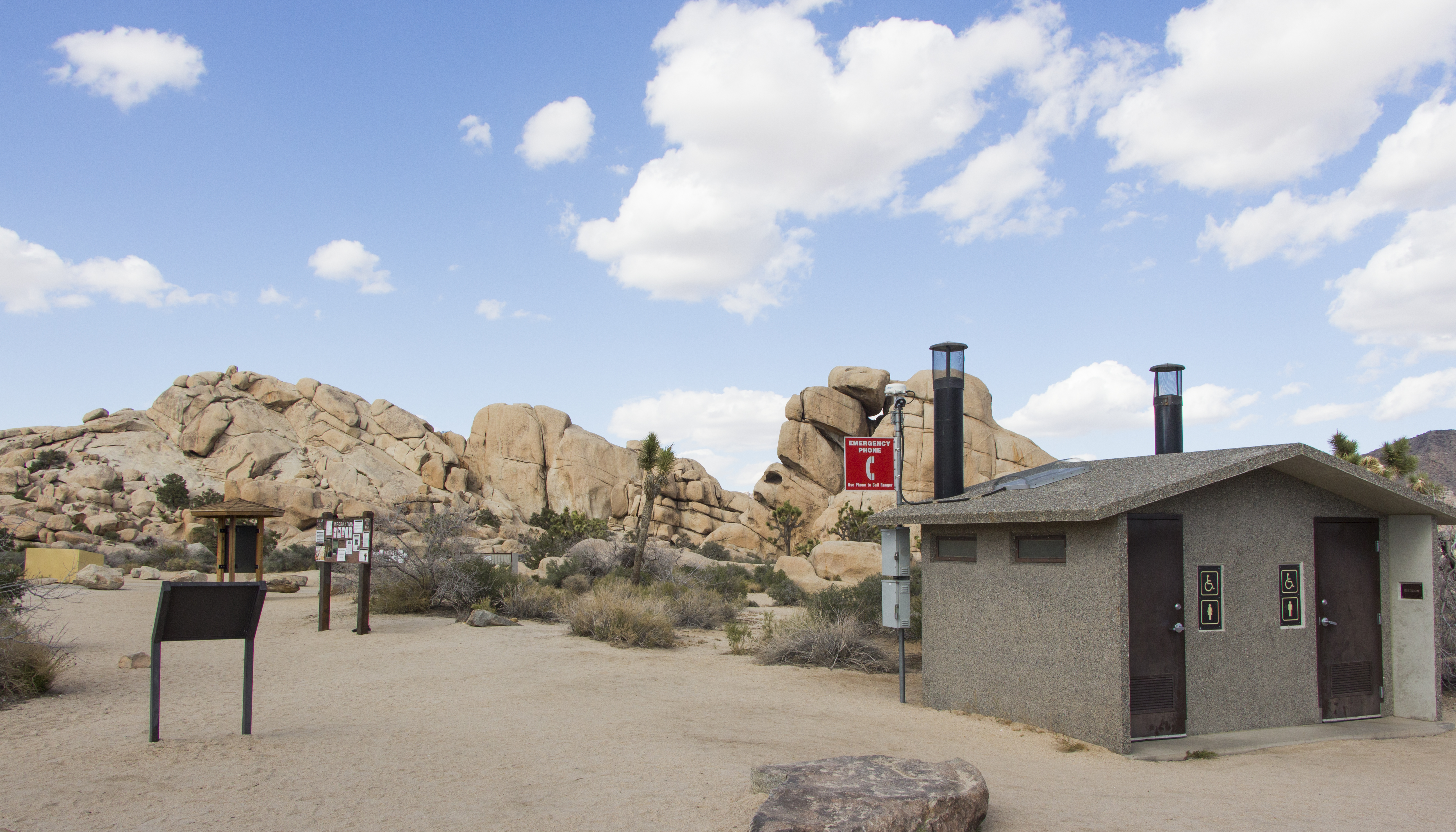
There are 44 sites at Hidden Valley Campground, and not a single one takes a reservation. That first-come, first-served reality shapes every decision you make about staying here - when you arrive, how you prepare, and what you do if every site is full by 10 AM. This campground sits off Park Boulevard roughly 14 miles from the town of Joshua Tree, near Barker Dam and the Hidden Valley Nature Trail. It is a straightforward, no-frills place to sleep, and understanding exactly how it works before you arrive is the difference between a smooth trip and a frustrating one.
NPS via NPS.gov (Public Domain)
Campsites at Hidden Valley Campground (2026 Guide)
5 min read
Campsite Guide
Check-in and check-out both happen at noon. Quiet hours run from 10:00 PM to 6:00 AM, and campers here tend to enforce them.
Your plans
For more, see complete visitor guide, all campgrounds, hiking trails, lodging and accommodations, Campsites at Cottonwood Campground (2026 Guide) (2026 guide), Campsites at Indian Cove Campground (2026 Guide) (2026 guide), Campsites at Sheep Pass Group Campground (2026 Guide), and Campsites at White Tank Campground (2026 Guide) (2026 Guide).
How the First-Come, First-Served System Actually Works
The process is simple on paper, but the timing matters more than most visitors realize. Here is exactly how it goes:
Claiming Your Site
Drive through the campground and find an empty campsite. Once you spot one, occupy it immediately - set up a tent or leave personal items to show the site is taken. Then proceed directly to an entrance station to complete registration and pay. You have one hour from the moment you set up to get that payment done.
If you arrive after the entrance stations close for the night, you can delay payment until the following morning. Just make sure your site is clearly occupied before dark, because other campers will assume an empty-looking site is available.
When to Arrive
The parking situation here is straightforward but unforgiving. Sites go fast, especially between October and May when temperatures are reasonable. Plan to arrive before 9 AM on weekends and before noon on weekdays if you want a realistic shot at a site. Holiday weekends are a different story - some campers start circling the loop as early as 6 AM.
Rangers will tell you that the busiest periods are spring wildflower season (typically March through April) and fall when the heat finally breaks. If you show up at 3 PM on a Saturday in March, expect to find every site taken and a handful of other drivers doing the same slow loop you are.

What You Get for Your Money
The nightly fee as of 2026 is $25.00 for a standard site and $12.50 if you hold a Senior or Access Pass. That covers one campsite for up to six people, three tents, and two vehicles - though some sites only have parking for one car, so look carefully before you pick.
Amenities (and What Is Missing)
Every site has a picnic table and a fire pit. There are pit toilets scattered through the campground. That is where the amenities end.
There is no water. You need to bring every drop you plan to use - drinking, cooking, washing dishes, everything. The park website mentions this, but the common mistake is underestimating how much you actually go through. Figure on at least one gallon per person per day, more if you are hiking in heat.
Cell service drops out at points along Park Boulevard before you even reach the campground. Download maps and directions before you lose signal, and use the official NPS app rather than third-party hiking apps - the park service has issued alerts about inaccurate information showing up on some of those third-party platforms.
Quiet Hours and Check-In
Campgrounds are open 24 hours a day. Check-in and check-out both happen at noon. Quiet hours run from 10:00 PM to 6:00 AM, and campers here tend to enforce them. If you are the type who stays up talking around the fire past 10, pick a site away from the loop entrance where traffic noise is lower.

Current Conditions and What to Watch For
Two active alerts affect visitors to this area as of 2026.
The Oasis of Mara Trail has a partial closure due to a heavy flooding event - the trail is closed past the Oasis itself. If you planned to hike that full loop, you will need to turn around earlier than expected.
The other alert is worth a paragraph on its own. Some third-party hiking apps are providing inaccurate trail and safety information. This is not a minor complaint - people have followed bad directions onto closed routes or underestimated distances. The park service specifically recommends using the official NPS app for accurate information. Download it before you arrive.
Nearby Trails Worth Your Time
The campground sits right next to the Hidden Valley Nature Trail, a short loop that winds through a closed valley surrounded by rock formations. It is an easy walk, good for late afternoon when the light hits the rocks.
Barker Dam is close by as well - about a mile round-trip with minimal elevation gain. Early morning is your best bet for seeing water if there has been recent rain, and you might spot bighorn sheep working the slopes above the dam.
For something more strenuous, the trails into the Wonderland of Rocks start from this same area. Pack extra water for this stretch - there is no shade and the route finding can be confusing once you get into the rock maze.

Practical Takeaways
- Arrive early. Before 9 AM on weekends, before noon on weekdays. Earlier is better during peak season (October through May).
- Bring all your water. One gallon per person per day minimum. There is no water available at the campground.
- Pay within one hour of setting up your site, or first thing in the morning if you arrive after the entrance station closes.
- Three tents maximum per site, six people, two vehicles. Some sites only fit one car - check before you set up.
- Download the official NPS app before you lose cell service. Do not rely on third-party hiking apps for trail information.
- Quiet hours are 10 PM to 6 AM. The nearest alternative if this campground is full is usually Ryan or Jumbo Rocks, both also first-come, first-served.

Final Thoughts
Hidden Valley Campground works well if you respect the system. The first-come, first-served model rewards early arrivals and flexibility. If you show up prepared with water, a backup plan for where you will try next if the campground is full, and a realistic understanding of what the facilities offer, you will be fine. If you roll in at 4 PM on a Saturday in March expecting a smooth setup, you will be learning why this campground has a reputation for filling fast.
Check the complete visitor guide for in-depth trail descriptions and seasonal weather patterns, or browse all campgrounds if Hidden Valley is full and you need alternatives.
Sources
- Official source: National Park Service nps.gov/jotr/planyourvisit/hidden-valley-campground.htm
- Official source: NPS — Joshua Tree National Park nps.gov/jotr/index.htm
Photo Gallery
More to Explore

Park Guide
Acadia National Park: Carriage Roads, Cadillac Mountain & 2026 Guide
Discover carriage roads, Cadillac Mountain, and rugged Maine coast. Complete 2026 guide to Acadia National Park — trails, fees, lodging, permits, and what rangers recommend.

Hiking Guide
Grand Canyon Hiking Trails: Day Hikes, Water Sources & Rim to Rim
Compare Grand Canyon hiking trails: Bright Angel, South Kaibab, Hermit, Grandview, and rim to rim, with distances, elevation, water stops, and trailhead access for each.

Best Of
Best of Glacier Bay National Park
The best of Glacier Bay is reached by boat: ranger-led day tours up the bay to the tidewater glaciers. What's worth it, how to book, and when to go (2026).

Campsite Guide
White Sands Backcountry Camping: Closed for 2026 — What to Know
As of 2026, backcountry camping at White Sands National Park is closed for site rehabilitation. What that means, and where to camp nearby instead.

Weather Guide
Guadalupe Mountains National Park Weather: Weather
Guadalupe Mountains National Park: weather guide guide updated 2026. Practical visitor information, reservations, and seasonal tips worth bookmarking before

Best Of
Best of Cuyahoga Valley National Park: Best Things to Do
Seeing a Cleveland Orchestra concert with the woods as your backdrop is a uniquely Cuyahoga Valley experience.
Sign in to join the conversation.
Sources & Attribution
Location data courtesy of the National Park Service (U.S. Department of the Interior). NPS data is public domain. Official NPS page.
Images: NPS; NPS; NPS; NPS; NPS.
Map data © OpenStreetMap contributors.
Park operations alerts: NPS.gov · Weather and weather hazards: National Weather Service · Live conditions.
Information may change. Always verify fees, hours, and conditions directly with the official source before visiting.
Did this guide help? Share it with a friend.