At the trailhead, the sun is high and the air is bone-dry. The silence is broken only by the crunch of boots on gravel and the low hum of wind through the joshua trees. This isn't a park for casual strolls. The best hikes in Joshua Tree demand attention to sun, water, and rock. You're walking through a landscape that feels more like a dream than a desert.
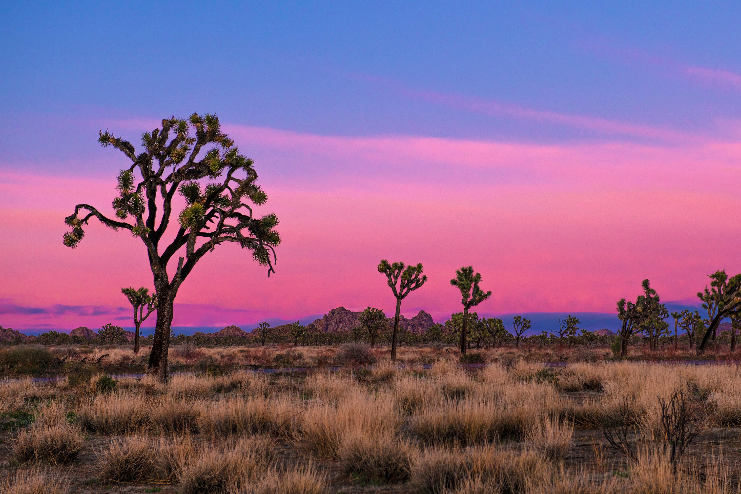
NPS via NPS.gov (Public Domain)
Joshua Tree National Park Best Hikes: Complete Guide (2026)
10 min read
Hiking Guide
Navigate the sun, silence, and giant boulders of Joshua Tree's best hikes. Our 2026 guide details the trails that define this stark, dreamlike desert.
This article contains affiliate links — we may earn a small commission at no extra cost to you.
What Hiking Here Actually Means
Hiking here is a negotiation with exposure. Trails are mostly flat or gently rolling, but the challenge comes from sun, wind, and deceptive distances. You'll walk on sand, scramble over granite slabs, and navigate between house-sized boulders. The park's two deserts—the higher Mojave with its namesake trees and the lower, hotter Colorado—mean conditions shift dramatically with a few hundred feet of elevation.
Most first-time visitors underestimate two things: the intensity of the sun, even in winter, and how quickly a simple trail can become a navigational puzzle in the rock piles. Rangers will tell you that the most common rescue calls are for heat exhaustion and people who wandered off-trail in the Wonderland of Rocks and couldn't find their way back. Your fitness matters less here than your preparation and your willingness to carry more water than you think you'll need.
Boy Scout Trail: The Desert Backbone
Distance: 8 miles one-way (16 miles out-and-back)
Elevation Gain: Roughly 300 feet net (with rolling ups and downs)
Trailhead & Parking: The main western trailhead is off Boy Scout Road, a dirt road off Park Boulevard. The small lot fits about 8 cars and is usually full by 8:30 AM on weekends. Overflow parking is along the shoulder of Park Boulevard, but don't block the road. The eastern end starts at Indian Cove Campground; parking there is for campers, so day-hikers should use the western start.
The Trail: This is a point-to-point trek through the heart of the Wonderland of Rocks. The surface alternates between packed sand washes and sections where you're walking on smooth, exposed granite. Cairns mark the way through the boulder fields, but you need to pay attention - it's easy to lose the thread. There's no shade. None.
The Moment: The trail narrows here, winding between two massive monzogranite domes, and for a few hundred yards you're in a silent, cool corridor of stone before it opens again to the vast, open desert.
What Most Underestimate: The mental focus required for route-finding. This isn't a paved path. If you lose the cairns, turn back immediately. Most people also try to do the full 16-mile out-and-back in a day, which is a brutal proposition outside of November through February.
Best Time: Start at dawn, October through April. Summer is out of the question for anything but a very short, pre-sunrise section.

Lost Horse Mine Loop: History and High Vistas
Distance: 6.5-mile loop
Elevation Gain: 700 feet
Trailhead & Parking: The dedicated lot on Lost Horse Mine Road is moderate-sized. It fills later than others, often by 9:30 AM, because the trailhead is further from the main park road. The road to it is well-graded dirt, passable for all vehicles.
The Trail: A steady, moderate climb on a wide, rocky roadbed leads to the well-preserved stamp mill and mine structures. The return leg of the loop is a single-track trail that's rougher and less defined, offering better views and solitude. Watch for loose rocks on the descent.
The Moment: Rounding a bend to see the stark, skeletal remains of the 10-stamp mill standing against the empty sky, a monument to stubbornness in a landscape that won.
What Most Underestimate: The wind. The ridge where the mine sits is exposed, and gusts can knock you off-balance. Hold onto your hat.
Best Time: Late afternoon, when the low sun lights up the mine structures and the shadows stretch long across the valley. Spring and fall.
Fortynine Palms Oasis: A Rewarding Grind
Distance: 3 miles out-and-back
Elevation Gain: 300 feet in each direction
Trailhead & Parking: This trailhead is outside the park's main fee area, off Canyon Road in Twentynine Palms. The lot is small and known for break-ins - rangers emphasize leaving absolutely nothing visible in your car. It's often full by 8 AM.
The Trail: A constant, rocky climb up a ridge, followed by a steep descent into the canyon holding the oasis. The trail is all business: no gentle warm-up, just immediate ascent. The footing is uneven with baseball-sized rocks. The return trip is the real workout - that 300-foot climb out feels much steeper when you're tired.
The Moment: The first glimpse of green palm fronds shimmering in a rocky bowl at the canyon's bottom, a shock of life in the stark terrain.
What Most Underestimate: The "out-and-back" means you gain elevation on the way to your destination and on the way back. That 600 feet of total climbing in 3 miles makes it more strenuous than the distance suggests.
Best Time: Early morning, ideally on a weekday to secure parking. Avoid midday sun on the shadeless ridge. Best in cooler months.

Ryan Mountain: The Park's Punishing Summit
Distance: 3 miles out-and-back
Elevation Gain: 1,050 feet
Trailhead & Parking: The Ryan Mountain lot is directly off Park Boulevard. It's a notorious bottleneck, often full by 7:30 AM on pleasant weekends. People park for miles along the road, but this creates congestion. If the lot is full, consider a different hike.
The Trail: A relentless, well-built series of stone steps and switchbacks from bottom to top. There are no flat sections. It's a stairmaster with a view. The trail is wide and obvious, but the altitude gain is concentrated and leg-burning.
The Moment: The 360-degree panorama from the summit cairn. You can trace the entire route of Park Boulevard, identify the major rock formations, and on crystal-clear days, see the Salton Sea to the south.
What Most Underestimate: The wind chill at the top. It can be 20 degrees colder and blowing 30 mph, even on a calm day below. Bring a wind layer.
Best Time: Sunrise. You'll hike up in the cool dark with a headlamp and be rewarded with the desert waking up. Second choice is sunset, but carry a headlamp for the descent.
Hidden Valley Trail: The Family-Friendly Classic
Distance: 1-mile loop
Elevation Gain: 100 feet
Trailhead & Parking: The Hidden Valley Picnic Area lot is large but perpetually crowded because it's a hub for climbers and picnickers. Circling for a spot after 10 AM is common. Overflow spills along Park Boulevard.
The Trail: A smooth, sandy loop that winds through a natural rock enclosure once (allegedly) used by cattle rustlers. It's mostly flat with a few short, rocky steps. The path is clear, wide, and perfect for all ages and abilities.
The Moment: Stepping through the narrow rock entrance into the hidden valley itself, a sudden, quiet bowl of sand and boulders surrounded by high walls.
What Most Underestimate: How much time they'll spend here. It's a short hike, but the scrambling opportunities on the periphery boulders are irresistible. Kids (and adults) will disappear into the nooks and crannies for hours.
Best Time: Anytime except high noon in summer. It's a great late-day option when other, more exposed trails are in shadow.

Skull Rock Loop: Boulders and Easy Miles
Distance: 1.7-mile loop
Elevation Gain: Minimal
Trailhead & Parking: You can start from either the Jumbo Rocks Campground or the large Skull Rock pullout on Park Boulevard. The pullout fills fast. Starting from Jumbo Rocks site #9 (where the trail is signed) is often smarter if you can find a legal spot in the campground loop.
The Trail: A meandering, fun path through the iconic boulder piles of the Jumbo Rocks area. The trail surface is a mix of sand and smooth rock. You'll duck under boulders, squeeze through narrow gaps, and of course, pass the famous skull-shaped rock.
The Moment: The section where you walk through a natural tunnel formed by two massive boulders leaning against each other.
What Most Underestimate: The potential to get slightly turned around. The trail is well-marked with signs and cairns, but the maze of social paths leading to climbing areas can be confusing. Keep an eye out for the official trail markers.
Best Time: Early morning or late afternoon, when the low sun casts dramatic shadows across the boulder fields, making them look even more surreal.
Seasonal Trail Conditions
December-February: Days are cool (around 60°F), nights drop below freezing. This is prime hiking season, but ice can form on north-facing granite slabs, making trails like Ryan Mountain treacherous in the early morning. Start later to let the sun melt the frost.
March-May: The sweet spot. Daytime highs in the 70s and 80s. Wildflowers, if winter rains were good, peak in the lower Colorado Desert (south park) in March and the Mojave (north park) in April. Crowds are at their absolute peak, especially on weekends.
June-September: Hiking is strongly discouraged from late morning through afternoon. Daytime temperatures exceed 100°F, and overnight lows stay above 75°F. If you hike, you must start before sunrise and finish by 9 AM. Carry a minimum of one gallon of water per person, per short hike. The Cholla Cactus Garden is often closed for maintenance during this period.
October-November: Another excellent window. Heat breaks, crowds thin after October, and daytime temps return to the 70s and 80s. This is the best time for longer, more strenuous hikes like Boy Scout.

Trailhead Logistics
Parking strategy is half the battle. The lots for Ryan Mountain, Hidden Valley, and Barker Dam are consistently full by 8-9 AM on weekends from October through May. Your best bet is to arrive by 7 AM, or plan to visit on a weekday. The park is open 24 hours - a sunrise hike solves the parking problem and offers the best light and temperatures.
Cell service drops out at the park boundaries. Assume you will have zero signal for navigation or calls from the moment you leave Highway 62 or the I-10. Download offline maps and trail information beforehand.
There are no reliable water sources on any trail. The only potable water fill stations are at the three main visitor centers (Joshua Tree, Oasis, and Cottonwood) and at the Black Rock Canyon Campground. Fill every container you have before you head into the park interior.
For current trail conditions, the ranger station at the Joshua Tree Visitor Center (on Park Boulevard at the West Entrance) is your most reliable source. They know which trails have recent washouts, where the bees are active at water catchments, and which third-party app errors are currently causing problems.
What to Carry
Forget generic lists. For Joshua Tree hiking trails, your pack must address three specific threats: dehydration, sun, and abrasion.
Water: One gallon per person, per day, minimum. For any hike over 2 miles in warm weather, carry more. A hydration bladder is better than bottles - you'll drink more often. Electrolyte tablets are a smart addition.
Sun Protection: A wide-brimmed hat, not a baseball cap. Sunglasses. Mineral-based sunscreen (the sweat-resistant sport kinds melt off). A lightweight, long-sleeve sun shirt is more effective and less messy than constant reapplication of sunscreen.
Footwear: Trail runners or hiking shoes with sticky rubber soles are ideal. You need grip for scrambling on granite. The sand and fine grit will get into low-top shoes, so consider gaiters if that bothers you. Do not hike in sandals.
Navigation: A physical map and compass, and the know-how to use them. The official park map works. Your phone's GPS will work without service, but the battery will die quickly in the heat. Carry a paper backup.
The Extras: A headlamp, even for day hikes. It's easy to get delayed, and darkness falls fast. A lightweight windbreaker or fleece - ridge tops are cold. A basic first-aid kit with extra bandages for scrapes and blisters.
Practical Takeaways
- Your arrival time dictates your hike. After 9 AM, your options shrink to whatever has parking.
- One gallon of water per person, per day, is the non-negotiable rule. Double-check your carry before leaving the visitor center.
- Footing is everything. Granite can be slick as ice when dusty or frosty. Test your weight before committing to a step.
- If you lose the trail in a boulder field, stop. Retrace your steps to the last cairn. Do not press on hoping to find it.
- The difference between 85°F and 95°F is the difference between enjoyable and dangerous. Plan your hike length around the forecast high.
- Cotton kills. Wear synthetic or wool fabrics that wick sweat. Denim becomes a heavy, chafing liability.
- Check the NPS website for alerts. As of 2026, the Cholla Cactus Garden trail is periodically closed for maintenance, and the Oasis of Mara has a partial closure due to flood damage.
- The best light for photography - and the most comfortable hiking - is the first and last two hours of the day.
- Joshua trees are fragile. Their shallow root systems are damaged by foot traffic. Stay on the trail.
- For a broader context on park rules and regions, consult the complete visitor guide. For overnight stays, research the camping options, and to understand the climate extremes, read up on the best time to visit.
Recommended Gear
What experienced visitors bring to Joshua Tree National Park Best Hikes: Complete Guide (2026)
Links may earn us a commission at no extra cost to you. We only recommend gear we believe in.
Hiking Essentials
Hydration Pack (3L)
Hands-free water for long trail days
Trekking Poles (Pair)
Save your knees on steep descents
Hiking Boots (Ankle Support)
Sturdy footwear for rocky, uneven trails
Sun & Heat Protection
Wide-Brim Sun Hat
Full coverage UPF 50+ protection at altitude
Insulated Water Bottle (32oz)
Keeps water cold in desert heat all day
Electrolyte Mix Packets
Replace what water alone cannot during intense heat
Winter Gear
Microspikes / Traction Devices
Essential for icy rim trails in winter months
Packable Down Jacket
Lightweight warmth that stuffs into a pocket
Sources
- Official source: NPS — Joshua Tree National Park nps.gov/jotr/index.htm
Photo Gallery
More to Explore

Park Guide
Acadia National Park: Carriage Roads, Cadillac Mountain & 2026 Guide
Discover carriage roads, Cadillac Mountain, and rugged Maine coast. Complete 2026 guide to Acadia National Park — trails, fees, lodging, permits, and what rangers recommend.

Hiking Guide
Grand Canyon Hiking Trails: Day Hikes, Water Sources & Rim to Rim
Compare Grand Canyon hiking trails: Bright Angel, South Kaibab, Hermit, Grandview, and rim to rim, with distances, elevation, water stops, and trailhead access for each.

Best Of
Best of Glacier Bay National Park
The best of Glacier Bay is reached by boat: ranger-led day tours up the bay to the tidewater glaciers. What's worth it, how to book, and when to go (2026).

Campsite Guide
White Sands Backcountry Camping: Closed for 2026 — What to Know
As of 2026, backcountry camping at White Sands National Park is closed for site rehabilitation. What that means, and where to camp nearby instead.

Weather Guide
Guadalupe Mountains National Park Weather: Weather
Guadalupe Mountains National Park: weather guide guide updated 2026. Practical visitor information, reservations, and seasonal tips worth bookmarking before

Best Of
Best of Cuyahoga Valley National Park: Best Things to Do
Seeing a Cleveland Orchestra concert with the woods as your backdrop is a uniquely Cuyahoga Valley experience.
Sign in to join the conversation.
Sources & Attribution
Location data courtesy of the National Park Service (U.S. Department of the Interior). NPS data is public domain. Official NPS page.
Images: NPS; NPS; NPS; NPS; NPS.
Map data © OpenStreetMap contributors.
Park operations alerts: NPS.gov · Weather and weather hazards: National Weather Service · Live conditions.
Information may change. Always verify fees, hours, and conditions directly with the official source before visiting.
Did this guide help? Share it with a friend.