The wind hits you first, about a mile past the Tejas Trail junction, before you even see the campsites. It's a constant presence on the exposed ridgeline approaches, and by the time you drop into the semi-protected bowl where the five tent pads sit, you understand why this campground draws the people who come here. They're not here for convenience. They're here for what opens up at sunset: the sky turns the west face of the Guadalupe Mountains into something that looks lit from inside.
NPS via NPS.gov (Public Domain)
Campsites at Bush Mountain Wilderness Campground (2026 Guide)
7 min read
Campsite Guide
The 6.2-mile hike to the campground follows the Tejas Trail for the first stretch, then connects to the Bush Mountain Trail.
Your plans
For more, see Campsites at Blue Ridge Wilderness Campground (2026 Guide), Campsites at Frijole Horse Corral Campground (2026 Guide), Campsites at Guadalupe Peak Wilderness Campground (2026 Guide), Campsites at Pine Springs Campground (2026 Guide), and Campsites at Tejas Wilderness Campground (2026 Guide).
Bush Mountain Wilderness Campground sits 6.2 miles from the Pine Springs Trailhead via the Tejas and Bush Mountain Trails. That's the only way in, and it's the only way out. There are no shortcuts, no alternate approaches, and no vehicle access. If you're planning a trip to this campground, start with a complete visitor guide from the park service to understand what you're signing up for. The bush mountain wilderness campground is not a place you stumble into - it's a place you earn.
Permits, Fees, and the Booking Process
A Wilderness Use Permit is required for every overnight stay at the bush mountain wilderness campground. This is not optional. Rangers at the visitor center will tell you that most first-time visitors to Guadalupe Mountains don't realize permits are required until they show up at the trailhead and have to sort it out on their phones before the parking lot fills up. Don't be that person.
The fee structure as of 2026:
- Permit Reservation Fee: $6.00 per permit. This is a flat fee per reservation, not per person.
- Per-Person-Per-Night Recreation Fee: $6.00 for each individual listed on the permit.
Those two fees stack. One person camping one night pays $12 total ($6 reservation + $6 recreation). Three people camping one night pay $24 ($6 reservation + $18 recreation). One person camping two nights pays $18 ($6 reservation + $12 recreation). You can run the math yourself, but the recreation fee adds up fast for groups.
Permits can be reserved in advance through the park's online system. Walk-up permits are sometimes available at the Pine Springs visitor center, but during peak season (March through May and October through November), availability is unreliable. Reserve ahead.
The park store at Pine Springs went cashless starting August 14th, 2025 - all major credit cards, debit cards, and mobile payments are accepted. If you're stopping at the visitor center to pick up your permit, plan accordingly.
Trail Access and What the Approach Demands
The 6.2-mile hike to the campground follows the Tejas Trail for the first stretch, then connects to the Bush Mountain Trail. The trail surface changes from packed red dirt to exposed limestone slabs as you gain elevation. About two miles in, the trees thin out, and the wind becomes a factor. This is where most visitors underestimate the difficulty.
Elevation gain on this route is significant. You start at roughly 5,600 feet at Pine Springs and climb to over 8,000 feet at Bush Mountain. That's not a casual afternoon stroll. The trail register at the Pine Springs trailhead is full of comments from people who underestimated the climb and turned back before reaching the campsites. Rely on your own judgment, not someone else's trip report.
The common mistake - and almost everyone makes it at least once - is assuming that 6.2 miles is a short day because it looks short on the map. It's not. The trail narrows here frequently, with exposed sections where the path drops off sharply to your left. Hikers carrying full overnight packs should budget six to eight hours one way, especially if they're not acclimated to the elevation.

The Campsites: What You Actually Get
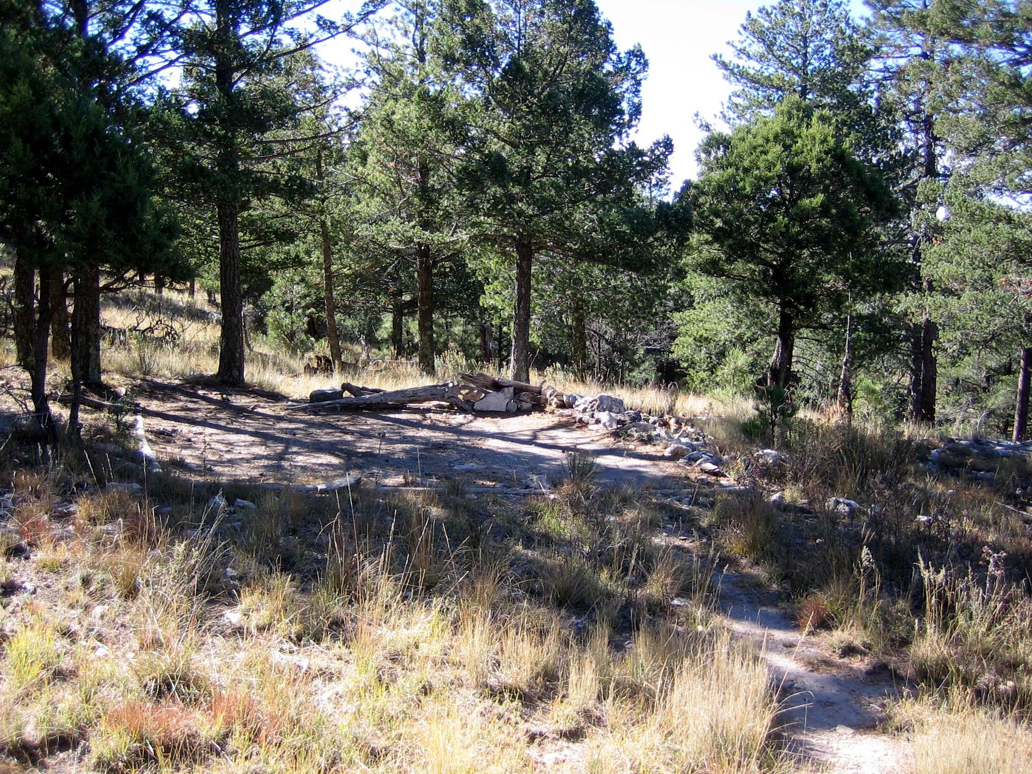
Five designated campsites, each defined by a tent pad. That's it. No picnic tables. No fire rings. No trash receptacles. No water. This is wilderness camping in the strictest sense.
The tent pads are semi-protected from the high winds that sweep across the ridgeline, but "semi-protected" is doing some heavy lifting here. The pads sit in a slight bowl that breaks the worst of the gusts, but don't expect to pitch a freestanding tent without guylines and stakes that can hold in rocky ground. Experienced visitors know to bring deadman anchors or heavy-duty sand stakes, because the soil is thin and the wind finds every gap.
What the park website doesn't mention: the tent pads are positioned for views, not for maximum wind protection. Site 3 and Site 4 have the best sightlines toward the western horizon. Site 1 and Site 2 sit slightly lower and catch marginally less wind. Site 5 is the most exposed but also the most private. If you're booking for sunset photography, aim for Site 3 or 4. If you're booking for a good night's sleep, take Site 1 or 2.
All campers must use the tent pads. Camping outside the designated pads is not permitted. This is strictly enforced.
When to Go and What to Expect
Prime season runs March through May and October through November. Daytime temperatures range from the low 50s to mid-70s Fahrenheit, depending on elevation and wind. Nights can drop below freezing even in spring and fall - pack a sleeping bag rated for at least 20°F.
July through September brings monsoon season. Afternoon thunderstorms roll in fast, and lightning exposure on the exposed trails is a genuine safety concern. The hike in during summer should start before sunrise, aiming to be at the campsite by noon, before the clouds build. The wash sections on the Bush Mountain Trail are dangerous when wet - loose gravel and unstable rock surfaces become slick and unpredictable.
Winter (December through February) sees snow and ice on the upper trails. The approach to the bush mountain wilderness campground can be impassable for days after a storm. The park service does not actively clear these trails. Check current conditions before committing to a winter trip.

Current Conditions and Alerts You Need to Know
As of the 2026 season, three active notices apply to visitors using the Pine Springs area and the surrounding backcountry:
- Williams Ranch Road is closed. The road is currently impassable and closed to public access due to unsafe conditions. This affects access to the western side of the park but does not directly affect the Bush Mountain approach from Pine Springs.
- Devil's Hall is a strenuous hike. The portion of the route in the wash requires rock scrambling and is dangerous when wet or if water is present. The wash surface is loose gravel and rocks and may be unstable. This is a separate day-hike destination, not on the route to the campground, but worth noting if you're planning multiple days in the area.
- The park store is cashless. Already mentioned, but worth repeating: bring a card or mobile payment if you plan to buy anything at the visitor center.
What to Pack for Bush Mountain Specifically
Most first-time visitors overpack. The 6.2-mile approach with significant elevation gain punishes every unnecessary pound. Here's what matters:
- Water capacity: 4 liters minimum per person per day. There is no water at the campsite. The closest reliable water is at Pine Springs trailhead. Cache water if you're doing multiple nights, or plan to filter from springs on the approach (but be prepared for dry conditions - spring flow varies by season).
- Wind shelter: A tent that handles sustained 30-40 mph gusts. This is not negotiable. Pack extra stakes.
- Sun protection: The exposed sections of trail offer zero shade. Sunscreen, a wide-brim hat, and long sleeves are necessary even in spring.
- Navigation skills: The Bush Mountain Trail is marked but not heavily signed. Download maps before you lose cell service - service drops out at the trailhead and does not return until you're back within a few miles of Pine Springs.
- Leave No Trace gear: Pack out all waste. There are no facilities at the campsite. A wag bag or comparable waste disposal system is required by park regulations.

Practical Takeaways
- Reserve your permit in advance. The $6 reservation fee plus $6 per person per night adds up, but showing up without a permit means you're not camping. Walk-up availability is unreliable.
- Start early. From Pine Springs trailhead, aim to be on trail by 7 AM at the latest. This gives you the best window for weather, temperature, and daylight.
- Pick your site deliberately. Sites 3 and 4 for views. Sites 1 and 2 for wind protection. Site 5 for privacy. Book knowing your priorities.
- Pack for wind, not just cold. The temperature might be moderate, but the wind can make it feel 15-20 degrees colder. A windproof outer layer is more important here than a heavy insulated jacket.
- Expect the trail to take longer than you think. 6.2 miles with 2,400 feet of elevation gain while carrying an overnight pack is a full-day effort. Plan for it.
Final Thoughts
The bush mountain wilderness campground is not the easiest place to spend a night in Guadalupe Mountains National Park. That's the point. The people who hike in and stay here tend to be the ones who know what they want: quiet, exposure, and a sunset that makes the approach feel worth every switchback. The five tent pads don't offer much in the way of amenities. But they sit in a part of the park that rewards the effort required to reach it. If you're looking for a campsite that filters out the casual crowd and gives you space to see the desert sky without artificial light, this is the one.
Check the official all campgrounds page for current reservation availability and any additional alerts before you head out. Conditions change fast up there, and the smart visitor checks twice before driving out.
For more information, see our complete Guadalupe Mountains National Park Guide.
Sources
- Official source: National Park Service nps.gov/gumo/planyourvisit/bm_wcg.htm
- Official source: NPS — Guadalupe Mountains National Park nps.gov/gumo/index.htm
Photo Gallery
More to Explore

Park Guide
Acadia National Park: Carriage Roads, Cadillac Mountain & 2026 Guide
Discover carriage roads, Cadillac Mountain, and rugged Maine coast. Complete 2026 guide to Acadia National Park — trails, fees, lodging, permits, and what rangers recommend.

Hiking Guide
Grand Canyon Hiking Trails: Day Hikes, Water Sources & Rim to Rim
Compare Grand Canyon hiking trails: Bright Angel, South Kaibab, Hermit, Grandview, and rim to rim, with distances, elevation, water stops, and trailhead access for each.

Best Of
Best of Glacier Bay National Park
The best of Glacier Bay is reached by boat: ranger-led day tours up the bay to the tidewater glaciers. What's worth it, how to book, and when to go (2026).

Campsite Guide
White Sands Backcountry Camping: Closed for 2026 — What to Know
As of 2026, backcountry camping at White Sands National Park is closed for site rehabilitation. What that means, and where to camp nearby instead.

Weather Guide
Guadalupe Mountains National Park Weather: Weather
Guadalupe Mountains National Park: weather guide guide updated 2026. Practical visitor information, reservations, and seasonal tips worth bookmarking before

Best Of
Best of Cuyahoga Valley National Park: Best Things to Do
Seeing a Cleveland Orchestra concert with the woods as your backdrop is a uniquely Cuyahoga Valley experience.
Sign in to join the conversation.
Sources & Attribution
Location data courtesy of the National Park Service (U.S. Department of the Interior). NPS data is public domain. Official NPS page.
Images: NPS; NPS; NPS; NPS; NPS.
Map data © OpenStreetMap contributors.
Park operations alerts: NPS.gov · Weather and weather hazards: National Weather Service · Live conditions.
Information may change. Always verify fees, hours, and conditions directly with the official source before visiting.
Did this guide help? Share it with a friend.