Campsites at Mckittrick Ridge Wilderness Campground (2026 Guide)
HomeCampsite GuideCampsites at Mckittrick Ridge Wilderness Campground (2026 Guide)
Your plans
Advertisement
Getting to the Ridge: The Approach Matters
The question most people ask about this campground isn't what it looks like - it's whether they can actually make the climb to reach it. McKittrick Ridge Wilderness Campground sits at the end of a route that demands respect. From the McKittrick Canyon Trailhead, you are looking at 7.6 miles and over 2,700 feet of elevation gain. That number does not tell the full story. A significant portion of that climb is concentrated, steep, and sustained. Your legs will have clear opinions about the last few switchbacks.
The alternative is starting from Dog Canyon. That route shaves off the worst of the vertical gain, though it adds driving time to reach the trailhead on the park's north side. Rangers will tell you that first-time visitors commonly underestimate the McKittrick Canyon approach. The canyon itself is beautiful - a cool, shaded corridor with bigtooth maple and Douglas fir - but the climb out of it onto the ridge is where the work really begins. Pack extra water for this stretch. There is no reliable source once you leave the canyon floor.
Photo: NPS via NPS.gov (Public Domain)
What You Need to Know Before You Reserve
Permits and Fees
McKittrick Ridge Wilderness Campground operates entirely on a permit system. You need a Wilderness Use Permit for any overnight stay. As of 2026, the fee structure is straightforward: a $6 reservation fee per permit, plus a $6 per-person-per-night recreation fee. One person camping one night pays $12 total. Three people camping two nights pay $42. The reservation system is the only way to secure a site - no walk-up permits are available for this campground.
Reservations are handled through Recreation.gov like many other National Park Service wilderness campgrounds. The complete visitor guide has more details on the booking process and what to expect when reserving.
Site Details
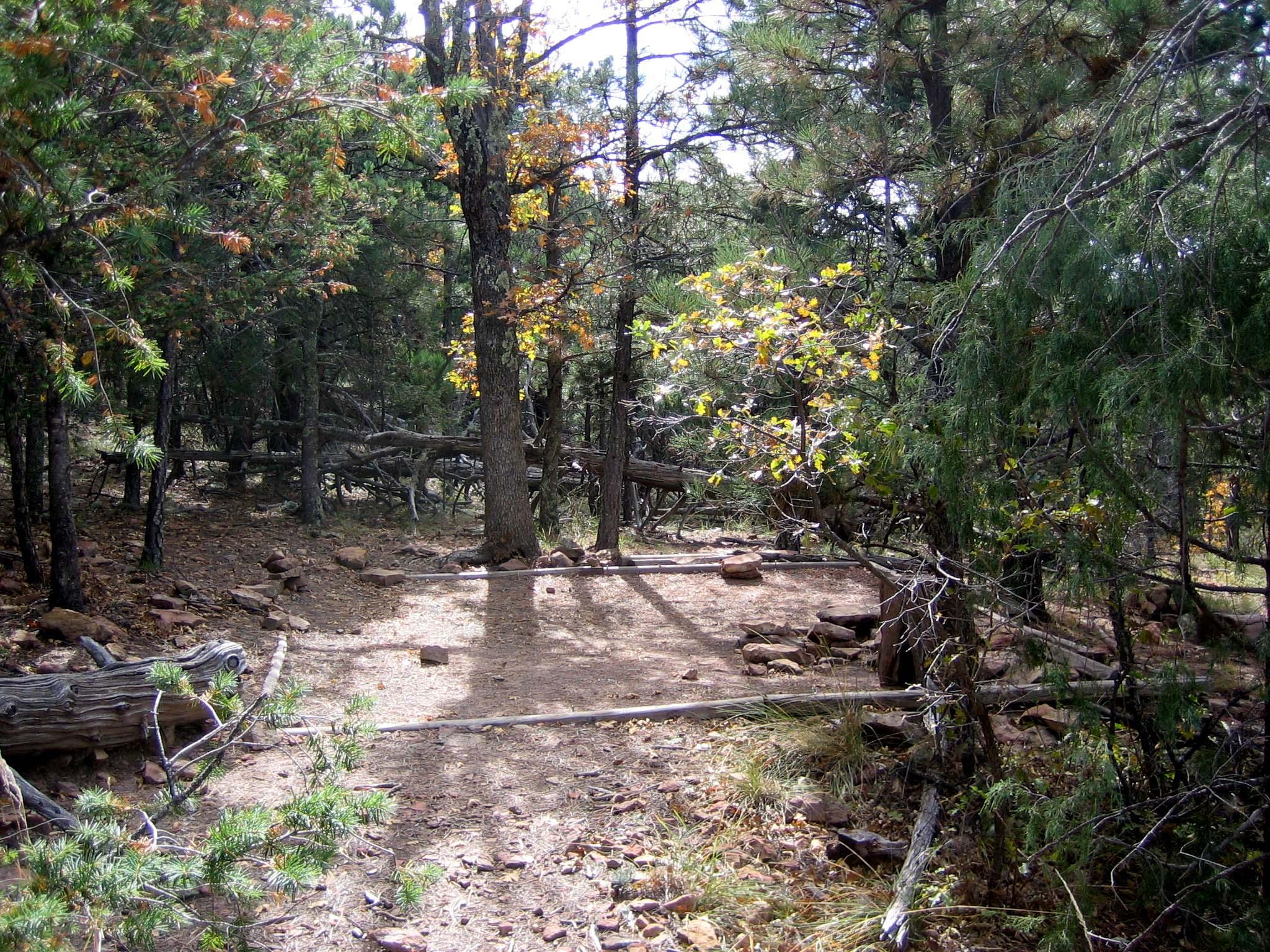
There are 8 tent-only sites at McKittrick Ridge. All require using designated tent pads. The pads are spread along the ridge, and the sites are primitive by design - no water, no toilets, no amenities beyond the pad and a fire ring where permitted. This is a wilderness campground in the truest sense of the term. You carry everything in, and you carry everything out.
Hours and Seasonal Access
The campground is open 24 hours daily, all week. That said, wilderness campgrounds in the park may close due to emergency, maintenance work, or resource protection concerns. Check the park's alerts page before heading out. As of the latest updates, Williams Ranch Road is closed due to unsafe conditions, which does not directly affect access to McKittrick Ridge but is worth noting if you are planning a broader trip through the park's backcountry.
Photo: NPS via NPS.gov (Public Domain)
What the Official Website Does Not Tell You
The park service publishes the basic details - distance, elevation, permit requirements - but here are a few things experienced visitors notice on their first trip.
Cell service drops out well before you reach the McKittrick Canyon Trailhead. Download your maps, your permit confirmation, and any driving directions before you lose signal. The parking situation at McKittrick Canyon can be tight on weekends. Early morning is your best bet for a spot, especially between March and May when the canyon's spring wildflowers draw crowds.
The hike itself changes character dramatically depending on the season. In summer, the exposed sections of the ridge soak up direct sun from mid-morning through late afternoon. In winter, the north-facing slopes hold ice well into the day. Spring and fall are the sweet spots, but even then, afternoon thunderstorms roll in fast. Rangers emphasize starting early - not just for the parking, but to be off the ridge before the daily thunderstorm window opens.
Photo: NPS via NPS.gov (Public Domain)
What You Will Find at the Top
The ridge sits at roughly 7,600 feet, which puts it above most of the surrounding terrain. From this overlook you can see across the salt flats into New Mexico on clear days. The view stretches west over the Guadalupe Mountains and east across the Delaware Basin. The elevation gain is worth it - the perspective from the ridge is completely different from anything you see on the canyon floor.
The campsites are spaced along the ridge, giving each site a degree of privacy. The wind can be a factor up here. It picks up predictably in the afternoon and does not always settle down at night. A tent that handles wind well makes a real difference. So does a good sleeping pad - the tent pads are level but firm, and the ground does not give much.
Photo: NPS via NPS.gov (Public Domain)
Practical Takeaways
Reserve in advance. Permits require a $6 reservation fee plus $6 per person per night. Book through Recreation.gov.
Start from Dog Canyon if the climb sounds like too much. It is a longer drive but a gentler approach.
Pack all your water. There is no source on the ridge. Plan for a gallon per person per day minimum.
Watch the weather. Afternoon storms are common from June through September. Be off the ridge by early afternoon if possible.
Check for alerts. The park store went cashless in August 2025, so bring a card. Williams Ranch Road is closed. Devil's Hall is rated strenuous and dangerous when wet.
Eight sites, eight permits. The all campgrounds page has the full list of backcountry options if McKittrick Ridge is full.
Final Thoughts
McKittrick Ridge Wilderness Campground is not the place for a casual first camping trip. It is a backcountry site that requires planning, fitness, and a willingness to carry everything you need for the duration of your stay. But the payoff is genuine solitude and a perspective on the Guadalupe Mountains that few visitors see. The ridge is quiet in a way the canyon bottom never is. Most visitors underestimate the climb on the way in. Do not be most visitors. Plan for the elevation, pack for the wind, and give yourself time to sit still and watch the light change across the desert below.