Book your site six months out if you want to camp in the Chisos Basin from November through March. This is not an exaggeration - those 56 sites fill within minutes of the reservation window opening on Recreation.gov. The Chisos Basin Campground sits at 5,400 feet in an open woodland with direct views of Casa Grande and Emory Peak, and it offers something no other campground in Big Bend can match: you can start hiking into the high Chisos before the sun clears the ridge.
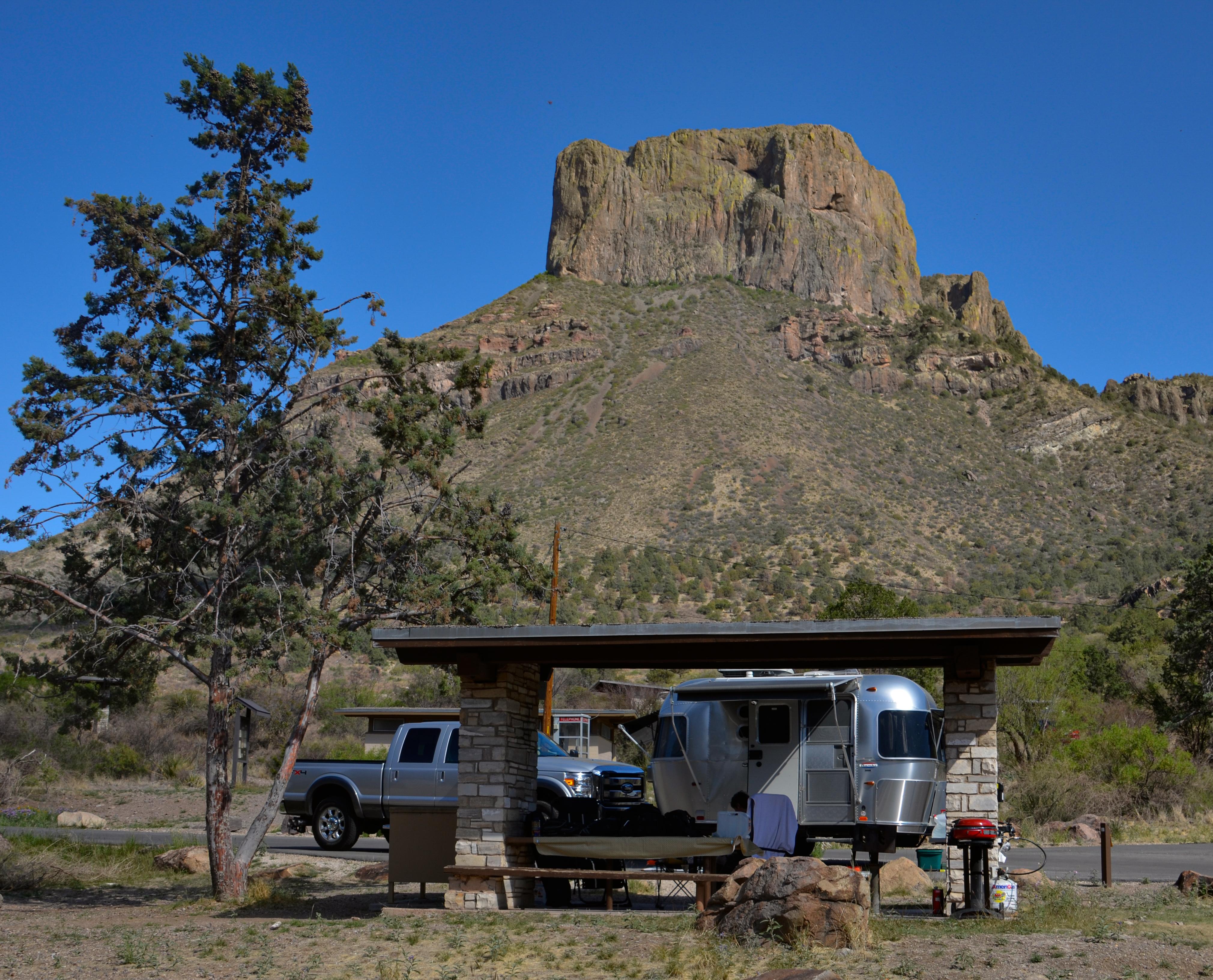
NPS via NPS.gov (Public Domain)
Campsites at Chisos Basin Campground (2026 Guide)
7 min read
Campsite Guide
The Basin gets genuinely dark at night - darker than most visitors have ever experienced. The nearest city lights are 100 miles away.
Your plans
For more, see complete visitor guide, all campgrounds, hiking trails, lodging and accommodations, Campsites at Cottonwood Campground (2026 Guide) (2026 guide), and Campsites at Rio Grande Village Campground (2026 Guide).
This guide covers everything you need to know about camping here, from the access road limitations to which trails leave directly from the campground. For the full picture of what to do across the entire park, check our complete visitor guide.
The Access Road Will Decide If You Fit
Rangers will tell you the road into the Basin is the single most overlooked factor when people book this campground. The paved road from park headquarters climbs roughly 2,000 feet in seven miles of switchbacks. It is narrow. It is winding. And the park service is blunt about the limits: trailers over 20 feet and RVs over 24 feet are not recommended.
That "not recommended" language is carefully chosen. You will see people attempt it. You will also see them blocking traffic on the tightest switchbacks while they try to back up. The campsites themselves are small - built for tents and short vans, not for slide-outs and awnings. If you are towing anything larger than a small pop-up, call the visitor center at 432-477-1121 and ask about current conditions before you commit.
The road is paved the entire way, so a high-clearance vehicle is not required. What matters is length and turning radius. A standard passenger car handles it fine. A short-wheelbase van is fine. A 25-foot motorhome is pushing it.

What the Campground Actually Feels Like
The 56 sites are spread through an open woodland of piñon pine, juniper, and oak. This is not desert floor camping - you are surrounded by mountain slopes on all sides, and the basin walls trap the cool air. Summer nights routinely drop into the 50s while the desert floor below still bakes at 90. Winter nights below freezing are common, and occasional snow dusts the peaks.
Each site costs $16.00 per night as of 2026, plus the park entrance fee (separate from the camping fee). Site capacity is eight people and two vehicles max. The ground is mostly packed dirt and gravel - tent stakes go in fine most of the year, but the dry summer months can leave the ground hard enough to bend cheap stakes.
Reservations are required year-round. You cannot show up and hope for a first-come site. The park moved entirely to Recreation.gov several years ago, and the system does not hold walk-up sites.
What You Will Find at Your Site
- A level tent pad area
- A picnic table
- A fire ring with a grill grate
- No hookups (no water, no electric, no sewer)
- No dump station in the Basin (the nearest is at Rio Grande Village)
Water is available at central faucets throughout the campground. Bring your own containers - the spigots are standard hose threads, and you will need to fill up daily if you are cooking and drinking from them.
The Elevation Changes Things
At 5,400 feet, the air is thinner than most visitors from lower elevations expect. If you are coming from sea level, you will notice it on the trails. The Lost Mine Trail gains 1,100 feet from the trailhead, and that elevation change will hit your breathing harder than the same climb at 2,000 feet. Drink more water than you think you need. The dry mountain air pulls moisture out of you fast.

The Views Are the Point
Every site in the Basin has some version of the same view: the sheer face of Casa Grande rising to the south, Emory Peak off to the east, and the gap in the basin wall known as "The Window" to the west. The sunset light through that notch is the reason photographers fill the campground in spring and fall. The light shafts through the gap and lights up the desert floor beyond in layers of orange and red.
Early morning is your best bet for clear views. By mid-afternoon, especially in summer, clouds often build over the Chisos peaks. The light gets flat. The hiking gets hot. Plan your photography and your strenuous hikes for the first four hours of daylight.

Trails You Can Walk to From Your Tent
This is the primary reason experienced visitors choose the Chisos Basin Campground over the other options in the park. You can step out of your tent and be on the trail network within five minutes.
Lost Mine Trail
This is the most popular day hike in the park, and the trailhead is a quarter-mile walk from the campground loop. Round trip is 4.8 miles with 1,100 feet of elevation gain. The trail climbs to the shoulder of Lost Mine Peak and opens onto views of Juniper Canyon and the Sierra del Carmen mountains on the Mexican side. Most visitors underestimate how exposed the upper section is - the sun is direct and unrelenting above the treeline. Pack extra water for this stretch.
Emory Peak Trail
From the same trailhead system, Emory Peak runs 10.5 miles round trip to the highest point in the park. This is a full-day commitment. The last section involves scrambling over boulders. If you are afraid of heights, the summit is not for you. If you want the highest point in Texas, this is it.
The Window View Trail
An easy 1.6-mile round trip that takes you to the notch in the basin wall. The trail is paved in sections and runs downhill on the way out - which means uphill on the way back. The view at the end is a sheer drop into the desert below, with the sun setting directly through the gap if you time it right.
Other Trails
The Laguna Meadow Trail, the Pinnacles Trail, and the South Rim Trail all connect from the Basin trailhead network. The South Rim is 12-14 miles round trip depending on your route, and the payoff is a view of the entire Big Bend from 7,400 feet. Rangers will tell you this is the best single-day hike in the park if your legs can handle it.

Practical Realities
Reservations and Timing
Reservations open on a rolling window at Recreation.gov. For peak season (November through April), sites book within hours of becoming available. The summer months (June through September) are easier to book, but daytime temperatures in the Basin still hit the low 90s, and afternoon thunderstorms are common from July through September.
The campground is open year-round. Christmas week and spring break are the hardest times to get a site.
What to Bring
The park website does not emphasize this enough: bring a headlamp. The Basin gets genuinely dark at night - darker than most visitors have ever experienced. The nearest city lights are 100 miles away. If you step out after sunset, you cannot see your hand in front of your face without a light. The night sky viewing here is exceptional. Far from any city lights, the Milky Way is visible as a distinct band across the sky on moonless nights.
Cell service drops out at the park entrance. There is no signal in the Basin. The payphone at the Chisos Mountains Lodge is your only option for calls.
Pets
Pets are not allowed on any park trails, in the backcountry, or on the river. They are allowed in the campground and anywhere vehicles can go. They cannot be left unattended. If you bring a dog, your hiking options are essentially zero inside the park.
Drones
Big Bend is a no-drone zone. The park service enforces this. The fine is not worth the shot.
The Lodge and Camp Store
The Chisos Mountains Lodge is a five-minute walk from the campground. It has a restaurant, a gift shop, and a small camp store that sells ice, firewood, and basic supplies. The restaurant serves breakfast and dinner, and it is the only hot meal option in the Basin. Prices are higher than what you would pay in Alpine or Marathon, but you are 45 miles from the nearest grocery store.
Practical Takeaways
- Book exactly 6 months ahead for November-April. Mark your calendar. Set an alarm. The sites go fast.
- Measure your rig before you drive up. If your trailer exceeds 20 feet or your RV exceeds 24 feet, choose Rio Grande Village or Cottonwood instead.
- Fill your water containers at the spigots daily. Don't assume you can refill at night - the spigots are shared and can run low during busy weekends.
- Hike before 9 AM from May through September. Afternoon heat and thunderstorms are reliable.
- Bring layers year-round. The 5,400-foot elevation means temperatures drop 15-20 degrees at night compared to the desert floor. A summer afternoon at 90 can become a night at 55.
- Download offline maps. Cell service drops out at the park entrance. Gaia, AllTrails, or paper maps will save you.
- Check the NPS alerts page before you leave. Road construction, weather closures, and port of entry hours change. As of 2026, the Boquillas Crossing is open Friday-Monday 9 AM to 4 PM if you plan to visit Mexico.
Final Thoughts
The Chisos Basin Campground is the most popular camping option in Big Bend for good reason. The views from your picnic table are better than what most parks charge for scenic overlooks. The trail access is unmatched. The elevation keeps summer nights comfortable and winter days brisk. But it is also the most constrained option - limited sites, strict vehicle length limits, and a reservation system that rewards planning.
If you can get a site here, take it. If you cannot, the other campgrounds at Rio Grande Village and Cottonwood are solid alternatives, and the all campgrounds guide covers your options. Just know that the experience is different down on the desert floor. The Basin has a character all its own - cooler, greener, and more remote-feeling than anywhere else in the park. Worth the effort to book.
For more information, see our complete Big Bend National Park Guide.
Sources
- Official source: National Park Service nps.gov/bibe/planyourvisit/basin_campground.htm
- Official source: NPS — Big Bend National Park nps.gov/bibe/index.htm
Photo Gallery
More to Explore

Park Guide
Acadia National Park: Carriage Roads, Cadillac Mountain & 2026 Guide
Discover carriage roads, Cadillac Mountain, and rugged Maine coast. Complete 2026 guide to Acadia National Park — trails, fees, lodging, permits, and what rangers recommend.

Hiking Guide
Grand Canyon Hiking Trails: Day Hikes, Water Sources & Rim to Rim
Compare Grand Canyon hiking trails: Bright Angel, South Kaibab, Hermit, Grandview, and rim to rim, with distances, elevation, water stops, and trailhead access for each.

Best Of
Best of Glacier Bay National Park
The best of Glacier Bay is reached by boat: ranger-led day tours up the bay to the tidewater glaciers. What's worth it, how to book, and when to go (2026).

Campsite Guide
White Sands Backcountry Camping: Closed for 2026 — What to Know
As of 2026, backcountry camping at White Sands National Park is closed for site rehabilitation. What that means, and where to camp nearby instead.

Weather Guide
Guadalupe Mountains National Park Weather: Weather
Guadalupe Mountains National Park: weather guide guide updated 2026. Practical visitor information, reservations, and seasonal tips worth bookmarking before

Best Of
Best of Cuyahoga Valley National Park: Best Things to Do
Seeing a Cleveland Orchestra concert with the woods as your backdrop is a uniquely Cuyahoga Valley experience.
Sign in to join the conversation.
Sources & Attribution
Location data courtesy of the National Park Service (U.S. Department of the Interior). NPS data is public domain. Official NPS page.
Images: NPS; NPS; NPS; NPS; NPS.
Map data © OpenStreetMap contributors.
Park operations alerts: NPS.gov · Weather and weather hazards: National Weather Service · Live conditions.
Information may change. Always verify fees, hours, and conditions directly with the official source before visiting.
Did this guide help? Share it with a friend.