Two of the park's most famous drives are unpaved, and one is a one-way gravel road built over a century ago. For alpine terrain without a high-clearance vehicle, you've got two options—and they couldn't be more different.
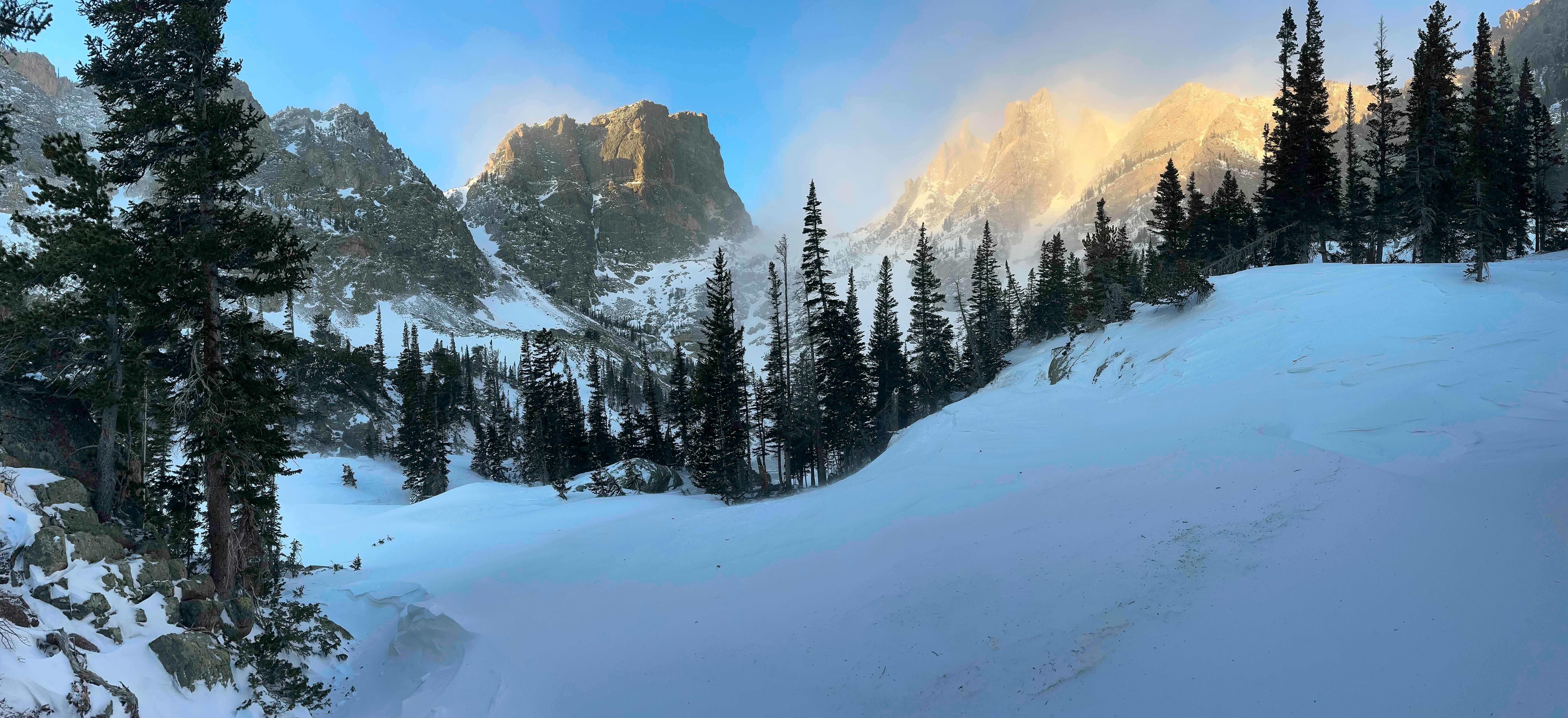
NPS via NPS.gov (Public Domain)
Rocky Mountain National Park Scenic Drives: Jeep Trails (2026)
8 min read
Scenic Drives
Two of the park's most famous drives are unpaved, and one is a one-way gravel road built over a century ago. Updated for 2026 with 5 Rocky Mountain National
You may also want hiking trails or best time to visit.
The Drive at a Glance
Total distance: Trail Ridge Road runs 48 miles between Estes Park and Grand Lake. Old Fall River Road stretches 9.4 miles one-way from the Fall River Entrance to the Alpine Visitor Center.
Typical time with stops: Trail Ridge Road takes 2-3 hours without stops, 4-5 hours if you pull over at every overlook. Old Fall River Road takes 45 minutes to drive, 2-3 hours with photo stops.
Direction matters: Old Fall River Road is one-way (uphill, east to west). Trail Ridge Road is two-way but best driven east-to-west for morning light on the peaks.
Road surface: Trail Ridge Road is fully paved. Old Fall River Road is unpaved gravel - the closest thing to a proper rocky mountain national park jeep trail that doesn't require 4WD.
Seasonal opening: Trail Ridge Road typically opens late May and closes mid-October. Old Fall River Road opens July 4 weekend (snow permitting) and closes in late September. Both are weather-dependent.
Vehicle restrictions: Old Fall River Road has a 25-foot vehicle length limit and 7,000-pound weight limit. No trailers or RVs. Trail Ridge Road has no vehicle restrictions but trailers over 25 feet will struggle with the switchbacks.

Old Fall River Road: The Original Jeep Trail
Built between 1913 and 1920, this was the original route across the Continental Divide before Trail Ridge Road existed. It's a slow, narrow, unpaved road that climbs from 8,500 feet to 11,796 feet at Fall River Pass. The surface is packed gravel with occasional washboard sections. Rangers will tell you this drive is not about getting anywhere quickly - it's about experiencing the park the way early visitors did.
Endovalley Picnic Area (Mile 1.2)
The road starts just past the Fall River Entrance. About a mile in, Endovalley opens up—a flat meadow with picnic tables and the Alluvial Fan. From this overlook you can see where a 1982 dam failure sent water and boulders tumbling down the valley. The cascade is still there, water flowing over house-sized rocks. Most visitors drive right past this. Don't. Pull over for 15 minutes and walk the short loop.
Chasm Falls (Mile 3.5)
A 25-foot waterfall that drops through a narrow granite slot. The pullout holds maybe 4 cars. Early morning is your best bet for parking. The spray keeps the surrounding rocks slick well into July. You'll hear the falls before you see them - the sound bounces off the canyon walls. There's a short trail down to the base, but the viewing platform gives you the better angle.
The Switchbacks (Miles 5-8)
This is where the road earns its reputation. Five tight switchbacks climb the headwall above the falls. The road narrows here - single lane in spots with sheer drops on the outside. Keep an eye out for oncoming traffic at the turnouts. Park service recommends using low gear on the descent if you're coming back down (though the road is one-way uphill, maintenance vehicles occasionally descend). The elevation gain is worth it for the view that opens up at the top.
Alpine Visitor Center (Mile 9.4)
The road ends at 11,796 feet. The visitor center has restrooms, a snack bar, and a viewing deck. From this overlook you can see the Never Summer Range to the west and the Mummy Range to the east. The Alpine Ridge Trail starts here - a quarter-mile paved path to 12,005 feet. Pack extra water for this stretch. The altitude hits hard if you drove straight up from Estes Park without acclimating.

Trail Ridge Road: The Paved Alternative
Trail Ridge Road is the highest continuous paved road in North America, topping out at 12,183 feet. It's fully paved, two lanes, and open to all vehicles under 25 feet with trailers. If Old Fall River Road is the original jeep trail experience, Trail Ridge Road is the modern version - wider, faster, and with more pullouts.
Deer Mountain Overlook (East side, Mile 5)
At 10,013 feet, Deer Mountain sits just off the road. The overlook gives you a clear view of the mountain's forested slopes and the Estes Park valley below. The deer mountain trail rocky mountain starts from the Beaver Meadows Entrance area - it's a 6-mile round trip to the summit if you're looking for rocky mountain hiking trails that connect to the drive. Early morning is your best bet for seeing elk grazing in the meadows below.
Many Parks Curve Overlook (Mile 8)
This is the first major stop heading west from Estes Park. You're at 9,600 feet looking back east over the town and the Mummy Range. The parking lot fills by 9 AM in July. Cell service drops out at about this point on the east side. The view is better in the afternoon when the sun is behind you - morning shots are backlit and hazy.
Rainbow Curve Overlook (Mile 11)
At 10,700 feet, the trees start thinning out. From this overlook you can see Longs Peak (14,259 feet) to the south and the tundra stretching ahead. This is where the temperature typically drops 10-15 degrees from the valley floor. Keep an eye out for yellow-bellied marmots on the rocks below the railing - they're the most photographed animals on this stretch.
Forest Canyon Overlook (Mile 16)
One of the best pullouts on the entire road. You're at 11,700 feet looking 2,000 feet down into Forest Canyon. The U-shaped valley is textbook glacial geology - flat bottom, steep walls, the Big Thompson River visible as a silver thread. Rangers will tell you this is the best spot on the road for afternoon photography. The light hits the canyon walls between 2 PM and 4 PM. Most visitors spend 10 minutes here. Plan for 20.
Alpine Visitor Center (Mile 22)
The midway point and the highest elevation on the road at 12,183 feet. The parking situation here is genuinely bad - the lot holds maybe 80 cars and it fills by 10 AM. If you arrive after 10 and the lot is full, keep driving. There are no overflow options. The visitor center has a small museum, restrooms, and a snack bar that charges $4 for a bottle of water. Bring your own.
Milner Pass and the Continental Divide (Mile 27)
The road crosses the Continental Divide at 10,758 feet. There's a small pullout and a sign marking the spot. The Colorado River Trailhead is here - a rocky mountain hiking trail that follows the river toward its source at La Poudre Pass. Most visitors underestimate how cold it gets at this elevation even in August. Bring a jacket.
Farview Curve Overlook (West side, Mile 35)
From this overlook you can see the Kawnueeche Valley stretching west and the Never Summer Range to the north. This is the best stop on the west side of the road. The lighting is excellent in the morning - the sun hits the peaks directly. Afternoon light is flat and hazy. Spend 15 minutes here. The parking area holds about 12 cars and rarely fills.

Timing and Crowds
Trail Ridge Road opens for the season in late May, but full access to the Alpine Visitor Center doesn't happen until early June most years. The road closes for the season in mid-October, sometimes earlier if early snow hits.
Old Fall River Road opens July 4 weekend and closes in late September. It opens later because it's unpaved and lower elevation snow melts slower. The road is typically closed to vehicles by October 1.
The busiest hours on Trail Ridge Road are 9 AM to 2 PM, especially between Many Parks Curve and the Alpine Visitor Center. Tour buses from Estes Park start rolling around 8:30 AM and continue through early afternoon. If you want to avoid the crowds, drive east-to-west starting at 6:30 AM. You'll have the pullouts to yourself until about 9 AM.
Old Fall River Road is less crowded overall but the parking at Chasm Falls and the Alpine Visitor Center fills by 9 AM. The road itself sees maybe 50 cars a day in peak season. The slower pace means you'll share the road with cyclists and the occasional park vehicle.

Driving Logistics
Parking: The Alpine Visitor Center lot fills by 10 AM daily in July and August. Many Parks Curve fills by 9 AM. Forest Canyon Overlook fills by 10 AM. All other pullouts have parking but it goes fast. There is no overflow parking at any of these stops.
Shuttle options: The park runs shuttle buses on Trail Ridge Road from late May through September. The shuttle stops at major pullouts and the visitor center. It does not run on Old Fall River Road. The shuttle is free with park admission.
Gas availability: No gas stations inside the park. Fill up in Estes Park (east side) or Grand Lake (west side). The nearest gas station to the Alpine Visitor Center is 22 miles east in Estes Park or 26 miles west in Grand Lake.
Cell service: Drops out completely on both roads above 9,000 feet. No signal at the Alpine Visitor Center. No signal on Old Fall River Road beyond Endovalley. Download maps and directions before entering the park.
RV and trailer restrictions: Trail Ridge Road allows vehicles up to 25 feet with trailers. The switchbacks above Rainbow Curve are tight - RVs over 25 feet will need to take the turns wide. Old Fall River Road prohibits all trailers and vehicles over 25 feet.
Practical Takeaways
- Start Trail Ridge Road by 7 AM if you want empty pullouts. By 9 AM, the lots fill and stay full until 3 PM.
- Drive Old Fall River Road uphill only - it's one-way for a reason. The gravel surface is loose and the drop-offs are unforgiving.
- Bring cash for the entrance fee. The entrance stations accept cards but the signal is spotty and transactions take longer.
- Pack a jacket even in August. The temperature at the Alpine Visitor Center averages 20 degrees colder than Estes Park. Wind chill at 12,000 feet can drop into the 40s on a sunny July afternoon.
- Fill your gas tank in Estes Park or Grand Lake before entering. The drive from one side to the other is 48 miles with no gas stations.
- Download offline maps before you lose service. Cell signal drops at 9,000 feet on both sides and doesn't return until you descend.
- Check the park's road conditions page before you go. Both roads close without warning for snow, ice, or maintenance. The park updates conditions daily at 7 AM during summer months.
For more information, see our complete National Park Guide.
Sources
- Official source: NPS — Rocky Mountain National Park nps.gov/romo/index.htm
Photo Gallery
More to Explore

Park Guide
Acadia National Park: Carriage Roads, Cadillac Mountain & 2026 Guide
Discover carriage roads, Cadillac Mountain, and rugged Maine coast. Complete 2026 guide to Acadia National Park — trails, fees, lodging, permits, and what rangers recommend.

Hiking Guide
Grand Canyon Hiking Trails: Day Hikes, Water Sources & Rim to Rim
Compare Grand Canyon hiking trails: Bright Angel, South Kaibab, Hermit, Grandview, and rim to rim, with distances, elevation, water stops, and trailhead access for each.

Best Of
Best of Glacier Bay National Park
The best of Glacier Bay is reached by boat: ranger-led day tours up the bay to the tidewater glaciers. What's worth it, how to book, and when to go (2026).

Campsite Guide
White Sands Backcountry Camping: Closed for 2026 — What to Know
As of 2026, backcountry camping at White Sands National Park is closed for site rehabilitation. What that means, and where to camp nearby instead.

Weather Guide
Guadalupe Mountains National Park Weather: Weather
Guadalupe Mountains National Park: weather guide guide updated 2026. Practical visitor information, reservations, and seasonal tips worth bookmarking before

Best Of
Best of Cuyahoga Valley National Park: Best Things to Do
Seeing a Cleveland Orchestra concert with the woods as your backdrop is a uniquely Cuyahoga Valley experience.
Sign in to join the conversation.
Sources & Attribution
Location data courtesy of the National Park Service (U.S. Department of the Interior). NPS data is public domain. Official NPS page.
Images: NPS; NPS; NPS; NPS; NPS.
Map data © OpenStreetMap contributors.
Park operations alerts: NPS.gov · Weather and weather hazards: National Weather Service · Live conditions.
Information may change. Always verify fees, hours, and conditions directly with the official source before visiting.
Did this guide help? Share it with a friend.