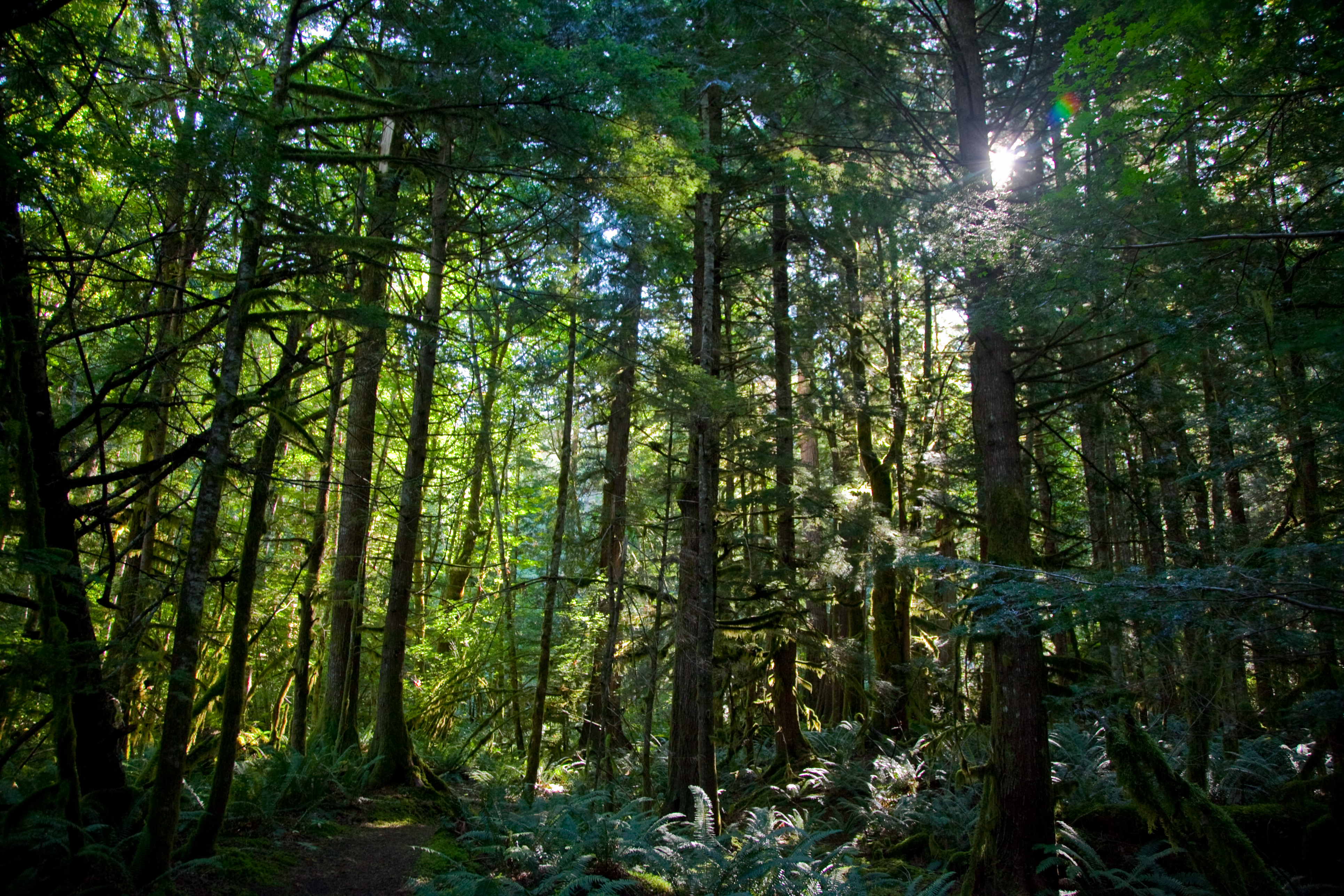
The River Loop Trail is a 1.8-mile forest walk where the Skagit River's low, steady rush is a constant companion, filtering through Douglas firs and western red cedars. The packed dirt path stays cool and shaded even on clear days. This short, accessible hike offers a proper introduction to the North Cascades' scale—a chance to stretch your legs without a full-day commitment. Most visitors underestimate how quickly the parking pull-out fills; it's popular for good reason.
NPS via NPS.gov (Public Domain)
River Loop Trail: 1.8-Mile Forest Walk, North Cascades
6 min read
Places & Points of Interest
Plan your 2026 visit to River Loop Trail. Complete guide to trails, fees, lodging, best time to visit, and insider tips.
Your plans
Quick Information
The River Loop Trail is free to access, as is the entire North Cascades National Park Service Complex. The trailhead is open year-round, but conditions vary dramatically. The best time to visit for a dry, predictable walk is from late June through September. The trail is located in Washington State, off the North Cascades Highway (State Route 20), roughly 15 miles east of the town of Marblemount. The flush toilet at the trailhead is a notable amenity for this stretch of highway. Parking is limited to a paved pull-out that can accommodate about a dozen vehicles and a couple of RVs; it's often full by mid-morning on summer weekends. Cell service is unreliable and typically drops out at the trailhead.
Getting There
From the west, take Interstate 5 to Burlington, then head east on State Route 20 (the North Cascades Highway) for about 46 miles. The trailhead is on the south side of the highway, roughly 5 miles east of the Colonial Creek Campground area. Look for a signed pull-out. From the east, the trailhead is about 60 miles west of Winthrop, but note that State Route 20 is closed seasonally from roughly November to May between the Ross Dam Trailhead (milepost 134) and the Silver Star Gate (milepost 171). As of 2026, there is an active closure at milepost 130 (Colonial Creek), so always check the Washington State Department of Transportation website for real-time road status before you go. The parking situation here is first-come, first-served.

What to Expect
Expect a gentle, rolling trail with minimal elevation gain—about 100 feet total. The path is a classic Pacific Northwest forest walk: soft underfoot with dirt, pine needles, and exposed roots. The air carries the scent of damp earth and cedar. You'll cross a few sturdy footbridges over seasonal streams. The main draw is the series of viewpoints along the Skagit River, where opaque, glacial-green water churns through boulder gardens. Trail conditions are generally good but can be muddy in spring and slick with wet leaves in fall. For solitude on the riverbanks, aim for early morning; the low light through the trees justifies the early start.
Top Attractions & Points of Interest
While the River Loop Trail itself is the attraction, it's a gateway to the broader park. The loop is simple: from the trailhead, you can go either direction, as it's a true loop. Most hikers go clockwise for a slightly more gradual descent to the first river viewpoint.
The Skagit River Viewpoints
There are three main spots where the trail edges close to the bank. The first, about 0.4 miles in, gives you a head-on view of the river's power. The second, near the midpoint, is a wider, gravelly area where you might see driftwood piled high from spring runoff. The third is the most secluded, a quiet bend where the water slows momentarily. From these overlooks you can see the opposite forested bank and, if you're lucky, an osprey circling overhead.
The Old-Growth Forest
The trail doesn't just go to the river; it meanders through a mature conifer forest. Look for massive Douglas firs with furrowed bark and the shaggy, reddish bark of western red cedars. Rangers will tell you this forest type is a hallmark of the lower Skagit River valley.
Proximity to Colonial Creek
The trailhead is just minutes from the Colonial Creek South and North Campgrounds, making it a perfect after-dinner stroll for campers. The sound of the nearby creek adds another layer to the soundscape.

Activities
The River Loop Trail is primarily a day hiking destination. It's ideal for families, those seeking a leg-stretcher during a long drive on SR 20, or photographers looking for intimate river scenes without a strenuous hike. Its easy grade makes it suitable for most fitness levels. While you're in the area, the park offers countless other hiking trails for more ambitious adventures.
The broader park complex is a hub for water activities. The nearby lakes - Diablo, Gorge, and Ross - are popular for paddling in the North Cascades and motorboating. The Skagit River itself, which you see from the trail, is a known destination for rafting, especially in summer. Fishing in the North Cascades is also popular in the many lakes and rivers.
Seasonal Guide
June - September: The trail is in prime condition. Dry, clear, and buzzing with insects (bring repellent). This is high season; expect company.
October - November: A quieter, moodier time. Fall colors light up the understory of vine maple. Trails can be slick with wet leaves and occasional frost in the morning.
December - May: The trail is often snow-covered and inaccessible due to the seasonal closure of State Route 20. Even if the road is plowed to the trailhead, expect packed snow and ice; microspikes are recommended. Always check the best time to visit for current conditions.

Practical Information
There is no entrance fee or permit required for this day hike. For camping options, the nearest are Colonial Creek South ($24/night, 93 sites) and Colonial Creek North ($24/night, 38 sites). Both are first-come, first-served and fill quickly in summer. Other nearby frontcountry campgrounds include Goodell Creek and Newhalem Creek. For lodging and accommodations, you'll need to look to the towns of Marblemount to the west or Winthrop to the east. There are no services at the trailhead beyond the restroom. The last reliable gas and food are in Marblemount.
Safety & Preparation
This is a low-risk trail, but standard rules apply. Pack extra water for this stretch, even though it's short - there's no potable water at the trailhead. The river is cold, fast, and dangerous; do not attempt to wade or swim. Be aware of your footing on the occasional root or muddy patch. As with all trailheads along SR 20, the park service has issued cautions about vehicle break-ins. Remove all valuables, electronics, and even charging cords from your car before you hike. Leave nothing visible in the passenger compartment.

Insider Tips
- Reverse the Loop: If you want the river views sooner, hike the loop counter-clockwise. You'll hit the first big overlook in under five minutes.
- Combine It: This trail pairs perfectly with a visit to the nearby Thunder Knob Trail (3.6 miles roundtrip) for higher lake views, or a stop at the Diablo Lake Overlook.
- Listen for Wildlife: This is a good spot for wildlife viewing. Keep an eye out for pileated woodpeckers hammering on snags and listen for the croak of ravens.
- Beat the Crowds: The lot is often full by 10 AM. Arrive before 9 AM or consider visiting in the late afternoon after the main day-use crowd has moved on.
- Check Road Status Twice: First, check the WSDOT website for SR 20 closures. Second, check the park's alert page for any trail-specific or flood-related issues, especially after heavy rain.
- The Gift of the Flush Toilet: That restroom at the trailhead is one of the few flush toilets on this section of highway. Use it wisely.
- Post-Hike Stop: Drive five minutes west to the Colonial Creek area. The picnic spots by Diablo Lake are a superior place for lunch compared to the river pull-outs.
For more information, see our complete North Cascades National Park Guide.
Sources
- Official source: NPS — North Cascades National Park nps.gov/noca/index.htm
- Official source: National Park Service nps.gov/places/river-loop-trail.htm
Photo Gallery
More to Explore

Park Guide
Acadia National Park: Carriage Roads, Cadillac Mountain & 2026 Guide
Discover carriage roads, Cadillac Mountain, and rugged Maine coast. Complete 2026 guide to Acadia National Park — trails, fees, lodging, permits, and what rangers recommend.

Hiking Guide
Grand Canyon Hiking Trails: Day Hikes, Water Sources & Rim to Rim
Compare Grand Canyon hiking trails: Bright Angel, South Kaibab, Hermit, Grandview, and rim to rim, with distances, elevation, water stops, and trailhead access for each.

Best Of
Best of Glacier Bay National Park
The best of Glacier Bay is reached by boat: ranger-led day tours up the bay to the tidewater glaciers. What's worth it, how to book, and when to go (2026).

Campsite Guide
White Sands Backcountry Camping: Closed for 2026 — What to Know
As of 2026, backcountry camping at White Sands National Park is closed for site rehabilitation. What that means, and where to camp nearby instead.

Weather Guide
Guadalupe Mountains National Park Weather: Weather
Guadalupe Mountains National Park: weather guide guide updated 2026. Practical visitor information, reservations, and seasonal tips worth bookmarking before

Best Of
Best of Cuyahoga Valley National Park: Best Things to Do
Seeing a Cleveland Orchestra concert with the woods as your backdrop is a uniquely Cuyahoga Valley experience.
Sign in to join the conversation.
Sources & Attribution
Location data courtesy of the National Park Service (U.S. Department of the Interior). NPS data is public domain. Official NPS page.
Images: NPS; NPS; NPS; NPS; NPS.
Map data © OpenStreetMap contributors.
Park operations alerts: NPS.gov · Weather and weather hazards: National Weather Service · Live conditions.
Information may change. Always verify fees, hours, and conditions directly with the official source before visiting.
Did this guide help? Share it with a friend.