Book your site well in advance if you plan to camp at Nāmakanipaio during peak season - December through April fills fast, and the 16 tent-only sites go quickly. Located 31.5 miles south of Hilo on Highway-11 at 4,000 feet elevation, this campground sits within Hawaiʻi Volcanoes National Park and puts you close to Kīlauea's summit activity. For a full overview of the park, check the complete visitor guide before you arrive.
NPS via NPS.gov (Public Domain)
Campsites at Nāmakanipaio (2026 Guide)
7 min read
Campsite Guide
Standard occupancy is 2 people per site with one tent. If you have more than 2 in your party, you can expand to 4 people per site by adding a second tent.
Your plans
For more, see Campsites at Kulanaokuaiki (2026 Guide).
What You Get at Nāmakanipaio
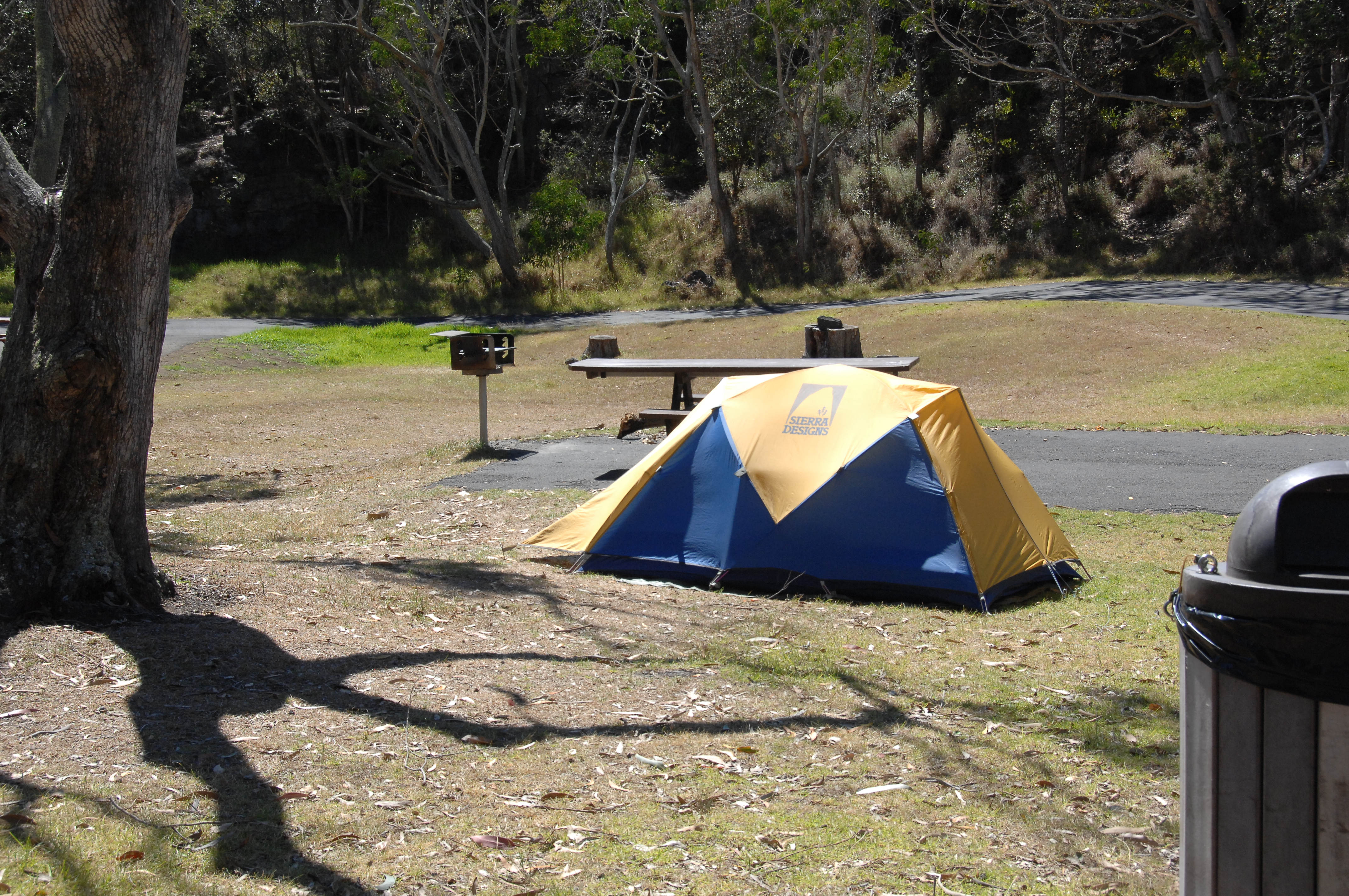
The campground is a large, open grassy area shaded by tall eucalyptus and ʻōhiʻa trees. It operates on a first-come, first-served basis, but you can also reserve through the park's concessionaire. The per-tent fee is $15.00 per night as of 2026, and park entrance fees apply separately. There is a self-pay station at the campground if you arrive after the entrance station closes - the after-hours self-pay station is on the Kīlauea Visitor Center lanai.
Each site comes with a picnic table and barbecue pit. Restrooms and drinking water are available on-site. Campfires are permitted only in the barbecue pits - no ground fires. The maximum stay is 7 days, which gives you enough time to explore most of the park's major trails and viewpoints.
Site Setup and Group Size
Standard occupancy is 2 people per site with one tent. If you have more than 2 in your party, you can expand to 4 people per site by adding a second tent. This makes Nāmakanipaio a decent option for small groups or families who want to share a site rather than booking multiple spots.
What to Know About Elevation
At 4,000 feet, the campground sits high enough that temperatures drop noticeably after sunset. Expect overnight lows in the 50s°F (10-15°C) year-round, and daytime highs rarely exceed the low 70s°F (21-23°C). That sounds pleasant, and it is - but the wind off Mauna Loa and the overnight moisture mean you want a tent with good rainfly coverage and a sleeping bag rated for at least 40°F.
Getting There and Parking
From Hilo, drive south on Highway-11 for 31.5 miles. The entrance to Nāmakanipaio will be on your left. The road is paved the entire way, and any vehicle can manage it. GPS coordinates for the campground are approximately 19.6273, -155.5646 if you need them for your mapping app.
Parking is at your individual site - pull through or back in, depending on the layout. The sites are arranged in a loop off the main drive, and the grassy terrain is flat enough for standard vehicles. RVs and campers are not permitted here; this is a tent-only campground.

Current Conditions and Alerts for 2026
As of early 2026, visitors should be aware of several active conditions at the park:
Kīlauea eruption: The volcano is erupting as of this writing. Eruptions can last a few hours and are often separated by pauses lasting several weeks. Stay out of closed areas and monitor air quality. Rangers will tell you that eruption viewing is possible from several designated overlooks, but conditions change without notice.
Volcanic tephra: Ash, rock fragments, and glassy strands (tephra) are present at the Kīlauea summit. These particles can irritate your skin, eyes, and respiratory system. Eye protection, long sleeves, long pants, a hat, closed-toe shoes, and a dust mask are recommended for any hiking near the summit.
Voicemail outage: The park's voicemail system is down due to storm damage. You can reach staff by email while repairs are underway.
Nāhuku Lava Tube bridge replacement: Most of the Nāhuku Lava Tube Trail remains open, but the entrance section through the rainforest to the front of the tube, the bridge, and 50 feet into the cave are closed during bridge replacement. The trail is accessible one-way in and out from the east exit end. Check the park website for updates on this project.
Trails and Activities from the Campground
Nāmakanipaio sits within easy driving distance of the park's main attractions. Here are the highlights you can reach without a long commute from your tent.
Close to Campground
Devastation Trail (30-60 minutes) is a paved walk through a landscape buried by cinder from the 1959 Kīlauea Iki eruption. It's an easy, accessible stroll that gives you a sense of how quickly volcanic landscapes recover - or don't.
Nāhuku Lava Tube Trail (30-90 minutes) takes you through lush rainforest into a 500-year-old lava tube. Note the bridge closure mentioned above before planning your visit.
Kīlauea Iki Trail (2-4 hours) descends 400 feet through rainforest to the floor of Kīlauea Iki crater. You'll walk across the hardened lava lake from the 1959 eruption. The trail is a 4-mile loop, and most visitors underestimate how much the return climb saps your energy. Pack extra water for this stretch.
Crater Rim Trail (1-6 hours) traces the edge of Kaluapele (Kīlauea caldera) from Uēkahuna past Keanakākoʻi Crater. You can do short sections or the full traverse.
Worth the Drive
Puʻuloa Petroglyphs Trail (60-90 minutes) crosses a lava field to the largest group of petroglyphs in Hawaiʻi. The trailhead is off Chain of Craters Road, about a 30-minute drive from the campground. Early morning is your best bet for avoiding heat and crowds.
Hōlei Sea Arch (20-30 minutes) sits at the end of Chain of Craters Road. Walk a short distance to see a 90-foot sea arch carved into the cliffs. The contrast between black lava cliffs and blue Pacific is striking.
Chain of Craters Road itself is worth the drive - allow 2-6 hours round trip from the campground. The road drops 3,700 feet in elevation over 18 miles, passing lava flows, pit craters, and ocean views.

The Other Campground: Kulanaokuaiki
If Nāmakanipaio is full, Kulanaokuaiki is a backup option. Located off Hilina Pali Road at 3,200 feet elevation, it has 9 walk-in tent sites at $10.00 per night. It is more remote and quieter but has accessible vault toilets and no water - you must bring your own. The trade-off is solitude, especially for anyone wanting to hike the Kaʻū Desert or Mauna Iki trails. For a comparison of both options, see the all campgrounds page.
Practical Advice for Camping Here
Reservations: You can reserve online through the park's concessionaire or try your luck as a walk-up. During summer months and holiday weekends, reserved sites fill weeks out. If you arrive without a reservation, aim for check-in before noon on a weekday.
Weather preparation: Rain is common even when the forecast says "partly sunny." The campground sits at an elevation where clouds roll in by mid-afternoon almost daily. A waterproof tent fly and a tarp for covering gear are not optional.
Food storage: The park has nēnē (Hawaiian geese) and other birds that will investigate unattended food. Use the provided coolers or keep food in your vehicle when you are away from the site. The park also recommends securing food from feral pigs and rats.
Fire: Campfires are allowed only in the barbecue pits. Collecting firewood from the park is prohibited - buy certified firewood in Hilo or Volcano Village. The self-pay station sells firewood bundles when staffed.
Noise: The campground is quiet after 10 PM. Rangers patrol regularly and will remind guests about quiet hours. The open grassy layout means sound carries, so keep conversations low if you return late from stargazing.
Cell service: Cell service drops out at the campground and throughout much of the park. Verizon and AT&T both have weak signals at 4,000 feet, and T-Mobile is essentially unusable. Download maps and information before you drive in from Hilo.

What to Pack Specific to This Campground
- Warm layers: The 50°F nights feel colder with moisture and wind. A fleece jacket and a windproof shell are worth their weight.
- Rain gear: A rain jacket and pack cover. Not negotiable.
- Dust mask and eye protection: If the eruption continues, tephra at the summit can drift. The park recommends these for anyone hiking near Kīlauea Overlook or Uēkahuna.
- Headlamp: The restrooms are a short walk from the sites, and there is no lighting on the path.
- Water: The campground has potable water, but fill up before you head out for the day - trailheads do not always have water.
- Cash: The self-pay station for entrance and camping fees is cash-only. There is no ATM at the campground. Volcano Village (5 miles north) has an ATM, but bring cash from Hilo to be safe.
Final Thoughts
Nāmakanipaio is not the most secluded campground in the national park system. You will hear Highway-11 traffic during the day, and the open grass means other campers are visible. What it offers instead is convenience: you are 5 minutes from the Kīlauea Visitor Center, 10 minutes from the Devastation Trail parking lot, and 30 minutes from the Chain of Craters Road overlooks. The elevation keeps temperatures comfortable year-round, and the eucalyptus grove provides shade that many tropical campgrounds lack.
For a tent-only campground inside one of the most active volcanic landscapes on earth, $15.00 per night is fair. Just remember: the volcano does not care about your itinerary. Check the NPS alerts page the morning of your departure, pack the dust mask, and keep your plans flexible. That approach will serve you better than any reservation strategy.
Sources
- Official source: NPS — Hawaii Volcanoes National Park nps.gov/havo/index.htm
- Official source: National Park Service nps.gov/havo/planyourvisit/namakanipaio-campground.htm
Photo Gallery
More to Explore

Park Guide
Acadia National Park: Carriage Roads, Cadillac Mountain & 2026 Guide
Discover carriage roads, Cadillac Mountain, and rugged Maine coast. Complete 2026 guide to Acadia National Park — trails, fees, lodging, permits, and what rangers recommend.

Hiking Guide
Grand Canyon Hiking Trails: Day Hikes, Water Sources & Rim to Rim
Compare Grand Canyon hiking trails: Bright Angel, South Kaibab, Hermit, Grandview, and rim to rim, with distances, elevation, water stops, and trailhead access for each.

Best Of
Best of Glacier Bay National Park
The best of Glacier Bay is reached by boat: ranger-led day tours up the bay to the tidewater glaciers. What's worth it, how to book, and when to go (2026).

Campsite Guide
White Sands Backcountry Camping: Closed for 2026 — What to Know
As of 2026, backcountry camping at White Sands National Park is closed for site rehabilitation. What that means, and where to camp nearby instead.

Weather Guide
Guadalupe Mountains National Park Weather: Weather
Guadalupe Mountains National Park: weather guide guide updated 2026. Practical visitor information, reservations, and seasonal tips worth bookmarking before

Best Of
Best of Cuyahoga Valley National Park: Best Things to Do
Seeing a Cleveland Orchestra concert with the woods as your backdrop is a uniquely Cuyahoga Valley experience.
Sign in to join the conversation.
Sources & Attribution
Location data courtesy of the National Park Service (U.S. Department of the Interior). NPS data is public domain. Official NPS page.
Images: NPS; NPS; NPS; NPS; NPS.
Map data © OpenStreetMap contributors.
Park operations alerts: NPS.gov · Weather and weather hazards: National Weather Service · Live conditions.
Information may change. Always verify fees, hours, and conditions directly with the official source before visiting.
Did this guide help? Share it with a friend.