Most first-time visitors to Great Sand Dunes National Park assume all backcountry camping happens in the dunefield. They're wrong about half the time. The park actually offers two completely different backpacking experiences: one across the tallest sand dunes in North America and another through subalpine forest along the Sangre de Cristo foothills. The choice determines your gear, your permit strategy, and your physical limits. Each has its own rules, seasons, and hazards - and neither one is what the casual day-visitor imagines.
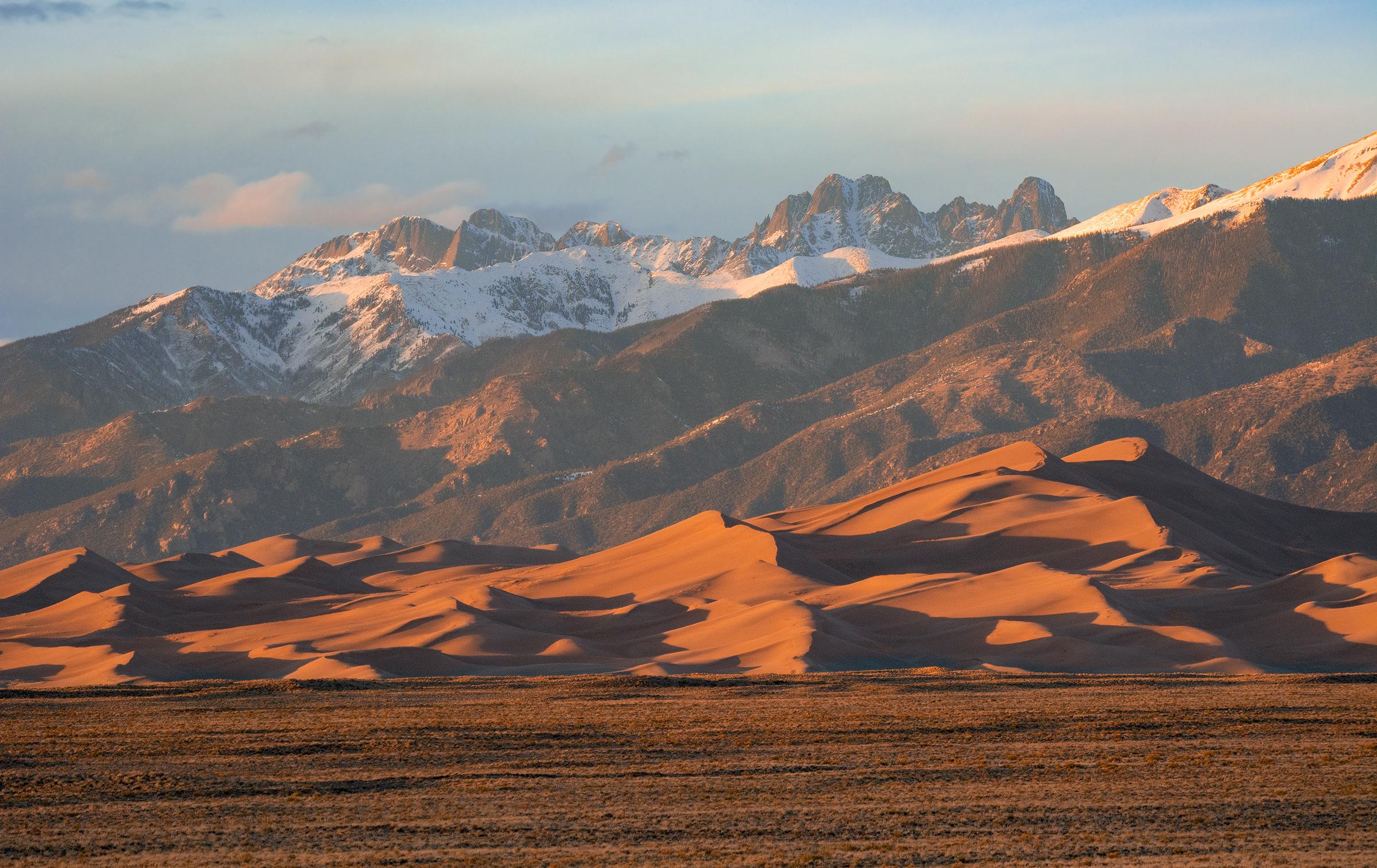
NPS via NPS.gov (Public Domain)
Backpacking Campsites in the Dunes or Forest (2026 Guide)
7 min read
Campsite Guide
Most first-time visitors to Great Sand Dunes National Park assume all backcountry camping happens in the dunefield. They're wrong about half the time.
Your plans
Plan your visit with complete visitor guide, all campgrounds, and hiking trails.
This guide covers every practical detail on securing backpacking campsites in the dunes or forest, from permit logistics to the specific gear you'll need for each terrain type. Whether you're planning a sand-only overnighter or a multi-day forest traverse, you'll find the exact setup distances, water sources, and seasonal windows here. For a full overview of the park, see the complete visitor guide.
The Two Backcountry Zones - What You Need to Know
Great Sand Dunes separates its backcountry into two distinct permit areas: the dunefield and the forest/mountain zone. They share a single free permit system but operate under different regulations.
Dunefield Backpacking
You can camp anywhere on the sand once you're at least 1.5 miles from the main parking lot (measured from the Dunes Parking Area). There are no designated sites, no fire rings, no established trails - just sand, ridge lines, and the Medano Creek drainage below.
- Distance from trailhead: Minimum 1.5 miles, but most experienced backpackers push 2-3 miles in to escape the day-use crowd and get above the noise of the parking lot.
- Water: You must pack all your own water. Medano Creek is seasonal (typically April-June) and carries heavy sediment. Treating it is possible but the grit will wreck your filter quickly. Rangers recommend carrying 1 gallon per person per day for cooking and drinking.
- Season: Year-round, but summer surface temperatures on the sand can exceed 140°F. May-September is the busiest window; November-March sees subfreezing nights and possible snow.
- Navigation: There are no trail markers. Rangers will tell you to use a GPS unit or map and compass. The dunes shift constantly, so landmarks are unreliable.
Forest/Mountain Zone
The forest zone covers the lower slopes of the Sangre de Cristo Mountains, accessed via the Mosca Pass Trail, the Sand Ramp Trail, and several connector routes. Here you'll find designated campsites with tent pads, fire grates, and - on some sites - bear cables.
- Designated sites: There are roughly a dozen maintained sites spread along the Sand Ramp Trail and Mosca Pass. Each site has a capacity of 4-8 people. Some require a short side-hike from the main trail.
- Water: Seasonal streams are more reliable here. Mosca Creek and several unnamed tributaries flow from snowmelt (typically May-July). Drier months (August-October) may require carrying water or caching.
- Season: May through October is the standard window. Snow can linger on higher sections of the Sand Ramp Trail into June.
- Permit quotas: The forest sites have a much lower capacity than the dunefield. On summer weekends, they often fill by 10 AM the day of your trip.

How to Secure a Permit (and When You Don't Need One)
Backcountry permits for backpacking campsites in the dunes or forest are free but mandatory. You pick them up in person at the Visitor Center. There's no online reservation system - everything is first-come, first-served on the day of your trip.
- Visitor Center hours (as of 2026): 8:30 AM to 4:30 PM daily, extended to 6 PM in summer. Permits are issued until 3 PM for same-day departures.
- What you need: The permit form asks for your itinerary, number of people, and a vehicle license plate. You must watch a brief leave-no-trace video (about 8 minutes). No fee.
- Forest site tip: If you arrive later than 10 AM on a weekend, don't count on getting a forest site. The dunefield is a safer bet - its permit limit is much higher and rarely reaches capacity.
Most visitors underestimate how early they need to arrive for forest permits in July. The visitor center line can stretch twenty deep by 9 AM. Pack your patience and have a backup plan.

Gear Differences: Sand vs. Forest
Your gear list changes dramatically depending on which zone you pick. The dunes punish poor choices; the forest rewards lightweight efficiency.
For the Dunefield
- Footwear: Gaiters are mandatory. Sand will pour into low-cut shoes within thirty steps. Many backpackers wear closed-toe sandals (like Keens) with gaiters, or waterproof boots with sealed cuffs. Whatever you use, the sand grinds down soles faster than any other surface.
- Tent stakes: Standard stakes will pull out of sand in a moderate wind. Use sand anchors (snow stakes work) or fill stuff sacks with sand and tie them to your tent corners.
- Sun and wind protection: The dunefield has zero shade. A wide-brimmed hat, sunglasses (with retainer strap), and high-SPF sunscreen are non-negotiable. Wind can pick up sand and pelt exposed skin raw.
- Water storage: You'll need to carry every drop. A 1-gallon collapsible bag per person per day is the minimum. The weight adds up quickly - plan your distances accordingly.
For the Forest Zone
- Trekking poles: The Sand Ramp Trail has a gradual climb but several steep sections. Poles take strain off your knees on the descent.
- Bear canister: While bears are present, the forest campsites often have bear cables. Confirm at permit time. If your site lacks them, you need an approved bear canister (a hard-sided one, not a bag).
- Insect protection: Mosquitoes are heavy in June and July along Mosca Creek. Bring DEET or permethrin-treated clothing.
- Layered clothing: Forest nights can dip into the 40s even in August. A puffy jacket and base layer are worth the extra ounces.

Navigation and Safety - What the Park Website Doesn't Mention
The official guide covers the basics: stay on trail, carry a map, tell someone your itinerary. But experienced visitors know a few things that make the difference between a good trip and a bad one.
In the Dunefield
- The "sand ramp": The easiest access to the main dunefield is through the gap between High Dune (the star dune near the parking lot) and the creek drainage. Stay left of the creek to hit the steepest initial climb. Many first-timers try to go straight up the closest dune face, which is actually the most punishing route.
- Afternoon winds: The wind picks up reliably around 2 PM. If you're setting up camp, do it before lunch. The gusts can flatten a poorly anchored tent.
- Cell service drops out about a half-mile into the sand. Don't rely on your phone for navigation. Download offline maps or bring a compass.
In the Forest
- Trail junction confusion: The Sand Ramp Trail intersects with several unmarked game trails. The main path is the most worn, but in early season you'll find sections overgrown. Keep your map handy. The trail narrows here and there are no blazes.
- Water crossings: Mosca Creek runs high during snowmelt (May-June). You may have to wade - waterproof boots are optional, but bring camp sandals. The flow drops to a trickle by August.
- Elevation gain: The forest campsites sit between 8,500 and 9,500 feet. If you're coming from sea level, the thin air will hit you on the uphill. Pack extra water for this stretch and plan a slower pace.

Seasonal Timing: When to Go and When to Skip
May-June: Best for forest sites (water flows, snow melts). Dunefield is good but afternoon temperatures are climbing. Evening thunderstorms possible.
July-August: Peak heat in the dunes. Forest is cooler but mosquitoes peak. The dunes are still doable if you hike at dawn and camp high on the ridges where the breeze is stronger.
September-October: The sweet spot. Forest sites see fewer visitors, water is lower but still drinkable. Dunes are comfortable. Nights get chilly - bring a 20°F bag.
November-March: Forest zone is largely inaccessible due to snow. Dunefield remains open but snow can cover the sand. Parking lot access is plowed; the road to the visitor center is maintained. Permits are easy to get, but you'll need serious cold-weather gear.
For a complete breakdown of all overnight options in the park, check the all campgrounds page.
Practical Takeaways
- Arrive early for forest permits: By 9 AM on summer weekends, rangers will have issued most forest sites. Hit the visitor center by 8 AM.
- Pack water for the dunes: 1 gallon per person per day. There is no alternative water source within the dunefield zone.
- Use sand anchors: Standard tent stakes are useless. Bring snow stakes or learn how to bury sandbags.
- Watch the weather: Afternoon thunderstorms roll off the Sangre de Cristos in summer - lightning on open sand is extremely dangerous. Start your hike before 7 AM and be back to camp by noon.
- Don't underestimate the sand: A mile in the dunes takes twice the effort of a mile on trail. Plan your distances accordingly.
- Forest sites require a short hike: The closest forest campsite is about 2 miles from the Mosca Pass trailhead. The farthest is around 6 miles. Know your route before you load your pack.
- Fire regulations: Fires are prohibited in the dunefield. In the forest zone, fires are allowed only in the provided metal grates at designated sites. Bring a stove either way.
Final Thoughts
The beauty of Great Sand Dunes' two-zone backcountry system is that it offers a genuinely different experience each time. One trip you're navigating a landscape that feels like another planet, carrying every drop of water and watching your tent anchor shift in silent wind. The next you're in cool pine duff, listening to Mosca Creek and the sound of a camp stove simmering at twilight. Neither one is better - they're just different tools for different moods. Pick your terrain, get your permit early, and respect the limits that a place like this imposes. The sand will still be there tomorrow; the forest will regrow its downed trees. All you have to do is show up prepared.
Sources
- Official source: NPS — Great Sand Dunes National Park nps.gov/grsa/index.htm
Photo Gallery
More to Explore

Park Guide
Acadia National Park: Carriage Roads, Cadillac Mountain & 2026 Guide
Discover carriage roads, Cadillac Mountain, and rugged Maine coast. Complete 2026 guide to Acadia National Park — trails, fees, lodging, permits, and what rangers recommend.

Hiking Guide
Grand Canyon Hiking Trails: Day Hikes, Water Sources & Rim to Rim
Compare Grand Canyon hiking trails: Bright Angel, South Kaibab, Hermit, Grandview, and rim to rim, with distances, elevation, water stops, and trailhead access for each.

Best Of
Best of Glacier Bay National Park
The best of Glacier Bay is reached by boat: ranger-led day tours up the bay to the tidewater glaciers. What's worth it, how to book, and when to go (2026).

Campsite Guide
White Sands Backcountry Camping: Closed for 2026 — What to Know
As of 2026, backcountry camping at White Sands National Park is closed for site rehabilitation. What that means, and where to camp nearby instead.

Weather Guide
Guadalupe Mountains National Park Weather: Weather
Guadalupe Mountains National Park: weather guide guide updated 2026. Practical visitor information, reservations, and seasonal tips worth bookmarking before

Best Of
Best of Cuyahoga Valley National Park: Best Things to Do
Seeing a Cleveland Orchestra concert with the woods as your backdrop is a uniquely Cuyahoga Valley experience.
Sign in to join the conversation.
Sources & Attribution
Location data courtesy of the National Park Service (U.S. Department of the Interior). NPS data is public domain.
Images: NPS; NPS; NPS; NPS; NPS.
Park operations alerts: NPS.gov · Weather and weather hazards: National Weather Service · Live conditions.
Information may change. Always verify fees, hours, and conditions directly with the official source before visiting.
Did this guide help? Share it with a friend.